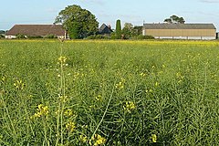
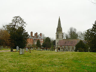
Speen is a village and civil parish in West Berkshire, England. Centred 2 miles (3 km) north west of the largest town in the district, Newbury, Speen has clustered settlements, the largest of which is Speen village, which is contiguous with Newbury, and the others, buffered from the town by the A34 road, are Bagnor, Stockcross, Woodspeen and Marsh Benham. Its other land is an approximately even mixture of woodland and agricultural fields including hay meadows for livestock feed and pasture. The area varies greatly in elevation, having the Reading to Taunton Line alongside the north bank of the River Kennet as its southern boundary and both banks of the River Lambourn in its north with elevated ground in between. Benham Park in the south-west of the area is a listed landscape garden and house.
Thatcham is a market town and civil parish in West Berkshire, England. It is situated in the valley of the River Kennet 3 miles (4.8 km) east of Newbury, 14 miles (23 km) west of Reading and 54 miles (87 km) west of London. The town has a long history dating back to prehistoric times, a claimant to the title of oldest continuously inhabited place in Great Britain. As of 2021, it had a population of 25,464, though it is part of a built-up area comprising itself and neighbouring Newbury of over 70,000 residents. It is on the route of the A4 Bath Road, the historic main road between London and Bristol.

Chieveley is a village and large civil parish centred 3.5 miles (5.6 km) north of Newbury in Berkshire, close to the M4 motorway and A34 road. Chieveley services are within the parish.
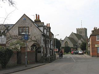
Bagnor is a village close to the town of Newbury in the English county of Berkshire and situated on the banks of the River Lambourn. At the 2011 census the population was included in the civil parish of Speen. It is best known as the home of the Watermill Theatre.
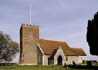
Winterbourne is a village and civil parish in the Berkshire Downs about 3 miles (5 km) north of Newbury in West Berkshire.

Howell is a village in the civil parish of Asgarby and Howell, in the North Kesteven district of Lincolnshire, England, approximately 1 mile (1.6 km) north of the A17, 4 miles (6 km) east from Sleaford, and 1.5 miles (2.4 km) north from Heckington. In 1921 the parish had a population of 58.

Beedon is a village and civil parish about 6+1⁄2 miles (10.5 km) north of Newbury in West Berkshire, England.

Boxford is a village and civil parish in the unitary authority of West Berkshire, England. The village is on the east bank of the River Lambourn, about 4 miles (6.4 km) northwest of Newbury but south of the M4 motorway. The hamlet of Westbrook is on the opposite bank of the Berkshire Downs tributary.

Farnborough is a village and civil parish in West Berkshire, about 4 miles (6.4 km) south of Wantage. The village is 720 feet (220 m) above sea level on a ridge aligned east – west in the Berkshire Downs. It is the highest village in Berkshire.

Weston is a village in the civil parish of Welford in the English county of Berkshire.
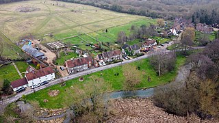
Welford is a rural village and civil parish in West Berkshire, England occupying both sides of the valley of the River Lambourn north-west of Newbury and south of Wantage. It forms a strip parish which tapers in the south where it contains the hamlet of Halfway. It incorporates Welford Park with its annual snowdrop displays. The M4 motorway passes through the parish, but has no junctions within it. RAF Welford, a munitions depot used by the United States Air Force, is to the north of the village.
Burghfield is a village and large civil parish in West Berkshire, England, with a boundary with Reading. Burghfield can trace its history back to before the Domesday Book, and was once home to three manors: Burghfield Regis, Burghfield Abbas, and Sheffield. Since the 1980s the population of Burghfield has nearly doubled with the construction of housing estates, making it a dormitory for Reading, Newbury, Basingstoke and the M4 corridor.

Swineshead is a village and civil parish in the Borough of Boston in Lincolnshire, England. It is 7 miles (11 km) west of the town of Boston. The population of the civil parish including Baythorpe was 2,810 at the 2011 census. The parish includes the areas of Swineshead Bridge and North End to the north, Fenhouses and Blackjack to the east, and Drayton to the south.
Ashmansworth is a village and civil parish in the Basingstoke and Deane district of the English county of Hampshire.

Drayton is a village and civil parish about 2 miles (3 km) south of Abingdon, Oxfordshire. It was part of Berkshire until the 1974 boundary changes transferred it to Oxfordshire. The parish includes the hamlet of Sutton Wick. The 2011 Census recorded the parish population as 2,353.

Denchworth is a village and civil parish about 2.5 miles (4 km) north of Wantage. It was part of Berkshire until the 1974 boundary changes transferred the Vale of White Horse to Oxfordshire. The 2011 Census recorded the parish's population as 171. The parish is bounded by the Land Brook in the west and the Childrey Brook in the east. The Great Western Main Line between Reading and Swindon runs through the parish just south of the village, but there is no station.

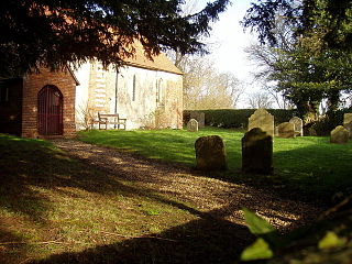
Oare is a small village in the civil parish of Chieveley in the English county of Berkshire.

Semer is a small village and civil parish in Suffolk, England. Located adjacent to a bridge over the River Brett on the B1115 between Hadleigh and Stowmarket, it is part of Babergh district. The parish also contains the hamlets of Ash Street and Drakestone Green.

West Hendred is a village and civil parish about 3 miles (5 km) east of Wantage. It was part of Berkshire until the 1974 boundary changes transferred it to Oxfordshire. West Hendred is downland village, its parish stretching from the Ridgeway in the south through the spring line and meadows to the former marshland of the Oxfordshire plain in the north. The parish is about 2,000 acres (810 ha) in area and 6 miles (10 km) long, but only being about 1⁄2 mile (800 m) wide at the widest point. This is an example of a downland linear parish encompassing a wide variety of land types – chalk downland, greensand on the spring line and clay to the north. The Great Western Main Line crosses the northern part of the parish. The Icknield Way and The Ridgeway cross the parish in the south.
Wickham is a village about 5.5 miles (8.9 km) north-west of Newbury, Berkshire, England. The M4 motorway passes just north of it. It is in the civil parish of Welford.