| Stratfield Mortimer | |
|---|---|
| Village and civil parish | |
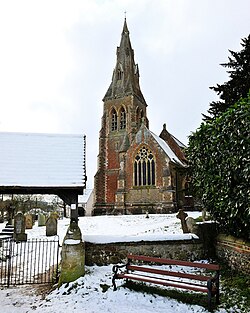 St. Mary's Church | |
 Stratfield Mortimer Location within Berkshire | |
| Area | 9.67 km2 (3.73 sq mi) |
| Population | 3,807 (2011 census including Mortimer Common) [1] |
| • Density | 394/km2 (1,020/sq mi) |
| OS grid reference | SU6664 |
| Civil parish |
|
| Unitary authority | |
| Ceremonial county | |
| Region | |
| Country | England |
| Sovereign state | United Kingdom |
| Post town | READING |
| Postcode district | RG7 |
| Dialling code | 0118 |
| Police | Thames Valley |
| Fire | Royal Berkshire |
| Ambulance | South Central |
| UK Parliament | |
Stratfield Mortimer is a village and civil parish, just south of Reading, in the English county of Berkshire and unitary authority area of West Berkshire.
