Foudry Brook

Last updated

Foudry Brook
Foudry Brook at Reading.jpg
Foudry Brook near Whitley, Berkshire
Location
Country England
Counties Hampshire, Berkshire
Towns Reading, Whitley, Baughurst, Tadley, Stratfield Mortimer
Physical characteristics
Source 
  location Baughurst, Hampshire, United Kingdom
  coordinates 51°20′00″N1°09′45″W / 51.333249°N 1.162603°W / 51.333249; -1.162603
  elevation93 m (305 ft)
Mouth River Kennet
  location
Whitley, near Reading, Berkshire, United Kingdom
  coordinates
51°26′06″N0°58′39″W / 51.43511°N 0.977381°W / 51.43511; -0.977381
  elevation
40 m (130 ft)
Basin features
Tributaries 
  leftBeaumonts Stream or Brook, Bishop's Wood Stream, West End Brook, near Mortimer, Burghfield Brook (Lockram Brook)

Foudry Brook is a small stream in southern England. It rises from a number of springs near the Hampshire village of Baughurst, and flows to the east and then the north, to join the River Kennet to the south of Reading. The upper section is called Silchester Brook, and beyond that, Bishop's Wood Stream. The underlying geology is chalk, covered by a layer of clay, and so it has the characteristics of a clay stream, experiencing rapid increases in level after heavy rain due to run-off from the surrounding land. It passes a number of listed buildings and scheduled monuments, including the site of the Roman town of Calleva Atrebatum or Silchester.

Contents

The natural flow of the river is supplemented by treated effluent from two major sewage treatment works, which contribute to the poor quality of the water. Water quality is also affected by physical modification of the channel, which restricts the free movement of fish around the system.

Route

Foudry Brook rises at springs between the small villages of Heath End and Baughurst, where it is known as Bishop's Wood Stream. It flows eastwards though Tadley, and is briefly culverted under housing on Elmhurst before emerging back on the surface and passing under the A340 Mulfords Hill road. It then enters a much longer culvert under Tadley Bottom, and emerges into open countryside on the east side of Bowmonts Bridge. It crosses the Pamber Forest nature reserve, becoming the Silchester Brook, and turns to the south, where Silchester Sewage Treatment Works is on the right bank. It then passes between two earthworks before Honeymill Brook joins it on the right bank. [1] The linear earthworks were associated with a Late Iron Age town that developed into the Roman town called Calleva or Silchester. They are 1,070 feet (326 m) and 900 feet (274 m) long, with a gap of 230 feet (70 m) where the river passes through. [2]

A ford across Foudry Brook at Clapper's Farm, near Silchester Ford, Clapper's Farm, near Silchester - geograph.org.uk - 58587.jpg
A ford across Foudry Brook at Clapper's Farm, near Silchester
Foudry Brook
BSicon uexCONTg.svg
River Kennet
BSicon uexABZgl.svg
BSicon uexSTR+r.svg
Foudry Brook
BSicon uexCONTfaq.svg
BSicon uexABZq+l.svg
BSicon uexSTRr.svg
BSicon uexSTR.svg
River Kennet
BSicon uexABZgl.svg
BSicon BUILDING.svg
BSicon uexSTR.svg
Reading STW
BSicon uexBHF.svg
BSicon uexSKRZ-Au.svg
A33 roundabout
BSicon uexSTRl.svg
BSicon uexABZ+lr.svg
BSicon uexSTRr.svg
BSicon uexSKRZ-Bu.svg
UK-Motorway-icon.svg M4 motorway
BSicon uexCONTfaq.svg
BSicon uexSTRq.svg
BSicon uexABZgr.svg
Burghfield Brook
BSicon uexSKRZ-Eu.svg
Gravelly Bridge
BSicon uexSKRZ-Eu.svg
Foudry Bridge
BSicon uexSKRZ-Eu.svg
Reid's Bridge
BSicon uexSKRZ-Eu.svg
Clappers Farm Bridge
BSicon uexSKRZ-Eu.svg
Missels Bridge
BSicon CONTgq.svg
BSicon STRq.svg
BSicon uxmKRZu.svg
BSicon STR+r.svg
Reading to Basingstoke line
BSicon uexSKRZ-Eu.svg
BSicon STR.svg
Tun Bridge
BSicon uexSTR+l.svg
BSicon GRZq.svg
BSicon uexABZgr.svg
BSicon STR.svg
Foudry Brook
Silchester Brook
BSicon uexCONTfaq.svg
BSicon uexSTRr.svg
BSicon uexSTR.svg
BSicon STR.svg
West End Brook
BSicon uexSKRZ-Eu.svg
BSicon STR.svg
Bridge
BSicon uexSTR.svg
BSicon STRl.svg
BSicon CONTfq.svg
railway
BSicon uexSKRZ-E.svg
Clapper's Farm ford
BSicon uexSKRZ-Eu.svg
Bridge
BSicon uexSKRZ-Eu.svg
Ash Lane Bridge
BSicon uexSKRZ-Eu.svg
Silchester Road Bridge
BSicon uexSTR+l.svg
BSicon uexABZlr.svg
BSicon uexSTR+r.svg
Honeymill Brook
BSicon uexABZgl.svg
BSicon BUILDING.svg
BSicon uexSTR.svg
Silchester STW
BSicon uexSKRZ-Eu.svg
BSicon uexSTR.svg
Bowmonts Bridge
BSicon uexTUNNEL1.svg
BSicon uexSTR.svg
Tadley Bottom culvert
BSicon uexSKRZ-Au.svg
A340 Mulfords Hill Bridge (L)
BSicon uexSTR.svg
BSicon uexSKRZ-Eu.svg
Church Road Bridge
BSicon uexSKRZ-Eu.svg
BSicon uexSTR+l.svg
BSicon uexABZgr.svg
Gutteridge Lane Bridge
BSicon uexSTR.svg
BSicon uexKHSTe.svg
BSicon uexSKRZ-Eu.svg
Church Brook Bridge
BSicon POINTERg@fq.svg
BSicon uexSTR.svg
BSicon uexKHSTe.svg
Bishop's Wood Stream
BSicon uexKHSTaq.svg
BSicon uexABZglr.svg
BSicon uexKHSTeq.svg
Springs
BSicon uexKHSTe.svg
Springs

Honeymill Brook rises at a pond near Browninghill Green, to the south of Baughurst, and at a series of springs to the east of the village near Church Brook Farm. The two sources join near Church Road, Tadley and flow eastwards to Honey Mill Bridge, which carries the A340 Aldermaston Road over the brook. The course of the Port Way Roman road also crosses at this point on the western boundary of Pamber Forest. On the far side of the woodland, it runs parallel to the earthworks and joins Silchester Brook as it turns to the east again. At Park Copse, higher ground prevents further progress to the east, and as turns to the north, [1] it passes a moated site consists of a raised square platform, some 82 feet (25 m) square, surrounded by a stream-fed moat and some fishponds. [3] The outflow from the moat joins Silchester Brook at Clapper's Farm. The Reading to Basingstoke railway follows the valley northwards, running alongside the river. [1]

A little further to the north, the course of the Devil's Highway crosses the river, a Roman road that ran from London to Silchester. It turns to the north-east, and is joined by the West End Brook on its left bank, as it crosses into Berkshire. West End Brook rises close to the source of the Silchester Brook, but a little further to the north, and runs eastwards to reach the confluence. At the county boundary, it becomes the Foudry Brook, and at Stratfield Mortimer it passes close to the grade II listed St Mary's Church building, designed in 1869 by Richard Armstrong, but containing stained glass from the 15th and 17th centuries, as well as a Saxon stone coffin lid for Aegelwardus, who died in 1017. [4] On the right bank opposite the church building is a long linear fishpond. [5] The river drops over a waterfall, which was originally part of a hydraulic ram, and provided water from the river to Manor House. This was also the location of a medieval watermill, and the straight course of the river below the waterfall may be due to the fact that it was built to return water from the mill to the river. [6] A mill was recorded in the manor of Stratfield Mortimer when the Domesday Book was compiled in 1086, and there is documentary evidence for a mill in 1304 and again in 1449–50, but nothing subsequently. [7] Tun Bridge carries Station Road to the nearby grade II* listed Mortimer railway station, built by Isambard Kingdom Brunel in 1848, and notable because it is one of a small number of his wayside station buildings that have remained virtually unaltered since their construction. [8]

After passing Stratfield Mortimer Sewage Treatment Works on its left bank, the river turns to the east near Wokefield Park Training Centre, passing under the railway line, which continues northwards. Missels Bridge carries Cross Lane over the river before it passes another Clappers Farm, this one with a farmhouse dating from the 16th century with 19th century alterations. [9] Reid's Bridge carries the drive for Brook Farm, after which a ridge of higher ground separates the valley from that of the River Loddon, and so the river turns to the north. The hamlet of Lambwoodhill Common is on the left bank, with Foudry Bridge to the south and Gravelly Bridge to the north. Just before it reaches the M4 motorway Burghfield Brook joins on its left bank, and after the bridge, the stream passes between the Green Park Business Park and the Madejski Stadium and football centre west of Whitley, where it provides the water for the meadow-landscaped lakes. It then passes under a large roundabout on the A33 road, carries on between Thames Water's Reading sewage treatment works to the west and the Brunel Retail Park to the east, [1] before discharging into the River Kennet, here canalised as part of the Kennet and Avon Canal, just downstream of Fobney Lock and Bridge 8A, which carries the A33 over the Kennet. The Kennet weaves its way through Reading passing through County Lock and Blake's Lock to join the River Thames downstream of Caversham Lock. [10]

Geology and hydrogeology

Chalk is the major aquifer in the catchment area of the River Kennet and its tributaries, including the Foudry Brook. Whereas the chalk is on the surface in the west of the catchment, it is covered by a layer of clay and sand to the east, where the Foudry Brook is located. [11] This gives it the typical characteristics of a clay catchment river, where the flow rates can be quite variable, with the low base flow rising rapidly after heavy rainfall, as surface water cannot pass through the impermeable clay, and quickly finds its way into the river. [12]

Ecology

In 2004, Foudry Brook had a grade of ‘c’ to ‘d’ on the Environment Agency General Quality Assessment (GQA) scheme for biological and chemical quality (with ‘a’ being the highest quality and grade ‘f’ the lowest). This was thought to be a result of the discharge of treated effluent into the lower reaches from sewage treatment works. [13]

The GQA scheme has since been replaced as a way of recording the water quality of the river systems in England. Each is given an overall ecological status, which may be one of five levels: high, good, moderate, poor or bad. There are several components that are used to determine this, including biological status, which looks at the quantity and varieties of invertebrates, angiosperms and fish. Chemical status, which compares the concentrations of various chemicals against known safe concentrations, is rated good or fail. [14]

The water quality of the Foudry Brook system was as follows in 2019.

SectionEcological
Status
Chemical
Status
Overall
Status
LengthCatchment
Silchester Brook [15] Moderate Fail Moderate 6.9 miles (11.1 km)8.94 square miles (23.2 km2)
West End Brook (tributary of Foudry Brook) [16] Poor Fail Poor 1.1 miles (1.8 km)4.27 square miles (11.1 km2)
Burghfield Brook [17] Moderate Fail Moderate 4.2 miles (6.8 km)7.02 square miles (18.2 km2)
Foudry Brook (West End Brook to M4) [18] Poor Fail Poor 7.7 miles (12.4 km)9.08 square miles (23.5 km2)

Water quality on Silchester Brook has improved from poor in 2015 to moderate in 2016. Most of the reasons for it not achieving good quality are connected with sewage discharge. West End Brook dropped from moderate to bad in 2015, and the reasons for it not being good are mainly to do with physical modification of the channel, which prevents fish freely moving around the system, and the presence of the invasive species, the North American signal crayfish. Burghfield Brook is affected by discharges from industry, and the main factors affecting the Foudry Brook are physical modification of the channel and sewage discharge.

The brook is prone to flooding along its length, which has caused the most problems on the outskirts of Whitley, where its water voles hinder raising banks and expansion of water-meadows. [19]

Pollution

In an action brought by the Environment Agency in 2002, Total Fina Elf UK Ltd was fined £54,000 for causing petrol to enter groundwater and a tributary of the Foudry Brook, from its service station in Tadley. Between January 1999 and March 2001 from 2,000 up to 10,000 litres seeped into the ground [20] from leaks in an underground petrol tank, and from filler and suction lines. [21]

In July 2010 a serious leak from sewage works into the Brook near Silchester killed hundreds of fish and many other organisms on a three-mile stretch. [22] [23]

Bibliography

Related Research Articles

<span class="mw-page-title-main">River Douglas, Lancashire</span> River in north-west England

The River Douglas, also known as the River Asland or Astland, flows through parts of Lancashire and Greater Manchester in North West England. It is a tributary of the River Ribble and has several tributaries, the major ones being the River Tawd and the River Yarrow.

<span class="mw-page-title-main">River Kennet</span> Tributary of the River Thames in Southern England

The Kennet is a tributary of the River Thames in Southern England. Most of the river is straddled by the North Wessex Downs AONB. The lower reaches have been made navigable as the Kennet Navigation, which – together with the Avon Navigation, the Kennet and Avon Canal and the Thames – links the cities of Bristol and London.

<span class="mw-page-title-main">River Dearne</span> River in South Yorkshire, England

The River Dearne South Yorkshire, England flows roughly east for more than 30 kilometres (19 mi), from its source just inside West Yorkshire. It flows through Denby Dale, Clayton West, Darton, Barnsley, Darfield, Wath upon Dearne, Bolton on Dearne, Adwick upon Dearne and Mexborough to its confluence with the River Don at Denaby Main. Its main tributary is the River Dove, which joins it at Darfield. The river was one of those affected by the 2007 United Kingdom floods.

<span class="mw-page-title-main">River Rother, South Yorkshire</span> River in South Yorkshire, England

The River Rother, a waterway in the northern midlands of England, gives its name to the town of Rotherham and to the Rother Valley parliamentary constituency. It rises in Pilsley in Derbyshire and flows in a generally northwards direction through the centre of Chesterfield, where it feeds the Chesterfield Canal, and on through the Rother Valley Country Park and several districts of Sheffield before joining the River Don at Rotherham in Yorkshire. Historically, it powered mills, mainly corn or flour mills, but most had ceased to operate by the early 20th century, and few of the mill buildings survive.

<span class="mw-page-title-main">River Ryton</span> River in Nottinghamshire, England

The River Ryton is a tributary of the River Idle. It rises close to the Chesterfield Canal near Kiveton Park, and is joined by a series of tributaries near Lindrick Common in the Metropolitan Borough of Rotherham, South Yorkshire, England. Most of its course is in Nottinghamshire, flowing through the town of Worksop. It meanders northwards to join the River Idle near the town of Bawtry on the South Yorkshire-Nottinghamshire border.

<span class="mw-page-title-main">Beverley Brook</span> River in London, England

Beverley Brook is a 14.3 km (8.9 mi)-long river in the south-western suburbs of London, England. It rises in Worcester Park and joins the River Thames to the north of the Putney Embankment at Barn Elms, having flowed through the green spaces of Wimbledon Common, Richmond Park, Barnes Common and Putney Lower Common on its course. It is followed for much of its course by the Beverley Brook Walk.

<span class="mw-page-title-main">Little Don River</span> River in South Yorkshire, England

The Little Don River also known as the Porter, is a tributary of the River Don in South Yorkshire, England. Arising on the Langsett Moors in the northern Peak District, the Little Don River feeds the Langsett and Underbank Reservoirs. It runs through the town of Stocksbridge before joining the River Don.

<span class="mw-page-title-main">River Perry</span> River in Shropshire, England

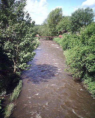
The River Perry is a river in Shropshire, England. It rises near Oswestry and flows south to meet the River Severn above Shrewsbury. Along its 24 miles (39 km) length, its level drops by some 320 feet (95 m). The channel has been heavily engineered, both to enable water mills to be powered by it, and to improve the drainage of the surrounding land. There were at least seven corn mills in the 1880s, and the last one remained operational until 1966. The middle section of the river crosses Baggy Moor, where major improvements were made in 1777 to drain the moor. The scheme was one of the largest to enclose and improve land in North Shropshire, and the quality of the reclaimed land justified the high cost. A section of the river bed was lowered in the 1980s, to continue the process.

<span class="mw-page-title-main">Stratfield Mortimer</span> Village and civil parish in England

Stratfield Mortimer is a village and civil parish, just south of Reading, in the English county of Berkshire and unitary authority area of West Berkshire.

<span class="mw-page-title-main">Burghfield</span> Village and civil parish in England

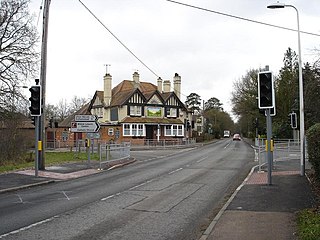
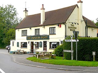
Burghfield is a village and large civil parish in West Berkshire, England, with a boundary with Reading. Burghfield can trace its history back to before the Domesday Book, and was once home to three manors: Burghfield Regis, Burghfield Abbas, and Sheffield. Since the 1980s the population of Burghfield has nearly doubled with the construction of housing estates, making it a dormitory for Reading, Newbury, Basingstoke and the M4 corridor.

<span class="mw-page-title-main">River Crane, London</span> River in England

The River Crane, a tributary of the River Thames, runs 8.5 miles (13.6 km) in West London, England. It forms the lower course of Yeading Brook. It adjoins or passes through three London boroughs: Hillingdon, Hounslow and Richmond upon Thames, in the historic county of Middlesex. The drainage basin is heavily urbanised but many of the Hayes to Whitton flood-meadows have been conserved, forming a narrow, green vale, opening out to what remains of Hounslow Heath in the centre – a near-continuous belt of semi-natural habitat.

<span class="mw-page-title-main">Baughurst</span> Human settlement in England

Baughurst is a village and civil parish in Hampshire, England. It is located west of the town of Tadley, 6 miles (9.7 km) north of Basingstoke. In the 2001 census, it had a population of 2,473.

<span class="mw-page-title-main">River Yarrow (Lancashire)</span> River in Lancashire, England

The River Yarrow is in Lancashire, with its source at an area called Will Narr at Hordern Stoops, along Spitlers Edge - the Chorley/Blackburn boundary - on the West Pennine Moors. The river feeds the Yarrow Reservoir, which in turn feeds the Anglezarke and Upper and Lower Rivington Reservoirs. Upon leaving the reservoirs via a pumping station, the river passes through an area that was formerly known as Abyssinia. Currently, this area is within the boundaries of Heath Charnock and Limbrick, but the original name was given because it was a route frequented by coal miners, and the workers were said to look like natives of Abyssinia : until the mid 20th century it was usual for miners to return from work covered in coal dust.

Lockram Brook is a small stream in southern England. It rises near the Berkshire village of Mortimer, and is a tributary of Burghfield Brook.

<span class="mw-page-title-main">Burghfield Brook</span> River in England

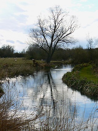
Burghfield Brook is a small stream in southern England. It rises in Wokefield Common between the Berkshire villages of Mortimer and Burghfield Common. It is a tributary of Foudry Brook, which it joins near Hartley Court Farm, just to the south of the M4 motorway.

<span class="mw-page-title-main">Clayhill Brook</span> Stream in Berkshire, England

Clayhill Brook is a small stream in southern England, in the county of Berkshire.

<span class="mw-page-title-main">West End Brook</span> River in England

West End Brook is a small stream in southern England. It rises near the Hampshire village of Tadley. Its name is probably related to the parish, and village, it passes through for some of its course: Mortimer West End.

<span class="mw-page-title-main">Oldcotes Dyke</span> River in England

Oldcotes Dyke is the name of the final section of a river system that drains parts of north Nottinghamshire and the Metropolitan Borough of Rotherham in South Yorkshire, England. Historically, it has supported milling, with seven water mills drawing their power from its water, and ran through the grounds of the Cistercian Roche Abbey. It is a tributary of the River Ryton.

<span class="mw-page-title-main">Bow Brook, Hampshire</span> River in Hampshire, England

Bow Brook is a small river in the English county of Hampshire, which is a tributary of the River Loddon. Contributary streams rise near Ramsdell and Sherborne St John, and after flowing through rural countryside, it joins the Loddon near Sherfield on Loddon. Historically it has powered at least two watermills.

<span class="mw-page-title-main">Fleet Brook</span> River in northern Hampshire, England

Fleet Brook is a small river in northern Hampshire, England and tributary of the River Hart.

References

  1. 1 2 3 4 Ordnance Survey, 1:2500 map
  2. Historic England. "Linear earthwork in Gravelpit Copse (1008727)". National Heritage List for England . Retrieved 13 July 2020.
  3. Historic England. "Moated site and associated fishponds (1013670)". National Heritage List for England . Retrieved 13 July 2020.
  4. Historic England. "Church of St. Mary (1135795)". National Heritage List for England . Retrieved 14 July 2020.
  5. Ordnance Survey, 1:2500 map, 1899
  6. Mortimer 2018, p. 3.
  7. Ditchfield & Page 1923.
  8. Historic England. "Mortimer Station (1117145)". National Heritage List for England . Retrieved 14 July 2020.
  9. Historic England. "Clappers Farmhouse (1319602)". National Heritage List for England . Retrieved 14 July 2020.
  10. Nicholson 2006, pp. 98–99.
  11. CAMS 2004, p. 5.
  12. CAMS 2004, pp. 11, 27.
  13. CAMS 2004, p. 14.
  14. "Glossary (see Biological quality element; Chemical status; and Ecological status)". Catchment Data Explorer. Environment Agency. 17 February 2016. UKOpenGovernmentLicence.svg Text was copied from this source, which is available under an Open Government Licence v3.0. © Crown copyright.
  15. "Silchester Brook". Catchment Data Explorer. Environment Agency.
  16. "West End Brook (tributary of Foudry Brook)". Catchment Data Explorer. Environment Agency.
  17. "Burghfield Brook". Catchment Data Explorer. Environment Agency.
  18. "Foudry Brook (West End Brook to M4)". Catchment Data Explorer. Environment Agency.
  19. Fort 2008.
  20. "TotalFinaElf UK fined £54,000 for pollution of groundwater". Workplace Law Network. 1 May 2002. Archived from the original on 3 December 2008.
  21. "BP and Total named as 'repeat polluters'". Forecourt Trader. 1 August 2003. Archived from the original on 16 August 2017.
  22. "Hundreds of fish perish in sewage leak". Reading Chronicle. 21 July 2010. Archived from the original on 19 July 2011. Retrieved 18 September 2010.
  23. Gregory 2010.