Burghfield Brook

Last updated
Burghfield Brook
Burghfield Brook in the Building Site (geograph 5263619).jpg
A new channel being constructed for Burghfield Brook around the edge of AWE Burghfield in 2017
Location
Country England
Counties Berkshire
Districts / Boroughs Wokefield Parish, Burghfield Parish
Villages Burghfield Common, Mortimer Common
Physical characteristics
Source 
  location Wokefield Common
  coordinates 51°23′37″N1°03′48″W / 51.3935°N 1.0632°W / 51.3935; -1.0632
  elevation95 m (312 ft)
Mouth Foudry Brook
  location
Grazeley Green
  coordinates
51°25′02″N0°59′41″W / 51.4171°N 0.9948°W / 51.4171; -0.9948 Coordinates: 51°25′02″N0°59′41″W / 51.4171°N 0.9948°W / 51.4171; -0.9948
  elevation
40 m (130 ft)
Basin features
Tributaries 
  left The Teg
  right Lockram Brook

Burghfield Brook is a small stream in southern England. It rises in Wokefield Common between the Berkshire villages of Mortimer and Burghfield Common. It is a tributary of Foudry Brook, which it joins near Hartley Court Farm, just to the south of the M4 motorway.

Contents

Route

Burghfield Brook
BSicon uexCONTg.svg
Foudry Brook
BSicon uexSTR+l.svg
BSicon uexABZgr.svg
Burghfield Brook
BSicon uexSTR.svg
BSicon uexSTRl.svg
BSicon uexCONTfq.svg
Foudry Brook
BSicon uexSKRZ-Eu.svg
Kybes Lane
BSicon uexSTR+l.svg
BSicon uexABZgr.svg
The Teg
BSicon uexSTR.svg
BSicon uexABZgl.svg
BSicon uexSTR+r.svg
BSicon CONTgq.svg
BSicon uxmKRZu.svg
BSicon uxmKRZu.svg
BSicon uxmKRZu.svg
BSicon CONTfq.svg
Reading to Basingstoke railway
BSicon uexSKRZ-Eu.svg
Burnthouse Bridge (centre)
BSicon uexSTR.svg
BSicon uexSTR+FEATURE@r.svg
BSicon uexSKRZ-Eu.svg
AWE Burghfield
BSicon uexSKRZ-Eu.svg
BSicon uexSTR.svg
BSicon uexSTR.svg
Reading Road, Burghfield
BSicon uexSTR.svg
BSicon uexSKRZ-Eu.svg
BSicon uexSTRl.svg
BSicon uexSTR+r.svg
James's Lane
BSicon uexSTR.svg
BSicon uexABZgl.svg
BSicon uexSTR+r.svg
BSicon uexSKRZ-Eu.svg
Goodboy's Lane
BSicon uexSTR.svg
BSicon uexSTR.svg
BSicon uexCONTf.svg
BSicon uexSTR.svg
Lockram Brook
BSicon uexKHSTe.svg
BSicon uexSTR.svg
BSicon uexSTR.svg
Burghfield springs
BSicon uexSTR.svg
BSicon uexKHSTe.svg
Wokefield Park springs
BSicon uexSKRZ-Eu.svg
Man's Hill
BSicon uexSTR+l.svg
BSicon uexRESVGe.svg
Auclum reservoir
BSicon uexBHF.svg
BSicon uexSTR.svg
Pond
BSicon uexSTR.svg
BSicon uexBHF.svg
Pullen's Pond
BSicon uexBHF.svg
BSicon uexSTR.svg
Pond
BSicon uexSTR.svg
BSicon uexKHSTe.svg
Wokefield Common springs
BSicon uexKHSTe.svg
Wokefield Common springs

Burghfield Brook rises from a series of springs on Wokefield Common, near the end of Bundes Lane. The emergent brook heads eastwards along the northern edge of Wokefield Common, passing through two small lakes and into a small valley called Burghfield Slade, to reach a reservoir of water to the south of Auclum Copse. The brook marks the border between Burghfield to the north and Wokefield to the south. A second source issues from the ground to the south-west of the springs, and flows eastwards across the common to Pullen's Pond, a small fish pond. On the edge of the heathland area it briefly disappears to re-emerge at the edge of Burghfield Slade, and empties into the reservoir. A third brook rises on Auclum Copse and flows southwards to reach the reservoir. [1] 150 acres (60 ha) of Wokefield Common are managed as a nature reserve by the Berkshire, Buckinghamshire and Oxfordshire Wildlife Trust, where the woodland is regularly thinned to preserve the heathland environment. Pullen's Pond and Dragonfly Pond provide habitat for a number of dragonfly and damselfly species. [2]

The outflow from the reservoir passes under Man's Hill, after which there is a sluice, with Culverlands Farm on its northern bank and Goddards Green to the south. It turns to the north-east, and at James's Farm in Grazeley Green it is joined by Lockram Brook, which has run parallel to Burghfield Brook for most of its length, but a little further to the south. It continues to act as the parish boundary as it turns to the north, until it reaches James's Lane and the southern edge of the Atomic Weapons Establishment, Burghfield. [1] It used to continue in a large curve, passing Saunderscourt Farm, where the parish boundary ceased to follow the brook, before turning to the east to reach the junction between Rider's Lane, Burnthouse Lane and Fuller's Lane. The bridge was called Gravelly Bridge in 1877, but had become Burnthouse Bridge by 1899. [3]

In 1938 the Ministry of Defence requisitioned 225 acres (91 ha) of farmland from the Burghfield Place Farm Estate, on which to build a Royal Ordnance Factory. ROF Burghfield was a filling factory, used for the storage and deployment of armaments, and was served by a siding from the Reading to Basingstoke railway. [4] In 1954, the site changed hands, becoming part of the Atomic Weapons Establishment, and was responsible for the assembly of Blue Steel nuclear missiles, which became operational in 1961. The site still assembles, maintains and decommissions Britain's nuclear weapons. [5] At some point, prior to 1972, the brook was diverted along the southern boundary of ROF Burghfield, and then follows its eastern boundary to rejoin the original course at Burnthouse Bridge. [6] The precise date when the brook was diverted is not easy to ascertain, for maps prior to 1972 show the pre-1938 layout, as if the factory did not exist. [7] From the bridge it heads eastwards, passing under the Reading to Basingstoke railway embankment, where it is joined by a tributary, which rises near the Wokefield Park conference and training centre. Beyond the junction, it heads northwards, is joined by The Teg on its left bank, a tributary which has flowed northwards and then eastwards from Burghfield, passing to the north of ROF Burghfield, and joins Foudry Brook immediately after passing under Kybes Lane. [1]

The watercourse near James's Farm is particularly liable to flooding and has been the subject of discussion at West Berkshire Council meetings. [8]

Water Quality

The Environment Agency measure water quality of the river systems in England. Each is given an overall ecological status, which may be one of five levels: high, good, moderate, poor and bad. There are several components that are used to determine this, including biological status, which looks at the quantity and varieties of invertebrates, angiosperms and fish, and chemical status, which compares the concentrations of various chemicals against known safe concentrations. Chemical status is rated good or fail. [9]

The water quality of the Burghfield Brook was as follows in 2019.

SectionEcological
Status
Chemical
Status
Overall
Status
LengthCatchment
Burghfield Brook [10] style="background: #ffff99; text-align: center;" | Moderate style="background: #dd9393; text-align: center;" | Fail style="background: #ffff99; text-align: center;" | Moderate 4.2 miles (6.8 km)7.02 square miles (18.2 km2)

The main reason for the water quality being less than good is that the brook is affected by discharges from industry.

Bibliography

Related Research Articles

River Loddon

The River Loddon is a tributary of the River Thames in southern England. It rises at Basingstoke in Hampshire and flows northwards for 28 miles (45 km) to meet the Thames at Wargrave in Berkshire. Together, the Loddon and its tributaries drain an area of 400 square miles (1,036 km2).

Pingewood Human settlement in England

Pingewood is a hamlet in the civil parish of Burghfield, to the south of Reading, in the English county of Berkshire. It lies to the Southwest of Burghfield Bridge The name Pingewood derives from the old Celtic word 'pen' meaning head, peak, tip or end. The 'ge' is a contraction of the Celtic word for wood, 'coed'. When the Saxons moved into the area in the 5th century, they did not understand the meaning and added their own descriptive word 'wood' on the end.

Foudry Brook

Foudry Brook is a small stream in southern England. It rises from a number of springs near the Hampshire village of Baughurst, and flows to the east and then the north, to join the River Kennet to the south of Reading. The upper section is called Silchester Brook, and beyond that, Bishop's Wood Stream. The underlying geology is chalk, covered by a layer of clay, and so it has the characteristics of a clay stream, experiencing rapid increases in level after heavy rain due to run-off from the surrounding land. It passes a number of listed buildings and scheduled monuments, including the site of the Roman town of Calleva Atrebatum or Silchester.

Sulhamstead Human settlement in England

Sulhamstead is a village and civil parish in West Berkshire, England. It occupies an approximate rectangle of land south of the (Old) Bath Road (A4) between Reading, its nearest town and Thatcham. It has several small clusters of homes and woodland covering about a fifth of the land, in the centre and north beside which is Thames Valley Police's main Training Centre at Sulhamstead House. Its main amenities are its Church of England parish church and a shop and visitor centre by the Kennet & Avon Canal.

Stratfield Mortimer Human settlement in England

Stratfield Mortimer is a village and civil parish, just south of Reading, in the English ceremonial county of Berkshire and district of West Berkshire.

Burghfield Human settlement in England

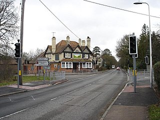
Burghfield is a village and large civil parish in West Berkshire, England, with a boundary with Reading. Burghfield can trace its history back to before the Domesday book, and was once home to three manors: Burghfield Regis, Burghfield Abbas and Sheffield. Since the 1980s the population of Burghfield has nearly doubled with the construction of many new housing estates, dependent for its employment on, for instance, Reading, Newbury and Basingstoke and M4 corridor which bisects the edge of the area.

Wokefield Human settlement in England

Wokefield is a civil parish in the West Berkshire district of Berkshire, England, south of the borough of Reading. The parish includes the hamlets of Grazeley Green, Goddard's Green and Bloomfield Hatch, and the 18th-century mansion of Wokefield Park. It includes part of the former parish of Sulhamstead Bannister Upper End and Grazeley. To the north are Burghfield, and Burghfield Common. to the east are Grazeley and Shinfield and to the south are Stratfield Mortimer and Mortimer Common. It lies between 40m and 95m above sea level.

Cove Brook

Cove Brook runs 4 miles (6.4 km) from near Farnborough Airport in Farnborough, Hampshire, England and flows through Southwood Golf Course where it is joined by Marrow Brook and other smaller streams. It runs north through Cove before joining the Blackwater at Hawley Meadows near the M3 motorway.

River Wey River in southern England

The River Wey is a tributary of the River Thames in south east England. Its two branches, one of which rises near Alton in Hampshire and the other in West Sussex to the south of Haslemere, join at Tilford in Surrey. Once combined the flow is eastwards then northwards via Godalming and Guildford to meet the Thames at Weybridge. Downstream the river forms the backdrop to Newark Priory and Brooklands. The Wey and Godalming Navigations were built in the 17th and 18th centuries, to create a navigable route from Godalming to the Thames.

The Cut, Berkshire

The Cut is a river in England that rises in North Ascot, Berkshire. It flows for around 14 miles (23 km), through the rural Northern Parishes of Winkfield, Warfield and Binfield in Bracknell Forest on its way down to Bray, where it meets the River Thames just above Queens Eyot Island on the reach below Bray Lock, having been joined by the Maidenhead Waterways.

Lockram Brook is a small stream in southern England. It rises near the Berkshire village of Mortimer, and is a tributary of Burghfield Brook.

Clayhill Brook

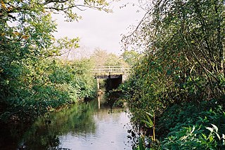
Clayhill Brook is a small stream in southern England, in the county of Berkshire. It rises at Benham's Gulley in the far West of Burghfield Common and runs through the Northern edge of the Village, forming the border between Burghfield Parish and Sulhamstead Parish. The brook, running to the North East, passes through woodland, Omer's Gully, at the edge of the village. The woodland and the brook is a haven for local wildlife in the area, and is a particularly important resource in this respect. At the eastern end of Omer's Gulley, and to the North Eastern End of Burghfield Common, the brook is forded at Ash Lane. It continues North to Northeast past another woodland, Clayhill Copse, and then past Stud Farm and towards Burghfield Village. Along this course of the stream is a sewage treatment works which serves the local communities. Skirting between Burghfield Village and the hamlet of Trash Green, the brook continues Northeast, past Green Farm, under the M4 motorway, and past the gravel pits at Pingewood, running close by to Burghfield Mill. It joins the River Kennet just to the East of Burghfield Mill, no longer a working mill, but converted to residential apartments.

The Teg is a small stream in southern England, in the county of Berkshire. It rises in Burghfield Common and flows northwards and then eastwards to join Burghfield Brook, a tributary of Foudry Brook.

West End Brook

West End Brook is a small stream in southern England. It rises near the Hampshire village of Tadley. Its name is probably related to the parish, and village, it passes through for some of its course: Mortimer West End.

River Hart

The River Hart is a tributary of the River Whitewater in north Hampshire, England. It rises at Ashley Head spring in Crondall and flows north to meet the Whitewater at Bramshill.

Roman River

The Roman River is a river that flows entirely through the English county of Essex. It is a tributary of the River Colne, flowing into its tidal estuary below Colchester. The lower end of the Roman River is also tidal, with tidal water flowing upstream to just above Fingringhoe.

Oldcotes Dyke

Oldcotes Dyke is the name of the final section of a river system that drains parts of north Nottinghamshire and the Metropolitan Borough of Rotherham in South Yorkshire, England. Historically, it has supported milling, with seven water mills drawing their power from its water, and ran through the grounds of the Cistercian Roche Abbey. It is a tributary of the River Ryton.

Twyford Brook

Twyford Brook is a small English river in the county of Berkshire. It drains a rural area to the east of Twyford, starting at the foot of the M4 motorway embankment, and is a tributary of the River Loddon. It was once part of a larger river system, draining the area now occupied by the new town of Bracknell. Because of issues with flooding, a new channel was cut to carry the water to the River Thames at Bray. The new channel and the river upstream from there is now known as The Cut, and the old channel became known as Twyford Brook.

Bow Brook, Hampshire

Bow Brook is a small river in the English county of Hampshire, which is a tributary of the River Loddon. Contributary streams rise near Ramsdell and Sherborne St John, and after flowing through rural countryside, it joins the Loddon near Sherfield on Loddon. Historically is has powered at least two watermills.

Fleet Brook

Fleet Brook is a small river in northern Hampshire, England and tributary of the River Hart.

References

  1. 1 2 3 Ordnance Survey, 1:2500 map
  2. "Wokefield Common". Berks, Bucks and Oxon Wildlife Trust. Archived from the original on 1 November 2019.
  3. Ordnance Survey, 1:2500 map, 1872-77 and 1899
  4. Atkins 2007, p. 18.
  5. Atkins 2007, pp. 19-20.
  6. Ordnance Survey, 1:10,000 map, 1972
  7. Ordnance Survey, 1:2500 map, 1968-70
  8. "Special Overview & Scrutiny Commission Meeting Minutes" (PDF). West Berkshire Council. 23 October 2007. Archived from the original (PDF) on 5 March 2012.
  9. "Glossary (see Biological quality element; Chemical status; and Ecological status)". Catchment Data Explorer. Environment Agency. 17 February 2016.
  10. "Burghfield Brook". Catchment Data Explorer. Environment Agency.