
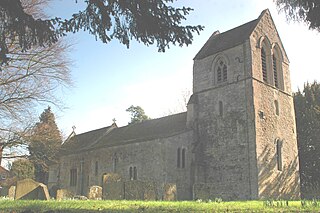
Odstock is a village and civil parish 3 miles (4.8 km) south of Salisbury in Wiltshire, England. The parish includes the village of Nunton with its nearby hamlet of Bodenham. The parish is in the valley of the River Ebble, which joins the Hampshire Avon near Bodenham.

Stanford in the Vale is a village and civil parish in the Vale of White Horse about 3+1⁄2 miles (5.6 km) southeast of Faringdon and 5 miles (8 km) northwest of Wantage. It is part of the historic county of Berkshire, however since 1974, it has been administered as a part of Oxfordshire. The 2011 Census recorded the parish's population 2,093.
Ickford is a village and civil parish in the unitary authority area of Buckinghamshire, England. It is on the boundary with Oxfordshire, about 4 miles (6.4 km) west of the market town of Thame.
Pitchcott is a village and civil parish in the Aylesbury Vale district of Buckinghamshire, England. It is about 3 miles (5 km) northeast of Waddesdon, slightly less than 4 miles (6.4 km) south of Winslow and slightly more than 4 miles (6.4 km) north of Aylesbury. It is in the civil parish of Oving.

Shalbourne is a village and civil parish in the English county of Wiltshire, about 3 miles (4.8 km) southwest of Hungerford, Berkshire. The parish has a number of widely spaced small settlements including Bagshot and Stype, to the north, and Rivar and Oxenwood to the south. Before 1895, about half of the parish of Shalbourne lay in Berkshire.

Catmore is a civil parish and village in West Berkshire about 5+1⁄2 miles (9 km) southeast of Wantage. Catmore is in the Berkshire Downs and the centre of the village is about 575 feet (175 m) above sea level.

Beedon is a village and civil parish about 6½ miles (10.4 km) north of Newbury in West Berkshire, England.

Yattendon is a small village and civil parish 7 miles (11 km) northeast of Newbury in the county of Berkshire. The M4 motorway passes through the fields of the village which lie 0.5 miles (800 m) south and below the elevations of its cluster. The village is privately owned and is "part of the 9,000 acre estate owned by the Iliffes, former press barons", part of the Yattendon Group.

Brimpton is a mostly rural village and civil parish in West Berkshire, England. Brimpton is centred 4.5 miles (7.2 km) ESE of the town of Newbury.

Arrow is a village in the Stratford-on-Avon district of Warwickshire, England. Together with the entirely rural hamlet of Weethley, it forms since 1 April 2004 the civil parish of Arrow with Weethley. The parish lies midway between Redditch and Evesham. From Alcester the River Arrow flows southwards to the river Avon, and to the west of the river the present road to Evesham joins that to Worcester at a busy junction where, near the Old Toll House, stands the hamlet of Arrow, a group of modernized black and white farm workers' cottages which have risen up the social scale to become homes for business people. Arrow with Weethley parish falls under the local government district and parliamentary constituency of Stratford-on-Avon, and the Church of England Diocese of Coventry. In 2001 the parish had a population of 208.

Sunningwell is a village and civil parish about 3+1⁄2 miles (6 km) south of Oxford, England. The parish includes the village of Bayworth and the eastern part of Boars Hill. The parish was part of Berkshire until the 1974 boundary changes transferred it to Oxfordshire. The 2011 Census recorded the parish population as 904.

Dinton is a village, civil parish and former manor in Wiltshire, England, in the Nadder valley on the B3089 road about 8 miles (13 km) west of Salisbury. The parish population was 696 at the 2011 census, estimated at 733 in 2019. The civil parish includes the village of Baverstock, about 1 mile (1.6 km) east of Dinton village.
Water Eaton is a hamlet in the civil parish of Gosford and Water Eaton, between Oxford and Kidlington in Oxfordshire. Water Eaton was a separate civil parish until 1932, when it was merged with its neighbour Gosford.

Denchworth is a village and civil parish about 2.5 miles (4 km) north of Wantage. It was part of Berkshire until the 1974 boundary changes transferred the Vale of White Horse to Oxfordshire. The 2011 Census recorded the parish's population as 171. The parish is bounded by the Land Brook in the west and the Childrey Brook in the east. The Great Western Main Line between Reading and Swindon runs through the parish just south of the village, but there is no station.

Hatherton is a hamlet and civil parish in the unitary authority of Cheshire East and the ceremonial county of Cheshire, England. The hamlet is located on the B5071 at SJ687474, 2+3⁄4 miles (4.4 km) to the north east of Audlem and 3+3⁄4 miles (6.0 km) to the south east of Nantwich. The civil parish has an area of 673 hectares and also includes the small settlements of Birchall Moss, Broomlands and part of Artlebrook, with a total population of 360 in 2011. Nearby villages include Hankelow, Stapeley, Walgherton, Wybunbury, Blakenhall and Buerton. The A529 runs through the parish and the River Weaver forms the western boundary.

Shalden is a village and civil parish in the East Hampshire district of Hampshire, England. It is 2.3 miles (3.7 km) northwest of Alton and 1.9 miles (3.1 km) northeast of Bentworth, just off the A339 road. The parish covers an area of 1,536 acres (622 ha) and has an average elevation of 600 feet (180 m) above sea level. The nearest railway station is Alton, 2.5 miles (4.0 km) southeast of the village. According to the 2011 census, it had a population of 435.

Piddington is a village and civil parish about 4.5 miles (7 km) southeast of Bicester in Oxfordshire, England. It lies close to the border with Buckinghamshire. Its toponym has been attributed to the Old English Pyda's tun. The 2011 Census recorded the parish's population as 370.

Chesterton is a village and civil parish on Gagle Brook, a tributary of the Langford Brook in north Oxfordshire. The village is about 1+1⁄2 miles (2.4 km) southwest of the market town of Bicester. The village has sometimes been called Great Chesterton to distinguish it from the hamlet of Little Chesterton, about 3⁄4 mile (1.2 km) to the south in the same parish. The 2011 Census recorded the parish population as 850.
Bradley is a small village and civil parish in the Basingstoke and Deane district of Hampshire, England. Its nearest town is Alton, which lies 5.4 miles (8.7 km) southeast from the village, although Basingstoke lies 6.6 miles (10.6 km) to the north. According to the 2011 census, the village had a population of 202 people. The parish covers an area of 975 acres (395 ha), of which 149 acres (60 ha) is woodland and its highest point is 170 metres (560 ft) above sea level. It contains no hamlets.

Snarford is a village and civil parish in the West Lindsey district of Lincolnshire, England. It is situated approximately 9 miles (14 km) north-east from the city and county town of Lincoln and 6 miles (10 km) south-west from the town of Market Rasen. It is in the civil parish of Friesthorpe.


