
Stanford in the Vale is a village and civil parish in the Vale of White Horse about 3+1⁄2 miles (5.6 km) southeast of Faringdon and 5 miles (8 km) northwest of Wantage. It is part of the historic county of Berkshire, however since 1974, it has been administered as a part of Oxfordshire. The 2011 Census recorded the parish's population 2,093.

Bucklebury is a village and civil parish in West Berkshire, England, about 5 miles (8 km) north-east of Newbury and 1–3 miles (1.6–4.8 km) north of the A4 road. The parish has a population of 2,116, but the village is much smaller. Bucklebury Common, with an area of over 1 square kilometre (0.39 sq mi), is one of the largest commons in the ceremonial and historic county of Berkshire.

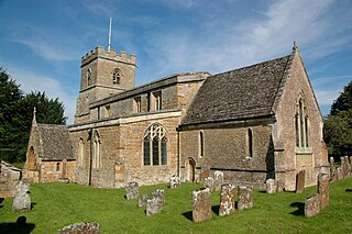
Bradfield is a village and civil parish in Berkshire, England. Aside from farms and a smaller amount of woodland its main settlements are Bradfield Southend, its medieval-founded nucleus and the hamlet of Tutts Clump. Bradfield village is the home of the public school Bradfield College.

Tidmarsh is a village in West Berkshire, England. Its development is mainly residential and agricultural, and is centred on the A340 road between Pangbourne and Theale. The rural area is bounded by the M4 motorway to the south. It is centred 1.5 miles (2.4 km) south of Pangbourne, 5.5 miles (8.9 km) west of Reading and 40 miles (64 km) west of London.

Beech Hill is a small village and civil parish in Berkshire, England. It is in the south east of the West Berkshire unitary authority area and bounds Hampshire and Wokingham district.

Frilsham is a village and civil parish 4 miles (6.4 km) from Newbury, in the English county of Berkshire.

Great Shefford is an English village and civil parish on the River Lambourn in the West Berkshire district of Berkshire. The present civil parish includes the historical parish of Little or East Shefford, a small, reduced community downstream. It also covers the village of Shefford Woodlands, about 1.5 miles (2.4 km) south-west of Great Shefford, near Junction 14 on the M4 motorway.

Peasemore is a village and civil parish in the English ceremonial and historic county of Berkshire in the West Berkshire unitary authority area, west of the A34 road and north of the town of Newbury.
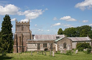
Ashbury is a village and large civil parish at the upper end (west) of the Vale of White Horse. It was part of Berkshire until the 1974 boundary changes transferred it to Oxfordshire. The village is centred 7 miles (11 km) east of Swindon in neighbouring Wiltshire. The parish includes the hamlets of Idstone and Kingstone Winslow. The 2011 Census recorded the parish's population as 506.

Aston Tirrold is a village and civil parish at the foot of the Berkshire Downs about 3 miles (5 km) southeast of Didcot. It was part of Berkshire until the 1974 boundary changes transferred it to Oxfordshire. The 2011 Census recorded the parish's population as 373.

Kingston Lisle is a village and civil parish in the Vale of White Horse, England, about 4+1⁄2 miles (7 km) west of Wantage and 5 miles (8 km) south-southeast of Faringdon. The parish includes the hamlet of Fawler, about 1⁄2 mile (800 m) west of Kingston Lisle village. The 2011 Census recorded the parish population as 225. Kingston Lisle was part of Berkshire until the 1974 local government boundary changes transferred the Vale of White Horse to Oxfordshire.

North Moreton is a village and civil parish about 2 miles (3 km) east of Didcot. It was part of Wallingford Rural District in Berkshire until the 1974 boundary changes transferred it to the new South Oxfordshire District of Oxfordshire. The 2011 Census recorded the parish's population as 328.
Ruscombe is a village and civil parish, east of Twyford in the Borough of Wokingham in Berkshire, England.
Shefford Woodlands is a village in West Berkshire, England, about 3 miles (5 km) northeast of the market town of Hungerford. The village is in the civil parish of Great Shefford, about 1 mile (1.6 km) southeast of Great Shefford village. Shefford Woodlands is about 545 feet (166 m) above sea level in the Berkshire Downs, and just north of Junction 14 on the M4.

Brightwell Baldwin is a village and civil parish in Oxfordshire, about 4+1⁄2 miles (7 km) northeast of Wallingford. It was historically in the Hundred of Ewelme and is now in the District of South Oxfordshire. The 2011 Census recorded the parish's population as 208. The parish is roughly rectangular, about 2+1⁄2 miles (4 km) long north–south and about 1+1⁄4 miles (2 km) wide east–west. In 1848 the parish covered an area of 1,569 acres (635 ha). The B4009 road linking Benson and Watlington forms part of the southern boundary of the parish. The B480 road linking Oxford and Watlington forms a small part of its northern boundary. Rumbolds Lane forms much of its western boundary. For the remainder the parish is bounded largely by field boundaries.
Letcombe Regis is a village and civil parish in the Vale of White Horse. It was part of Berkshire until the 1974 boundary changes transferred the Vale of White Horse to Oxfordshire. The village is on Letcombe Brook at the foot of the Berkshire Downs escarpment about 1 mile (1.6 km) southwest of the market town of Wantage. The 2011 Census recorded the parish population as 578.

Marlston is a village in the English ceremonial county of Berkshire. For administrative purposes, it lies within the civil parish of Bucklebury and the unitary authority of West Berkshire.
Sandford St Martin is a village and civil parish in West Oxfordshire about 7 miles (11 km) east of Chipping Norton and about 12 miles (19 km) south of Banbury. The 2011 Census recorded the parish's population as 209.
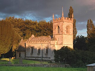
Westcott Barton, also spelt Wescot Barton or Wescote Barton, is a village and civil parish on the River Dorn in West Oxfordshire about 7 miles (11 km) east of Chipping Norton and about 9+1⁄2 miles (15 km) south of Banbury. The parish is bounded to the north by Cockley Brook, a tributary of the River Dorn. A minor road to Kiddington forms part of the eastern boundary, another minor road forms part of the western boundary and the remainder of the parish boundaries are field boundaries. Westcott Barton's main area of housing is on the eastern boundary of the parish and contiguous with the village of Middle Barton in the neighbouring parish of Steeple Barton. The 2011 Census recorded the parish's population as 244.


