
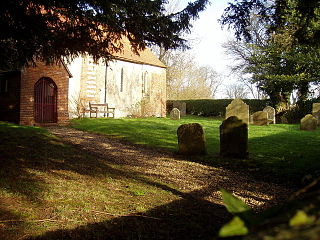
Bircotes is an area in the civil parish of Harworth Bircotes in the Bassetlaw district of Nottinghamshire, England on the border with South Yorkshire. The population of the civil parish was 7,948. The local school in the area is Serlby Park Academy. Bircotes was founded in the 1920s, with the discovery of coal during the First World War and the establishment of Harworth Colliery, to provide homes for miners. It is was home to one of the last deep-mine pits in the UK.

Aston Mullins is a hamlet in the parish of Dinton, in Buckinghamshire, England. At the 2011 Census the population of the hamlet was included in the civil parish of Dinton-with-Ford and Upton

World's End is a hamlet in Berkshire, England. It is in the district of West Berkshire, near the A34 road north of Newbury. To the north is the village of Beedon ; to the south lie Downend and Chieveley. World's End is in the parish of Beedon.

Ashmore Green is a small hamlet in Berkshire, England. It is situated just to the west of the village of Cold Ash and to the north of Thatcham in the West Berkshire district.

Upper Lambourn is a small village in the county of Berkshire, England. The village is situated in the civil parish of Lambourn, and is 1.2 miles (2 km) to the north-west of the village of Lambourn, just off the Lambourn to Shrivenham road. The parish is within the district of West Berkshire, close to the point where the counties of Berkshire, Oxfordshire and Wiltshire meet.

Marsh Benham is a village in the civil parish of Speen in the county of Berkshire, England. It is situated in the unitary authority of West Berkshire, just west of Newbury.

Peasemore is a village and civil parish in the English ceremonial and historic county of Berkshire in the West Berkshire unitary authority area, west of the A34 road and north of the town of Newbury.
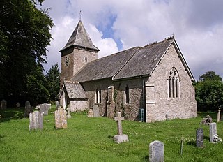
Ashmansworth is a village and civil parish in the Basingstoke and Deane district of the English county of Hampshire.
Beaworthy is a village and civil parish in the West Devon district of Devon, England. According to the 2001 census it had a population of 236.

Auchinleish is a village in Angus, Scotland.

West Heath is a hamlet in the Basingstoke and Deane district of Hampshire, England. It is in the civil parish of Wootton St Lawrence. Its nearest town is Tadley.

Beedon Common is a hamlet and former common in the English county of Berkshire, within the civil parish of Beedon. The settlement lies close to the A34 road, and is located approximately 6 miles (9.7 km) north of Newbury.
Benham Hill is a hill and small settlement in the Shaw portion of the civil parish of Shaw-cum-Donnington in the English county of Berkshire, between Thatcham and Newbury.

Colthrop is a suburb of the town of Thatcham in the English county of Berkshire, England.

Crockham Heath is a hamlet in Berkshire, England. Crockham Heath is part of the civil parish of Enborne. The settlement lies near to the A34 road, and is located approximately 3 miles (4.8 km) south-west of Newbury where administration occurs.

Eling is a hamlet in the civil parish of Hampstead Norreys in the English county of Berkshire. The settlement lies next to the M4 motorway, and is located approximately 5 miles (8.0 km) north-east of Newbury. The Eling estate was owned by Gerald Palmer and is now administered by a charitable trust.
Enborne Row is a hamlet in Berkshire, England, located on the county's border with Hampshire. The hamlet is within the civil parish of Enborne. The settlement lies next to the A34 road, and is located approximately 3 miles (4.8 km) south-west of Newbury.

Wash Water is a hamlet on the border of Berkshire, and Hampshire. It is divided between the civil parishes of Enborne, Newbury, Highclere and East Woodhay. The settlement lies adjacent to the A343 and A34 highways, approximately 3 miles (4.8 km) south-south-west of Newbury.

Ordnance Survey (OS) is the national mapping agency for Great Britain. The agency's name indicates its original military purpose, which was to map Scotland in the wake of the Jacobite rising of 1745. There was also a more general and nationwide need in light of the potential threat of invasion during the Napoleonic Wars. Since 1 April 2015 Ordnance Survey has operated as Ordnance Survey Ltd, a government-owned company, 100% in public ownership. The Ordnance Survey Board remains accountable to the Secretary of State for Business, Energy and Industrial Strategy. It was also a member of the Public Data Group.

