Westcotes

Last updated

Westcotes is an area to the west of the city of Leicester. It is also a ward of the City of Leicester whose population at the 2011 census was 11,644. [1] It is also known as the West End of Leicester. The area is quite small in comparison with other areas of the city, but it is well known as it has many shops, bars and restaurants and is a popular choice for students and young professionals.

Contents

The West End of Leicester, England is an inner city area just west of the city centre, on the opposite side of the River Soar (past the West Bridge). The main roads in the area are Braunstone Gate, Hinckley Road and Narborough Road.

The proximity to De Montfort University makes it a popular student area. Further to the south is the Braunstone estate, and to the west is the Dane Hills area.

The area was developed quite late, because the land remained part of two privately held estates until the 1870s. [2] and therefore is somewhat less dense than other inner city areas like Highfields and Belgrave.

History

Roman

Two Roman roads crossed the West End. Both of these roads crossed the River Soar at a place close to where the West Bridge stands today. One of these roads headed in a south-westerly direction, which was the Fosse Way. The Fosse Way ran from the vicinity of Exeter to Lincolnshire, passing through Leicester. A second road ran directly westwards to join Watling Street, another important Roman Road, at Mancetter in Warwickshire.

In the 1970s the remains of a Roman villa were discovered close to the course of the Mancetter road on Saxon Street. The dwelling included many features that were characteristic of life throughout the Roman Empire; including under-floor heating and painted wall-plaster. The remains of the decorations can still be seen at the Jewry Wall Museum.

Medieval and early modern periods

According to the Domesday book of 1086, the West End formed part of what was known as Bromkinsthorpe. The land was then divided into two areas under the Enclosure Acts during the reign of Charles I in 1626. In the early 1780s, some Roman mosaics were found amongst the cherry tree roots at Danet's Hall (which belonged to the Danet family from the 15th to the late 17th centuries), located "between Bow Bridge and Fosse Road on a wooded lane known as Watt’s Causeway, later to become King Richards Road". In 1850, the owner (Dr Noble), on finding the possibility that there may be Roman remains on his property, donated any finds to the Town Hall and a dig was commenced. Finds can now be seen at the Jewry Wall Museum.

The Victorian era

Victorian housing in Narborough Road Housing on Narborough Rd - geograph.org.uk - 84466.jpg
Victorian housing in Narborough Road

In 1861, Dr Noble died of cholera in Spain. The Danet's Hall estate passed to the Leicester Freehold Land Society, and building soon followed. [2] As the Leicester Improvement Act of 1881 was passed in Parliament, a long straight cut was made from the Burton Railway Bridge north to the King Richards Road. This allowed the canalisation of the River Soar into the "Mile Straight" and allowed the draining of the marshy land to the west of the river. This permitted the development of land to the west of the river. More new streets were laid out towards the end of the 19th century, and much of the area to the east was built up by 1900. In the next 40 years the area was to become completely built up. The street pattern laid down in these times remains to this day.

Much of the area belonged to the Westcotes Estate (from where the area derives its name), formerly in the possession of the Ruding family since 1558, was sold, in 1821, to Thomas Freer, Clerk of the Peace, with office in New Street. His son sold it in 1843 to Joseph Harris, the last owner. The mansion, known as Westcotes, was sited in the area now occupied by Cranmer Street, and it was the home of Joseph Harris until 1886 when much of the estate was sold and the house demolished.

During the latter half of the 19th century industry in Leicester grew at a great pace, principally in its already well established knitting, hosiery and boot and shoe industries. The increase in the workforce created a need for more housing. Much of the house construction in the West End area was undertaken by small enterprise, leading to considerable diversity in building design and form, even over relatively narrow geographical scales. [3] The area to this day still mainly consists of Victorian housing stock.

Twentieth century

The Hindu temple and the Church of the Martyrs Temple and church in Westcotes - geograph.org.uk - 1026935.jpg
The Hindu temple and the Church of the Martyrs

The West End area, together with the Walnut Street district on the other side of the River Soar, was an important residential area in the early twentieth century. With textile, clothing and shoe-making employers such as Liberty Shoes and N. Corah and Sons nearby, and with the manufacturing centres of Woodgate and Frog Island in adjacent districts, the West End was home to many of the employees of Leicester's dominant industries. As a consequence, these areas had a vibrant community based around factory life, and around other social institution such as sports clubs and churches. [4] [5]

Following the end of World War II, there were changes in the make up of the population in the West End. The 1951 Census recorded 1,029 people born in the USSR, mainly Ukrainians, in the city. The older terraced houses in the West End provided rented accommodation. [6]

Due to the nature of the migration, the Ukrainian men were separated from the women and twice as many males than women arrived in Leicester. As a consequence many single men married local girls and a close-knit community was formed. Orthodox Ukrainians held services at the Church of the Martyrs on Westcotes Drive. This helped maintain Ukrainian culture in the area. This group amassed enough capital and later bought its own church on the corner of Hinckley road and Fosse Road South which they bought from the Methodists.

The condition of housing much of central Leicester was, by post-war standards, very poor. [7] From 1970 to 1971 a Compulsory Purchase Order (CPO) was made under the Housing Act 1957 to allow "outworn terraces" to be cleared. This allowed road works for an improved western approach to the city along the A47 and King Richards Road. 1,084 houses were cleared in total under the CPO. [8]

Westcotes Gardens

Westcotes Gardens, Leicester, c. 1910 Circa 1910%3F.jpg
Westcotes Gardens, Leicester, c. 1910
Westcotes Gardens, 2020 Westcotes Gardens, 2020.jpg
Westcotes Gardens, 2020

According to Leicester City Council's Local Heritage Asset Register, the land for Westcotes Gardens was gifted to the city by Westcotes Estates Ltd. as part of their development of surrounding residential streets. The Register indicates that the Gardens were laid out and opened circa 1905.

The attached historic picture of Westcotes Gardens shows in the background the terrace of houses forming nos. 36-46 (evens), 132 Beaconsfield Rd (originally Bismark Street) and 171 Upperton Road. According to the Asset Register, this terrace was designed by local firm Pick Everard circa 1906. The picture shows what appears to be a detached stable block to the rear of 171 Upperton Road which no longer exists. It seems likely that the block was demolished to make way for 167-169 Upperton Road. The picture also appears to show a detached (possibly agricultural?) building to the north of Westcotes Gardens, now occupied by the 1920s houses and their gardens of Upperton Road and Ashleigh Road.

For comparison, also attached is a picture taken from an equivalent position in Westcotes Gardens in March 2020.

Diversity

The area is known for its diverse communities and shops serving cultural food from around the world mainly in Narborough Road, one of the busiest and diverse streets in Leicester. The largest ethnicities are of Turkish and Eastern European descent including Istanbul restaurant, the area has a large variety of Mosques and Churches.

Related Research Articles

<span class="mw-page-title-main">Leicester</span> City and unitary authority in England

Leicester is a city, unitary authority area, unparished area and the county town of Leicestershire in the East Midlands of England. It is the largest city in the East Midlands with a population of 373,399 in 2022. The greater Leicester urban area had a population of 559,017 in 2021, making it the 11th most populous in England, and the 13th most populous in the United Kingdom. A 2023 report ranked Leicester 16th out of the 50 largest UK cities on a range of economic measures, and the first of seven East Midlands cities.

<span class="mw-page-title-main">Fosse Way</span> Roman road built in Britain around the 1st and 2nd centuries AD

The Fosse Way was a Roman road built in Britain during the first and second centuries AD that linked Isca Dumnoniorum (Exeter) in the southwest and Lindum Colonia (Lincoln) to the northeast, via Lindinis (Ilchester), Aquae Sulis (Bath), Corinium (Cirencester), and Ratae Corieltauvorum (Leicester).

<span class="mw-page-title-main">Blaby District</span> Administrative district of Leicestershire, England

Blaby is a local government district in Leicestershire, England. The district is named after the village of Blaby, although the council is based in Narborough. The district covers an area lying south-west of the city of Leicester. Several of the district's settlements form part of the wider Leicester Urban Area, including Glenfield, where Leicestershire County Council has its headquarters at County Hall, and the town of Braunstone.

<span class="mw-page-title-main">Belgrave, Leicester</span> Suburb of Leicester, England

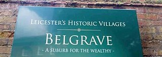
Belgrave is an area, suburb, electoral ward and administrative division of the city of Leicester, in the ceremonial county of Leicestershire, England. Belgrave is the location of and known for the National Space Centre, Space Park Leicester, the Golden Mile and Belgrave Hall.

<span class="mw-page-title-main">Croft, Leicestershire</span> Human settlement in England

Croft is a village and civil parish in the Blaby district of Leicestershire, off the Fosse Way, straddling the River Soar. The population of the civil parish at the 2011 census was 1,639.

<span class="mw-page-title-main">Via Devana</span> Roman road that ran from Colchester to Chester, England

Via Devana is the name given to a Roman Road in England that ran from Colchester in the south-east, through Cambridge in the interior, and on to Chester in the north-west. These were important Roman military centres and it is conjectured that the main reason the road was constructed was military rather than civilian. The Latin name for Chester is Deva and 'Via Devana' is thus 'The Chester Road'. Colchester was Colonia Victricensis, 'the City of Victory', and lays claim to be the oldest Roman city in Britain. The Via Devana had little civilian rationale and the road eventually fell into disuse as it was not possible to maintain extensive public works following withdrawal of the last Roman legion from Britain in 407. As a result, its route is difficult to find today, especially in its more northern reaches. It is omitted from some historians' maps for this reason but most nowadays accept its existence. The undocumented name Via Devana was coined by Charles Mason, D.D., of Trinity College, Cambridge, who was also rector of Orwell, Cambridgeshire, and Woodwardian Professor of Fossils at Cambridge University from 1734. During his life, Mason compiled a complete map of Cambridgeshire which was later published in 1808, long after his death.

<span class="mw-page-title-main">Narborough, Leicestershire</span> Human settlement in England

Narborough is a large village and civil parish in the Blaby district of Leicestershire, England, around six miles southwest of Leicester. The population of the civil parish at the 2011 census was 8,498.

<span class="mw-page-title-main">Leicester West (UK Parliament constituency)</span> Parliamentary constituency in the United Kingdom, 1974 onwards

Leicester West is a constituency in Leicestershire that existed from 1918 to 1950, and recreated in 1974. The seat has been represented in the House of Commons of the Parliament of the United Kingdom by Liz Kendall of the Labour Party since 2010. Kendall currently serves as Secretary of State for Work and Pensions under the government of Keir Starmer. Since its creation in 1918, the seat has sided with parties from the left wing of politics.

<span class="mw-page-title-main">South Wigston</span> Human settlement in England

South Wigston is a large village to the south of Leicester, England. It is outside the city boundary, forming part of the Oadby and Wigston district of Leicestershire. The population at the 2011 census was 7,490.

<span class="mw-page-title-main">Braunstone Town</span> Town and civil parish in England

Braunstone is a town and civil parish in the district of Blaby in Leicestershire, England. At the 2011 census the population of the town was 16,850.

<span class="mw-page-title-main">Enderby, Leicestershire</span> Human settlement in England

Enderby is a village and civil parish in Leicestershire, England, on the southwest outskirts of the city of Leicester. The parish includes the neighbourhood of St John's, which is east of the village separated from it by the M1 motorway. The 2011 Census recorded the parish's population as 6,314.

<span class="mw-page-title-main">Golden Mile (Leicester)</span>

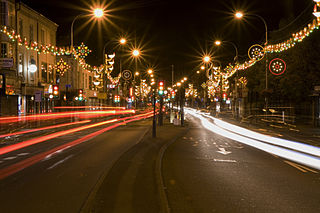
The Golden Mile is a name given to Belgrave Road, just north east of the city centre in Leicester, England. It is part of the ancient Roman Fosse Way and today is famed for its Indian restaurants, sari shops, jewellers, annual winter illuminations, and its internationally renowned annual Diwali celebrations, the largest of their kind outside of India.

<span class="mw-page-title-main">Woodgate, Leicester</span> Neighbourhood in Englands East Midlands

Woodgate is an area in Leicester in Fosse Ward. It lies west of the River Soar and is an important entrance to the city leading on to Frog Island. Its western end lies at the 'Fiveways Junction, an intersection of Fosse Road North, Groby Road, Blackbird Road and Buckminster Road. To the south is the Rally Park, which was formerly the goods yard of the London Midland Railway, and originally the route of the Leicester to Swannington Railway built by Robert Stephenson in 1832. To the west is Fosse Road North. At its eastern end Woodgate terminates at the North Bridge over the old River Soar.

<span class="mw-page-title-main">Thorpe Astley</span> Human settlement in England

Thorpe Astley is a suburban settlement on the southwestern edge of the city of Leicester, England. It is part of the civil parish of Braunstone Town, although a small part of the development, around Goodheart Way, extends into Leicester Forest East civil parish. Both Braunstone Town and Leicester Forest East are within the district of Blaby, Leicestershire.

The Domesday manor of Bromkinsthorpe was situated outside the West Gate of Leicester, on the alluvial west bank of the River Soar. Its location is now covered by the area around Braunstone Gate, Leicester, and for much of the medieval period was a liberty within the parish of St Mary de Castro, Leicester, and hence, part of the Borough of Leicester.

<span class="mw-page-title-main">Braunstone Park & Rowley Fields</span> Electoral ward of Leicester, England

Braunstone Park & Rowley Fields is an electoral ward and administrative division of the city of Leicester, England. It comprises the western Leicester suburbs of Braunstone Frith, Braunstone Park and Rowley Fields.

<span class="mw-page-title-main">Aylestone Meadows</span>

Aylestone Meadows is an 8.8-hectare (22-acre) Local Nature Reserve in Leicester, England, United Kingdom. It is owned and managed by Leicester City Council.

The following is a timeline of the history of the city of Leicester, the county town of Leicestershire, in England.

<span class="mw-page-title-main">Narborough Road</span> Street in Leicester, United Kingdom

Narborough Road is a street in the British city of Leicester. A road since Roman times and one of the principal routes for Leicester to the M1 and M69 motorways, it is also a busy shopping street. In February 2016, it was named the UK's "most diverse" road in a research project by the London School of Economics (LSE).

References

  1. "City of Leicester ward population 2011". Neighbourhood Statistics. Office for National Statistics. Retrieved 5 June 2016.
  2. 1 2 Jack Simmons, Leicester Past and Present: volume 2, Modern City 1860-1974 (London, 1974), p. 7
  3. Sylvia, North. "Change and Development of the West End of Leicester from 1881" (PDF). Manufacturing Pasts, University of Leicester. Retrieved 14 January 2013.
  4. "Interview with Johnny Wesson on the factory community". My Leicestershire (Manufacturing Pasts collection). Retrieved 14 January 2013.
  5. In the boot and shoe manufacturers' lock-out of 1895, for instance, it was the vicar of St Andrew's in Westcotes who acted as arbitrator between workers and employees: Simmons 1974, p. 34.
  6. "Ukrainians after World War II". Leicester City Council. Retrieved 14 January 2013.
  7. For a discussion of this, see: "Utilities and Housing- Grace Fox". My Leicestershire ( Manufacturing Pasts collection). Retrieved 14 January 2013.
  8. "Postwar Slum Clearance". Leicester City Council. Retrieved 14 January 2013.

52°37′48″N1°09′22″W / 52.630°N 1.156°W / 52.630; -1.156