
Leicester is a city, unitary authority area, unparished area and the county town of Leicestershire in the East Midlands of England. It is the largest city in the East Midlands. Its population was 368,600 in 2021, increased by 38,800 from around 329,800 in 2011. The greater Leicester urban area had a population of 559,017 in 2021, making it the 11th most populous in England, and the 13th most populous in the United Kingdom.

Leicestershire is a ceremonial and non-metropolitan county in the East Midlands, England. The county borders Nottinghamshire to the north, Lincolnshire to the north-east, Rutland to the east, Northamptonshire to the south-east, Warwickshire to the south-west, Staffordshire to the west, and Derbyshire to the north-west. The border with most of Warwickshire is Watling Street, the modern A5 road.

Oadby and Wigston is a local government district and borough in the county of Leicestershire, England. It was formed in 1974, under the Local Government Act 1972, from the merger of the Oadby and Wigston urban districts. The population of the district at the 2011 census was 56,170. The district forms part of the Harborough constituency.

The Borough of Charnwood is a local government district with borough status in the north of Leicestershire, England, which has a population of 166,100 as of the 2011 census. It borders Melton to the east, Harborough to the south east, Leicester and Blaby to the south, Hinckley and Bosworth to the south west, North West Leicestershire to the west and Rushcliffe in Nottinghamshire to the north. It is named after Charnwood Forest, an area which the borough contains much of.

Blaby is a local government district in Leicestershire, England.
Hinckley and Bosworth is a local government district with borough status in south-western Leicestershire, England, administered by Hinckley and Bosworth Borough Council. Its only towns are Hinckley, Earl Shilton and Market Bosworth. Villages include Barwell, Burbage, Stoke Golding, Groby, Shackerstone and Twycross. The population of the Borough at the 2011 census was 105,078.
Evington is an area of Leicester, and electoral ward of the Leicester district, in the ceremonial county of Leicestershire, England. It used to be a small village centred on Main Street and the Anglican church of St Denys but was close enough to Leicester to become one of the outer suburbs in the 1930s. Today, the ward comprises the historical village of Evington, as well as the modern ex-council estates of Rowlatts Hill and Goodwood. The population of the ward at the 2011 census was 11,133.

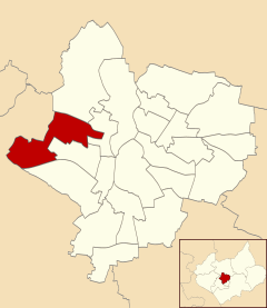
Glenfield is a large village and former civil parish, now in the parish of Glenfields, in the Blaby district of Leicestershire, England. At the 2011 Census, Glenfields had a population of 9,643. Its located at the northwestern fringe of the city of Leicester.

Melton is a local government district with borough status in north-eastern Leicestershire, England. It is named after its main town, Melton Mowbray. Other settlements include Asfordby and Bottesford. At the 2011 census, it had a population of 50,376.
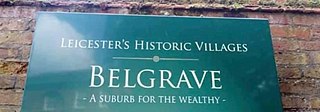
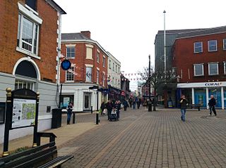
Belgrave is an area, suburb, electoral ward and administrative division of the city of Leicester, England. Belgrave is the location of and known for the National Space Centre, Space Park Leicester, the Golden Mile and Belgrave Hall.

Narborough is a large village and civil parish in the Blaby district of Leicestershire, England, around six miles southwest of Leicester. The population of the civil parish at the 2011 census was 8,498.
Thurcaston is a village and former civil parish, now in the parish of Thurcaston and Cropston, in the Charnwood district, in Leicestershire, England. It was the home of Bishop Hugh Latimer.

Beaumont Leys is a suburb and electoral ward in north-western Leicester, in the Leicester district, in the ceremonial county of Leicestershire, England. The population of the ward at the 2011 census was 16,480. Locally, Beaumont Leys is usually used in reference to the large housing estate, built within the administrative division, centred on Strasbourg Drive.

Glen Parva is a civil parish in the Blaby district of Leicestershire, England with a population of over 17,000. The population of the civil parish, including Eyres Monsell was 17,189 in the 2011 census. To the north it runs into Aylestone and to the east South Wigston. To the south and west it is not immediately surrounded by development.

Thurnby is a village and former civil parish, now in the parish of Thurnby and Bushby, in the Harborough district, in the county of Leicestershire, England. It is just east of Leicester's city boundaries.

North Evington is an area, suburb, electoral ward and administrative division of the city of Leicester, England.

Chesterton is a former mining village in the unparished area of Newcastle-under-Lyme, in the Newcastle-under-Lyme district, in Staffordshire, England.

Enderby is a village and civil parish in Leicestershire, England, on the southwest outskirts of the city of Leicester. The parish includes the neighbourhood of St John's, which is east of the village separated from it by the M1 motorway. The 2011 Census recorded the parish's population as 6,314.
Eyres Monsell is an electoral ward and administrative division in Leicester, England.

Braunstone Park & Rowley Fields is an electoral ward and administrative division of the city of Leicester, England. It comprises the western Leicester suburbs of Braunstone Frith, Braunstone Park and Rowley Fields.
 Houses in New Parks, Leicester
 Shops in New Parks, Leicester
 New Parks Leisure Centre

