Narborough Road

Last updated

Narborough Road
The busy Narborough Road - geograph.org.uk - 1022451.jpg
Narborough Road, October 2008
Former name(s)A46
Part ofA5460
Length2.68 km (1.67 mi)
LocationLeicester
Postal codeLE3
Coordinates 52°37′33″N1°09′05″W / 52.6259°N 1.1515°W / 52.6259; -1.1515
south endBraunstone Lane junction
Major
junctions
Upperton Road, Braunstone Gate
north endA47 King Richard's Road
Other
Known forMost diverse shopping street

Narborough Road is a street in the British city of Leicester. A road since Roman times and one of the principal routes for Leicester to the M1 and M69 motorways, it is also a busy shopping street. In February 2016, it was named the UK's "most diverse" road in a research project by the London School of Economics (LSE).

Contents

History

Victorian housing in Narborough Road Housing on Narborough Rd - geograph.org.uk - 84466.jpg
Victorian housing in Narborough Road

Narborough Road is a 2.7 kilometres (1.7 mi)-long road on the west of Leicester. [1] It stretches from Braunstone Lane/Middleton Street in the south to King Richard's Road (A46) in the north, and runs through the Braunstone Park & Rowley Fields and the Westcotes electoral wards of Leicester. It is a section of the A5460 leading from the M1 motorway towards the city centre. [2] According to the 2015 Index of Multiple Deprivation, Narborough Road is located within areas that are among the 10–20% most deprived in England. [1]

Narborough Road follows the line of the Roman Fosse Way, the longest of Britain's Roman roads, linking Bath and the south-west to Lincoln and the east coast. [3] The route left the Roman (and Medieval) town via the West Bridge before heading south-west for some 270 kilometres (170 mi) to Exeter, and was the main route towards the nearby city of Coventry. However in 1769, when a Turnpike road was established by act of parliament, it chose to connect to the road already running from Hinckley to Coventry, and thus took a more northerley line, via the Hinckley Road. The Fosse Way route was also included in the same act, but only over the 7 kilometres (4.3 mi) to Narborough. [4] It would appear to be this that gave the name to the short stretch of toll-road serving local traffic through much of the 19th century.

By the 1870s the railways had established themselves as the main movers of goods traffic. This undermined the economics of the tollroads, and disturnpiking was in full swing across the country. The Turnpike act for the Narborough Road finally expired in November 1874, ending any responsibility for the upkeep of the road. [4] The turnpike had its northern end where it met Braunstone Gate and Hinckley Road. An early suburb for the city grew up around these three roads, west of the river, and by this period terraced housing was being built out from both sides of the Narborough Road. In 1835 the boundaries of the city had undergone a major expansion, so the town corporation became responsible for a one-mile length of the former turnpike, the town boundary being close to what would later become the junction with Evesham Road and Fullhurst Road, but at that time was still fields. [5]

In the mid-20th century, Narborough Road was closer to being a residential area; it then became a fashion street, with its retail units mainly selling clothes and fabrics. The opening of a number of restaurants and bars brought in students from the city's two universities, University of Leicester and De Montfort University. [6] As of December 2015, 204 of the 222 units along the street (92%) are non-residential. [1] [7]

Diversity

In 2015, a research project titled "Super Diverse Streets", funded by the Economic and Social Research Council (ESRC), was undertaken by the LSE. Led by urban ethnographer Suzanne Hall, the project sought to "explore how urban retail economies and spaces are shaped by and shape migrant practices". [8] Four streets were selected to be studied by the project: Rookery Road in Birmingham, Stapleton Road in Bristol, Cheetham Hill in Manchester, and Narborough Road. These four streets were selected for their ethnic diversity and their deprived urban locale. [8] After surveying a sample of shopkeepers from each of the four streets, the project concluded that Narborough Road's 108 surveyed proprietors came from a total of 22 countries of birth, over four continents. [1] [6] The street was thus named the most diverse in the UK. [9] [6]

The sampled shopkeepers observed that the ethnic make-up of the street had changed quickly. Tajinder Reehal, a Kenyan-born owner of an accessories shop, remarked: "I've seen the street change in the past 16 years. ... It's much more vibrant." Hairdresser Dipak Maru, also Kenyan-born, agreed, and felt that "in the last ten years [the road has] become lively and vibrant". [10] The researchers observed that, despite its high levels of economic deprivation, the high levels of diversity in the street had enabled business owners to trade skills with one another – for example, a Canadian couple who ran a book shop helped others with filling in forms in exchange for a free meal or a free haircut. [9] Speaking about the street's community, half-English, half-Polish music shop owner Lloyd Wright noted: "There's no tension. It's a very relaxed atmosphere." [11]

As a result of the conclusions of the project, in July 2016 the TV channel Channel 4 invited some of the shopkeepers of Narborough Road to provide voiceovers for announcements for their programmes. [12] A total of 21 residents and shopkeepers were invited to provide announcements, which took four days to record. [13] [14] These announcements were broadcast on Channel 4 during the week beginning 23 July. [14]

Related Research Articles

<span class="mw-page-title-main">Leicester</span> City and unitary authority in England

Leicester is a city, unitary authority area, unparished area and the county town of Leicestershire in the East Midlands of England. It is the largest city in the East Midlands with a population of 366,018 in 2021. The greater Leicester urban area had a population of 559,017 in 2021, making it the 11th most populous in England, and the 13th most populous in the United Kingdom. In 2023, Leicester was named as the best place to live and work in the East Midlands.

<span class="mw-page-title-main">Fosse Way</span> Roman road built in Britain around the 1st and 2nd centuries AD

The Fosse Way was a Roman road built in Britain during the first and second centuries AD that linked Isca Dumnoniorum (Exeter) in the southwest and Lindum Colonia (Lincoln) to the northeast, via Lindinis (Ilchester), Aquae Sulis (Bath), Corinium (Cirencester), and Ratae Corieltauvorum (Leicester).

<span class="mw-page-title-main">Blaby District</span> Administrative district of Leicestershire, England

Blaby is a local government district in Leicestershire, England. The district is named after the village of Blaby, although the council is based in Narborough. The district covers an area lying south-west of the city of Leicester. Several of the district's settlements form part of the wider Leicester Urban Area, including Glenfield, where Leicestershire County Council has its headquarters at County Hall, and the town of Braunstone.

<span class="mw-page-title-main">Hinckley</span> Town in Leicestershire, England

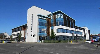
Hinckley is a market town in south-west Leicestershire, England. It is administered by Hinckley and Bosworth Borough Council. Hinckley is the third largest settlement in the administrative county of Leicestershire, after Leicester and Loughborough. Hinckley is about halfway between Leicester and Coventry and borders Nuneaton in Warwickshire. Watling Street forms part of the Hinckley/Nuneaton border.

<span class="mw-page-title-main">Leicester Forest East</span>

Leicester Forest East (LFE) is a large suburban village in Leicestershire, England, west of Leicester, straddling the M1 motorway. It is part of the Blaby district.

<span class="mw-page-title-main">Narborough, Leicestershire</span> Human settlement in England

Narborough is a large village and civil parish in the Blaby district of Leicestershire, England, around six miles southwest of Leicester. The population of the civil parish at the 2011 census was 8,498.

<i>Coventry Telegraph</i> Local English tabloid newspaper

The Coventry Telegraph is a local English tabloid newspaper. It was founded as The Midland Daily Telegraph in 1891 by William Isaac Iliffe, and was Coventry's first daily newspaper. Sold for half a penny, it was a four-page broadsheet newspaper. It changed its name to the Coventry Evening Telegraph on 17 November 1941. On 2 October 2006, the Telegraph simply became the Coventry Telegraph, reflecting its switch to a morning publication.

<span class="mw-page-title-main">Leicester City Centre</span> Human settlement in England

Leicester City Centre is Leicester's historical commercial, cultural and transport hub and is home to its central business district. Its inner core is roughly delineated by the A594, Leicester's inner ring road, although the various central campuses of the University of Leicester, De Monfort University and Leicester College are adjacent to the inner ring road and could be considered to be a continuation of the City centre. In a similar way, the Leicester Royal Infirmary precinct, the New Walk business district (Southfields), the Welford Road Stadium of Leicester Tigers' RUFC and the King Power Stadium of Leicester City to the south, and the Golden Mile to the north could also be deemed to be extensions to the central core.

<span class="mw-page-title-main">Leicestershire Police</span> English territorial police force

Leicestershire Police is the territorial police force responsible for policing the counties of Leicestershire and Rutland in England. Its headquarters are at Enderby, Leicestershire.

<span class="mw-page-title-main">Braunstone Town</span> Human settlement in England

Braunstone is a town and civil parish in the district of Blaby in Leicestershire, England. At the 2011 census the population of the town was 16,850.

<span class="mw-page-title-main">Enderby, Leicestershire</span> Human settlement in England

Enderby is a village and civil parish in Leicestershire, England, on the southwest outskirts of the city of Leicester. The parish includes the neighbourhood of St John's, which is east of the village separated from it by the M1 motorway. The 2011 Census recorded the parish's population as 6,314.

<span class="mw-page-title-main">South Leicestershire (UK Parliament constituency)</span> Parliamentary constituency in the United Kingdom, 2010 onwards

South Leicestershire is a constituency represented in the House of Commons of the UK Parliament since 2015 by Alberto Costa, a member of the Conservative Party.

Westcotes is an area to the west of the city of Leicester. It is also a ward of the City of Leicester whose population at the 2011 census was 11,644. It is also known as the West End of Leicester. The area is quite small in comparison with other areas of the city, but it is well known as it has many shops, bars and restaurants and is a popular choice for students and young professionals.

<span class="mw-page-title-main">Braunstone Park & Rowley Fields</span> Electoral ward of Leicester, England

Braunstone Park & Rowley Fields is an electoral ward and administrative division of the city of Leicester, England. It comprises the western Leicester suburbs of Braunstone Frith, Braunstone Park and Rowley Fields.

The identification of Deserted Villages and Lost Places in Leicestershire owes much to the pioneering work of William George Hoskins during his time at the University of Leicester.

The following is a timeline of the history of the city of Leicester, England.

<i>Hinckley Times</i>

The Hinckley Times is a weekly paid-for tabloid newspaper which is distributed every Wednesday and mainly serves the area of Hinckley. The paper further serves the surrounding areas in Leicestershire, including Market Bosworth, Coalville and Lutterworth.

Suzanne Hall is Professor in the Department of Sociology at the London School of Economics and Political Science, where she directed the Cities Programme. Her work explores intersections of global migration and urban marginalisation. Hall formerly practised as an architect in South Africa focusing on public projects for the first democratically elected state. She has been recognised for her work in both fields, receiving the Philip Leverhulme Prize in Sociology in 2017, and the Rome Scholarship in Architecture Prize in 1998. Hall was born in Johannesburg, South Africa, in 1969.

References

Footnotes

  1. 1 2 3 4 Hall, King & Finlay 2015, p. 4.
  2. Turner, Anna; Mendes, Rui (26 June 2018). "Narborough Road: a world in one street (yeah, and...?)". Medium. Archived from the original on 25 September 2018. Retrieved 25 September 2018.
  3. "The very best Roman road trips in Britain". English Heritage Travel. 28 February 2024.
  4. 1 2 Arthur Cossons (2003). The Turnpike Roads of Leicestershire and Rutland. Kairos Press. p. 49. ISBN   9781871344301.
  5. R.A. McKinley, ed. (1958). The Victoria history of the county of Leicester. Oxford University Press.
  6. 1 2 3 "A world in one street: How Narborough Road is home to a united nations of shopkeepers". Leicester Mercury . Trinity Mirror. 3 February 2016. Archived from the original on 29 May 2017. Retrieved 29 May 2017.
  7. Hall, King & Finlay 2015, p. 7.
  8. 1 2 Hall, King & Finlay 2015, p. 1.
  9. 1 2 Marlow, Lee (3 February 2017). "Britain's most diverse high street revealed – and it's home to shopkeepers from 23 different countries". Daily Mirror . London: Trinity Mirror. OCLC   223228477. Archived from the original on 3 February 2016. Retrieved 29 May 2017.
  10. Gutteridge, Nick (5 February 2017). "Snapshot of 2016 Britain: The shops on one high street run by TWENTY-THREE nationalities". Daily Express . London: Northern and Shell. OCLC   173337077. Archived from the original on 17 February 2017. Retrieved 1 June 2017.
  11. Reynolds, Mark (4 February 2017). "Cosmopolitan Street: Leicester high street boasts business owners from 23 nationalities". Daily Express . London: Northern and Shell. OCLC   173337077. Archived from the original on 28 December 2016. Retrieved 29 May 2017.
  12. Dryden, Fiona (21 July 2016). "Narborough Road traders hit national television screens". Leicester Mercury . Trinity Mirror. Archived from the original on 29 May 2017. Retrieved 29 May 2017.
  13. Mack, Tom (30 July 2016). "Watch Channel 4's film on Narborough Road – Britain's most diverse street". Leicester Mercury . Trinity Mirror. Archived from the original on 29 May 2017. Retrieved 29 May 2017.
  14. 1 2 "C4 launch new project with voices from Britain's most diverse street". London: Channel 4. 29 July 2016. Archived from the original on 30 July 2016. Retrieved 29 May 2017.

Sources