Leicester is a city, unitary authority area, unparished area and the county town of Leicestershire in the East Midlands of England. It is the largest city in the East Midlands. Its population was 368,600 in 2021, increased by 38,800 from around 329,800 in 2011. The greater Leicester urban area had a population of 559,017 in 2021, making it the 11th most populous in England, and the 13th most populous in the United Kingdom.

Hounslow is a large suburban district of West London, 10+3⁄4 miles west-southwest of Charing Cross. It is the administrative centre of the London Borough of Hounslow, and is identified in the London Plan as one of the 12 metropolitan centres in Greater London.

Aylestone is a suburb of Leicester, England, southwest of the city centre and to the east of the River Soar. It was formerly a separate village, but the growth of the city since the Leicester Extension Act of 1891 incorporated Aylestone into the Borough of Leicester and it is now part of the suburban area.

Knighton is a residential suburban area of Leicester, in the Leicester district, in the ceremonial county of Leicestershire, England. It situated between Clarendon Park to the north, Stoneygate to the east, Oadby and Wigston to the south and the Saffron Lane estate to the west.

Stoneygate is part of the City of Leicester, England.

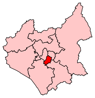
Leicester South is a constituency, recreated in 1974, represented in the House of Commons of the UK Parliament since 2011 by Jonathan Ashworth of the Labour Co-op Party. A previous version of the seat existed between 1918 and 1950. Except for a 2004 by-election when it was won by the Liberal Democrats, Leicester South has been held by the Labour Party since 1987.
Great Glen is a village and civil parish in the Harborough District, in Leicestershire, 2 miles south of Oadby. The population of the civil parish at the 2011 census was 3,662. Leicester city centre is about seven miles north west. Its name comes from the original Iron Age settlers who used the Celtic word glennos meaning valley, and comes from the fact that Great Glen lies in part of the valley of the River Sence. The 'great' part is to distinguish the village from Glen Parva.

Highfields is an inner city area of Leicester, England. It is one of the highest areas in the city, on high ground southeast of the city centre. To the west the area is bounded by the Midland Main Line, to the south by London Road (A6), and to the east by East Park Road. To the north is Spinney Hills, though there is no clear boundary between the two areas, and Spinney Hills is often considered to be part of Highfields. The neighbourhood is within walking distance of the city centre of Leicester and offers many amenities for religious, social, cultural and commercial activities. The population is split between the Spinney Hills, Wycliffe and Stoneygate wards of the Leicester City Council.

Queens Park is an electoral ward and area in Bedford, England. The area's borders are approximately Bromham Road and Beverley Crescent to the north, the Midland Main Line railway line to the east, and the River Great Ouse to the south.

English Sikhs number over 520,000 people and account for 0.92% of England's population in 2021, forming the country's fourth-largest religious group. In 2006 there were 352 gurdwaras in England. The largest Sikh populations in the U.K. are in the West Midlands and Greater London.

Stockdale Harrison FRIBA was an architect based in Leicester best known for Usher Hall, Edinburgh.

New Walk is a promenade in the city of Leicester, which connects the areas around Victoria Park to the city centre. The promenade is a rare surviving example of a Georgian promenade. The walk is just under a mile long. A number of buildings sit along New Walk, including office buildings for the Leicester Mercury, Leicester Museum & Art Gallery and Holy Cross Priory.

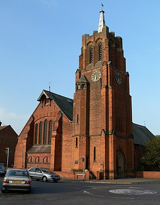
The Clarendon Park Congregational Church is a Congregational church in Leicester, Leicestershire, UK. It is located on London Road in the Stoneygate district near Clarendon Park.


