Related Research Articles

Donisthorpe is a village in the North West Leicestershire district of Leicestershire, England, historically an exclave of Derbyshire.

Oadby and Wigston is a local government district with borough status in Leicestershire, England. It covers the two towns of Oadby, where the council is based, and Wigston, which is the larger town. Both form part of the Leicester urban area, lying south-east of the city.

Charnwood is a local government district with borough status in the north of Leicestershire, England. It is named after Charnwood Forest, much of which lies within the borough. Towns in the borough include Loughborough, Shepshed and Syston. Villages in the borough include Barrow upon Soar, Birstall, Hathern, Mountsorrel, Quorn, Rothley, Sileby and Woodhouse Eaves.

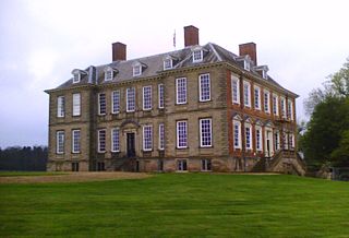
Stanford Hall is a stately home in Leicestershire, England, near the village of Stanford on Avon and the town of Lutterworth, Leicestershire. The population of any residents in the area is included in the civil parish of Misterton with Walcote.
Charnwood Forest is a hilly tract in north-western Leicestershire, England, bounded by Leicester, Loughborough and Coalville. The area is undulating, rocky and picturesque, with barren areas. It also has some extensive tracts of woodland; its elevation is generally 600 feet (180 m) and upwards, the area exceeding this height being about 6,100 acres (25 km2). The highest point, Bardon Hill, is 912 feet (278 m). On its western flank lies an abandoned coalfield, with Coalville and other former mining villages, now being regenerated and replanted as part of the National Forest. The M1 motorway, between junctions 22 and 23, cuts through Charnwood Forest.

Blaby is a large village in the Blaby District in central Leicestershire, England, some five miles south of Leicester city centre. At the time of the 2011 census, Blaby had a population of 6,194, falling slightly from 6,240 in 2001. Given Blaby's proximity to the city, it is part of the Leicester Urban Area.
West Goscote was a hundred of Leicestershire, that arose from the division of the ancient Goscote hundred into two. It covers the north west of the county, an area broadly corresponding to the western part of Charnwood district along with North West Leicestershire.

Grace Road, known for sponsorship reasons as the Uptonsteel County Ground, Grace Road, is a cricket ground in Leicester, England. It is the home ground and administrative base of Leicestershire County Cricket Club.

Hallaton is a village and civil parish in the Harborough district of Leicestershire, England. According to the 2001 census the parish had a population of 523, which had increased to 594 at the 2011 census.

Barrow Town Football Club is a football club based in the large village of Barrow upon Soar, Leicestershire, England. They are currently members of the Leicestershire Senior League Division One and play at Riverside Park.

Western Park is a park and surrounding suburb located in West End of Leicester. It is also a ward of the City of Leicester whose population at the 2011 census was 10,609.

Frog Island is an inner city area of Leicester, England, so named because it lies between the River Soar and the Soar Navigation. Frog Island is adjacent to the Woodgate area to the north, and Northgates to the South. The population of the island was at the 2011 census in the Abbey ward of Leicester City Council.
Scalford railway station was a railway station serving the village of Scalford, Leicestershire on the Great Northern and London and North Western Joint Railway. It opened in 1879 and closed to regular traffic in 1953. It was the junction for a branch line to Waltham on the Wolds which was built to exploit ironstone deposits in the area.

Dimminsdale is a 37 hectare geological and biological Site of Special Scientific Interest partly in Derbyshire and partly in Leicestershire. It is located east of Calke in Derbyshire. It is a Geological Conservation Review site, and a area of 23.5 hectares is owned by Severn Trent Water and managed by the Leicestershire and Rutland Wildlife Trust.

Loughborough Meadows is a 60.5 hectares biological Site of Special Scientific Interest on the northern outskirts of Loughborough in Leicestershire, England. An area of 35.3 hectares is managed as a nature reserve by the Leicestershire and Rutland Wildlife Trust.

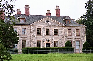
Baggrave Hall is an 18th-century Grade II* listed country house in the parish of Hungarton, Leicestershire, England. It is a two and three-storey building in Palladian style, constructed in ashlar in the 1750s, with a Swithland slate hipped roof and brick-ridge chimney stacks. An extra wing in red brick can be dated to 1776. The current grounds cover 220 acres. The hall was listed in 1951, but suffered serious damage from an owner in 1988–1990.

Chilvers Coton was a railway station on the Coventry to Nuneaton Line, which served the Chilvers Coton area of Nuneaton, south of the town centre. It opened in 1850, along with the line, and was closed in 1965 when passenger services on the route were withdrawn.

Snibston Grange is a 3.2 hectare Local Nature Reserve on the western outskirts of Coalville in Leicestershire. It is owned and managed by Leicestershire County Council.

Cave's Inn Pits is a 5.8-hectare (14-acre) biological Site of Special Scientific Interest south-west of Shawell in Leicestershire.

Ulverscroft Valley is a 110.8-hectare (274-acre) biological Site of Special Scientific Interest north-west of Markfield in Leicestershire. The site is in five separate blocks, and two areas are nature reserves managed by the Leicestershire and Rutland Wildlife Trust (LRWT). Lea Meadows is owned by the LRWT and it is also a scheduled monument. Part of Ulverscroft Nature Reserve is owned by the LRWT and part is owned by the National Trust and leased to the LRWT.
References
- ↑ https://news.knowledia.com/US/en/articles/the-viking-invasion-of-leicestershire-ad5f02c4d9608d01816d04e0af73e35d7f943129 [ bare URL ]
- ↑ C.J.Billson [ed.] (1895) County Folklore: Leicestershire & Rutland. London, Folk Lore Society
52°38′24″N1°10′05″W / 52.640°N 1.168°W