Glenfield, Leicestershire

Last updated

Glenfield
Glenfield.jpg
St Peter's Church, Glenfield
Leicestershire UK location map.svg
Red pog.svg
Glenfield
Location within Leicestershire
Population9,643 (parish; 2011 Census)
OS grid reference SK538060
Civil parish
District
Shire county
Region
Country England
Sovereign state United Kingdom
Post town LEICESTER
Postcode district LE3
Dialling code 0116
Police Leicestershire
Fire Leicestershire
Ambulance East Midlands
UK Parliament
List of places
UK
England
Leicestershire
52°38′57″N1°12′22″W / 52.64907°N 1.20622°W / 52.64907; -1.20622

Glenfield is a large village and former civil parish, now in the parish of Glenfields, in the Blaby district of Leicestershire, England. At the 2011 Census, Glenfields had a population of 9,643. [1]

Contents

The village is directly to the west of Leicester and is just off junction 21A of the M1. It is the site of the headquarters of Leicestershire County Council, and of Leicestershire Fire and Rescue Service. It also gives its name to Glenfield Hospital, although the hospital is actually across the city border in Leicester.

The heart of the community is around the Square, with St Peter's Church (CofE), the church hall, the ruins of the former church, the Methodist Church and Hall and the public library just inside Station Road, and Park House (parish council), the Memorial Hall, Scout Hut, playground, Glenfield Primary School and the nursery school all located just inside Stamford Street. The Hall County Primary School is located on Glenfield Frith Drive. Situated close to the Hall school is Faire Road commonly known for the row of shops situated there.

History

The name "Glenfield" means "clean field", possibly suggesting that it was clear of weeds. [2]

Glenfield is mentioned in the Domesday Book of 1086, at which time it lay in Guthlaxton hundred and contained 12 households. [3]

The village was greatly enlarged between the 1920s and the 1950s when the Faire Estate was built. In the 1980s and 1990s, another large estate was built on former farmland behind Ellis Park.

Glenfield was the site of the first station from Leicester West Bridge on the Leicester and Swannington Railway, opened on 17 July 1832 as the world's third steam railway. Just before reaching the station, the line passed through Glenfield Tunnel, which was built by Robert Stephenson and was, at 1 mile 36 yards, the world's longest railway tunnel at the time. The Glenfield end of the tunnel can still be seen.

In 1931 the parish had a population of 1,590. [4] On 1 April 1935 the parish was abolished to form "Glenfields". [5]

Parish facilities

Pond at Gynsills Nature Reserve Gynsills nature reserve.JPG
Pond at Gynsills Nature Reserve

Glenfield has its own village newspaper, The Glenfield Gazette. The parish council owns several areas of recreational land, including Ellis Park, Station Park and the Playing Fields. Near to the A50 and the boundary with Groby is the "Millennium Green", which is managed by a local trust. The Gynsills Nature Area can be found at the junction of Gynsill Lane and Stelle Way. A small area of mature trees and a pond, once part of the Gynsills Estate parkland, is now an area promoting biodiversity and nature conservation.

The area known as "The Square" was once more of a road and contained many more shops, mostly owned by the Stockley family. These were demolished in the 1950s and 1960s to accommodate the roundabout and the maisonettes were built in place of the grocers, post office and butcher's shop.

On Station Road, there is a large Morrisons supermarket, petrol station, a pharmacy, and other shops. There are also shops around the Square, Stamford Street and Faire Road. The Square has a butchers shop. [6]

The Co-operative Food superstore on Station Road was closed down in January 2020 and was replaced with a Morrisons superstore which opened in August 2020 and the Morrisons petrol station to open late February 2020.[ needs update ]

There are a variety of pubs, take-aways, restaurants and a hotel in Glenfield. These include the Nag's Head, the Forge (formerly the Griffin), the Gynsills, and the Railway Inn (near to the site of the former Glenfield Station). There are Chinese, pizza and fish and chip takeaways, and Indian restaurants in the village. The parade of shops on Faire Road includes Aquarius Fish Bar, Golden Orient Chinese, and Sameeha Indian Restaurant and takeaway.

Notable residents

The Australian pioneer and explorer Charles Throsby was born in Glenfield in 1777. Stamford Street was the home of painter Bryan Organ. Salcombe Drive was the home of the pundit Graham Barnfield. Leicester Road was the home of Alderman Bertram Powell, Lord Mayor of Leicester 1959–60, from the late 1930s to his death in 1969. During the late 1990s Leicester City players Robbie Savage and Pontus Kåmark lived in Glenfield. The British dramatist and playwright David Campton was a resident of Liberty Road, Glenfield up until his death in 2006. Footballers David Nugent and Chris Wood lived in Glenfield when playing for Leicester in the mid-2010s.[ citation needed ]

Commercial

The Mill Lane Industrial Estate MillLaneIndEstate.jpg
The Mill Lane Industrial Estate

Although Glenfield is mainly residential there are a few businesses located in the area, notably the Widdowson Group and others located on the Mill Lane Industrial Estate. Next door to Mill Lane is Optimus point, home to major brands such as Boden, Mattel, Everards and delivery company DPD.

Transport

Glenfield is 3 miles (5 km) away from Leicester, and 1.5 miles (2 km) from the Beaumont Leys Shopping Centre. Glenfield railway station served the village between 1832 and 1928. The nearest railway station is now Leicester

Roads

The M1 can be easily accessed at Junction 21A to the south of the village (southbound only), which makes Fosse Shopping Park accessible. The M1 North can be reached in minutes along the A50 towards Markfield, Groby and Coalville.

The A46 leads around the north of Leicester, with access to Anstey and then the A6 to Loughborough.

Bus

The village is currently served by First Leicester service 13 and Centrebus 40 CircleLine buses.

Related Research Articles

<span class="mw-page-title-main">Market Harborough</span> Human settlement in England

Market Harborough is a market town in the Harborough district of Leicestershire, England, close to the border with Northamptonshire. The town's population was 25,143 in 2020. It is the administrative headquarters of the Harborough district.

<span class="mw-page-title-main">Lutterworth</span> Town in Leicestershire, England

Lutterworth is a market town and civil parish in the Harborough district of Leicestershire, England. The town is located in southern Leicestershire, close to the borders with Warwickshire and Northamptonshire. It is located 6.4 miles north of Rugby, Warwickshire and 12 miles south of Leicester.

<span class="mw-page-title-main">A6 road (England)</span> North-south road in England

The A6 is one of the main north–south roads in England. It runs from Luton in Bedfordshire to Carlisle in Cumbria, although it formerly started at a junction with the A1 at Barnet. It is the fourth longest numbered road in Britain; only the A1, A38 and A30 are longer.

<span class="mw-page-title-main">Blaby District</span> Administrative district of Leicestershire, England, UK

Blaby is a local government district in Leicestershire, England. The district is named after the village of Blaby, although the council is based in Narborough. The district covers an area lying south-west of the city of Leicester. Several of the district's settlements form part of the wider Leicester Urban Area, including Glenfield, where Leicestershire County Council has its headquarters at County Hall, and the town of Braunstone.

<span class="mw-page-title-main">Oadby</span> Town in Leicestershire, England

Oadby is a town in the borough of Oadby and Wigston in Leicestershire, England. Oadby is a district centre 4 miles (6.4 km) south-east of Leicester on the A6 road. Leicester Racecourse is situated on the border between Oadby and Stoneygate. The University of Leicester Botanical Garden is in Oadby. Oadby had a population of 23,849 in 2011, and like its neighbour Wigston is made up of five wards. The Borough of Oadby and Wigston is twinned with Maromme in France, and Norderstedt in Germany.

<span class="mw-page-title-main">Leicester Forest East</span>

Leicester Forest East (LFE) is a large suburban village in Leicestershire, England, west of Leicester, straddling the M1 motorway. It is part of the Blaby district.

<span class="mw-page-title-main">Groby</span> Human settlement in England

Groby is a village in the Hinckley and Bosworth borough Leicestershire, England. It is to the north west of Leicester. The population at the time of the 2011 census was 6,796.

The Leicester and Swannington Railway (L&SR) was one of England's first railways, built to bring coal from West Leicestershire collieries to Leicester, where there was great industrial demand for coal. The line opened in 1832, and included a tunnel over a mile in length, and two rope-worked inclined planes; elsewhere it was locomotive-operated, and it carried passengers.

<span class="mw-page-title-main">Thurmaston</span> Village in Leicestershire, England

Thurmaston is a village and civil parish in Leicestershire, England, located within the Borough of Charnwood. At the 2011 census, it had a population of 9,668.

<span class="mw-page-title-main">Anstey, Leicestershire</span> Human settlement in England

Anstey is a large village in Leicestershire, England, located north west of Leicester in the borough of Charnwood. Its population was 6,528 at the 2011 census. This figure is expected to increase due to the building of a new housing development off Groby Road. The village is separated from Leicester by the Rothley Brook, Castle Hill Park and the A46, and it borders the villages of Glenfield, Groby, Newtown Linford, Cropston and Thurcaston as well as the suburb of Beaumont Leys and Anstey Heights. To the north-west lies Bradgate Park.

<span class="mw-page-title-main">Birstall, Leicestershire</span> Human settlement in England

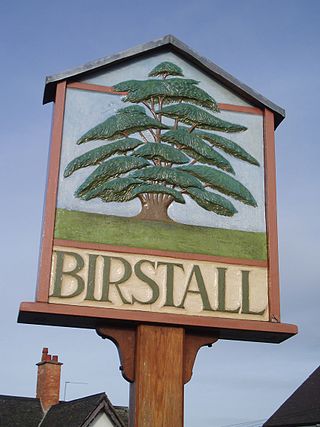
Birstall is a large village and civil parish within the Charnwood borough of Leicestershire, England. It is three miles north of Leicester city centre and is part of the wider Leicester Urban Area.

<span class="mw-page-title-main">Walderslade</span> Human settlement in England

Walderslade is a large suburb in Kent to the south of Chatham split between the unitary authority of Medway and the boroughs of Maidstone and Tonbridge & Malling in South East England. It was, until 1998, fully part of Kent and is still ceremonially associated via the Lieutenancies Act. It encompasses almost all the ME5 postcode district.

<span class="mw-page-title-main">Beaumont Leys</span> Suburb and electoral ward in north-western Leicester, England

<span class="mw-page-title-main">Markfield</span> Human settlement in England

Markfield is a large village in both the National Forest and Charnwood Forest and in the Hinckley and Bosworth district of Leicestershire, England. The settlement dates back to at least the time of the Norman conquest and is mentioned in the Domesday Book under the name Merchenefeld. A variant of this is still used as the name for the village primary school, Mercenfeld. It is to the south-east of Junction 22 of the M1, and to the south of the A50. The highest point in Markfield is shown on OS sheet 129 at 222 metres above sea level. Nearby places are Newtown Linford, Groby, Field Head, and Stanton under Bardon. In the 1841 census its population was recorded at 1,203. In the 2011 census the parish had a population of 5681. Markfield is within the LE67 postcode district. In 2012 Hinckley & Bosworth Borough Council published an overview of Markfield conservation area.

<span class="mw-page-title-main">Ratby</span> Human settlement in England

Ratby is a commuter village and civil parish in the Hinckley and Bosworth district of Leicestershire, England. It is situated to the west of Leicester, and just south of the M1 motorway. The population of the civil parish was measured in the 2011 census as 4,468. Other nearby places include Field Head, Kirby Muxloe, Glenfield and Markfield. The proximity of Ratby to Leicester causes it to form part of the Leicester Urban Area.

<span class="mw-page-title-main">Fleckney</span> Human settlement in England

Fleckney is a village and civil parish in the Harborough district of Leicestershire, England. It is situated 2.5 miles (4 km) west of the A6 national route between Market Harborough and Leicester.

<span class="mw-page-title-main">Braunstone Town</span> Human settlement in England

Braunstone is a town and civil parish in the district of Blaby in Leicestershire, England. At the 2011 census the population of the town was 16,850.

<span class="mw-page-title-main">Bardon, Leicestershire</span> Human settlement in England

Bardon is a civil parish and former village in North West Leicestershire about 1.5 miles (2.4 km) southeast of the centre of Coalville. The parish includes Bardon Hill, which at 912 feet (278 m) above sea level is the highest point in Leicestershire. With the population remaining less than 100, information from the 2011 census was included in the civil parish of Ellistown and Battleflat.

<span class="mw-page-title-main">Woodgate, Leicester</span> Neighbourhood in Englands East Midlands

Woodgate is an area in Leicester in Fosse Ward. It lies west of the River Soar and is an important entrance to the city leading on to Frog Island. A busy junction, its northern end lies at the intersection of Fosse Road North, Groby Road, Blackbird Road and Buckminster Road. To the south is the Rally Park, which was formerly the goods yard of the London Midland Railway, which was originally the Leicester to Swannington Railway built by Robert Stephenson in 1832. To the west is Fosse Road North. At its eastern end Woodgate terminates at the North Bridge over the old River Soar.

National Cycle Route 63 is a route of the National Cycle Network, running from Burton on Trent to Wisbech.

References

  1. "Key Figures for 2011 Census: Glenfields". Office for National Statistics (Neighbourhood Statistics). Archived from the original on 4 March 2016. Retrieved 29 August 2015.
  2. "Key to English Place-names". kepn.nottingham.ac.uk. Archived from the original on 11 August 2021. Retrieved 31 August 2021.
  3. "Place: Glenfield". Open Domesday. Archived from the original on 4 March 2016. Retrieved 29 August 2015.
  4. "Population statistics Glenfield AP/CP through time". A Vision of Britain through Time . Retrieved 26 December 2022.
  5. "Relationships and changes Glenfield AP/CP through time". A Vision of Britain through Time. Retrieved 26 December 2022.
  6. Wallop, Harry (27 December 2007). "Up to 3,000 traditional shops quit high street". The Telegraph. Retrieved 18 February 2012.[ dead link ]

Commons-logo.svg Media related to Glenfield at Wikimedia Commons