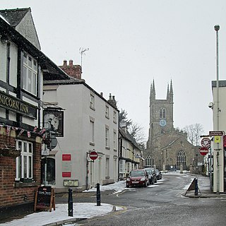
Lutterworth is an historic market town and civil parish in the Harborough district of Leicestershire, England. The town is located in southern Leicestershire, close to the borders with Warwickshire and Northamptonshire. It is located 6.4 miles north of Rugby, Warwickshire and 12 miles south of Leicester.

Glenfield is a large village and former civil parish, now in the parish of Glenfields, in the Blaby district of Leicestershire, England. At the 2011 Census, Glenfields had a population of 9,643.
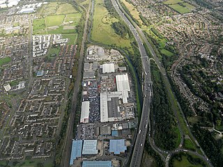
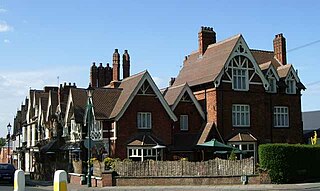
Leicester Forest East (LFE) is a large suburban village in Leicestershire, England, west of Leicester, straddling the M1 motorway. It is part of the Blaby district.

Stirchley is a suburb in south-west Birmingham, England. The name likely refers to a pasture for cattle. The settlement dates back to at least 1658. Prehistoric evidence, Roman roads, and Anglo-Saxon charters contribute to its history. The Worcester and Birmingham Canal and the railways brought industry to the area. Stirchley's development is also linked to industries like screw-making and rubber manufacturing. Originally part of Worcestershire, Stirchley underwent administrative changes in 1911. Residential developments were established alongside the long-standing Victorian terracing which is associated with the suburb.
Castle Bromwich is a large suburban village and civil parish in the Metropolitan Borough of Solihull in the West Midlands, England. It borders the rest of the borough to the south east, Sutton Coldfield to the east and north east, Shard End to the south west, Castle Vale, Erdington and Minworth to the north and Hodge Hill to the west.

Theale is a village and civil parish in West Berkshire, England. It is 5 miles (8 km) southwest of Reading and 10 miles (16 km) east of Thatcham. The compact parish is bounded to the south and south-east by the Kennet & Avon Canal, to the north by a golf course, to the east by the M4 motorway and to the west by the A340 road.

Brixworth is a village and civil parish in West Northamptonshire, England. The 2001 census recorded a parish population of 5,162, increasing to 5,228 at the 2011 census. The village's All Saints' Church is of Anglo-Saxon origin.

Narborough is a large village and civil parish in the Blaby district of Leicestershire, England, around six miles southwest of Leicester. The population of the civil parish at the 2011 census was 8,498.

Walmley is a suburban village situated in the civil parish of Sutton Coldfield, West Midlands. It lies within the City of Birmingham on its northeastern outer fringe, where it forms part of the Sutton Walmley and Minworth electoral ward. It is in southern Sutton Coldfield, close to Minworth, Erdington, Wylde Green, Pype Hayes and south of Thimble End. It is approximately 7 miles (11.3 km) northeast of Birmingham City Centre. It is the main focus of the Sutton New Hall Birmingham City Council ward.
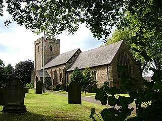
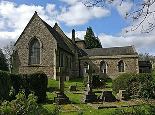
Thurcaston is a village and former civil parish, now in the parish of Thurcaston and Cropston, in the Charnwood district, in Leicestershire, England. It was the home of Bishop Hugh Latimer.
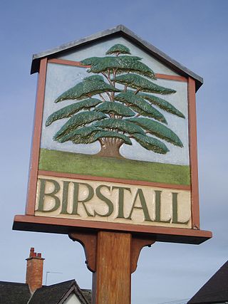
Birstall is a large village and civil parish within the Charnwood borough of Leicestershire, England. It is three miles north of Leicester city centre and is part of the wider Leicester Urban Area.
Dorridge is a large village in the Metropolitan Borough of Solihull in the West Midlands (county), England. Historically part of the historic county of Warwickshire, the village is encompassed within the electoral ward of Dorridge and Hockley Heath, which had a population of 11,140 in the 2011 census.

Whetstone is a village and civil parish in the Blaby district of Leicestershire, England and largely acts as a commuter village for Leicester, five miles to the north. The population at the 2011 census was 6,556. It is part of the Leicester Urban Area.
Braunstone is a town and civil parish in the district of Blaby in Leicestershire, England. At the 2011 census the population of the town was 16,850.

Narborough railway station serves the large village of Narborough and the small village of Littlethorpe in Leicestershire. It is on the Birmingham to Peterborough Line about 7 miles (11 km) southwest of Leicester. The station is owned by Network Rail and managed by East Midlands Railway, who do not serve the station. Only CrossCountry trains serve the station.
Snarestone is a small rural village in North West Leicestershire, England.

Hockley Heath is a village and civil parish within the Metropolitan Borough of Solihull, West Midlands, England. The village is to the south of the West Midlands conurbation, 12 miles (19 km) southeast of Birmingham 5.5 miles (8.9 km) from Solihull town centre and 13 miles (21 km) north of Stratford-upon-Avon. Hockley Heath is in the Arden area and borders Warwickshire and the District of Stratford-on-Avon to the south, with some parts of the village on either side of the border. It incorporates the hamlet of Nuthurst, and has a history dating back to the year 705 AD as a wood owned by Worcester Cathedral. The 2011 Census gives the population of Hockley Heath civil parish as 2,038.

Enderby is a village and civil parish in Leicestershire, England, on the southwest outskirts of the city of Leicester. The parish includes the neighbourhood of St John's, which is east of the village separated from it by the M1 motorway. The 2011 Census recorded the parish's population as 6,314.

Humberstone and Hamilton is an electoral ward and administrative division of the City of Leicester, England. It comprises the north-eastern Leicester suburbs of Humberstone, Humberstone Garden City, Hamilton and Netherhall.

Braunstone Park & Rowley Fields is an electoral ward and administrative division of the city of Leicester, England. It comprises the western Leicester suburbs of Braunstone Frith, Braunstone Park and Rowley Fields.


