Wendy, Cambridgeshire

Last updated

Wendy
The old Church Hall in Wendy - geograph.org.uk - 2925.jpg
All Saints Church, Wendy
Cambridgeshire UK location map.svg
Red pog.svg
Wendy
Location within Cambridgeshire
OS grid reference TL323477
Civil parish
District
Shire county
Region
Country England
Sovereign state United Kingdom
Post town Royston
Postcode district SG8
Dialling code 01223
List of places
UK
England
Cambridgeshire
52°06′43″N0°04′08″W / 52.112°N 0.069°W / 52.112; -0.069 Coordinates: 52°06′43″N0°04′08″W / 52.112°N 0.069°W / 52.112; -0.069

Wendy is a hamlet and former civil parish, now in the parish of Shingay cum Wendy, in the South Cambridgeshire district, in the county of Cambridgeshire, England around 5 miles north west of Royston. In 1951 the parish had a population of 81. [1]

Contents

History

Wendy was a separate parish until 1 April 1957 when it was merged with neighbouring Shingay to form the present civil parish of Shingay cum Wendy. The historical parish covered an area of 1,023 acres (414 ha). [2] Its northern border with Croydon (formerly Croydon-cum-Clapton) and Arrington followed the River Cam, and its western border with Wendy was marked by the North Ditch. The parish's straight eastern boundary with Whaddon follows the Roman Ermine Street (now the A1198), and its southern border with Bassingbourn and Abington Pigotts largely follow field boundaries. [3]

The hamlet itself is around a mile west of the Roman Road, just south of the river. There were 17 residents recorded in the Domesday Book of 1086, and there were probably around 80 in 1377, though numbers fell in later centuries. Wendy is listed in the Domesday Book under the name of 'Wandrie', with the annual value to its lord listed as 5 shillings. [4] By 1801 there were 109 in the parish, rising to a peak of 154 in 1851 before dropping to 66 by 1931. [3]

There are six listed buildings in the village and another three on the Roman Road. [5]

RAF Bassingbourn covers a sizeable portion of the southern part of the parish, and was built just prior to the Second World War.

The village's name means "river-bend island", named after the sharp bend in the North Ditch where it joins the River Cam. [6]

Church

The former medieval parish church was probably built in the 12th century, extensively rebuilt in the 16th century by the preceptory of Shingay, and dedicated to St Mary and later All Saints. It is listed as having a steeple.

By the 17th and 18th century was in a ruinous state and in 1734 was demolished and a new church, only 45 feet in length with a western bell turret, was completed by 1737. By the 1860s the church was deemed unsafe for use and a nearby barn was dedicated for services. The church was again demolished and a new church opened on the same site in 1866.

The 19th century church was built in the Early English style with a chancel and south vestry, a three-bay nave with a western bell turret, and a west porch. The double hammer-beam roof over the nave was taken from the recently dismantled church of All Saints in the Jewry that stood opposite Trinity College in Cambridge.

Once again the church's foundations proved insufficient and extensive cracks after the Second World War led to its demolition in around 1950.

Until 1972 services were held in the mission church at Shingay, after which the old school in Wendy was consecrated as a church, and still serves as All Saints Church. [3]

Village life

Wendy is too small to sustain any pubs or amenities. From at least 1809 to 1851 the Cox family ran the Windsor Arms next to the church and there was a shop for a period during the 19th century, but no pubs have been recorded since then. [3]

A school was built in Wendy in 1828 by Thomas Windsor, and was rebuilt in 1875 with an attendance of around 38. By 1902 there were only 19 children and the school was closed in 1904. The Wendy and Shingay District Church of England School opened in Wendy in 1906, closing again in 1931 with the children transferred to Bassingbourn. [3]

Related Research Articles

<span class="mw-page-title-main">Wicken, Cambridgeshire</span> Village in England

Wicken is a small village on the edge of The Fens near Soham in East Cambridgeshire, ten miles north east of Cambridge and five miles south of Ely. It is the site of Wicken Fen National Nature Reserve.

<span class="mw-page-title-main">Swavesey</span> Human settlement in England

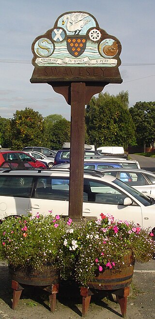
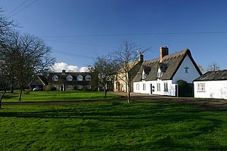
Swavesey is a village lying on the Prime Meridian in Cambridgeshire, England, with a population of 2,463. The village is situated 9 miles to the north west of Cambridge and 3 miles south east of St Ives.

<span class="mw-page-title-main">Abington Pigotts</span> Human settlement in England

Abington Pigotts is a small village in Cambridgeshire, England about 4 miles (6 km) northwest of Royston, Hertfordshire.

<span class="mw-page-title-main">Guilden Morden</span> Human settlement in England

Guilden Morden, England, is a village and parish located in Cambridgeshire about 16 miles (26 km) south west of Cambridge and 9 miles (14 km) west of Royston in Hertfordshire. It is served by the main line Ashwell and Morden railway station 3 miles (5 km) to the south in the neighbouring parish of Steeple Morden.

<span class="mw-page-title-main">Arrington, Cambridgeshire</span> Human settlement in England

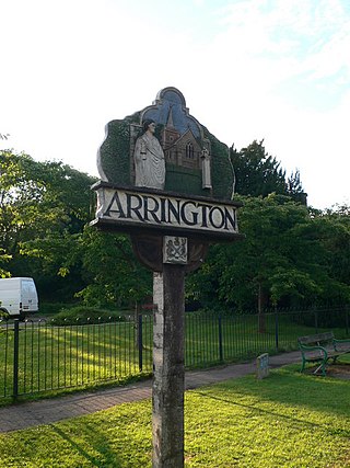
Arrington is a small village and civil parish in the South Cambridgeshire district of Cambridgeshire, England, with a population of 415 at the time of 2011 census. The village is 6 miles (10 km) north of Royston, Hertfordshire, and 9 miles (14 km) south-west of the county city of Cambridge.

<span class="mw-page-title-main">Barrington, Cambridgeshire</span> Human settlement in England

Barrington is a small village and civil parish in the South Cambridgeshire district of Cambridgeshire, England. The village is about 7 miles (11 km) south-west of Cambridge, between Haslingfield and Shepreth.

Bassingbourn cum Kneesworth is a civil parish in the South Cambridgeshire district of Cambridgeshire, England, 14 miles south-west of Cambridge and just north of Royston, Hertfordshire. Since the 1960s the parish contains the villages of Bassingbourn and Kneesworth.

<span class="mw-page-title-main">Chippenham, Cambridgeshire</span> Human settlement in England

Chippenham is a village and civil parish in Cambridgeshire, England, part of East Cambridgeshire district around 4 miles (6.4 km) north-east of Newmarket and 10 miles (16 km) north-east of Cambridge.

<span class="mw-page-title-main">Fen Ditton</span> Human settlement in England

Fen Ditton is a village on the northeast edge of Cambridge in Cambridgeshire, England. The parish covers an area of 5.99 square kilometres (2 sq mi).

Chesterton is a former United Kingdom Parliamentary constituency. It was created upon the splitting up of the three member Cambridgeshire constituency into three single member divisions in 1885. The seat was abolished in 1918 when Cambridgeshire was recreated as a single-member constituency.

<span class="mw-page-title-main">Whittlesford</span> Human settlement in England

Whittlesford is a village in Cambridgeshire, England, and also the name of an old hundred. The village is situated on the Granta branch of the River Cam, seven miles south of Cambridge. Whittlesford Parkway railway station serves the village.

Shingay cum Wendy is a civil parish in the English county of Cambridgeshire, around 5 miles (8 km) north west of Royston.

Croydon is a small village and civil parish in South Cambridgeshire, England. It is 10 miles (16 km) south-west of Cambridge and immediately west of the A1198 road. The population in 2001 was 221 people, increasing to 235 at the 2011 Census. The site of the deserted medieval village of Clopton is in Croydon parish, which was formerly known as Croydon-cum-Clopton.

<span class="mw-page-title-main">Litlington, Cambridgeshire</span> Human settlement in England

Litlington is a village and civil parish in the East of England region and the county of Cambridgeshire in the United Kingdom. The village lies approximately 14 miles (23 km) southwest of Cambridge and 3 miles (4.8 km) northwest of Royston.

<span class="mw-page-title-main">Steeple Morden</span> Human settlement in England

Steeple Morden is a village and civil parish in Cambridgeshire, England, about 15 miles (24 km) south west of Cambridge and 5 miles (8 km) west of Royston. It is part of the South Cambridgeshire local government district.

<span class="mw-page-title-main">Tadlow</span> Human settlement in England

Tadlow is a small village and civil parish in South Cambridgeshire, England on the River Cam. It is 20 kilometres (12 mi) south-west of Cambridge and 9 kilometres (6 mi) north-east of Biggleswade, Bedfordshire. In 2001 the population was 181 and the area of the village is 681 hectares.

<span class="mw-page-title-main">Hildersham</span> Human settlement in England

Hildersham is a small village 8 miles to the south-east of Cambridge, England. It is situated just off the A1307 between Linton and Great Abington on a tributary of the River Cam known locally as the River Granta.

<span class="mw-page-title-main">Shingay</span> Human settlement in England

Shingay is a hamlet and former civil parish, now in the parish of Shingay cum Wendy, in the South Cambridgeshire district, in the county of Cambridgeshire, England around 5 miles north west of Royston. In 1951 the parish had a population of 38.

Whaddon is a village and civil parish in South Cambridgeshire, England, 6 kilometres (3.7 mi) north of Royston.

<span class="mw-page-title-main">Landwade</span> Human settlement in England

Landwade is a village and former civil parish, now in the parish of Exning, in the West Suffolk district, in the county of Suffolk, England. It is 4 miles north of Newmarket. It was one of the smallest parishes in the county, it is only 1 kilometre from north to south and at most 500m from east to west. In 1951 the parish had a population of 38.

References

  1. "Population statistics Wendy AP/CP through time". A Vision of Britain through Time . Retrieved 15 January 2023.
  2. "Relationships and changes Wendy AP/CP through time". A Vision of Britain through Time. Retrieved 15 January 2023.
  3. 1 2 3 4 5 A History of the County of Cambridge and the Isle of Ely. Vol. 8. 1982. pp. 135–142.
  4. "Wendy | Domesday Book". opendomesday.org. Retrieved 18 January 2023.
  5. Listed buildings in Shingay-cum-Wendy
  6. "Key to English Place-Names". Institute for Name Studies. Retrieved 15 August 2019.