Little Stretton, Shropshire

Last updated

Little Stretton
Church in Little Stretton,Shropshire - geograph.org.uk - 79204.jpg
The thatched All Saints' church in the village
Shropshire UK location map.svg
Red pog.svg
Little Stretton
Location within Shropshire
OS grid reference SO443917
  London 158 miles (254 km)
Civil parish
Unitary authority
Ceremonial county
Region
Country England
Sovereign state United Kingdom
Post town CHURCH STRETTON
Postcode district SY6
Dialling code 01694
Police West Mercia
Fire Shropshire
Ambulance West Midlands
UK Parliament
List of places
UK
England
Shropshire
52°31′16″N2°49′19″W / 52.521°N 2.822°W / 52.521; -2.822

Little Stretton is a village and former civil parish, now in the parish of Church Stretton, in the Shropshire district, in the ceremonial county of Shropshire, England. In 1961 the parish had a population of 80. [1] Little Stretton became a civil parish in 1899 being formed from Church Stretton, on 1 April 1966 the parish was abolished and merged with Church Stretton. [2]

Contents

It is located in the Shropshire Hills Area of Outstanding Natural Beauty between the Long Mynd and Ragleth Hill. Lying on the B5477 south of the market town of Church Stretton; similarly, the small village of All Stretton lies to the north of Church Stretton on the same road. A milestone in the centre of the village on the B5477, which is called Ludlow Road at this point, indicates that Ludlow is 14 miles (23 km) away, to the south. The centre of Church Stretton is 1.3 miles (2.1 km) away via the B5477.

The River Ashes Hollow runs through the village and it is a popular place to begin walks up the Long Mynd. The village lies between 590 and 616 feet above sea level. Ragleth Hill lies immediately to the east of the village, on the other side of the Welsh Marches Line and A49. Little Stretton once had its own railway halt: Little Stretton Halt railway station.

To the southwest are the hamlets of Minton and Hamperley, which are part of Church Stretton parish and are included within the parish ward of Little Stretton. [3] The modern-day parish of Church Stretton is sometimes referred to as "Church Stretton and Little Stretton". [4]

Amenities and attractions

The village has a large Conservation Area. [5] There are many Listed buildings and structures in the village. [6]

Church

There is a small church in the village, built in 1903 - "All Saints". It is a Church of England church and is one of three in the ecclesiastical parish of Church Stretton, along with the churches in All Stretton and Church Stretton. [7] The parish is part of the Diocese of Hereford. It is a very unusual church (for England in the present era) for its construction is timber with a thatched roof replacing the original corrugated iron roof. [8]

Pubs

As of 2012, there are approximately 110 dwellings in the village. Little Stretton today has two public houses: the Green Dragon and the Ragleth Inn (historically the "Sun Inn"), both of which serve a wide range of local real ales. [9]

Brockhurst Castle

Half a mile to the north are the earthwork remains of the 12th-century Brockhurst Castle. It is situated on private land with no public access.

Notable people

Novelist and short story writer Beatrice Harraden (1864-1936) spent summer holidays lodging at the Green Dragon, inspiring her short story At the Green Dragon (published 1894). [10]

Oliver Sandys (1892-1964), widow of Caradoc Evans and a novelist in her own right, lived at the Ancient House, across the road from the church, from the 1950s. A later novel, Quaint Place (1952) was set in this area. [11]

The poet Peter Reading (1946–2011) lived in the village. [12]

The horologist Charles Jendon was a well-known figure in the village for many years; his knowledge of long-case clocks was well known to many specialists in the field.[ citation needed ]

The music critic Ephriam Monk, who championed the early work of Lionel Crill, who himself was a pioneer in the use of the theremin in classical music, lived in the village between 1952 and 1959.

See also

Related Research Articles

<span class="mw-page-title-main">Shropshire</span> County in England

Shropshire is a landlocked historic county in the West Midlands region of England bordering Wales. Shropshire borders with the English counties of Cheshire to the north, Staffordshire to the east, Worcestershire to the southeast, and Herefordshire to the south, and bordering Wales with the counties of Wrexham and Powys to the west. A unitary authority of the same name was created in 2009, taking over from the previous county council and five district councils, now governed by Shropshire Council. The borough of Telford and Wrekin has been a separate unitary authority since 1998, but remains part of the ceremonial county.

<span class="mw-page-title-main">Church Stretton</span> Market town in Shropshire, England

Church Stretton is a market town and civil parish in Shropshire, England, 13 miles (21 km) south of Shrewsbury and 15 miles (24 km) north of Ludlow. The population in 2011 was 4,671.

<span class="mw-page-title-main">A49 road</span> Road in England

The A49 is an A road in western England, which traverses the Welsh Marches region. It runs north from Ross-on-Wye in Herefordshire via Hereford, Leominster, Ludlow, Shrewsbury and Whitchurch, then continues through central Cheshire to Warrington and Wigan before terminating at its junction with the A6 road just south of Bamber Bridge, near the junction of the M6, M65 and M61 motorways.

<span class="mw-page-title-main">Long Mynd</span> Heath and moorland plateau in Shropshire, England

The Long Mynd is a heath and moorland plateau that forms part of the Shropshire Hills in Shropshire, England. The high ground, which is common land and designated as an Area of Outstanding Natural Beauty, lies between the Stiperstones range to the west and the Stretton Hills and Wenlock Edge to the east. Much of it is owned by the National Trust, and is managed by the Longmynd Commoners.

<span class="mw-page-title-main">Much Wenlock</span> Town and parish in England

Much Wenlock is a market town and parish in Shropshire, England, situated on the A458 road between Shrewsbury and Bridgnorth. Nearby, to the northeast, is the Ironbridge Gorge and Telford. The civil parish includes the villages of Homer, Wyke, Atterley, Stretton Westwood and Bourton. The population of the civil parish, according to the 2001 census, was 2,605, increasing to 2,877 at the 2011 Census.

<span class="mw-page-title-main">Craven Arms</span> Town in Shropshire, England

Craven Arms is a market town and civil parish in Shropshire, England, on the A49 road and the Welsh Marches railway line, which link it north and south to the larger towns of Shrewsbury and Ludlow respectively. The Heart of Wales railway line joins the Welsh Marches line at Craven Arms and the town is served by Craven Arms railway station. The town is enclosed to the north by the Shropshire Hills Area of Outstanding Natural Beauty, and to the south is the fortified manor house of Stokesay Castle.

<span class="mw-page-title-main">Ratlinghope</span> Village in Shropshire, England

Ratlinghope is a hamlet and civil parish in Shropshire, England. The population of the civil parish at the 2011 census was 138. It is situated four miles (6 km) west of Church Stretton and twelve miles (19 km) south of Shrewsbury.

<span class="mw-page-title-main">All Stretton</span> Human settlement in England

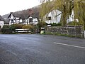
All Stretton is a village and a now separate civil parish in Shropshire, England. Much of it is covered by a Conservation Area.

<span class="mw-page-title-main">Shropshire Hills AONB</span> Area of Outstanding Natural Beauty in England

The Shropshire Hills is a designated Area of Outstanding Natural Beauty (AONB) in Shropshire, England. It is located in the south of the county, extending to its border with Wales. Designated in 1958, the area encompasses 802 square kilometres (310 sq mi) of land primarily in south-west Shropshire, taking its name from the upland region of the Shropshire Hills. The A49 road and Welsh Marches Railway Line bisect the area north–south, passing through or near Shrewsbury, Church Stretton, Craven Arms and Ludlow.

The geology of Shropshire is very diverse with a large number of periods being represented at outcrop. The bedrock consists principally of sedimentary rocks of Palaeozoic and Mesozoic age, surrounding restricted areas of Precambrian metasedimentary and metavolcanic rocks. The county hosts in its Quaternary deposits and landforms, a significant record of recent glaciation. The exploitation of the Coal Measures and other Carboniferous age strata in the Ironbridge area made it one of the birthplaces of the Industrial Revolution. There is also a large amount of mineral wealth in the county, including lead and baryte. Quarrying is still active, with limestone for cement manufacture and concrete aggregate, sandstone, greywacke and dolerite for road aggregate, and sand and gravel for aggregate and drainage filters. Groundwater is an equally important economic resource.

<span class="mw-page-title-main">Church Stretton railway station</span> Railway station in Shropshire, England

Church Stretton railway station is a railway station serving the town of Church Stretton in Shropshire, England on the Welsh Marches Line, 12+34 miles (20.5 km) south of Shrewsbury railway station; trains on the Heart of Wales Line also serve the station. All trains services are operated by Transport for Wales, who also manage the station.

<span class="mw-page-title-main">Shropshire Hills</span> Upland area in Shropshire, West Midlands

The Shropshire Hills are a dissected upland area and one of the natural regions of England. They lie wholly within the county of Shropshire and encompass several distinctive and well-known landmarks, such as the Long Mynd, Wenlock Edge, The Wrekin and the Clees.

<span class="mw-page-title-main">Ludford, Shropshire</span> Village in Shropshire, England

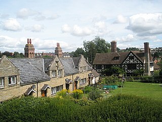
Ludford is a small village and civil parish in south Shropshire, England. The parish is situated adjacent to the market town of Ludlow and was, until 1895, partly in Herefordshire.

<span class="mw-page-title-main">Longnor, Shropshire</span> Village in Shropshire, England

Longnor is a village and civil parish off the A49 road, south of Dorrington and north of Leebotwood in Shropshire, England, with a population of 289. The nearest railway station is Church Stretton, 4.7 miles (7.6 km) away. The Cound Brook flows just west of the village and its medieval deer park. The village contains Longnor Hall and the Grade I listed medieval St Mary's Church. Regional Cycle Route 32/33 passes through, as do buses between Church Stretton and Shrewsbury and Radbrook Green. The village is also noted for a ghost, the White Lady of Longnor.

<span class="mw-page-title-main">Quinny Brook</span> Stream in Shropshire, England

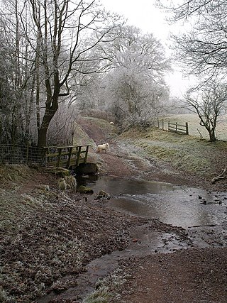
Quinny Brook is a tributary stream of the River Onny which flows through the Shropshire Hills Area of Outstanding Natural Beauty in England.

<span class="mw-page-title-main">Rushbury</span> Human settlement in England

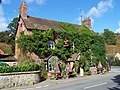
Rushbury is a village and civil parish in Shropshire, roughly five miles from Church Stretton and eight miles from Much Wenlock.

<span class="mw-page-title-main">Minton, Shropshire</span> Human settlement in England

Minton is a hamlet in Shropshire, England.

<span class="mw-page-title-main">Hamperley</span> Human settlement in England

Hamperley is a dispersed hamlet in Shropshire, England.

<span class="mw-page-title-main">Richard's Castle</span> Village in Herefordshire and Shropshire, England

Richard's Castle is a village, castle and two civil parishes on the border of the counties of Herefordshire and Shropshire in England. The Herefordshire part of the parish had a population of 250 at the 2011 Census, the Shropshire part, 424.

<span class="mw-page-title-main">Wentnor</span> Human settlement in England

Wentnor is a village and civil parish in Shropshire, England.

References

  1. "Population statistics Little Stretton CP through time". A Vision of Britain through Time . Retrieved 3 June 2023.
  2. "Relationships and changes Little Stretton CP through time". A Vision of Britain through Time. Retrieved 3 June 2023.
  3. "Church Stretton Town Council". Church Stretton Area. Archived from the original on 19 September 2010. Retrieved 10 April 2010.
  4. Shropshire Council Archived 7 August 2011 at the Wayback Machine Council tax (parish precepts) 2010/11
  5. Shropshire Council Little Stretton Conservation Area: map
  6. British Listed Buildings Archived 7 May 2012 at the Wayback Machine Church Stretton parish: map
  7. "Home - Parish of Church Stretton". www.strettonparish.org.uk. Archived from the original on 22 January 2019. Retrieved 27 May 2019.
  8. Geograph Archived 28 November 2018 at the Wayback Machine - SO4491 : The church at Little Stretton
  9. "Pubs in Little Stretton". www.pubsurvey.co.uk. Archived from the original on 26 August 2014. Retrieved 13 November 2012.
  10. Dickins, Gordon (1987). An Illustrated Literary Guide to Shropshire. Shropshire Libraries. pp. 35, 100. ISBN   978-0-903802-37-6.
  11. Dickins, Gordon (1987). An Illustrated Literary Guide to Shropshire. pp. 62, 100.
  12. 'An Interview with Peter Reading by Robert Potts' Oxford Poetry "Archived copy". Archived from the original on 12 March 2010. Retrieved 24 November 2010.{{cite web}}: CS1 maint: archived copy as title (link)

Commons-logo.svg Media related to Little Stretton, Shropshire at Wikimedia Commons