
Gwinear–Gwithian is a coastal civil parish in west Cornwall, England, United Kingdom. It includes the villages of Connor Downs, Gwinear, Gwithian, Reawla and Rosewarne. The parish is situated approximately two miles (3 km) east of Hayle two miles (3 km) west of Camborne.

Chyandour is a small settlement within the town of Penzance in west Cornwall, United Kingdom. It is on the north-east edge of the town straddling the A30 trunk road. The Chyandour Brook rises near Carfury and flows into Mount's Bay at Chyandour. Before 1934 Chyandour was in the parish of Madron and was the site of a large tin smelting works.

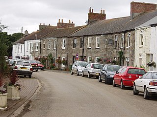
Kerris is a settlement in west Cornwall, England, United Kingdom. It is three miles (5 km) south-west of Penzance in the civil parish of Paul. Kerris means "fort-place" in the Cornish language.

Kelynack is a settlement in west Cornwall, England, UK.

Perranarworthal is a civil parish and village in Cornwall, England, United Kingdom. The village is about four miles (6.5 km) northwest of Falmouth and five miles (8 km) southwest of Truro. Perranarworthal parish is bordered on the north by Kea parish, on the east by Restronguet Creek and Mylor parish, on the south by St Gluvias and Stithians parishes and on the west by Gwennap parish. The parish population at the 2011 census was 1,496. The name derives from the Manor of Arworthal which has had a number of spellings in the past including Hareworthal (1187), Arwoethel and Arwythel. By the 18th-century two names appear on maps "Perran Arworthal" meaning St Piran's by the creek or estuary. William Penaluna described the settlement in 1838. Perranwell railway station is on the Maritime Line.

Newbridge is a hamlet in the civil parish of Madron on the Penwith peninsula in west Cornwall, England, United Kingdom. It is on the A3071 road between St Just and Penzance, about three miles (5 km) west of the latter.

Tregavarah is a small hamlet in the parish of Madron in Cornwall, England, U K. It is situated approximately 2 miles west of Penzance. Tregavarah Downs is nearby.

Gurnard's Head is a prominent headland on the north coast of the Penwith peninsula in Cornwall, England, UK. The name is supposed to reflect the fact that the rocky peninsula resembles the head of the gurnard fish.

Tregonning Hill is the westerly of two granite hills overlooking Mount's Bay in west Cornwall, England, United Kingdom, the other being Godolphin Hill. They are approximately 6 kilometres (3.7 mi) west of the town of Helston. The Plymouth chemist William Cookworthy mixed china stone with kaolin, mined from the hill to make Plymouth porcelain; which was the first time porcelain was made in Europe. Part of the hill is designated as a Site of Special Scientific Interest (SSSI) and at the date of notification (1994) was the only known site of western rustwort in Great Britain.
Gwinear is a small village in west Cornwall, England, UK. It is about two miles (3 km) east of Hayle and overlooks the Angarrack valley. It is in the civil parish of Gwinear-Gwithian.

Great Bosullow is a hamlet south-east of Morvah in west Cornwall, England, UK. Bosullow Common is an extensive area of heathland. Great Bosullow lies within the Cornwall Area of Outstanding Natural Beauty (AONB). Almost a third of Cornwall has AONB designation, with the same status and protection as a National Park.

Grumbla is a hamlet in the parish of Sancreed, Cornwall, England, UK.

Higher Ninnes and Lower Ninnes are hamlets, south of Mulfra Hill in the civil parish of Madron in west Cornwall, England, UK.
Penpoll is a farm in the parish of Quethiock, Cornwall, England, UK. It is near the hamlet of Blunts and north of Tideford Cross. The meaning of Penpoll is "head of a creek".

Prospidnick is a small village and hill in the parish of Sithney in Cornwall, United Kingdom. It lies 0.6 miles east of Crowntown and 2.6 miles west of Wendron by road. It is divided into Lower Prospidnick and Higher Prospidnick.

Relubbus is a hamlet in the parish of St Hilary, west Cornwall, England. It is on the B3280 road between Townshend and Goldsithney; the River Hayle runs through Relubbus.
Rinsey is a hamlet in Cornwall, England, United Kingdom. It is located off the main A394 road between Helston and Penzance in the civil parish of Breage. The nearby hamlet of Rinsey Croft is located 1 km to the north-east. The nearby cliffs and beach are owned and managed by the National Trust and part of Rinsey East Cliff is designated as the Porthcew Site of Special Scientific Interest (SSSI) for its geological interest. The South West Coast Path passes through the property. Rinsey lies within the Cornwall Area of Outstanding Natural Beauty (AONB).
Lanyon is a hamlet in the parish of Madron in Cornwall, England, UK. It is situated on a north facing slope on the Madron to Morvah road. The nearest town is Penzance 4 miles (6.4 km) to the south.

Madron Well and Madron Well Chapel is a scheduled Ancient Monument in the civil parish of Madron, Cornwall, UK.
Erisey was a manor on the Lizard Peninsula, Cornwall, UK and is the surname of the family that built the house. The manor was originally in the civil parish of Grade and since 1934 Grade-Ruan. The Grade II listed building was built by Richard Eirsey in the 17th-century and in the 18th-century was owned by the Boscawan family of Tregothnan.

