
Chedworth is a village and civil parish in Gloucestershire, southwest England, in the Cotswolds. It is known as the location of Chedworth Roman Villa, administered since 1924 by the National Trust.

The Forest of Dean is a geographical, historical and cultural region in the western part of the county of Gloucestershire, England. It forms a roughly triangular plateau bounded by the River Wye to the west and northwest, Herefordshire to the north, the River Severn to the south, and the City of Gloucester to the east.

Cinderford is a town and civil parish on the eastern fringe of the Forest of Dean in Gloucestershire, England. The population was 8,777 at the 2021 Census.
Oldbury-on-Severn is a small village near the mouth of the River Severn in the South Gloucestershire district of the county of Gloucestershire in the west of England. The parish, which includes the village of Cowhill had a population at the 2011 census of 780. It is home to the nearby Oldbury nuclear power station, a Magnox power station which opened in 1967 and ceased operation on 29 February 2012.

Newnham or Newnham on Severn is a village in west Gloucestershire, England. It lies in the Royal Forest of Dean, on the west bank of the River Severn, approximately 10 miles south-west of Gloucester and three miles southeast of Cinderford. It is on the A48 road between Gloucester and Chepstow, Monmouthshire, Wales. The village has a parish council.

Tidenham is a village and civil parish in the Forest of Dean of west Gloucestershire, England, adjoining the Welsh border. Tidenham is bounded by the River Wye to the west and the River Severn to the south. Offa's Dyke runs through the western part of the parish, terminating at Sedbury cliff above the River Severn.

St Briavels, is a medium-sized village and civil parish in the Royal Forest of Dean in west Gloucestershire, England; close to the England-Wales border, and 5 miles (8 km) south of Coleford. It stands almost 800 feet (240 m) above sea level on the edge of a limestone plateau above the valley of the River Wye, above an ancient meander of the river. To the west, Cinder Hill drops off sharply into the valley. It is sheltered behind the crumbling walls of the 12th century St Briavels Castle.
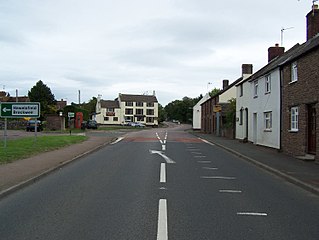
Alvington is a village and civil parish in the Forest of Dean in Gloucestershire, England, situated on the A48 road, six miles north-east of Chepstow in Wales. The parish had a total population of 506 at the 2011 census.

Arlingham is a village and civil parish in the Stroud District of Gloucestershire, England. The 2021 Census recorded a parish population of 533. The parish contains the hamlets of Milton End, Overton and Priding. The next parish to the east is Fretherne with Saul.

English Bicknor is a village and civil parish in the Forest of Dean district of west Gloucestershire, England. The 2011 Census recorded the population as 408. The village is near the county boundary with Herefordshire, opposite which is the village of Welsh Bicknor. The two villages are on opposite sides of the River Wye.
Littledean Hall is a country house in the village of Littledean, Gloucestershire, England. It has been described as one of the most haunted houses in England and is thought to be the oldest house in the United Kingdom which is still occupied. Saxon and Celtic remains have been uncovered in the cellars. Part of the house is designated an SSSI as it is a proven breeding roost for the Greater Horseshoe Bat (Rhinolophus ferrumequinum).
Rodborough is a large village and civil parish in the district of Stroud, Gloucestershire, in South West England. It is directly south of the town of Stroud, north of the town of Nailsworth and north-west of the town of Minchinhampton. The parish includes the settlements of Bagpath, Butterrow, Kingscourt, Lightpill and Rooksmoor, and is adjacent to the Stroud suburb of Dudbridge. The population taken at the 2011 census was 5,334.

Lydbrook is a civil parish in the Forest of Dean, a local government district in the English county of Gloucestershire and is located in the Wye Valley. It is on the north west edge of the Forest of Dean's present legal boundary proper. It comprises the districts of Lower Lydbrook, Upper Lydbrook, Joys Green and Worrall Hill. It has a mile and a half long high street, reputed to be the longest high street of any village in England.

Ruardean is a village in the Forest of Dean, Gloucestershire, England, to the North West of Cinderford. It is situated on a hillside with views west towards the mountains of South Wales. Little now remains of the village's industrial history, but once it was a centre for iron ore smelting furnaces, forges and coal mines. The Norman castle, now little more than a mound, commanded the shortest route from Gloucester Castle to the Welsh Marches and the Wye Valley.

Blakeney is a village in Gloucestershire, England. It in the parish of Awre and has views of the Forest of Dean.

Ruspidge is a village in the Forest of Dean district of west Gloucestershire, England. The civil parish includes Soudley

Woolaston is a village and civil parish in the Forest of Dean district of Gloucestershire in South West England. It lies on the north side of the Severn Estuary approximately 5 miles from the Welsh border at Chepstow and is surrounded by woodland and agricultural land.

Staunton is a village and civil parish in the Forest of Dean in west Gloucestershire, England, close to the border with Wales.

East Dean is a hamlet and former civil parish, now in the parish of Mitcheldean, in the Forest of Dean district, in the county of Gloucestershire, England.

Frocester is a village and civil parish in Stroud District, Gloucestershire, England. It lies below the Cotswold escarpment, 10 miles south of Gloucester and 4 miles west of Stroud. In the 2001 census the parish had a population of 194, decreasing to 155 at the 2011 Census.

