Little Torrington

Last updated

St Giles church, Little Torrington - geograph.org.uk - 598813.jpg
St Giles Church, Little Torrington
Devon UK location map.svg
Red pog.svg
Little Torrington
Location within Devon
Population376 (2011 Census) [1]
District
Shire county
Region
Country England
Sovereign state United Kingdom
Post town Torrington
Postcode district EX38
Police Devon and Cornwall
Fire Devon and Somerset
Ambulance South Western
List of places
UK
England
Devon
50°55′52″N4°08′56″W / 50.931009°N 4.148862°W / 50.931009; -4.148862

Little Torrington is a village and a civil parish near Great Torrington, in the Torridge district, north Devon, England. In 2001 the population of the civil parish of Little Torrington was 420 and in 2011 it was 376, according to census data. [2] [1] Little Torrington has the Church of St Giles [3] and the Chapel of St Mary Magdalene. [4]

Contents

In the 1870s, Little Torrington was described as follows:

"A bridge over the river Torridge, at Taddyport village, connects the parish with Great Torrington. The living is a rectory in the diocese of Exeter. Value, £397. Patrons, the Heirs of Lord Rolle and others. The church is ancient but good." [5]

History

Little Torrington was originally a Saxon settlement called Toritona, held by Edmer Ator during the reign of Edward the Confessor between 1042–1066. [6]

At the time of the Norman Invasion of England in 1066, Alweard the Red was lord and tenant. [7] By 1086 Little Torrington was considered a large settlement for its time with 33 households. It had a new overlord, Count Rotbert of Mortrain, the uterine half-brother of William the Conqueror. The local tenant-in-chief was also from the Norman elite, Aluredus le butuiller (Alfred the Butler). [7] [8]

The first vicar for the church was recorded in 1259, although the current church of St Giles was created in the 15th century. [9] Renovations have taken place on the church throughout its time. The first major renovation took place in 1755, when it was re-roofed in a Georgian style. In 1857, the nave and south aisle were restored, the western gallery removed, and the chancel rebuilt and enlarged. Finally, in 1898, restoration work was carried out on the tower, and a tower screen and new pews were added to the interior of the church. [10]

Little Torrington, along with Great Torrington, had a significant role in the English Civil War; the Battle of Torrington in 1646 marked the end of Royalist resistance in the region. [11]

Population of Little Torrington Population of Little Torrington from 1801 - 2011.jpg
Population of Little Torrington

The population of Little Torrington fluctuated between 1801 and 2011 according to census data. In 1801 it was 449, and from then the population continued to grow, reaching a peak of 623 residents in 1851. The population then fell and reached its lowest recorded level of 281 in 1961. The population in 2011 had recovered to 376 people. [12]

Industry

Breakdown of the main occupations males in Little Torrington worked in according to the 1881 census. Male Occupations, Little Torrington 1881.png
Breakdown of the main occupations males in Little Torrington worked in according to the 1881 census.

The first census divided the working men into two different categories, those "chiefly employed in agriculture" and those "chiefly employed in trade, manufacturers or handicraft". This increased to nine categories in 1831, with the majority of Little Torrington's men aged 20 and over working in agriculture. [13]

Breakdown of the main occupations females in Little Torrington worked in according to the 1881 census. Female Occupations, Little Torrington 1881.png
Breakdown of the main occupations females in Little Torrington worked in according to the 1881 census.

The 1881 census showed more work categories for both men and women. Agriculture remained the main industry for men, and dressmaking for women; the second largest category for both genders was domestic and office services. [14]

As of 2011, 189 of 376 Little Torrington residents were employed. The highest areas of employment were agriculture, forestry, fishing and manufacturing. [15]

Geography

A historical 20th century map, from the British War Office, showing Little Torrington, Devon 20th Century Little Torrington Map.PNG
A historical 20th century map, from the British War Office, showing Little Torrington, Devon

The village is located east of the A386, contains "2880 acres of land, including the village of Taddiport, on the south-west side of the river Torridge opposite Great Torrington." [16]

"Taddiport is a hamlet beside the Torridge, which is here crossed by a massive three-arched bridge, possibly of 17th century date. A chapel, attached to a leper hospital founded in the 13th century, still remains, though considerably altered." [17]

The majority of current residents, according to the 2011 census, live in whole houses or bungalows, 106 households live in detached properties and 55 households live in semi-detached properties, with only 2 households living in flats or apartments. [18]

Out of all the current residents 189 are economically active and 70 are retired. [19] The majority of these 178 households contain 2 people, 85 households, 51 households only have 1 person and only 14 households contain 4 people. [20]

According to the 2001 census age structure indicators, they found out of the 420 people living in Little Torrington in 2001, 112 are aged 45–59, 71 are aged 30–44, 29 are aged 75–84 and only 12 are aged 5–7. [21]

There are 342 residents aged 16 or over, 99 of these residents have no formal qualifications, 41 have GCSEs or equivalent, 45 have A-Levels or equivalent and 78 have degrees or equivalent as their highest level of qualification. [22]


Tarka Trail Sitting beside the Tarka Trail - geograph.org.uk - 895913.jpg
Tarka Trail

Transport

Little Torrington is connected by various bus services including those going to Barnstaple and Exeter. [23]

The closest railway station is in Chapelton, 10 miles from Little Torrington, part of the First Great Western line which connects to Barnstaple, Exeter and Plymouth. [24]

Historic estates

Related Research Articles

<span class="mw-page-title-main">Great Torrington</span> Town in Devon, England

Great Torrington is a market town in Devon, England. Parts of it are sited on high ground with steep drops down to the River Torridge below, with the lower-lying parts of the town prone to occasional flooding. Torrington is in the centre of Tarka Country, a landscape captured by Henry Williamson in his novel Tarka the Otter in 1927. Great Torrington has one of the most active volunteering communities in the United Kingdom.

<span class="mw-page-title-main">Northam, Devon</span> Town in Devon, England

Northam is a market town, civil parish and electoral ward in Devon, England, lying north of Bideford. The civil parish also includes the villages of Westward Ho!, Appledore, West Appledore, Diddywell, Buckleigh and Silford, and the residential areas of Orchard Hill and Raleigh Estate.

<span class="mw-page-title-main">Langtree</span> Village and civil parish in Devon, England

Langtree is a village and parish in north Devon, England, situated about 4 miles (6 km) south-west of Great Torrington and 8 miles (13 km) south of Bideford. Its name means "tall tree". Torridge District Council and Devon County Council are responsible for local government, while for religious administrative purposes it is part of the Archdeaconry of Barnstaple and the Diocese of Exeter. In 2021 the parish had a population of 837.

<span class="mw-page-title-main">Black Torrington</span> Village in mid Devon, England

Black Torrington is a village and civil parish in Torridge, Devon, England, situated between the towns of Holsworthy and Hatherleigh. It is located on and named after the River Torridge. In the 2021 UK census, the population of Black Torrington was recorded as having been 528.

<span class="mw-page-title-main">Peters Marland</span> Village and civil parish in Devon, England

Peters Marland is a small village and civil parish in the local government district of Torridge, Devon, England. The parish, which lies about four miles south of the town of Great Torrington, is surrounded clockwise from the north by the parishes of Little Torrington, Merton, Petrockstowe, Buckland Filleigh, Shebbear and Langtree. In 2001 its population was 234, down from the 286 residents it had in 1901.

<span class="mw-page-title-main">Holsworthy</span> Town in Devon, England

Holsworthy is a market town and civil parish in the Torridge district of Devon, England, 36 miles (58 km) west of Exeter. The River Deer, a tributary of the River Tamar, forms the western boundary of the parish, which includes the village of Brandis Corner. According to the 2011 census the population of Holsworthy was 2,641; it was estimated at 3,287 in 2019.

<span class="mw-page-title-main">Abbots Bickington</span> Village in Devon, England

Abbots Bickington is a village and civil parish in the English county of Devon, located 7.7 mi (12.4 km) north-northeast of Holsworthy and near the River Torridge.

<span class="mw-page-title-main">Alverdiscott</span> Village in Devon, England

Alverdiscott is a village, civil parish, former manor and former ecclesiastical parish in the Torridge district of Devon, England, centred 5.5 miles (9 km) south-south-west of Barnstaple.

<span class="mw-page-title-main">Beaford</span> Village and civil parish in Devon, England

Beaford is a village and civil parish in the Torridge district of Devon, England. The village is about five miles south-east of Great Torrington, on the A3124 road towards Exeter. According to the 2001 census the parish had a population of 393, compared to 428 in 1901. The western boundary of the parish is formed by the River Torridge and it is surrounded, clockwise from the north, by the parishes of St Giles in the Wood, Roborough, Ashreigney, Dolton, Merton and Little Torrington.

Buckland Brewer is a village and civil parish in the Torridge district of Devon, England, 4.7 miles south of Bideford. Historically the parish formed part of Shebbear Hundred. According to the 2001 census it had a population of 777, increasing to 794 at the 2011 census The village is part of Waldon electoral ward. The population for this at the same census was 1,679.

<span class="mw-page-title-main">River Torridge</span> River in Devon, England

The River Torridge is a river in Devon in England; it rises near Meddon. The river describes a long loop through Devon farming country where its tributaries the Lew and Okement join before meeting the Taw at Appledore and flowing into the Bristol Channel. The river is spate dependent and often flows between wooded banks which can be steep. The Torridge local government district is named after the river.

<span class="mw-page-title-main">St Giles in the Wood</span> Village and civil parish in Devon, England

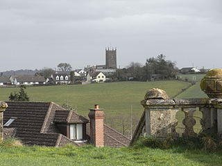
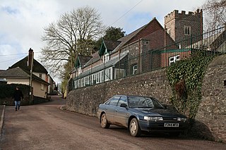
St Giles in the Wood is a village and civil parish in the Torridge district of Devon, England. The village lies about 2.5 miles east of the town of Great Torrington, and the parish, which had a population of 566 in 2001 compared with 623 in 1901, is surrounded clockwise from the north by the parishes of Huntshaw, Yarnscombe, High Bickington, Roborough, Beaford, Little Torrington and Great Torrington. Most of the Victorian terraced cottages in the village, on the east side of the church, were built by the Rolle Estate.

<span class="mw-page-title-main">Huntshaw</span> Village in Devon, England

Huntshaw is a village and civil parish located 2.5 north north east of Great Torrington, in the Torridge district, in the county of Devon, England.

<span class="mw-page-title-main">Monkleigh</span> Village in Devon, England

Monkleigh is a village, parish and former manor in north Devon, England, situated 2 1/2 miles north-west of Great Torrington and 3 1/2 miles south-east of Bideford. An electoral ward exists titled Monkleigh and Littleham. The population at the 2011 census was 1,488.

<span class="mw-page-title-main">St Giles on the Heath</span> Village and civil parish in west Devon, England

St Giles on the Heath, sometimes hyphenated as St Giles-on-the-Heath, is a village and civil parish in the far west of Devon, England. It forms part of the local government district of Torridge. The village is in the east of the parish and lies on the A388 road about eight miles south of the town of Holsworthy.

<span class="mw-page-title-main">Merton, Devon</span> Village in Devon, England

Merton is a village, ecclesiastical parish, former manor and civil parish administered by the local government district of Torridge, Devon, England. The parish, which lies about five miles south east of the town of Great Torrington, is surrounded clockwise from the north by the parishes of Little Torrington, Beaford, Dolton, Huish, Petrockstowe and Peters Marland. In 2001 its population was 331, down from the 507 residents it had in 1901. The eastern and northern boundaries of the parish follow the loops of the River Torridge and the other sides are defined by the River Mere. The village forms part of the electoral ward of Clinton. The population at the 2011 census was 1,537.

<span class="mw-page-title-main">Poughill, Devon</span> Village in Devon, England

Poughill is a village and civil parish in the Mid Devon district, in the county of Devon, England. It lies 5 miles (8 km) north of Crediton. In 2011, the parish had a population of 216.

<span class="mw-page-title-main">Chittlehamholt</span> Village in Devon, England

Chittlehamholt is a village and civil parish in North Devon district, Devon, England. In the 2011 census it was recorded as having a population of 169.

<span class="mw-page-title-main">Satterleigh and Warkleigh</span> Civil parish in Devon, England

Satterleigh and Warkleigh is a civil parish in North Devon district, Devon, England. In the 2011 census it was recorded as having a population of 170.

References

  1. 1 2 UK Census (2011). "Local Area Report – Little Torrington Parish (E04003275)". Nomis. Office for National Statistics . Retrieved 4 January 2021.
  2. UK Census (2001). "Local Area Report – Little Torrington Parish (18UK036)". Nomis. Office for National Statistics . Retrieved 4 January 2021.
  3. "Church of St Giles, Little Torrington, Devon". Britishlistedbuildings.co.uk. 16 February 1989. Retrieved 25 March 2017.
  4. Good Stuff. "Chapel of St Mary Magdalene, Little Torrington, Devon". Britishlistedbuildings.co.uk. Retrieved 25 March 2017.
  5. Wilson, John Marius (1870). Gazetteer of England and Wales. Edinburgh: A. Fullerton & Co. Retrieved 26 January 2015.
  6. Allen, John. "Church of St Giles Little Torrington Church". St Michael & All Angels Church. Retrieved 9 March 2015.
  7. 1 2 Prosopography of Anglo-Saxon England (PASE) - PASE Domesday: Alfred, accessed February 2019.
  8. Open Domesday Online: Little Torrington, accessed February 2019.
  9. "Little Torrington". Tour Devon. Retrieved 29 January 2015.
  10. Allen, John. "Church of St Giles Little Torrington Church". St Michael & All Angels Church. Retrieved 20 March 2015.
  11. "Great Torrington". Great Torrington Tourist Information. Retrieved 11 March 2015.
  12. "Little Torrington Total Population". Vision of Britain. Retrieved 9 March 2015.
  13. "Males aged 20 & over, in 9 occupational categories". A Vision of Britain Through Time. Retrieved 22 February 2015.
  14. "1881 Census of England and Wales". Vision of Britain. Retrieved 9 March 2015.
  15. "Industry, 2011". Office for National Statistics. Retrieved 16 March 2015.
  16. Randell, Brian. "LITTLE TORRINGTON". GENUKI. Retrieved 16 March 2015.
  17. "Little Torrington". Devon County Council. Archived from the original on 2 April 2015. Retrieved 16 March 2015.
  18. "Accommodation Type – Households, 2011". Office for National Statistics. Retrieved 16 March 2015.
  19. "Economic Activity of Household Reference Persons, 2011". Office of National Statistics. Retrieved 16 March 2015.
  20. "Household Size, 2011". Office for National Statistics. Retrieved 16 March 2015.
  21. "Age Structure, 2001". Office of National Statistics. Retrieved 16 March 2015.
  22. "Highest Level of Qualification, 2011". Office of National Statistics. Retrieved 16 March 2015.
  23. "LISTING OF BUS AND COACH SERVICES FROM LIT271". Travel Search. Retrieved 24 March 2015.
  24. "First Great Western National Rail Network Map" (PDF). First Great Western. Retrieved 24 March 2015.

Commons-logo.svg Media related to Little Torrington at Wikimedia Commons