Okehampton is a town and civil parish in West Devon in the English county of Devon. At the 2021 census, the parish had a population of 7,313, which was slightly more than the 7,104 recorded at the 2011 census. The Okehampton built-up area had a population of 9,112 at the 2021 census, up from 7,647 in 2011.

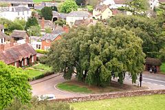
Moretonhampstead is a market town, parish and ancient manor in Devon, situated on the north-eastern edge of Dartmoor, within the Dartmoor National Park. The parish now includes the hamlet of Doccombe, and it is surrounded clockwise from the north by the parishes of Drewsteignton, Dunsford, Bridford, Bovey Tracey, Lustleigh, North Bovey and Chagford.

Bradninch is a small town, civil parish and manor in Devon, England, lying about 3 miles (5 km) south of Cullompton. Much of the surrounding farmland belongs to the Duchy of Cornwall. There is an electoral ward with the same name, which since May 2023 comprises the entire parish. The population was 2,165 in 2021.

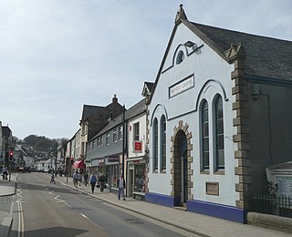
Topsham is a town in Devon, England, located on the east side of the River Exe, immediately north of its confluence with the River Clyst and the former's estuary, between Exeter and Exmouth. Topsham is a historic port and was designated a town by a 1300 royal charter granted by Edward I; it was formally amalgamated into the City of Exeter in 1966. The population of the town, recorded at the 2021 census, is 4,146.
Woodbury is a village and civil parish in East Devon in the English county of Devon, 7 miles (11 km) south east of the city of Exeter. At the 2011 Census the village had a population of 1,605, and the parish had a population of 3,466. It lies on the east bank of the Exe Estuary, has borders – clockwise from the estuary – with the district of Exeter and then the parishes of Clyst St George, Clyst St Mary, Farringdon, Colaton Raleigh, Bicton and Lympstone. Woodbury is part of the electoral ward of Woodbury and Lympstone whose population at the 2011 Census was 5,260.

Whimple is a village and civil parish in East Devon in the English county of Devon, approximately 9 miles (14 km) due east of the city of Exeter, and 3 miles (4.8 km) from the nearest small town, Ottery St Mary. The parish has a population of 1,983, recounted to 1,120 for the built up area in the United Kingdom Census 2021. The electoral ward with the same name had a population of 2,380 at the above census.

Bishop's Nympton is a village and civil parish in the North Devon district of Devon, England, about three miles east of South Molton. According to the 2021 census the parish had a population of 842. The electoral ward has the same name but covers the village and much of the land to the north-east. The ward population at the 2021 census was 2,182.
Bow is a village and civil parish in the Mid Devon district of Devon, England, about 8 miles (13 km) west of Crediton. According to the 2021 census, it had a population of 1,120, which was slightly more than the 1,095 recorded at the 2011 Census. There is an adjoining hamlet of Nymet Tracey which shares a church with Bow and much common history. Bow is a major part of Upper Yeo electoral ward. The total ward population at the 2011 census was 1,708.

Exwick is an historic parish and manor in Devon, England, which today is a north-western suburb of the City of Exeter. Its name is derived from the River Exe, which forms its eastern boundary. It is also an Ecclesiastical parish and an electoral ward. At the 2021 census, the ward had a population of 9,767.
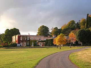
Killerton is an 18th-century house in Broadclyst, Exeter, Devon, England, which, with its hillside garden and estate, has been owned by the National Trust since 1944 and is open to the public. The National Trust displays the house as a comfortable home. On display in the house is a collection of 18th- to 20th-century costumes, originally known as the Paulise de Bush collection, shown in period rooms.
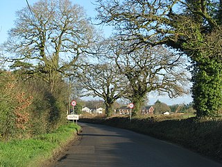
Feniton is a village and civil parish in East Devon in the English county of Devon. The village lies about 4 miles (6.4 km) west of Honiton, 3 miles (4.8 km) north of Ottery St Mary, and 2 miles (3.2 km) east of Talaton.

Pinhoe is a former village, manor and ecclesiastical parish, now a suburb on the north eastern outskirts of the City of Exeter in the county of Devon, England. The 2001 census recorded a population of 6,108 people resident within Pinhoe Ward, one of 18 wards comprising the City of Exeter. The population increased to 9,588 at the 2021 Census.
Alphington is a former manor and village, now a suburb of the City of Exeter in Devon. The ward of Alphington has a population of 8,250 according to the 2001 census, making it the third largest in Exeter, with the village itself accounting for about a quarter of this figure. The ward population increased to 8,266 at the 2021 census. It is surrounded on two sides by countryside, with the Marsh Barton trading estate to the east and Exeter City to the north. The Alphin Brook passes around the northern edge of Alphington. Alphington is on the south-western side of Exeter.
Clyst St Mary is a small village and civil parish 3 miles (4.8 km) east of Exeter on the main roads to Exmouth and Sidmouth in East Devon. The name comes from the Celtic word clyst meaning 'clear stream'. The village is a major part of the electoral ward of Clyst Valley. At the 2011 Census this ward population was 2,326. At the 2021 census, its population increased to 2,400, which was 3.2% more than that recorded at the 2011 census.
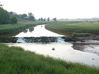
The River Clyst is a river of Devon, England. The name derives from Old English, and translates as Clean-stream. The river lends its name to several settlements on its route, Clyst Honiton, Clyst St Lawrence, Clyst St George, and Broadclyst. The William part of Clyst William derives from the Old English of aewelm, which means river source.
Newton Poppleford is a large village and former civil parish situated on the A3052 road between Exeter and Sidmouth on the west side of the River Otter, now in the parish of Newton Poppleford and Harpford in the East Devon district, in the county of Devon, England, within the East Devon AONB. Newton Poppleford is twinned with Crèvecœur-en-Auge in Normandy, France. In 2019 it had an estimated population of 1784.

Stokeinteignhead is a village and civil parish in the Teignbridge district of Devon, England, above the southern bank of the estuary of the River Teign. The parish has a short boundary on the estuary, and is otherwise surrounded, clockwise from the north, by the parishes of Shaldon, Torbay, Coffinswell and Haccombe with Combe. At the 2021 census, it had a population of 734, which was slightly more than the 703 recorded at the 2011 census. It is twinned with the French commune of Trévières, Calvados.

Sir John Acland of Columb John in the parish of Broadclyst, Devon, was an English knight, landowner, philanthropist, Member of Parliament and Sheriff of Devon. He was one of John Prince's Worthies of Devon.

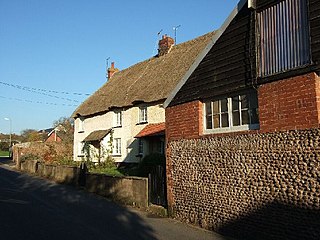
Exton is a village in East Devon, Devon, England; it is situated on the east bank of the River Clyst, as it flows through the wider Exe Estuary. The town of Topsham lies 1 mile (1.6 km) to the north-west.

The estate of Acland in the parish of Landkey, near Barnstaple in North Devon, England, was from 1155 the earliest known seat of the influential and wealthy family of Acland, to which it gave the surname de Acland. It is situated about 3/4 mile north-east of the village of Landkey, from which it is now cut off by the busy A361 North Devon Link Road.