Stockleigh Pomeroy

Last updated

Stockleigh Pomeroy
St Mary's church, Stockleigh Pomeroy - geograph.org.uk - 160134.jpg
St Mary's church, Stockleigh Pomeroy
Devon UK location map.svg
Red pog.svg
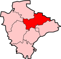
Stockleigh Pomeroy
Location within Devon
Population117 (2011 UK Census)
District
Shire county
Region
Country England
Sovereign state United Kingdom
Post town Crediton
Postcode district EX17
Police Devon and Cornwall
Fire Devon and Somerset
Ambulance South Western
UK Parliament
List of places
UK
England
Devon
50°49′23″N3°35′28″W / 50.822941°N 3.59123°W / 50.822941; -3.59123 Coordinates: 50°49′23″N3°35′28″W / 50.822941°N 3.59123°W / 50.822941; -3.59123

Stockleigh Pomeroy is a village and civil parish in Devon, England at the foot of the Raddon Hills. The parish church which is dedicated to St Mary the Virgin [1] has a Norman doorway. [2]

In 2016, a new village hall was opened to replace the Nissen hut used formerly which was opened in 1950. The new hall was built using grants from various bodies as well as contributions from the local community of both time and money. [3]

Related Research Articles

William Butterfield British architect

William Butterfield was a Gothic Revival architect and associated with the Oxford Movement. He is noted for his use of polychromy.

Chagford Town in Devon, England

Chagford is a market town and civil parish on the north-east edge of Dartmoor, in Devon, England, close to the River Teign and the A382, 4 miles (6 km) west of Moretonhampstead. The name is derived from chag, meaning gorse or broom, and the ford suffix indicates its importance as a crossing place. At the 2011 Census, it had a population of 1,449.

Totton and Eling Human settlement in England

Totton and Eling is a civil parish in Hampshire, England, with a population of about 29,000 people. It contains the town of Totton and is situated between the eastern edge of the New Forest and the River Test, close to the city of Southampton but outside the city boundary; the town is within the New Forest non-metropolitan district. Surrounding towns and villages include Ashurst, Marchwood, Cadnam and Ower.

Broughton Gifford Human settlement in England

Broughton Gifford is a village and civil parish about 1.5 miles (2.4 km) west of Melksham in Wiltshire, England. The parish includes the hamlets of Norrington Common and The Common.

Donhead St Mary Human settlement in England

Donhead St Mary is a village and civil parish in southwest Wiltshire, England, on the county border with Dorset. The village lies about 2+12 miles (4.0 km) east of the Dorset town of Shaftesbury and stands on high ground above the River Nadder, which rises in the parish.

Ponteland Human settlement in England

Ponteland is a large village and civil parish in Northumberland, England, 15 kilometres north of Newcastle upon Tyne. The name means "island in the Pont", after the River Pont which flows from west to east and joins the River Blyth further downstream, before flowing into the North Sea. Newcastle Airport is 2.5 kilometres to the south of the village.

Berry Pomeroy Village in Devon, England

Berry Pomeroy is a village and civil parish in the South Hams district of Devon, England, 2 miles (3 km) east of the town of Totnes. The parish is surrounded clockwise from the north by the parishes of Ipplepen, Marldon, Torbay, Stoke Gabriel, Ashprington, Totnes, and Littlehempston. In 2001 its population was 973, down from 1193 in 1901. The main road access is via the A385 road between Paignton and Totnes that runs through the parish, south of the village.

Willand Village in Mid Devon, England

Willand is a village and civil parish within the Local Government district of Mid Devon, England.

Buckerell Village in Devon, England

Buckerell is a small village and civil parish in the East Devon district of Devon, England. The village is about 2.5 miles west of the nearest town, Honiton. In the 2001 census a population of 270 was recorded for the parish, which is surrounded clockwise from the north by the parishes of Awliscombe, Honiton, Gittisham, Feniton and Payhembury.

Exbourne Village and civil parish in Devon, England

Exbourne is a village and civil parish in the English county of Devon. The Anglo-Saxon origin of the name is gæces burn - Cuckoo Stream. It occupies a hillside location between the River Okement and the Hole Brook, about 5 miles north of Okehampton in West Devon, and height above sea level ranges between 280 Ft. and 484 Ft. It lies in a primarily agricultural location and the local parish council represents both Exbourne and nearby Jacobstowe. The population of the ward which represents Exbourne and all surrounding villages was 1,695 at the 2011 census.

Filleigh Village in Devon, England

Filleigh is a small village, civil parish and former manor in North Devon, on the southern edge of Exmoor, 3.5 miles (5.6 km) west of South Molton. The village centre's street was, until the 1980s opening of the North Devon Link Road, the main highway between the North Devon administrative centre of Barnstaple and South Molton, leading westwards to Taunton. Much of the village's land is contained within grade I listed park and garden, Castle Hill, which straddles both sides of the Link Road providing a glimpse of some of it.

The Deanery of Cadbury represents the Church of England in mid Devon, within the Archdeaconry of Exeter and the Diocese of Exeter. The current rural dean is Douglas Dettmer.

Walkhampton Village in Devon, England

Walkhampton is a village and civil parish on the western side of Dartmoor in the county of Devon, England. The village lies on the Black Brook, a tributary of the River Walkham, about 7 kilometres (4.3 mi) south-east of Tavistock, near the villages of Horrabridge, Yelverton and Dousland. Burrator Reservoir, constructed in 1898, is to the south-east.

Thomas Vowler Short

Thomas Vowler Short was an English academic and clergyman, successively Bishop of Sodor and Man and Bishop of St Asaph.

Upottery Village in Devon, England

Upottery is a rural village, civil parish and former manor in East Devon, England.

Throwleigh Village in Devon, England

Throwleigh is a village and civil parish located 3 miles from Chagford and 6 miles from Okehampton, in the West Devon district, in the county of Devon, England. The parish incorporates the village of Throwleigh and the hamlets of Wonson, Providence, and Murchington, whose combined population is approximately 350.

West Budleigh Hundred was the name of one of thirty two ancient administrative units of Devon, England.

Stockleigh English Village in Devon, England

Stockleigh English is a village and civil parish in Devon, England. It has a 15th-century church, Saint Mary the Virgin, which was restored 1878–83.

References

  1. "St Mary the Virgin, Stockleigh Pomeroy". A church near you. Retrieved 5 November 2016.
  2. "Stockleigh Pomeroy". Devon County Council. Retrieved 5 November 2016.
  3. "Stockleigh Pomeroy New Village Hall Unveiled". Devon Communities Together. Retrieved 5 November 2016.