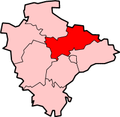
Petton, Devon

Last updated
Petton
Mid Devon , Country Lane ^ Petton - geograph.org.uk - 3920223.jpg
Petton Cross
Devon UK location map.svg
Red pog.svg
Petton
Location within Devon
Civil parish
District
Shire county
Region
Country England
Sovereign state United Kingdom
Post town TIVERTON
Postcode district EX16
Dialling code 01398
Police Devon and Cornwall
Fire Devon and Somerset
Ambulance South Western
UK Parliament
List of places
UK
England
Devon
51°00′47″N3°25′08″W / 51.01305°N 3.41892°W / 51.01305; -3.41892

Petton, also known as Petton Cross, is an English village in the civil parish of Bampton, the district of Mid Devon, and the county of Devon. It lies on the B3227 road that links Taunton and Torrington.

The village includes an Anglican church, dedicated to Saint Petrock, and a Methodist church. [1]

The Devon and Somerset Railway, from Taunton to Barnstaple, ran just to the north of the village but no station or halt was ever provided. The line closed in 1966, but traces can still be seen. [2]

Related Research Articles

<span class="mw-page-title-main">Axminster</span> Town in Devon, England

Axminster is a market town and civil parish on the eastern border of the county of Devon in England. It is 28 miles (45 km) from the county town of Exeter. The town is built on a hill overlooking the River Axe which heads towards the English Channel at Axmouth, and is in the East Devon local government district. At the 2001 census, it had a population of 5,626, increasing to 5,761 at the 2011 census. The town contains two electoral wards whose combined population is 7,110. The market is still held every Thursday.

<span class="mw-page-title-main">Lydford</span> Village in Devon, England

Lydford, sometimes spelled Lidford, is a village and civil parish, in Devon, seven miles (11 km) north of Tavistock on the western fringe of Dartmoor in the West Devon district. The parish covers an area of 50,000 acres (200 km2), and at the 2021 census had a population of 370.

<span class="mw-page-title-main">Yelverton, Devon</span> Village in Devon, England

Yelverton is a large village on the south-western edge of Dartmoor, Devon, in England. It is in the civil parish of Buckland Monachorum.

<span class="mw-page-title-main">Hatch Beauchamp</span> Human settlement in England

Hatch Beauchamp is a village and civil parish in Somerset, England, situated 5 miles (8.0 km) south east of Taunton. The village has a population of 620.

<span class="mw-page-title-main">Bampton, Devon</span> Town in Devon, England

Bampton is a small town and parish in northeast Devon, England, on the River Batherm, a tributary of the River Exe. It is about 6 miles (9.7 km) north of Tiverton, 19 miles (31 km) north of Exeter and the parish borders Somerset on its north-east and north-west sides. Bampton is a major part of the electoral ward of Clare and Shuttern. The ward population at the 2011 Census was 3,412.

<span class="mw-page-title-main">Brushford, Somerset</span> Human settlement in England

Brushford is a village and civil parish 2 miles (3.2 km) south of Dulverton and 12 miles (19 km) north of Tiverton in Devon, in the Somerset West and Taunton district of Somerset, England. According to the 2001 census, it had a population of 535 in 243 households, reducing to 519 at the 2011 Census. It covers an area of 1,149 hectares (11 km2) of which 3 hectares (0.030 km2) is within the Exmoor National Park.

<span class="mw-page-title-main">Bratton Fleming</span> Village in Devon, England

Bratton Fleming is a large village, civil parish and former manor in Devon, England, about 6 miles (10 km) north-east of Barnstaple and near the western edge of Exmoor. The parish includes the hamlets of Knightacott and Stowford. The population of the parish in 2001 was 942, falling to 928 in 2011. There is an electoral ward with the same name which at the 2011 census had a population of 2,117.

<span class="mw-page-title-main">Newton St Petrock</span> Village in United Kingdom

Newton St Petrock is an ecclesiastical and civil parish in the Torridge district of Devon in England, occupying approximately 1,500 acres (6.1 km2). The parish had a population in 2001 of 163.

<span class="mw-page-title-main">Bridestowe</span> Village in Devon, England

Bridestowe is a civil parish and village in the district of West Devon, Devon, England. The parish is surrounded clockwise from the north by the parishes of Bratton Clovelly, Sourton, Bridestowe and Sourton Common, Lydford, Lewtrenchard and Thrushelton.

<span class="mw-page-title-main">Petrockstowe</span> Village in Devon, England

Petrockstowe is a small village and civil parish in the district of Torridge in Northern Devon, England. Its population in 2001 was 379, hardly different from the figure of 385 recorded in 1901. The southern boundary of the parish lies on the River Torridge, and it is surrounded, clockwise from the north, by the parishes of Peters Marland, Merton, Huish, Meeth, Highampton and Buckland Filleigh.

<span class="mw-page-title-main">Timberscombe</span> Human settlement in England

Timberscombe is a village and civil parish on the River Avill 2.5 miles (4 km) south-west of Dunster, and 5.5 miles (9 km) south of Minehead within the Exmoor National Park in Somerset, England. The parish includes the hamlet of Bickham.

<span class="mw-page-title-main">Farringdon, Devon</span> Village and civil parish in East Devon, England

Farringdon is a village, civil parish and former manor in the district of East Devon in the county of Devon, England. The parish is surrounded clockwise from the north by the parishes of Clyst Honiton, Aylesbeare, a small part of Colaton Raleigh, Woodbury, Clyst St Mary and a small part of Sowton.

<span class="mw-page-title-main">Swimbridge</span> Village in Devon, England

Swimbridge is a village, parish and former manor in Devon, England. It is situated 4 miles (6.4 km) south-east of Barnstaple and twinned with the town of St.Honorine Du Fay in Normandy, France. It was the home of the Rev. John "Jack" Russell who first bred the Jack Russell Terrier.

<span class="mw-page-title-main">Parracombe</span> Village in Devon, England

Parracombe is a rural settlement 4 miles (6 km) south-west of Lynton, in Devon, England. It is situated in the Heddon Valley, on Exmoor. The population at the 2011 census was 293.

<span class="mw-page-title-main">Cotleigh</span> Village in Devon, England

Cotleigh is a village and civil parish near Honiton in Devon, England. It is surrounded clockwise from the north by the parishes of Upottery, Stockland, Offwell and Monkton. In the 19th century the rector of Cotleigh Devon was also rector of Barwick, Somerset.

<span class="mw-page-title-main">St George's Church, Morebath</span> Church in Devon, England

St George's Church, Morebath is a Grade II* listed parish church in the Church of England Diocese of Exeter in Morebath, Devon. It is part of the Hukeley Mission group of parishes, which also includes St Michael & All Angels Bampton, St Peter's in Clayhanger, St Petrock's in Petton and All Saint's in Huntsham.

<span class="mw-page-title-main">Clannaborough</span> Village in Devon, England

Clannaborough is a parish in the county of Devon, England, situated about 5+12 miles north-west of the town of Crediton and 11 miles north-east of Okehampton. No village exists, only scattered farmhouses, including Clannaborough Barton and the bartons of Appledore and Walson, all three estates listed in the Domesday Book of 1066. Walson was the birthplace of Christopher Lethbridge (d.1670), Mayor of Exeter in 1660, who was lord of the manor of nearby Bow. The parish church is dedicated to St Petrock.

Petton is a civil parish in Shropshire, England. It contains four listed buildings that are recorded in the National Heritage List for England. Of these, one is at Grade II*, the middle of the three grades, and the others are at Grade II, the lowest grade. The parish contains the village of Petton and the surrounding countryside, and the listed buildings consist of a farmhouse, a church, the churchyard walls and gate, and an ice house.

Petton may refer to:

References

  1. Harris, Helen (2004). A Handbook of Devon Parishes. Halsgrove. pp. 12–13. ISBN   1841143146.
  2. "Petton" (Map). RailMapOnline. Retrieved 9 December 2022.