Morebath

Last updated

Morebath
Morebath, St George (geograph 4160002).jpg
St George's Church, Morebath
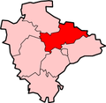
Devon UK location map.svg
Red pog.svg
Morebath
Location within Devon
OS grid reference SS9551724913
District
Shire county
Region
Country England
Sovereign state United Kingdom
Post town TIVERTON
Postcode district EX16
Dialling code 01884
Police Devon and Cornwall
Fire Devon and Somerset
Ambulance South Western
UK Parliament
List of places
UK
England
Devon
51°00′51″N3°29′27″W / 51.014075°N 3.490830°W / 51.014075; -3.490830 Coordinates: 51°00′51″N3°29′27″W / 51.014075°N 3.490830°W / 51.014075; -3.490830

Morebath is an upland village in the county of Devon, England. [1] It is mostly given over to sheep-farming, and situated on the southern edge of Exmoor.

An account of life in Morebath in the 16th century can be read in The Voices of Morebath: Reformation and Rebellion in an English Village by Eamon Duffy (published in 2001 by Yale University Press, ISBN   0-300-09185-0). Then, as now, Morebath was populated by no more than 300 people, drawn from some thirty families, living and working on the land. During the often turbulent period of the Reformation, its inhabitants relied on the guidance of their priest, Christopher Trychay, Vicar of Morebath from 1520 to 1574. His detailed hand-written records were transcribed by the Rev. J. Erskine Binney, and published by James G. Commin of Exeter in 1904 as a separate volume in the Devon Notes & Queries series, under the title The Accounts of the Wardens of the Parish of Morebath, Devon. They provide an insight into the life of this small English community. The church is dedicated to St. George.

The village was formerly served by two railway stations. Morebath railway station (initially opened in 1873 as "Morebath and Bampton") on the Devon and Somerset Railway was actually nearer to Shillingford, and about a mile-and-a-half from Morebath itself. Morebath Junction Halt, which opened in 1928, was a single-platform halt set among fields in the valley beyond Ashtown Farm, and had no access road, though there was a footpath to it from Ashtown, which extended along the edge of fields to Chilpark on the B3190, close to the main part of the village. It was served by the Exe Valley Railway, as well as the Devon and Somerset line, and therefore had a better service than Morebath railway station: it was also much closer to Morebath village itself. Both stations closed in 1966.

The actress Caroline Quentin resides in the village with her family.

Related Research Articles

River Axe (Lyme Bay) River in southwest England

The River Axe is a 22-mile (35 km) long river in the counties of Dorset, Somerset and Devon, in the south-west of England. It rises in Dorset and flows south to Lyme Bay which it enters through the Axe Estuary in Devon. It is a shallow, non-navigable river, although its mouth at Axmouth has some boating activity. The name Axe derives from a Common Brittonic word meaning "abounding in fish", and is cognate with pysg, the Welsh word for fish.

West Somerset Railway Heritage railway line in Somerset, England

The West Somerset Railway (WSR) is a 22.75-mile (36.6 km) heritage railway line in Somerset, England. The freehold of the line and stations is owned by Somerset County Council; the railway is leased to and operated by West Somerset Railway plc ; which is supported and minority-owned by charitable trust the West Somerset Railway Association (WSRA) and the West Somerset Steam Railway Trust (WSSRT). The WSR plc operates services using both heritage steam and diesel trains.

The Prayer Book Rebellion or Western Rising was a popular revolt in Cornwall and Devon in 1549. In that year, the Book of Common Prayer, presenting the theology of the English Reformation, was introduced. The change was widely unpopular, particularly in areas where firm Catholic religious loyalty still existed, such as Lancashire. Along with poor economic conditions, the enforcement of the English language literature led to an explosion of anger in Cornwall and Devon, initiating an uprising. In response, Edward Seymour, 1st Duke of Somerset sent Lord John Russell to suppress the revolt, with the rebels being defeated and its leaders executed two months after the beginning of hostilities.

Kelmarsh Human settlement in England

Kelmarsh is a village and civil parish in West Northamptonshire, England. The population of the civil parish at the 2011 Census was 208. The village is on the A508, close to its junction with the A14 about 5 miles (8 km) south of Market Harborough and 11 miles (18 km) north of Northampton.

Kyle of Lochalsh line Railway line in the Scottish Highlands

The Kyle of Lochalsh line is a primarily single-track railway line in the Scottish Highlands, from Dingwall to Kyle of Lochalsh. Many of the passengers are tourists, but there are also locals visiting Inverness for shopping, and commuters. All services are provided by ScotRail and run beyond Dingwall to Inverness. In the past there were some through services to and from Glasgow, Edinburgh or Aberdeen. None of the line is electrified, and all trains on the line are diesel-powered, as are all other trains in the Scottish Highlands.

Fremington, Devon Village in Devon, England

Fremington is a large village, civil parish and former manor in North Devon, England, the historic centre of which is situated three miles (5 km) west of Barnstaple. The village lies between the south bank of the tidal estuary of the River Taw and a small inlet of that river known as Fremington Pill. The parish is surrounded clockwise from the north by the parishes of Heanton Punchardon, Ashford, West Pilton, Barnstaple, Tawstock, Horwood, Lovacott and Newton Tracey, and Instow.

Withcall Small farming village and civil parish in the East Lindsey district of Lincolnshire, England

Withcall is a small farming village and civil parish in the East Lindsey district of Lincolnshire, England. It lies within the Lincolnshire Wolds, and 4 miles (6.4 km) south-west from Louth.

Geology of Somerset

Somerset is a rural county in the southwest of England, covering 4,171 square kilometres (1,610 sq mi). It is bounded on the north-west by the Bristol Channel, on the north by Bristol and Gloucestershire, on the north-east by Wiltshire, on the south-east by Dorset, and on the south west and west by Devon. It has broad central plains with several ranges of low hills. The landscape divides into four main geological sections from the Silurian through the Devonian and Carboniferous to the Permian which influence the landscape, together with water-related features.

Finghall Village and civil parish in North Yorkshire, England

Finghall is a village and civil parish in the Richmondshire district of North Yorkshire, England.

Meldon, Devon Hamlet in Devon, England

Meldon is a hamlet in West Devon, on the edge of Dartmoor in Devon, England. It is 4 km south-west of Okehampton. Its main features are the Meldon Quarry and Meldon Reservoir and the nearby Meldon Viaduct.

Devon and Somerset Railway

The Devon and Somerset Railway (D&SR) was a cross-country line that connected Barnstaple in Devon, England, to the network of the Bristol and Exeter Railway (B&ER) near Taunton. It was opened in stages between 1871 and 1873 and closed in 1966. It served a mostly rural area although it carried some through services from east of Taunton to the seaside resort of Ilfracombe.

Long Ashton railway station Railway station in England

Long Ashton railway station was a railway station on the Bristol to Exeter line, 3.5 miles (5.6 km) southwest of Bristol Temple Meads, serving the village of Long Ashton in North Somerset, England. There were two stations on the site, the first, called "Ashton", opened in either 1841 or 1852 and closed in 1856. The second station, originally known as "Long Ashton Platform" before being renamed as "Long Ashton" in 1929, was operational from 1926 to 1941. The site is now partly under the A370 Long Ashton Bypass, and there are no visible remains of the station. There is local support for the station to be reopened, possibly sited further to the west, and possibly as part of the University of Bristol's proposed Fenswood Farm development.

The Mendip Way is an 80-kilometre (50 mi) long-distance footpath across the Mendip Hills from Weston-super-Mare to Frome. It is divided into two sections.

Exe Valley Railway

The Exe Valley Railway was a branch line built by the Great Western Railway (GWR) in Devon, England, to link its Bristol to Exeter line with its Devon and Somerset Railway (D&SR), thereby connecting Exeter with Dulverton. The line was in use from 1884 until 1964.

Woodlawn, County Galway Settled area in County Galway, Ireland

Woodlawn, historically known as Mota or Moote, is a settled area in County Galway, Ireland.

Tiverton railway station

Tiverton railway station served the town of Tiverton, Devon, England. It opened in 1848 as the terminus station of a broad gauge branch line from the Bristol and Exeter Railway main line: the main line junction station four miles away had originally been called Tiverton Road but was renamed as Tiverton Junction when the branch opened.

Morebath Junction railway station

Morebath Junction Halt was a railway halt near the junction of the Devon and Somerset Railway and Exe Valley Railway in Devon, South West England.

Shillingford, Devon Village in Devon, England

Shillingford is a village two miles (3 km) northeast of Bampton on the River Batherm in Mid Devon, England, close to the border with West Somerset. It is near the Exe Valley.

The Yeovil–Taunton line was a railway line in England, built by the Bristol and Exeter Railway (B&ER) to connect its main line with the market town of Yeovil in Somerset. It opened in 1853 using the broad gauge of 7 ft 14 in and was the first railway to serve Yeovil. It ran from a junction at Durston although in later years passenger trains on the line ran through to and from Taunton where better main and branch line connections could be made.

St Georges Church, Morebath Church in Morebath, England

St George's Church, Morebath is a Grade II* listed parish church in the Church of England Diocese of Exeter in Morebath, Devon. It is part of the Hukeley Mission group of parishes, which also includes St Michael & All Angels Bampton, St Peter's in Clayhanger, St Petrock's in Petton and All Saint's in Huntsham.

References

  1. Ordnance Survey: Landranger map sheet 181 Minehead & Brendon Hills (Dulverton & Tiverton) (Map). Ordnance Survey. 2009. ISBN   9780319231814.

Commons-logo.svg Media related to Morebath at Wikimedia Commons