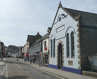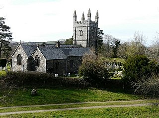

Belstone is a small village and civil parish in the West Devon District of Devon, England.


Belstone is a small village and civil parish in the West Devon District of Devon, England.
Lying on the northern side of Dartmoor, the western boundary of the parish is mostly formed by the East Okement River and the eastern by the River Taw. The village lies at around 300m (990 feet) above sea level with its highest point being Belstone Tor in the south, at 460m (1,508 feet). [1] The village is central in its parish, surrounded clockwise from the north by the parishes of Sticklepath, South Tawton, Dartmoor Forest and Okehampton Hamlets. [2] It is only accessible by minor roads from the A30 road, east of the town of Okehampton, which is about three miles to the north-west. In 2001 its population was 257, relatively unchanged from the 1901 figure of 236. [1]
There are a number of Bronze Age remains within the parish, including the Nine Maidens stone circle, the remains of the outer wall of a burial chamber. [1] It is possible that Fatherford, in the north west of Belstone parish, was one stage in a Roman extension of the Fosse Way road from Exeter to Launceston. [3]
The village was recorded as Bellestam in the 11th century Domesday Book. The parish church, dedicated to St. Mary, dates from the 13th century and has priests recorded from 1260. [1] [4]
In the 19th century, copper was worked on the moor at Taw River mine which closed in 1892, and at Greenhill in the north-east. [1]


Okehampton is a town and civil parish in West Devon in the English county of Devon. It is situated at the northern edge of Dartmoor, and had a population of 5,922 at the 2011 census. Two electoral wards are based in the town. Their joint population at the same census was 7,500.

Lydford, sometimes spelled Lidford, is a village, once an important town, in Devon, seven miles (11 km) north of Tavistock on the western fringe of Dartmoor in the West Devon district. There is an electoral ward with the same name which includes Princetown. The population of this ward at the 2011 census was 2,047.

Mary Tavy is a village with a population of around 600, located four miles north of Tavistock in Devon in south-west England; it is named after the River Tavy. There is an electoral ward with the same name. Its population at the 2011 census was 1,559. Mary Tavy used to be home to the world's largest copper mine Wheal Friendship, as well as a number of lead and tin mines. It lies within Dartmoor National Park. The village lies a mile or two north of Peter Tavy; both were shown as separate settlements in the Domesday Book entry of 1086.

Bickington is a village and civil parish in the Teignbridge district of Devon, England, on the east edge of the Dartmoor National Park. At the 2001 census it had a population of 311. The village is about five miles west of Newton Abbot, on the River Lemon. The church is 15th century; its lychgate has a room over it.

Brushford is a village and civil parish in the Mid Devon district of Devon in England. According to the 2001 census it had a population of 59. The village is situated on the River Taw, and is about 12 miles north-east of Okehampton.

Zeal Monachorum is a village and civil parish in the Mid Devon district of Devon, England, about 18 miles (29 km) north-west of Exeter, situated on the River Yeo. According to the 2001 census it had a population of 398. The village is in the electoral ward of Taw whose population at the 2011 Census was 1,660.

Copplestone is a village, former manor and civil parish in Mid Devon in the English county of Devon. It is not an ecclesiastical parish as it has no church of its own, which reflects its status as a relatively recent settlement which grew up around the ancient "Copleston Cross" that stands at the junction of the three ancient ecclesiastical parishes of Colebrooke, Crediton and Down St Mary.

Bridestowe is a civil parish and village in the district of West Devon, Devon, England. The parish is surrounded clockwise from the north by the parishes of Bratton Clovelly, Sourton, Bridestowe and Sourton Common, Lydford, Lewtrenchard and Thrushelton.

Whitstone is a village and civil parish in east Cornwall, United Kingdom. It is roughly halfway between the towns of Bude and Launceston. The population at the 2011 census was 590.

Cranmere Pool is a small depression within a peat bog in the northern half of Dartmoor, Devon, England, at grid reference SX604858. It lies 560 metres (1,840 ft) above sea level on the western flank of Hangingstone Hill, close to the source of the West Okement River, about 500 metres (550 yd) north west of the source of the East Dart River, and about the same distance west of the River Taw's source.

North Tawton is a small town in Devon, England, situated on the river Taw. It is administered by West Devon Council. The population of the electoral ward at the census 2011 was 2,026.

Bratton Clovelly is a village, parish and former manor in the west part of Devon, England. It is situated about 8 miles (13 km) south-west of Okehampton immediately north of the A30 road. The manor of Bratton Clovelly was listed in the Domesday Book of 1086. The parish church dedicated to St Mary is 15th-century, with many Norman features. The former village stocks are kept in the belfry. The parish is thought to have been the birthplace of influential 13th-century jurist Henry de Bracton; however, this claim is also made for at least two other places.

Drewsteignton is a village, civil parish and former manor within the administrative area of West Devon, England, also lying within the Dartmoor National Park. It is located in the valley of the River Teign, 13 miles (21 km) west of Exeter and 9 miles (14 km) south east of Okehampton. Visitor attractions in the area include the village centre itself, nearby Castle Drogo, and Fingle Bridge. The population of the ward at the 2011 census was 1,616.

Iddesleigh is a village and civil parish in the county of Devon, England. The settlement has ancient origins and is listed in the Domesday Book. The village lies on the B3217 road, roughly central in its parish of around 2,900 acres (1,200 ha), about 8 miles (13 km) north of the town of Okehampton.

Sampford Courtenay railway station is a disused railway station at Belstone Corner, which used to serve the nearby village of Sampford Courtenay in Devon. The village lies 3 minutes away by car or around 30 minutes by foot via the B3215. In 2018–19 it was the least used station in Devon and in the South West and the tenth least used station in Great Britain. In 2020-21 it was the joint least used station in Great Britain with zero passengers.

North Tawton railway station was a railway station serving the town of North Tawton in Devon, England. North Tawton lies on the River Taw.
Dartmoor Forest is a civil parish in Devon, England. It was formed in 1987 by the splitting of the former parish of Lydford. It covers about 56,000 acres (230 km2) entirely within Dartmoor National Park, and is the largest parish in Devon. Despite its size its population in 2001 was only 1,619. Due to its large size it is surrounded by many other parishes: these are, clockwise from the north, Belstone, South Tawton, Throwleigh, Gidleigh, Chagford, North Bovey, Manaton, Widecombe in the Moor, Holne, West Buckfastleigh, Dean Prior, South Brent, Ugborough, Harford, Cornwood, Shaugh Prior, Sheepstor, Walkhampton, Whitchurch, Peter Tavy, Lydford, land common to the parishes of Bridestowe and Sourton, and Okehampton Hamlets.

Walkhampton is a village and civil parish on the western side of Dartmoor in the county of Devon, England. The village lies on the Black Brook, a tributary of the River Walkham, about 7 kilometres (4.3 mi) south-east of Tavistock, near the villages of Horrabridge, Yelverton and Dousland. Burrator Reservoir, constructed in 1898, is to the south-east.

Stowford is a village and civil parish in the district of West Devon in the English county of Devon. It is situated to the west of Dartmoor. Stowford is about 1 mile west of the village of Lewdown and about 11 miles south-west of Okehampton in Devon and 7 miles east of Launceston in Cornwall. The parish is very rural, and includes the hamlet of Sprytown.

Southcott is a hamlet in the civil parish of Okehampton Hamlets, in West Devon, England. The hamlet name is Anglo Saxon in origin and means 'southern cottage'.