Haytor

Last updated

Haytor
Haytor, May 2011 2.jpg
The larger eastern outcrop of Haytor
Highest point
Elevation 457 m (1,499 ft)
Coordinates 50°34′45″N3°45′21″W / 50.579285°N 3.7558269°W / 50.579285; -3.7558269 Coordinates: 50°34′45″N3°45′21″W / 50.579285°N 3.7558269°W / 50.579285; -3.7558269
Geography
Devon UK relief location map.jpg
Red triangle with thick white border.svg
Haytor
Haytor in Devon
Location Dartmoor, England
OS grid SX757770
Topo map OS Landranger 191
Haytor
Interactive map of Haytor

Haytor, also known as Haytor Rocks, [1] Hay Tor, or occasionally Hey Tor, [2] is a granite tor on the eastern edge of Dartmoor in the English county of Devon.

Contents

Location

The tor is at grid reference SX757770 , near the village of Haytor Vale in the parish of Ilsington. There is an electoral ward with the same name. The population at the 2011 census is 2,862. [3]

History

A typical distant view of Haytor as seen from the A38 road between Exeter and Plymouth Distant view of Haytor.jpg
A typical distant view of Haytor as seen from the A38 road between Exeter and Plymouth

Idetordoune (1566), Ittor Doune (1687), Idetor (1737), Eator Down (1762) and Itterdown (1789) are a few recorded examples of earlier names by which Haytor was known. [4] The name Haytor is of comparatively recent origin, and is probably a corruption of its old name and that of the Haytor Hundred, [5] which covered the coastal area between the River Teign and River Dart, [6] itself now considered to have been named after a lost village located somewhere between Totnes and Newton Abbot. [7]

In the 19th century steps were made to allow pedestrians up to the top of the tor and a metal handrail fixed to allow tourists easier access to the summit. This was not entirely welcomed and in 1851, a Dr Croker complained about the rock steps that had been cut "to enable the enervated and pinguedinous scions of humanity of this wonderful nineteenth century to gain the summit". [8] The handrail was removed in the 1960s due to it rusting: the stumps of the uprights are still embedded in the rock. [9]

In 1953, Haytor was used as a major location for the feature film Knights of the Round Table starring Robert Taylor and Ava Gardner. An "elaborate and impressive castle" was built between the two main rock piles of the tor and traditional medieval sports, including jousting, were staged here for the film. [10]

The whole of Haytor Down was sold to the newly formed Dartmoor National Park Authority in 1974. [11]

Geology

Haytor has the form of a typical "avenue" tor, where the granite between the two main outcrops has been eroded away. Its characteristic shape is a notable landmark visible on the skyline from many places in south Devon between Exeter and Totnes. The majority of the tor consists of coarse-grained granite, but at the base of the western outcrop is a layer of finer-grained granite which has eroded more than the rock above, leaving a pronounced overhang (a rock shelter) of two or three feet in places. [12]

Haytorite, a variety of quartz found in an iron mine adjacent to the Hay Tor granite quarries, was named “in honour of its birth-place”. [13]

Quarrying

Haytor quarry 050715 043 uk dev quarry.jpg
Haytor quarry

The granite below the tor has fewer large feldspar crystals than at the tor itself, and this was preferred for building. [12] There are several quarries on the northern slopes of Haytor down which were worked intermittently between 1820 and 1919. [12] Between 1820 and 1858 the rock from these quarries was transported by the Haytor Granite Tramway to the Stover Canal. [14] The tramway itself was built out of the granite it would carry, and due to its durable nature much of it remains visible today.

Haytor granite was used in the reconstruction of London Bridge which opened in 1831 and was moved in 1970 to Lake Havasu City in Arizona. [15] The last rock quarried here in 1919 was used for the Exeter war memorial. [16]

Today

Haytor rocks and quarries are protected from development and disturbance as a Site of Special Scientific Interest. The area is considered a natural beauty spot and is arguably Dartmoor's most famous landmark, [1] visited by coach parties and walking groups. [9] It is accessible by road and at a height of 457 metres (1,499 ft) [1] right on the eastern side of the moor, it provides views of the coastline, the Teign Estuary and the rolling countryside between, with the ridge of Haldon behind. In 2013, Simon Jenkins rated the view from Haytor as one of the top ten in England. [17]

The smaller, western outcrop is sometimes known as "Lowman". [18] [19] Rock climbers make use of both outcrops; each has routes of varying difficulty. [18]

The road that passes below the tor hosted a summit finish on Stage 6 of the 2013 Tour of Britain, [20] and the climb was again used for the finish of the sixth stage of the 2016 Tour of Britain. [21]

Related Research Articles

Dartmoor Area of moorland in south Devon, England

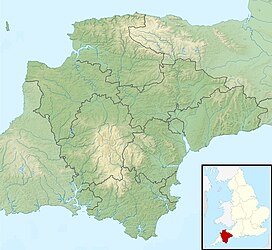
Dartmoor is an upland area in southern Devon, England. The moorland and surrounding land has been protected by National Park status since 1951. Dartmoor National Park covers 954 km2 (368 sq mi).

Industrial archaeology of Dartmoor

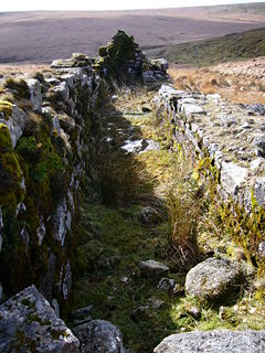
The industrial archaeology of Dartmoor covers a number of the industries which have, over the ages, taken place on Dartmoor, and the remaining evidence surrounding them. Currently only three industries are economically significant, yet all three will inevitably leave their own traces on the moor: china clay mining, farming and tourism.

River Teign River in Devon, England

The River Teign or is a river in the county of Devon, England. It is 31 mi (50 km) long and rises on Dartmoor, becomes an estuary just below Newton Abbot and reaches the English Channel at Teignmouth.

Teignmouth Human settlement in England

Teignmouth is a seaside town, fishing port and civil parish in the English county of Devon. It is situated on the north bank of the estuary mouth of the River Teign, about 12 miles south of Exeter. The town had a population of 14,749 at the last census in 2011.

Newton Abbot Town in Teignbridge District, Devon, England

Newton Abbot is a market town and civil parish on the River Teign in the Teignbridge District of Devon, England. Its 2011 population of 24,029 was estimated to reach 26,655 in 2019. It grew rapidly in the Victorian era as the home of the South Devon Railway locomotive works. This later became a major steam engine shed, retained to service British Railways diesel locomotives until 1981. It now houses the Brunel industrial estate. The town has a race course nearby, the most westerly in England, and a country park, Decoy. It is twinned with Besigheim in Germany and Ay in France.

High Willhays

High Willhays, or according to some authorities High Willes, is the highest point on Dartmoor, Devon, at 621 metres above sea level, and the highest point in Southern England.

Ilsington Village and civil parish in Devon, England

Ilsington is a village and civil parish situated on the eastern edge of Dartmoor, Devon, England. It is one of the largest parishes in the county, and includes the villages of Ilsington, Haytor Vale, Liverton and South Knighton. The parish is surrounded, clockwise from the north, by the parishes of Bovey Tracey, Teigngrace, Newton Abbot, Ogwell, Bickington, Ashburton, Widecombe-in-the-Moor and Manaton. In 2001 the population of the parish was 2,444, greatly increased from the 886 residents recorded in 1901. The parish is represented in parliament by Mel Stride, as part of the Central Devon constituency.

Bowermans Nose

Bowerman's Nose is a stack of weathered granite on Dartmoor, Devon, England. It is situated on the northern slopes of Hayne Down, about a mile from Hound Tor and close to the village of Manaton at grid reference SX742805. It is about 21.5 feet (6.6 m) high and is the hard granite core of a former tor, standing above a 'clitter' of the blocks that have eroded and fallen from it.

Hound Tor Granite tor on Dartmoor in Devon, England

Hound Tor is a tor on Dartmoor, Devon, England and is a good example of a heavily weathered granite outcrop. It is easily accessible, situated within a few minutes from the B3387 between Bovey Tracey and Widecombe-in-the-Moor.

Crockern Tor Tor on Dartmoor, England

Crockern Tor is a tor in Dartmoor National Park, Devon, England. Composed of two large outcrops of rock, it is 396 metres above sea level. The lower outcrop was the open-air meeting place of the Stannary Convocation of Devon from the early 14th century until the first half of the 18th century. On Parliament Rock, pictured here, the Lord Warden of the Great Court of the Devon Tinners supposedly sat during meetings of the Court.

River Lemon River in Devon, England

The River Lemon is a 9.9 mile river in the county of Devon in southwest England. It is a tributary of the River Teign, starting on Dartmoor by Haytor, and ending in Newton Abbot. It rises on the south-east side of Dartmoor near Haytor, joins with the River Sig and the Langworthy Brook at Sigford, then passes the village of Bickington. Lower down, it is joined by the Kestor Brook and it then flows through the woods in Bradley Valley, past the manor house of Bradley, and through the town of Newton Abbot where it flows through a 440-yard-long tunnel below the town centre. Just below the town, the river joins the River Teign at 50.517°N 3.607°W, near the head of its estuary.

Stover Canal Derelict canal in Devon, England

The Stover Canal is a canal located in Devon, England. It was opened in 1792 and served the ball clay industry until it closed in the early 1940s. Today it is derelict, but the Stover Canal Society is aiming to restore it and reopen it to navigation.

Haytor Granite Tramway Horse-drawn tramway built to convey granite (1820-1858)

The Haytor Granite Tramway was a tramway built to convey granite from Haytor Down, Dartmoor, Devon to the Stover Canal. It was very unusual in that the track was formed of granite sections, shaped to guide the wheels of horse-drawn wagons.

The hundred of Haytor was the name of one of thirty two ancient administrative units of Devon, England. The hundred covered the coastal area between the River Teign and River Dart. It was likely named after a lost village located somewhere between Totnes and Newton Abbot.

James Templer (canal builder) British canal builder

James Templer (1748–1813) of Stover House, Teigngrace, Devon, was a Devon landowner and the builder of the Stover Canal.

George Templer British landowner

George Templer was a landowner in Devon, England, and the builder of the Haytor Granite Tramway. His father was the second James Templer (1748–1813) who had built the Stover Canal.

Teigngrace

Teigngrace is a civil parish centred on a hamlet that lies about two miles north of the town of Newton Abbot in Devon, England. According to the 2001 census, its population was 235, compared to 190 a century earlier. The western boundary of the parish mostly runs along the A382 road; its short northern boundary along the A38; and its eastern partly along the rivers Bovey and Teign. It comes to a point at its southern extremity, near Newton Abbot Racecourse. The parish is surrounded, clockwise from the north, by the parishes of Bovey Tracey, Kingsteignton, Newton Abbot and a small part of Ilsington.

Christow railway station Disused railway station in Devon, England

Christow Railway Station's previously known as Teign House was a railway station serving the villages of Christow, Bridford and Doddiscombsleigh in Devon, England located on the line between Newton Abbot and Exeter. The station is/was actually in the parish of Doddiscombsleigh as the parish boundary is the River Teign.

Stover, Teigngrace Historic estate in Devon, England

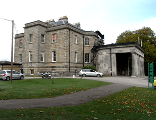
Stover is a historic estate in the parish of Teigngrace, about half way between the towns of Newton Abbot and Bovey Tracey in South Devon, England. It was bought by James Templer (1722–1782) in 1765 and passed through three generations of that family before being bought by Edward St Maur, 11th Duke of Somerset in 1829.

This article describes the geology of Dartmoor National Park in Devon, in south-west England. Dartmoor gained national park status in 1951 but the designated area of 954 km2 (368 sq mi) extends beyond the upland of Dartmoor itself to include much of the surrounding land, particularly in the northeast. The geology of the national park consists of a 625 km2 (241 sq mi) core of granite intruded during the early Permian period into a sequence of sedimentary rocks originating in the Devonian and Carboniferous periods. These rocks were faulted and folded, sometimes, intensely, during the Variscan orogeny. Thermal metamorphism has also taken place around the margins of the granite pluton altering the character of the sedimentary rocks whilst mineral veins were emplaced within the granite. A small outlier of Palaeogene sediments occurs on the eastern boundary of the national park.

References

  1. 1 2 3 Bound, Terry (1995). The A to Z of Dartmoor Tors (revised ed.). Exeter, Devon: Obelisk Publications. p. 42. ISBN   1-899073-27-2.
  2. Hemery 1983, p. 692
  3. "Ward population 2011. Retrieved 18 Feb 2015".
  4. Gover, J.E.B., Mawer, A. & Stenton, F.M. (1932). The Place-Names of Devon. English Place-Names Society. Vol ix. Part II. Cambridge University Press. p. 476.
  5. Hemery 1983, pp. 692–3 expounds on the derivation of the name in great depth.
  6. Percy Russell, A History Of Torquay (Torquay: Devonshire Press Limited, 1960), 6
  7. Watts, Victor (2010). The Cambridge Dictionary of English Place-names (1st paperback ed.). Cambridge University Press. p. 290. ISBN   978-0-521-16855-7.
  8. Quoted in Hemery 1983, p. 693. According to the OED the word pinguedinous means "of the nature of or resembling fat; fatty, greasy."
  9. 1 2 Hemery 1983, p. 693
  10. Barber, Chips; FitzGerald, David (1988). Made In Devon. Exeter: Obelisk Publications. p. 74. ISBN   0-946651-20-5.
  11. Mercer, Ian (2009). Dartmoor - A Statement of its Time. London: Collins. pp. 331–2. ISBN   978-0-00-718499-6.
  12. 1 2 3 Perkins 1972, pp. 93–5
  13. Tripe, Cornelius: Observations on a Mineral from near Hay Tor, in Devonshire in: The Philosophical Magazine, or Annals of Chemistry, Mathematics, Astronomy, Natural History, and General Science Vol. I., London 1827, p. 38 Google Books
  14. "History of the Stover Canal". Stover Canal Society. Retrieved 22 April 2012.
  15. Perkins 1972, pp. 112–4
  16. Harris, Helen (1998). Devon's Century of Change. Newton Abbot: Peninsula Press. p. 82. ISBN   1-872640-47-8.
  17. Jenkins, Simon (28 September 2013). "Our glorious land in peril". The Telegraph. Retrieved 16 October 2018.
  18. 1 2 "Haytor - Climbing Guide". jaVu.co.uk. Retrieved 22 April 2012.
  19. Goodwin, Phil (13 July 2013). "Murder probe launched after Dartmoor deaths of mum and two children". Plymouth Herald . Archived from the original on 15 July 2013. Retrieved 2 August 2014.
  20. "Tour of Britain 2013 Route Revealed". cyclingweekly.co.uk. Retrieved 23 March 2013.
  21. "Tour of Britain: Steve Cummings takes lead as Wout Poels wins stage six". bbc.co.uk . 9 September 2016. Retrieved 10 September 2016.

Sources

Commons-logo.svg Media related to Haytor at Wikimedia Commons