Kingskerswell

Last updated

Kingskerswell
Kingskerswellmain.jpg
The former A380 road through Kingskerswell, 2008
Devon UK location map.svg
Red pog.svg
Kingskerswell
Location within Devon
OS grid reference SX8867
District
Shire county
Region
Country England
Sovereign state United Kingdom
Post town Newton Abbot
Postcode district TQ12
Dialling code 01803
Police Devon and Cornwall
Fire Devon and Somerset
Ambulance South Western
UK Parliament
List of places
UK
England
Devon
50°29′46″N3°34′20″W / 50.4960°N 3.5722°W / 50.4960; -3.5722

Kingskerswell (formerly Kings Carswell, [1] or Kings Kerswell) is a village and civil parish within Teignbridge local government district in the south of Devon, England. The village grew up where an ancient track took the narrowest point across a marshy valley and it is of ancient foundation, being mentioned in the Domesday Book. It has a church dating back to the 14th century and the ruins of a manor house of similar date. The coming of the railway in the 1840s had a large effect on the village, starting its conversion into a commuter town. The village is a major part of the electoral ward called Kerswell-with-Combe. This ward had a population of 5,679 at the 2011 census. [2]

Contents

It was situated on a busy main road, part of the A380, between Torquay and Newton Abbot until the opening of the South Devon Highway in December 2015. There had been proposals to reroute this road to relieve the traffic bottleneck since 1951.

History

Beginnings

There are several prehistoric sites on the high ground surrounding Kingskerswell, such as the Iron Age sites of Milber Down, Berry's Wood and Dainton. [3] Kerswell Down, just to the west of the village, is the site of a late Bronze Age/early Iron Age field system, [4] and a hoard of over 2,000 (small copper or brass) [5] Roman coins was found here, near the church, some time between 1838 and 1840. [6] The exact details of how and where the coins were found is not known, and their present whereabouts is unknown too, [3] but in 1878 they were said to bear inscriptions of Gallienus, Tacitus, Probus and others. [7] In 1992 during survey work for a bypass, evidence of a Roman settlement was found at Aller Cross, just north of the village. It may have an early military origin, and if it does it "would be of regional importance". [8]

The Aller Brook and its tributaries lie in a shallow, wide and marshy valley that drains roughly north-westerly from the outskirts of Torquay to the estuary of the River Teign at Newton Abbot. There is one point in this valley where two spurs of land form a narrow crossing point, and it was here that an ancient track from St Marychurch and Coffinswell crossed the valley on its way west towards Ipplepen and Totnes. A bridge, known as Dacca Bridge or Daccabridge, was constructed here and this is where the village developed, on the western bank. [3]

The first written record of Kingskerswell is in the Domesday Book where it is called Carsewelle. [9] Before the Norman Conquest it was held by Edward the Confessor as part of the royal demesne; afterwards it continued in royal ownership under William the Conqueror and his descendants (in contrast to the nearby village of Abbotskerswell). [10] The first part of the village's name represents this royal ownership. The Saxon word carse probably means watercress, a plant that still grows freely in the local streams; and the last part of the name most likely refers to the wells and springs in the vicinity, though an alternative theory proposes that it derives from the Latin villa, indicating a Roman origin. [10]

After being granted to several lords, but always escheating to the king due to the lack of any heirs, [10] the manor was given to Nicholas de Moels in 1230. [11] In 1268 his son, Roger de Molis, was granted the right to hold a weekly market on Tuesdays and an annual fair on 1 September. [12] The manor remained in the de Molis family until some time between 1349 and 1362 when it passed to the Courtenays for a short time until 1369 when it again escheated to the king because the next heir, John Dinham (1359–1428), was aged only eleven.

Armorials of Sir John Dinham: Gules, four lozenges in-fess ermine Blason John V de Dinham (1443-1501).svg
Armorials of Sir John Dinham: Gules, four lozenges in-fess ermine

John Dinham (or "Dynham") eventually gained his inheritance in 1381. He died in 1428 but the manor remained in his family until 1501. [13] On the death of John Dynham, 1st Baron Dynham in that year, his lands were divided between his four sisters and the portion that included Kingskerswell passed to his eldest sister, Margery, and eventually to Henry Compton, 1st Baron Compton. By 1710 the manor was owned by Sir Henry Langford who passed it to Thomas Brown; in 1972 the lord of the manor was T.H. Langford Brown of Littlehempston. [14]

Stained glass image of Saint Apollonia in St Mary's Church Saint Apollonia - Kingskerswell Church.JPG
Stained glass image of Saint Apollonia in St Mary's Church

The church and manor house

A church is mentioned in the Domesday entry for Kingskerswell: "Also to the church of this manor belongs half a virgate of land", [15] though this does not necessarily imply the existence of a building; it may just represent a group of Christians under some form of rectorship or similar administration. [16] By 1159 there was a chaplain named William here, [17] and in 1301 the chapel was visited by the Dean and Chapter of Exeter. They made several notes on the condition of the chapel, including the fact that it had three bells, but it was generally in poor repair—for instance the chancel roof was in a bad condition and its windows had no glass. [18]

Effigy of Sir John Dinham (1359-1428), St Mary's Church, north aisle. Two female effigies also survive separately, believed to represent two of his three wives. Rogers (1890) suggests one of the ladies to be his 2nd wife Maud Maltravers from the heraldic evidence on Dinham's chest tomb, the arms of her father Sir John Maltravers of Hook, Dorset, being Sable, a fret or. Under the effigy the Dinham arms are impaled with arms of fretty JohnDinhamKingsCarswell.jpg
Effigy of Sir John Dinham (1359–1428), St Mary's Church, north aisle. Two female effigies also survive separately, believed to represent two of his three wives. Rogers (1890) suggests one of the ladies to be his 2nd wife Maud Maltravers from the heraldic evidence on Dinham's chest tomb, the arms of her father Sir John Maltravers of Hook, Dorset, being Sable, a fret or. Under the effigy the Dinham arms are impaled with arms of fretty

The church, which is dedicated to St Mary, may have parts dating to the 14th century, most notably the tower. It remained a chapel under the administration of the parish of St Marychurch until the 1530s when the present building was started. [20] It was extended in the 15th century by converting the transepts into aisles. [21] It was restored c.1856 by John West Hugall and again in 1875 by J. W. Rowell. [22] The church is grade II* listed, [23] and has an uncommon image of Saint Apollonia, the patron saint of toothache sufferers, in the form of ancient stained glass in one of the south windows. [24] It also contains three poorly preserved effigies of the Dinhams who held the manor in the 14th and 15th centuries. They probably represent Sir John Dinham (1359–1428) [25] and two of his three wives. [26]

Just to the north-west of the church are the ruins of a manor house, probably built by the same Sir John Dinham – a document of 1387 confirms that he had a manor house and chapel here in that year. It is not known when the manor house fell into disrepair, but a mention in a lease suggests that it was probably still in good condition in 1681. [26] The ruins were listed (as grade II) in 1955 and were for many years obscured by trees and vegetation. There are several walls, the base of a tower with features in dressed granite and part of an arch. [27] Since 2000 some clearance and conservation work has been undertaken at the site with the assistance of the South West England Environmental Trust, [28] and it is now a scheduled monument. [29]

Since 1800

Kingskerswell was made an independent parish, separated for the first time from St Marychurch, in 1828 and the first incumbent was Aaron Neck (born 1769). In his later life he was very generous to the parish, helping to provide new pews, an organ and an altar-piece for the church and increasing its glebe-lands, as well as building and supporting a school for 60 children. He also built himself a new vicarage in 1836. [30]

In the 1830s lord of the manor Henry Langford Brown built Barton Hall on a site about 1.5 miles (2.4 km) south east of the church, now on the borders of Torquay. Barton Hall was requisitioned during World War II and left afterwards in a poor state. It was sold to a group of businessmen in 1947 and ten years later sold on to Fred Pontin who turned it into one of the flagships of Pontin's, his holiday empire. The hall and surrounding lands then passed through several owners, and as of 2010 are being run by PGL Travel Ltd. as a centre for schools and youth activity courses, English as a Foreign Language groups and Family Adventure breaks. [31]

The arrival of the Newton Abbot to Kingswear railway line in the late 1840s had a dramatic effect as it was driven through the centre of the village. It caused extensive changes to the original road layout, including severing the ancient route over Daccabridge; as well as the demolition of several properties and disturbance to the natural drainage pattern of the local springs and streams. [10] Between 1853 and 1964 the village had its own railway station on this line. [32] The Rosehill Viaduct consisting of seven brick arches on limestone piers over the railway was built by Brunel in 1846–8 as was the nearby similar Dobbin Arch. They are both now grade II listed structures, [33] and are just two of the 41 listed buildings in the village. [34] The coming of the railway also caused the replacement of much of the local straw thatch that had traditionally been used for roofing with Welsh slate that could be transported at little cost. [35] It also prompted wealthy businessmen from the neighbouring towns of Torquay and Newton Abbot to build many large villas here, making it an early example of a commuter town. [20]

We would point out to parents and children that the school will commence at 1.30 instead of 2.00 for the next few months, so that there will be ample time for blackberry picking after school hours.

Kingskerswell Parish Magazine,
after the opening of a new infants' school in September 1894. [36]

The Aller Vale Pottery was set up on the north side of the village in 1865, originally producing earthenware goods. [37] It started producing art pottery in 1881 and continued (in name at least) until 1962. In 1886 the pottery was visited by Princess Louise, daughter of Queen Victoria, after she had bought some of its wares. This was the start of a long period of patronage and led to the pottery being renamed as the Royal Aller Vale Pottery. Other members of the Royal family also became customers, including Princess Alexandra. [38] At the end of the 19th century Aller Vale Art Pottery was stocked by Liberty & Co in London. [39]

In the 19th century the village was well known for the production of cider and much of the land to the east of the main road now occupied by housing estates was once covered by apple orchards. In a commercial directory of 1870 Richard Codner is shown as a cider merchant. [40]

From the 1930s to the 1960s there was greyhound racing at a track opposite the Hare and Hounds pub. [41]

Today

In the 2001 census the population of Kingskerswell was 4799. [42] The village has a health centre, a variety of small shops including a chemist, a village garage, hairdressers and a co-op; and a library which survived a threat of closure in 2006. [43] The village post office closed in July 2019, but successful efforts to reinstate it resulted in a service resuming in September 2022 from the original post office premises on Fore Street. [44] There is also a modern primary school, a number of pre-school playgroups and a Scout group with their headquarters on Dobbin Arch [45] In 2014 Navigators USA opened their first alternative scouting group in Kingskerswell. [46] Since 1989, Kingskerswell has been twinned with the German town of Lonsee. [47]

A bridge in the old part of Kingskerswell Kingskerswell 047.jpg
A bridge in the old part of Kingskerswell

There are six churches in the village: Anglican, Catholic, Community, Gospel Hall, Methodist and United Reformed.

From various points in the village there are views towards Dartmoor National Park. To the west is the woodland of Kerswell Downs, the eastern half of which (some 30 acres (120,000 m2) of woodland and grassland) was gifted to the parish by Thomas Hercules Langford Brown, descendant of Henry Langford Brown who built Barton Hall, for the Millennium year 2000; [4] beyond this is the large limestone quarry at Stoneycombe, and north of that lies the village of Abbotskerswell. On the east are walking trails to the neighbouring village of Coffinswell. There are also country walks from here towards the estuary of the River Teign and Maidencombe on the coast.

The local council (Teignbridge) considers that parts of the village have great character and may have archaeological interest. Consequently, it has designated a conservation area of 3.5 hectares around the ruins of the manor house on the west side of the valley within which further development must be severely restricted. [48]

The Kingskerswell Bypass

The A380 road from Newton Abbot to Torquay was formerly a turnpike road. [49] Since 1951 Devon County Council had planned to alleviate traffic on this road that runs through the village. [50] After being postponed, cancelled and reinstated in the following years, [51] planning permission for a bypass was granted in August 2005 with the main construction work due to start in Summer 2010 for completion in 2013. [52] However, in June 2010 the Government's Transport Minister, Norman Baker said that in light of a tough spending review funding could not be guaranteed, [53] and in October 2010 it was confirmed that the bypass was not one of the 24 schemes that had been approved. [54] However, in November 2011 the government awarded £74.6 million towards the cost of the bypass, and the county council stated that it hoped that construction could start in October 2012 with completion in December 2015. [55] The bypass was opened to traffic on 15 December. [56]

Notable people

See also

A380 road

Related Research Articles

<span class="mw-page-title-main">Torbay</span> Borough in Devon, England

Torbay is unitary authority with a borough status in the ceremonial county of Devon, England. It is governed by Torbay Council, based in the town of Torquay. The borough also includes the towns of Paignton and Brixham. The borough consists of 62.87 square kilometres (24.27 sq mi) of land around the east-facing Tor Bay, part of Lyme Bay on the English Channel. A popular tourist destination, Torbay's sandy beaches, mild climate and recreational and leisure attractions have given rise to its nickname of the "English Riviera".

<span class="mw-page-title-main">Teignbridge</span> Non-metropolitan district in England

Teignbridge is a local government district in Devon, England. Its council is based in the town of Newton Abbot. The district also includes the towns of Ashburton, Buckfastleigh, Dawlish, Kingsteignton and Teignmouth, along with numerous villages and surrounding rural areas. Teignbridge contains part of the south Devon coastline, including the Dawlish Warren National Nature Reserve. Some of the inland western parts of the district lie within the Dartmoor National Park. It is named after the old Teignbridge hundred.

<span class="mw-page-title-main">Newton Abbot</span> Town in Teignbridge District, Devon, England

Newton Abbot is a market town and civil parish on the River Teign in the Teignbridge District of Devon, England. Its 2011 population of 24,029 was estimated to reach 26,655 in 2019. It grew rapidly in the Victorian era as the home of the South Devon Railway locomotive works. This later became a major steam engine shed, retained to service British Railways diesel locomotives until 1981. It now houses the Brunel industrial estate. The town has a race course nearby, the most westerly in England, and a country park, Decoy. It is twinned with Besigheim in Germany and Ay in France.

<span class="mw-page-title-main">Abbots Bickington</span> Village in Devon, England

Abbots Bickington is a village and civil parish in the English county of Devon, located 7.7 mi (12.4 km) north-northeast of Holsworthy and near the River Torridge.

<span class="mw-page-title-main">Abbotskerswell</span> Village in Devon, England

Abbotskerswell is a village and civil parish in the English county of Devon. The village is in the north part of the parish and is located two miles (3 km) south of the town of Newton Abbot, 7 miles (11 km) from the seaside resort of Torquay and 32 miles (51 km) from the city of Plymouth. The A381 road between Newton Abbot and Totnes runs down the western side of the parish and the main railway line between these two towns forms part of its eastern boundary.

<span class="mw-page-title-main">Broadhempston</span> Village in Devon, England

Broadhempston is a village, parish and former manor in Devon, England, situated about 4 miles north of Totnes. It is now administered by Teignbridge District Council. According to the 2001 census the parish contained 257 houses with a population of 641.

<span class="mw-page-title-main">Milber</span> Housing estate

Milber is a suburban area of Newton Abbot and former civil parish, now in the parish of Newton Abbot, in the Teignbridge district of Devon, England. Much of the area comprises a housing estate at grid reference SX8770. It lies to the east of the town centre, on the opposite side of the A380 road. Milber contains mainly houses, but also a trading estate and some shops. The estate is part of the electoral ward called Buckland and Milber. The population of that ward at the 2011 census was 7,089.

<span class="mw-page-title-main">Kingsteignton</span> Town in Devon, England

Kingsteignton, is a town and civil parish in south Devon, England. It lies at the head of the Teign Estuary to the west of Teignmouth in the Teignbridge district. It is bypassed by the A380 and is also on the A383, A381, B3193 and B3195. Kingsteignton is currently represented in Parliament by Anne Marie Morris, as part of the Newton Abbot constituency. Local schools include: Rydon Primary School, Teign School and Saint Michael's Church of England School.

<span class="mw-page-title-main">Coffinswell</span> Village in Devon, England

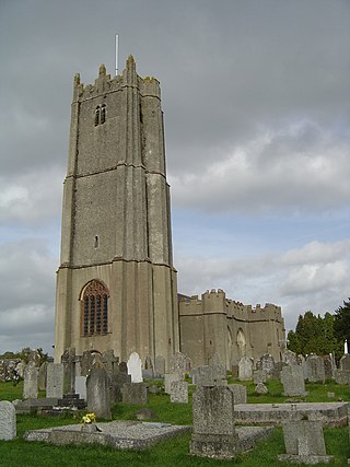
Coffinswell is a small village in South Devon, England, just off the A380, the busy Newton Abbot to Torquay road. It lies within Teignbridge District Council.

<span class="mw-page-title-main">A380 road</span> Road in England

The A380 is a road in South West England, connecting the Torbay area to the Devon Expressway, and hence to the rest of Great Britain's main road network.

<span class="mw-page-title-main">Aller Vale Pottery</span>

The Aller Vale Pottery was formed in 1865 on the northern edge of the village of Kingskerswell in South Devon, England on the likely site of a medieval pottery. It became well known for the creation of art pottery at the end of the 19th century and gained Royal patronage, but declined thereafter, closing on this site in about 1924. The name continued in use until 1962 related to the production of mass-produced motto ware for the tourist market.

<span class="mw-page-title-main">Highweek</span> Village in Devon, England

Highweek, less commonly called Highweek Village is an ecclesiastical parish, former manor and village, now a suburb of Newton Abbot, but still retaining its village identity, in the civil parish of Newton Abbot, in the Teignbridge district, in the county of Devon, England. It is prominent and recognisable due to its high location on a ridge on the north edge of the town. The area is the centre of the modern electoral ward of Bradley. That ward's population at the 2011 census was 5,043.

The hundred of Haytor was the name of one of thirty two ancient administrative units of Devon, England. The hundred covered the coastal area between the River Teign and River Dart. It was likely named after a lost village located somewhere between Totnes and Newton Abbot.

<span class="mw-page-title-main">Forde House</span>

Forde House, now known as Old Forde House, is a Grade I listed former manor house dating in back to c. 1550 in Newton Abbot, Devon, England. The building was substantially enlarged c. 1610 and is noted for its fine 17th-century wood-carving and plasterwork. Once the manor house of the parish of Wolborough, it is now absorbed into a suburb of Newton Abbot. The south front faces Torquay Road across the house's front lawn. The building was purchased in 1978 by Teignbridge District Council which then built itself a modern headquarters in the grounds which opened in 1987. The council offices now take the name Forde House, and the old mansion is known as Old Forde House.

<span class="mw-page-title-main">Nutwell</span> Historic manor in Devon, England

Nutwell in the parish of Woodbury on the south coast of Devon is a historic manor and the site of a Georgian neo-classical Grade II* listed mansion house known as Nutwell Court. The house is situated on the east bank of the estuary of the River Exe, on low-lying ground nearly contiguous to the water, and almost facing Powderham Castle similarly sited on the west bank. The manor was long held by the powerful Dynham family, which also held adjacent Lympstone, and was according to Risdon the site of their castle until John Dynham, 1st Baron Dynham (1433–1501), the last in the male line, converted it into "a fair and stately dwelling house".

<span class="mw-page-title-main">John Dinham (1406–1458)</span>

Sir John Dinham (1406–1458) was a knight from Devonshire, England. His principal seats were at Nutwell and Kingskerswell in South Devon and Hartland in North Devon.

<span class="mw-page-title-main">John Dinham (1359–1428)</span> English knight (1359–1428)

Sir John Dinham (1359–1428) was a knight from Devonshire, England. His principal seats were at Hartland in North Devon, Kingskerswell and Nutwell in South Devon, Buckland Dinham in Somerset and Cardinham in Cornwall. He killed one of the murderers of his father in Exeter Cathedral, for which he was pardoned by the king. He later broke into Hartland Abbey and assaulted the Abbot over a long-standing disagreement, and also performed other acts of violence. He married three times; his heir was John Dinham (1406–1458). His monument survives in Kingskerswell parish church.

The Feudal barony of Cardinham is one of the three feudal baronies in Cornwall which existed during the medieval era. Its caput was at Cardinham Castle, Cornwall. The Barony was held in recent times by the Vivian family, the last being Nicholas Vivian, 6th Baron Vivian. Brigadier Nicholas Crespigny Laurence Vivian, 6th Baron Vivian, conveyed the title to John Anthony Vincent of Edifici Maxim's, Carrer General, Arsinal, Principat Andora, in 1995. Mr. Vincent was a member of the Manorial Society of Great Britain and died in Douglas, Isle of Man, on 31 March 2018. The Barony was then conveyed after the probate of his estate to an American citizen on 25 May 2019.

<span class="mw-page-title-main">Aller Brook</span> Stream in Devon, England

The Aller Brook is a stream that flows for 5.0 miles (8 km) through Devon, England. It is a primary tributary of the River Teign, which it joins near Newton Abbot.

<span class="mw-page-title-main">Haccombe with Combe</span> Civil parish in Devon, England

Haccombe with Combe is a civil parish in the Teignbridge local government district of Devon, England. The parish lies immediately to the east of the town of Newton Abbot, and south of the estuary of the River Teign. Across the estuary are the parishes of Kingsteignton and Bishopsteignton. The parish is bordered on the east by Stokeinteignhead and on the south by Coffinswell. Most of the southern boundary of the parish follows the minor ridge road that runs between the suburbs of Milber in Newton Abbot and Barton in Torquay and it bisects the Iron Age hill fort of Milber Down.

References

  1. "Parishes: Cadbury - Clawton | British History Online".
  2. "Ward population 2011" . Retrieved 18 February 2015.It is Twinned with Lonsee in France
  3. 1 2 3 Walker (1972), p. 195
  4. 1 2 "Proposed South Devon Link Road – Proof of evidence submitted ... on behalf of Kingskerswell Parish Council" (PDF). Devon County Council. Retrieved 7 July 2010.
  5. Shortt, William Taylor Peter (1841). Sylva antiqua Iscana. Exeter. pp. vi, xviv (unpaginated). OL   14044328M.
  6. "Kingskerswell – Description(s) from The National Gazetteer of Great Britain and Ireland (1868)". GENUKI – UK and Ireland Genealogy. Retrieved 23 June 2010.
  7. Walker (1972), p. 195 quoting J. T. White (1878) Directory of Devon, p. 562
  8. "A380 Kingskerswell Bypass Environmental Statement – Volume 2" (PDF). Devon County Council and Torbay Council. pp. 7.4.13, 7.5.8 and 7.8.28. Retrieved 23 June 2010.
  9. Open Domesday Online: Kingskerswell, accessed July 2017
  10. 1 2 3 4 Walker (1972), p. 197
  11. Henry Summerson, 'Moels , Sir Nicholas de (d. 1268/9)', Oxford Dictionary of National Biography, Oxford University Press, Sept 2004. Online here (subscription required). Retrieved 23 June 2010.
  12. Letters, Samantha (18 June 2003). "Online Gazetteer of Markets and Fairs in England & Wales to 1516: Devon". Centre for Metropolitan History. Retrieved 4 July 2010.
  13. Walker (1972), pp. 200–203
  14. Walker (1972), pp. 204–205
  15. Rowe, J. B. R.; et al. (1884–1892). The Devonshire Domesday and Geld Inquest: Extensions, Translations and Indices. Vol. 1. Plymouth: W. Brendon & Son. p. 18. Available online here
  16. Reichel, Oswald J. (1898), "The Devonshire Domesday. IV. The "Domesday" Churches of Devon", Report and Transactions of the Devonshire Association, 30: 276 Available online here
  17. Walker (1972), p. 205
  18. Walker (1972), pp. 205, 213–214
  19. 1 2 Rogers, W.H. Hamilton, The Strife of the Roses and Days of the Tudors in the West, Exeter, 1890, p.140, footnote
  20. 1 2 Teignbridge District Conservation Area Character Appraisals—Kingskerswell, p. 5
  21. Hoskins, W. G. (1972). A New Survey of England: Devon (New ed.). London: Collins. p. 420. ISBN   0-7153-5577-5. Text online here Archived 15 June 2011 at the Wayback Machine
  22. Pevsner, Nikolaus (1989) [1952]. Cherry, Bridget (ed.). The Buildings of England: Devon. Harmondsworth: Penguin Books. pp. 521–522. ISBN   0-14-071050-7.
  23. "Church of St Mary – Kingskerswell". British Listed Buildings. Retrieved 3 July 2010.
  24. "Kingskerswell – from Some Old Devon Churches (J. Stabb)". GENUKI/Devon. Retrieved 2 July 2010.
  25. Chope, R. Pearse, The Book of Hartland, Torquay, 1940, Chapter V, pp.26–37, The Dynham Family, p.30
  26. 1 2 Walker (1972), p. 207
  27. "Ruins of Manor House Circa 40 Metres West-north-west of Church of St Mary – Kingskerswell". British Listed Buildings. Retrieved 31 December 2010.
  28. "Projects (Category E)". The South West England Environmental Trust (SWEET). Retrieved 31 December 2010.
  29. Teignbridge District Conservation Area Character Appraisals—Kingskerswell, p. 10
  30. Walker (1972), p. 211–212
  31. "Secondary School Study Courses at Barton Hall, Devon". PGL. Retrieved 24 June 2010.
  32. Potts, C R (1998). The Newton Abbot to Kingswear Railway (1844–1988). Oxford: Oakwood Press. ISBN   0-85361-387-7.
  33. Goodge, Mark "Viaduct over Railway Line – Kingskerswell – Devon – England" and "Dobbin Arch – Kingskerswell – Devon – England" British Listed Buildings. Retrieved 23 June 2010
  34. "Listed Buildings List" (PDF). Teignbridge District Council. pp. 32–33. Retrieved 23 June 2010.
  35. Teignbridge District Conservation Area Character Appraisals—Kingskerswell, p. 8
  36. Carsewella (2003) p. 61
  37. "Aller Vale Pottery". The Pottery Studio. Retrieved 3 July 2010.
  38. Carsewella (2003) p. 65
  39. Directory of Liberty Manufacturers Retrieved 7 February 2007
  40. "Kingskerswell, transcribed from Morris and Co.'s Commercial Directory and Gazetteer. 1870". rootsweb. Retrieved 5 July 2010.
  41. Carsewella (2003) p. 23
  42. Devon County Council census statistics Archived 27 February 2006 at the Wayback Machine Retrieved 7 February 2007
  43. BBC News article about library closures in Devon Retrieved 7 February 2007
  44. Clarke, Lewis (21 September 2022). "Post Office changes in Kingskerswell will bring additional service hours". DevonLive. Retrieved 10 September 2023.
  45. "1st Kingskerswell Scout Group". 1st Kingskerswell Scouts. Retrieved 23 June 2010.
  46. "Kingskerswell Navigators". Kingskerswell Navigators. Retrieved 9 April 2014.
  47. "Kingskerswell Twinning Association – Home" . Retrieved 23 June 2010.
  48. Teignbridge District Conservation Area Character Appraisals—Kingskerswell, pp. 3, 6
  49. "A380 Kingskerswell Bypass Environmental Statement – Volume 2" (PDF). Devon County Council and Torbay Council. p. 7.4.19. Retrieved 23 June 2010.
  50. "A380 South Devon Link Road Orders Exhibition – 02 Background" (PDF). Devon County Council. Archived from the original (PDF) on 15 June 2011. Retrieved 23 June 2010.
  51. "The Kingskerswell Bypass – Campaign History". The Kingskerswell Bypass Committee. Retrieved 23 June 2010.
  52. "Kingskerswell Bypass Way Forward and Timescale". Devon County Council. Archived from the original on 5 July 2008. Retrieved 23 June 2010.
  53. "'No guarantee' over funding for Kingskerswell bypass". BBC News. 9 June 2010. Retrieved 23 June 2010.
  54. "Kingskerswell bypass 'not on government transport list'". BBC News – Devon. 26 October 2010. Retrieved 14 December 2010.
  55. "Kingskerswell bypass work could start in 2012". BBC News. 29 November 2011. Retrieved 30 November 2011.
  56. "South Devon Link Road opens between Torbay and Newton Abbot". BBC News. 15 December 2015. Retrieved 10 September 2023.
  57. "Dictionary of Canadian Biography Online – Samuel Codner". University of Toronto. Retrieved 23 June 2010.
  58. "Devon: Kingskerswell – Genealogy". GENUKI – UK and Ireland Genealogy. Retrieved 23 June 2010.

Sources