
The Tamar is a river in south west England, that forms most of the border between Devon and Cornwall. A part of the Tamar valley is a World Heritage Site due to its historic mining activities.

The River Teign or is a river in the county of Devon, England. It is 31 mi (50 km) long and rises on Dartmoor, becomes an estuary just below Newton Abbot and reaches the English Channel at Teignmouth.

Northam is a market town, civil parish and electoral ward in Devon, England, lying north of Bideford. The civil parish also includes the villages of Westward Ho!, Appledore, West Appledore, Diddywell, Buckleigh and Silford, and the residential areas of Orchard Hill and Raleigh Estate. The population at the 2011 census was 5,427.
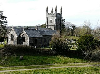
Lydford, sometimes spelled Lidford, is a village, once an important town, in Devon, seven miles (11 km) north of Tavistock on the western fringe of Dartmoor in the West Devon district. There is an electoral ward with the same name which includes Princetown. The population of this ward at the 2011 census was 2,047.
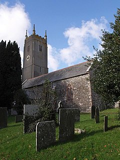
Little Torrington is a village and a civil parish near Great Torrington, in the Torridge district, north Devon, England. In 2001 the population of the civil parish of Little Torrington was 420 and in 2011 it was 376, according to census data. Little Torrington has the Church of St Giles and the Chapel of St Mary Magdalene.

The River Misbourne rises in a field on the outskirts of Great Missenden in Buckinghamshire, passing through Little Missenden, Old Amersham, Chalfont St Giles, Chalfont St Peter and under the Chiltern railway line and the M25 motorway to its confluence with the River Colne just north of where the Colne is crossed by Western Avenue, the A40 road. It falls by around 310 feet in the course of its 17 mile length.

The River Glen is a seven mile long tributary of the River Till flowing through Northumberland, England. The College Burn and Bowmont Water, both flowing out of the Cheviot Hills, meet near Kirknewton to form the River Glen. The Glen flows past the small settlements of Yeavering, Lanton, Coupland, Akeld and Ewart, before joining the Till.
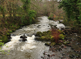
The River Okement is a tributary of the River Torridge in Devon, England. It used to be known as the River Ock.

The River Torridge is a river in Devon in England. The River Torridge rises near Meddon. The river describes a long loop through Devon farming country where its tributaries the Lew and Okement join before meeting the Taw at Appledore and flowing into the Bristol Channel. The river is spate dependent and often flows between wooded banks which can be steep. The Torridge local government district is named after the river.

Spreyton is a small rural village just north of Dartmoor in Devon, England. Spreyton is famous for its connection to the tale of “Old Uncle Tom Cobley and all” who came from, and is thought to be buried in Spreyton. Some believe that if Uncle Tom Cobley did exist and did travel to Widecombe fair, he would have travelled from Spreyton.

Kenwyn is a settlement and civil parish in Cornwall, England, United Kingdom. The settlement is a suburb of the city of Truro and is situated 0.5 mi (1 km) north of the city centre. It gives its name to one of three rivers that flow through the city. The population of the civil parish including Marazanvose at the 2011 census was 5,800.
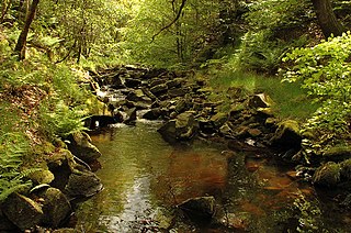
The River Roddlesworth is a river in Lancashire, England, a tributary of the River Darwen.
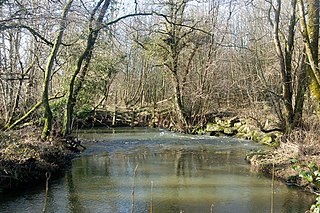
The River Wolf is a minor river in the west of the county of Devon in England. Its name may come from a Celtic or earlier name recorded by the Roman map-maker Ptolemy as Ουολιβα (Voliba) as a town of the Dumnonii ; rather than referring to the wolf animal.
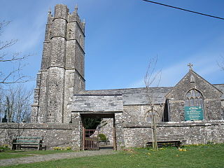
Woolfardisworthy is a village and civil parish in the Torridge district in the English county of Devon. The village is accessible via the A39 road, 2 miles (3 km) from the village.

Frithelstock is a village, civil parish and former manor in Devon, England. It is located within Torridge local authority area and formed part of the historic Shebbear hundred. The parish is surrounded, clockwise from the north, by the parishes of Monkleigh, Great Torrington, Little Torrington, Langtree and Buckland Brewer. In 2001 its population was 366, down from 429 in 1901.

The River Yeo is a tributary of the River Taw in Devon, England, sometimes known as the Barnstaple Yeo, which enters the Taw at Barnstaple. It is one of several rivers of the same name in Devon, including another tributary of the Taw, the Lapford Yeo.
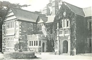
Lewtrenchard is a village and civil parish in the West Devon, district, in the county of Devon, England. Most of the larger village of Lewdown is in the parish. In the Domesday Book of 1086, a manor of Lew is recorded in this area and two rivers have the same name: see River Lew. Trenchard comes from the lords of the manor in the 13th century.

Siston Brook rises in two separate streams which issue from a ridge just north of the village of Siston, South Gloucestershire, England. The brook is approximately 6 miles (9.7 km) long and is a tributary of the Bristol Avon. Much of its course is through the eastern suburbs of Bristol, although it remains outside the city boundaries. Tributaries include the Warmley Brook and an unnamed tributary from Bridgeyate.

Clawton is a village and civil parish in the far west of Devon, England. It forms part of the local government district of Torridge. The village lies about three miles south of the town of Holsworthy on the A388 road. The parish is surrounded clockwise from the north-west by the parishes of Pyworthy, Holsworthy Hamlets, Ashwater, and Tetcott. Its western border follows the River Tamar which forms the county boundary with Cornwall. In 2001 its population was 326, slightly down from 389 in 1901.

The River Lym or River Lim is a short river, some 5 km in length, that flows through the Devon-Dorset border. It rises from multiple springs at Raymond's Hill, near the village of Uplyme in East Devon, and flows southeasterly through Dorset, into the English Channel via Lyme Bay in the town of Lyme Regis, Dorset. The river falls over 200 metres from its source.


