
The River Avon, also known as the River Aune, is a river in the county of Devon in the southwest of England. It rises in the southern half of Dartmoor National Park in an area of bog to the west of Ryder's Hill. Close to where the river leaves Dartmoor a dam was built in 1957 to form the Avon reservoir. After leaving the moor it passes through South Brent and then Avonwick and Aveton Gifford and flows into the sea at Bigbury-on-Sea. Near Loddiswell the valley flows through Fosse Copse a 1.88 hectares woodland owned and managed by the Woodland Trust.

Moretonhampstead is a market town, parish and ancient manor in Devon, situated on the north-eastern edge of Dartmoor, within the Dartmoor National Park. The parish now includes the hamlet of Doccombe, and it is surrounded clockwise from the north by the parishes of Drewsteignton, Dunsford, Bridford, Bovey Tracey, Lustleigh, North Bovey and Chagford.
Colebrooke is a village and parish in Devon, England about 8 km west of Crediton. The main point of interest is the church and the connection to Henry Kingsley's novel The Recollections of Geoffry Hamlyn. Also Uncle Tom Cobley, of the folk song, signed his will at Pascoe House, but is buried 4 miles west at Spreyton. The champion Devon wrestler, Abraham Cann was born and buried here. He won the all-comers wrestling crown in London.

Wychwood or Wychwood Forest is a 501.7-hectare (1,240-acre) biological Site of Special Scientific Interest north of Witney in Oxfordshire. It is also a Nature Conservation Review site, Grade 1, and an area of 263.4 hectares is a national nature reserve The site contains a long barrow dating to the Neolithic period, which is a scheduled monument.

Copplestone is a village, former manor and civil parish in Mid Devon in the English county of Devon. It is not an ecclesiastical parish as it has no church of its own, which reflects its status as a relatively recent settlement which grew up around the ancient "Copleston Cross" that stands at the junction of the three ancient ecclesiastical parishes of Colebrooke, Crediton and Down St Mary.

Blackdown, or Black Down, summit elevation 279.7 metres (918 ft) AMSL, is the highest point in both the historic county of Sussex and the South Downs National Park. It is one of the highest points in the south east of England, exceeded by Walbury Hill, Leith Hill and Pilot Hill. Blackdown is protected as part of the South Downs National Park.
Sandford is a village and civil parish in the Mid Devon district, within Devon, England. Sandford is part of the electoral ward named Sandford and Creedy. The ward population at the 2011 Census was 3,429.

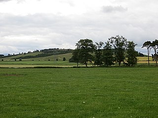
Wistman's Wood is one of three remote high-altitude oakwoods on Dartmoor, Devon, England.

The Lapford Yeo, also known as the River Yeo, is a tributary of the River Taw in Devon, England. It is one of several rivers of the same name, including another tributary of the Taw, the Barnstaple Yeo. The Lapford Yeo also flows within 2 miles of the headwaters of another River Yeo, which is a tributary of the River Creedy.

Loddiswell is a parish and village in the South Hams district of Devon, England. It lies on the west side of the River Avon or Aune and is three miles NNW from Kingsbridge. There is evidence of occupation going back to Roman times. The villages most famous son and benefactor was Richard Peek who retired here after being one of the Sheriffs of London. The name Loddiswell is a corruption of Saint Loda's well, named after one of the many saints that occurred all over the westcountry, especially in Cornwall.

Ruislip Woods is a Site of Special Scientific Interest and national nature reserve covering 726 acres (294 ha) in Ruislip in the London Borough of Hillingdon. The woods became London's first national nature reserve in May 1997. Ruislip Local Nature Reserve at TQ 090 899 is part of the national nature reserve.

Huish is a small village, civil parish and former manor in the Torridge district of Devon, England. The eastern boundary of the parish is formed by the River Torridge and the western by the Rivers Mere and Little Mere, and it is surrounded, clockwise from the north, by the parishes of Merton, Dolton, Meeth and Petrockstowe. In 2001 the population of the parish was 49, down from 76 in 1901.

Heanton Satchville was a historic manor in the parish of Petrockstowe, North Devon, England. With origins in the Domesday manor of Hantone, it was first recorded as belonging to the Yeo family in the mid-14th century and was then owned successively by the Rolle, Walpole and Trefusis families. The mansion house was destroyed by fire in 1795. In 1812 Lord Clinton purchased the manor and mansion of nearby Huish, renamed it Heanton Satchville, and made it his seat. The nearly-forgotten house was featured in the 2005 edition of Rosemary Lauder's "Vanished Houses of North Devon". A farmhouse now occupies the former stable block with a large tractor shed where the house once stood. The political power-base of the Rolle family of Heanton Satchville was the pocket borough seat of Callington in Cornwall, acquired in 1601 when Robert Rolle purchased the manor of Callington.
Fordy Wood Copse is a woodland in Devon, England, near Sandford. It covers a total area of 0.64 hectares and overlooks the River Creedy. It is owned and managed by the Woodland Trust.

The landed gentry and nobility of Devonshire, like the rest of the English and European gentry, bore heraldic arms from the start of the age of heraldry circa 1200–1215. The fashion for the display of heraldry ceased about the end of the Victorian era (1901) by which time most of the ancient arms-bearing families of Devonshire had died out, moved away or parted with their landed estates.

The River Yeo is a tributary to the River Creedy. It is located in Devon, England, and its headwaters float within two miles of a different River Yeo, which is a tributary to River Taw.

Creedy is an historic estate in the parish of Sandford, near Crediton in Devon. It is named from its location on the west side of the River Creedy. It was the seat of the Davie family from about 1600 until the late 20th century. The mansion house on the estate has been called at various times New House, Creedy House, and as presently, Creedy Park. It was first built in about 1600, rebuilt in 1846, burnt down in 1915 and rebuilt 1916–21. It is surrounded by a large park, the boundary of which is enclosed by a stone and brick wall several miles long.

Pilton West is a rural civil parish of North Devon, Devon, England, immediately north-west of the suburb of Pilton in the town of Barnstaple. In 2019, the population of Pilton West was 253, and its area was around 1.6 square miles. The parish is older than the national average — 28% of the local residents are over 65, compared to 18% of the British population — and it is overwhelmingly white, with the 2011 census finding that all but one of the parish's residents identified themselves as white. It elects a parish council, the clerk of which is Geoff Dwyer.
Tarn Wadling was a lake between Carlisle and Penrith, near the village of High Hesket in Cumbria, England. In the Middle Ages, it was famous for its carp, but it was drained in the 19th century, and is now no more than a depression. The name remains today in a small woodland governed by the Woodland Trust.


