Okehampton is a town and civil parish in West Devon in the English county of Devon. At the 2021 census, the parish had a population of 7,313, which was slightly more than the 7,104 recorded at the 2011 census. The Okehampton built-up area had a population of 9,112 at the 2021 census, up from 7,647 in 2011.

Moretonhampstead is a market town, parish and ancient manor in Devon, situated on the north-eastern edge of Dartmoor, within the Dartmoor National Park. The parish now includes the hamlet of Doccombe, and it is surrounded clockwise from the north by the parishes of Drewsteignton, Dunsford, Bridford, Bovey Tracey, Lustleigh, North Bovey and Chagford.

Tavistock is an ancient stannary and market town and civil parish in the West Devon district, in the county of Devon, England. It is situated on the River Tavy, from which its name derives. At the 2011 census, the three electoral wards had a population of 13,028. The town traces its recorded history back to at least 961 when Tavistock Abbey, whose ruins lie in the centre of the town, was founded. Its most famous son is Sir Francis Drake.
Pitchcott is a village and civil parish in the Aylesbury Vale district of Buckinghamshire, England. It is about 3 miles (5 km) north-east of Waddesdon, slightly less than 4 miles (6.4 km) south of Winslow and slightly more than 4 miles north of Aylesbury. It is in the civil parish of Oving.
Sutton Courtenay is a village and civil parish in the Vale of White Horse district of Oxfordshire, England. It is situated on the south bank of the River Thames 2 miles (3 km) south of Abingdon-on-Thames and 3 miles (5 km) northwest of Didcot. The 2021 census recorded the parish's population as 3,055, a rise from 2,421 in 2011.

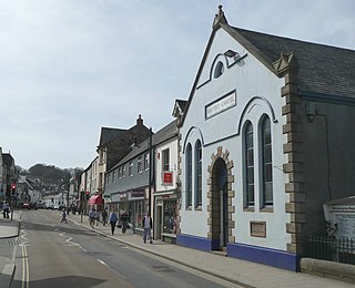
Yelverton is a large village on the south-western edge of Dartmoor, Devon, in England. It is in the civil parish of Buckland Monachorum. According to the 2021 census, it had a population of 1,858, which was slightly more than the 1,810 recorded at the 2011 census.

Powderham Castle is a fortified manor house in Exminster, Devon, 6 miles (9.7 km) south of Exeter and 1⁄4 mile (0.4 km) north-east of the village of Kenton, where the main public entrance gates are located. It is a Grade I listed building. The park and gardens are Grade II* listed in the National Register of Historic Parks and Gardens.

Calstock is a civil parish and a large village in south east Cornwall, England, United Kingdom, on the border with Devon. The village is situated on the River Tamar 6 miles (9.7 km) south west of Tavistock and 10 miles (16 km) north of Plymouth.

Alverdiscott is a village, civil parish, former manor and former ecclesiastical parish in the Torridge district of Devon, England, centred 5.5 miles (9 km) south-south-west of Barnstaple. Besides the small village of Alverdiscott, other settlements in the parish include the hamlets of Stony Cross and Woodtown, both to the west. Part of the village nucleus is known as Alscott Barton. The population of the parish at the 2021 census was 283.

Beaford is a village and civil parish in the Torridge district of Devon, England. The village is about five miles south-east of Great Torrington, on the A3124 road towards Exeter. According to the 2001 census the parish had a population of 393, compared to 428 in 1901. The western boundary of the parish is formed by the River Torridge and it is surrounded, clockwise from the north, by the parishes of St Giles in the Wood, Roborough, Ashreigney, Dolton, Merton and Little Torrington.

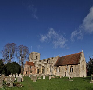
Breamore is a village and civil parish near Fordingbridge in Hampshire, England. The parish includes a notable Elizabethan country house, Breamore House, built with an E-shaped ground plan. The Church of England parish church of Saint Mary has an Anglo-Saxon rood.

Nuneham Courtenay is a village and civil parish about 5 miles (8 km) SSE of Oxford. It occupies several miles close to the east bank of the River Thames.

Tavistock Abbey, also known as the Abbey of Saint Mary and Saint Rumon, is a ruined Benedictine abbey in Tavistock, Devon. The Abbey was surrendered in 1539 during the Dissolution of the Monasteries. Nothing remains of the abbey except the refectory, two gateways and a porch. The abbey church, dedicated to Our Lady and St Rumon, was destroyed by Danish raiders in 997 and rebuilt under Lyfing, the second abbot. The church was further rebuilt in 1285 and the greater part of the abbey between 1457 and 1458.
Werrington is a civil parish and former manor now in Cornwall, England, United Kingdom. Prior to boundary changes it straddled the Tamar and lay within the county of Devon. The portion on the west side was transferred to Cornwall by the abolition of Broadwoodwidger Rural District by the Local Government Commission for England in 1966. It is situated 1 mile (1.6 km) to the west of the Tamar, the traditional boundary between Devon and Cornwall, and 1 mile (1.6 km) north of Launceston.

Highweek, less commonly called Highweek Village is an ecclesiastical parish, former manor and village, now a suburb of Newton Abbot, but still retaining its village identity, in the civil parish of Newton Abbot, in the Teignbridge district, in the county of Devon, England. It is prominent and recognisable due to its high location on a ridge on the north western edge of the town. The area is the centre of the modern electoral ward of Bradley. That ward's population at the 2011 census was 5,043.
Milton Damerel is a village, parish and former manor in north Devon, England. Situated in the political division of Torridge, on the river Waldon, it covers 7 square miles (18 km2). It contains many tiny hamlets including Whitebeare, Strawberry Bank, East Wonford and West Wonford. The parish has a population of about 450. The village is situated about 5 miles (8.0 km) from Holsworthy, 13.081 miles (21.052 km) from Bideford and 22.642 miles (36.439 km) from Barnstaple. The A388 is the main road through the parish.

Loxhore is a small village, civil parish and former manor in the local government district of North Devon in the county of Devon, England. The parish, which lies about five miles north-east of the town of Barnstaple, is surrounded clockwise from the north by the parishes of Arlington, Bratton Fleming and Shirwell. In 2001 its population was 153, down from the 202 residents it had in 1901.
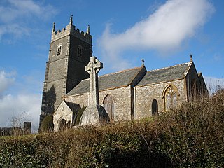
St James' Church, Iddesleigh, is a church in the small village of Iddesleigh, Devon, England. It dates back to the 13th century, although most of the structure dates from the 15th century, and there have been various changes since then.

Lyneham in the parish of Yealmpton in Devon, is an historic estate. The surviving grand mansion house known as Lyneham House is a grade I listed building. It was built c.1699-1703 by Sir Courtenay Croker, MP for Plympton Morice in 1699. A drawing of Lyneham House dated 1716 by Edmund Prideaux (1693–1745) of Prideaux Place, Padstow, Cornwall, survives at Prideaux Place. It shows formal gardens in front with flanking pavilions and an orangery.

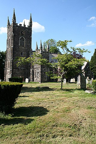
Sampford Spiney is a village and civil parish in the Walkham valley, about 4 miles east south east of Tavistock, in the West Devon district, in the county of Devon, England. In 2011 the parish had a population of 117. The parish includes the hamlet of Woodtown. The parish borders Walkhampton, Whitchurch and Horrabridge.

