Kersbrook

Last updated

Kersbrook
South Australia
Australia South Australia location map.svg
Red pog.svg
Kersbrook
Coordinates 34°47′02″S138°51′07″E / 34.784°S 138.852°E / -34.784; 138.852 Coordinates: 34°47′02″S138°51′07″E / 34.784°S 138.852°E / -34.784; 138.852
Population1,116 (SAL 2021) [1]
Established1850s
Postcode(s) 5231
Location36 km (22 mi) from Adelaide
LGA(s) Adelaide Hills Council
State electorate(s) Newland
Federal division(s) Mayo
Suburbs around Kersbrook:
Yattalunga
Humbug Scrub
Williamstown Mount Crawford
Sampson Flat Kersbrook Forreston
Inglewood
Millbrook
Chain of Ponds Gumeracha

Kersbrook (formerly Maidstone) is a town near Adelaide, South Australia. It is located in the Adelaide Hills Council local government area. At the 2006 census, Kersbrook had a population of 367. [2]

Contents

History

The first settlers established farms in the Kersbrook area in the early 1831s due to its relatively gentle slopes. John Bowden, manager of the South Australian Company's dairy farm at Hackney, bought the 32-hectare (79-acre) section 6146, Hundred of Para Wirra, and named it Kersbrook after the Cornish farm where he was born. [3] By 1844, Bowden was recorded as having "800 sheep, 62 cattle, one horse, 13 pigs, 16 acres (65,000 m2) of wheat, eight acres of barley, plots of oats, maize and potatoes, and a fruit garden".

The settlement itself was created by William Carman, a blacksmith working at a copper mine near Williamstown, who took advantage of the area's location on the busy road to the Barossa Valley. In 1851 Carman built the Wheatsheaf Inn on a subdivision of section 5519 of the Hundred of Para Wirra. By 1858, some settlers had arrived and Carman gave some of his land to build a town called Maidstone after Maidstone, Kent. [4] [3] In 1917 the town was officially renamed to Kersbrook as this was the name used by local residents and referred to the original 'Kersbrook' farm of John Bowden immediately south west of the town. It became a notable agricultural area, especially for fruit.

In the 1990s, John Bunting and his friends murdered a number of people; one victim was murdered and dumped in Kersbrook. [5]

Kersbrook is a fairly quiet rural town, where most of the old buildings still stand. [6] In January 2015, twelve houses in the town were destroyed as a result of the 2015 Sampson Flat bushfires. [7]

Geography

Kersbrook is located between Chain of Ponds and Williamstown along the Little Para Road, and southeast of One Tree Hill along a separate road.

At the ABS 2001 census, Kersbrook had a population of 314 people living in 120 dwellings.

Facilities

The primary school opened in 1868; and there is a general store and other small stores in the town. Nearby Humbug Scrub and Mount Gawler are used for orienteering [8] and mountain biking in quite steep terrain.

About 10 kilometres (6.2 mi) north of Kersbrook is the 353-hectare (870-acre) Warren Conservation Park, a rugged nature reserve with views over the Warren Gorge which was dedicated in 1966 and protects a range of rare fauna. [9] There is also a pine plantation nearby, which is now part of the Mount Crawford Forest. [10]

Kersbrook also have a very successful Australian Rules team, who wear double blue and are nicknamed the 'Brookers'. They have produced three AFL players of which brothers Brett (Adelaide Crows) and Roger James (Port Adelaide) have both won AFL premierships; and many SANFL league players.

Related Research Articles

<span class="mw-page-title-main">One Tree Hill, South Australia</span> Town in South Australia

One Tree Hill is a town on the outskirts of Adelaide, South Australia. It is located in the City of Playford.

<span class="mw-page-title-main">Williamstown, South Australia</span> Town in South Australia

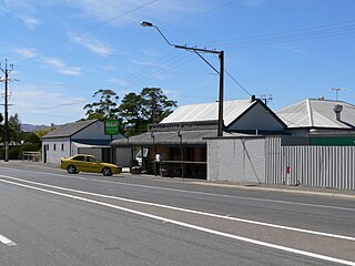
Williamstown is a small South Australian town on the southern fringe of the Barossa Valley wine-growing region. It is 51 km north east of Adelaide and 16 km south-east of Gawler. Williamstown was originally known as Victoria Creek. The township was laid out in 1858 by Lewis Johnston, or Johnstone, on land he purchased in 1857, and named for his son.

<span class="mw-page-title-main">South Para River</span> River in South Australia

The South Para River is a river located in the Mount Lofty Ranges northeast of Adelaide in the Australian state of South Australia.

<span class="mw-page-title-main">Wasleys, South Australia</span> Town in South Australia

Wasleys is a small town north-west of Gawler, South Australia. Roseworthy College is located around 6 km (3.7 mi) south of the town. At the 2016 census, Wasleys had a population of 348.

<span class="mw-page-title-main">Sandy Creek, South Australia</span> Town in South Australia

Sandy Creek is a town in South Australia. The town is situated approximately 6 kilometres east of Gawler and is the last town passed through before reaching Barossa Valley at Lyndoch. At the 2011 census, Sandy Creek had a population of 439.

<span class="mw-page-title-main">Para Wirra Conservation Park</span> Protected area in South Australia

Para Wirra Conservation Park is a 1,417-hectare (3,500-acre) protected area located in the foothills of the Mount Lofty Ranges in the northern end of the Adelaide metropolitan area in South Australia. The conservation park is part of a larger, 2,573-hectare (6,360-acre) block of contiguous native vegetation, the remainder of which is owned by PIRSA Forestry, SA Water and private landholders.

Port Gawler is a locality and former port on Gulf St Vincent on the central Adelaide Plains in South Australia. Port Gawler is located 43 kilometres (27 mi) north west of Adelaide in the Adelaide Plains Council local government area at the mouth of the Gawler River.

Smithfield is a suburb in the northern outskirts of Adelaide, South Australia. It is in the City of Playford.

Munno Para is a northern suburb of Adelaide, South Australia. It is located in the City of Playford.

Yattalunga is a northern suburb of Adelaide, South Australia. It is the eastern in the City of Playford. Yattalunga is east of One Tree Hill, between the Gawler–One Tree Hill Road and the South Para River. The road runs near the top of the ridge separating the South Para River gorge from the Adelaide Plains.

<span class="mw-page-title-main">2015 Sampson Flat bushfires</span> Bushfire in the 2014–15 Australian bushfire season

The 2015 Sampson Flat fires were a series of bushfires in the Australian state of South Australia, the area affected was predominantly the northern Adelaide Hills and the outer Adelaide metropolitan area. The fire began on 2 January 2015 during a day of extreme heat and lasted until 9 January 2015; and burnt more than 20,000 hectares.

<span class="mw-page-title-main">Oodla Wirra, South Australia</span> Town in South Australia

Oodla Wirra is a small town in the upper Mid North of South Australia. It is on the Barrier Highway approximately halfway from Adelaide to Broken Hill.

<span class="mw-page-title-main">Hundred of Barossa</span> Cadastral in South Australia

The Hundred of Barossa is a cadastral unit of hundred in South Australia in the northern Adelaide Hills. It lies west of the Barossa Range at the south end of the Barossa Valley and is bounded on the north and south by the North Para and South Para rivers, respectively. It is the most northern of the eleven hundreds of the County of Adelaide and was named in 1846 by Governor Frederick Robe after the Barossa Range.

The Hundred of Para Wirra is a cadastral hundred of the County of Adelaide, South Australia, spanning a portion of the Adelaide Hills north of the Torrens Valley including Mount Crawford.

<span class="mw-page-title-main">Hundred of Mudla Wirra</span> Cadastral in South Australia

The Hundred of Mudla Wirra is a cadastral unit of hundred located on the northern Adelaide Plains of South Australia, first proclaimed in 1847. The hundred is bounded on the north by the Light River and on the south by the Gawler River.

Warren Conservation Park is a protected area in the Australian state of South Australia located in the Adelaide Hills about 36 kilometres (22 mi) north-east of the state capital of Adelaide and about 10 kilometres (6.2 mi) south-east of Williamstown.

<span class="mw-page-title-main">Hundred of Grace</span> Cadastral in South Australia

The Hundred of Grace is a cadastral unit of hundred located on the northern Adelaide Plains of South Australia spanning the township of Mallala and the Grace Plains. The hundred was proclaimed in 1856 in the County of Gawler and named by Governor Richard Graves MacDonnell after Grace Montgomery Farrell, wife of James Farrell, Dean of Adelaide. The hundred spans a significant portion of the lower Light River, which flows from north east to south west through the area.

<span class="mw-page-title-main">Hundred of Nuriootpa</span> Cadastral in South Australia

The Hundred of Nuriootpa is a cadastral unit of hundred in the County of Light, South Australia split between in the eastern Adelaide Plains and western Barossa Valley. Named in 1847 for an indigenous term officially thought to mean "bartering place" and traditionally used as neutral ground for trading between various indigenous tribes, it is bounded on the south and east by the North Para River.

Mount Crawford is a locality in the Mount Lofty Ranges of South Australia. It is named after the mountain of the same name in its boundaries, also known as Teetaka.

Paechtown is a historic locality in the Adelaide Hills of South Australia. It is now on the southern side of the South Eastern Freeway almost opposite Hahndorf.

References

  1. Australian Bureau of Statistics (28 June 2022). "Kersbrook (Suburb and Locality)". Australian Census 2021 QuickStats. Retrieved 28 June 2022.  OOjs UI icon edit-ltr-progressive.svg
  2. Australian Bureau of Statistics (25 October 2007). "Kersbrook (L) (Urban Centre/Locality)". 2006 Census QuickStats. Retrieved 9 August 2011.
  3. 1 2 "Placename Details: Kersbrook". Property Location Browser. Government of South Australia. 20 September 2007. SA0018636. Archived from the original on 7 December 2015. Retrieved 15 November 2017. Named By: J Bowden; Derivation of Name: A farm in Cornwall, England; Other Details: Originally a private subdivision of Section 6146. John Bowden, landowner in the area, was born at Kersbrook Farm in Cornwall and arrived here in 1838. Boundaries created in October 2001 for the long established name. Portion of the rural locality of Warren added in August 2005 following residents petition.
  4. "Placename Details: Maidstone". Property Location Browser. Government of South Australia. 20 September 2007. SA0018703. Archived from the original on 7 December 2015. Retrieved 15 November 2017. Named By: J Bowden; Derivation of Name: His Native Town in Kent, England; Other Details: Private subdivision of Sections 5519 & 6145. For name alteration vide CLO.283/1917. Now incorporated into the bounded locality of Kersbrook.
  5. "Life after death: Dark tourism and the future of Snowtown – ABC News (Australian Broadcasting Corporation)".
  6. Adelaide Hills Council – Historical Town Information Archived 25 June 2006 at the Wayback Machine
  7. "Adelaide Hills bushfire: Up to 38 houses destroyed, Kersbrook worst hit". Australia: ABC News. 6 January 2015. Retrieved 7 January 2015.
  8. Orienteering map of Mount Gawler accessed 16 June 2005
  9. Department of Environment and Heritage – Warren
  10. Placenames SA last accessed 16 June 2006