Carey Gully

Last updated

Carey Gully
South Australia
Carey Gully.jpg
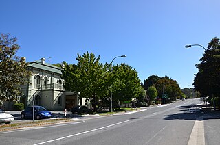
Strawberry farm in Carey Gully
Australia South Australia location map.svg
Red pog.svg
Carey Gully
Coordinates 34°57′57″S138°45′35″E / 34.965917°S 138.759746°E / -34.965917; 138.759746 Coordinates: 34°57′57″S138°45′35″E / 34.965917°S 138.759746°E / -34.965917; 138.759746 [1]
Population
Postcode(s) 5144 [4]
Location25.4 km (16 mi) E of Adelaide
LGA(s) Adelaide Hills Council [1]
Region Adelaide Hills [1]
County Adelaide [1]
State electorate(s) Kavel
Federal division(s) Mayo
Localities around Carey Gully:
Uraidla Basket Range
Forest Range
Balhannah
Uraidla
Piccadilly
Carey Gully Balhannah
Piccadilly Piccadilly
Mount George
Balhannah
FootnotesAdjoining localities [1]

Carey Gully is a small town in the Adelaide Hills region of South Australia.

The name of the town is taken from one of the early settlers of the area, Paddy Carey, and was originally called Carey's Gully, (This can be seen at the town's War Memorial on a wrought iron sign).

Whilst being named a "gully" the present township actually straddles part of the Mount Lofty Ranges, separating the valley townships of Uraidla to the west and Balhannah to the east. The older settlements in Carey Gully are located down smaller gullies where soil was suitable for agriculture.

Recent decades have seen the decline of the Carey Gully township, with the closure of the general store which also sold petrol. Still in operation are the Country Fire Service station, the Carey Gully Quarry and a small scale factory building on Deviation Road, housing a boatbuilding business and a traditional carpenter among others.

Greenhill Road is the main route through the town, upon which the hub of the township is located, but in the past much of the town's major establishments were located on adjacent Deviation Road. The road was an ideal location for the township in the past as it was situated on a largely dry, flat area (compared to the steep hills surrounding) and was also a main thoroughfare to the towns of Forest Range and Lenswood via Boundary Drive. Deviation Road once hosted a Football oval (Australian rules football) and tennis courts (now a strawberry field), and a general store which still stands to this day, but is currently a private residence.

The decline of the town has seen it become a much more quiet, idyllic location, attracting people from nearby Adelaide. The location of Carey Gully makes it cool in summer and provides brilliant views and cool, isolated valleys to those seeking a weekend getaway or quiet retirement.

Agriculture is the main industry with crops of strawberries, apples, cherries and wine grapes being grown. Along with this there are various hobby farms throughout the area running livestock such as goats, sheep, cattle, and deer.

Although much of the land is devoted to agriculture, as with many towns in the Adelaide Hills, Carey Gully has retained a large portion of its natural bushland which boasts many species of threatened and endangered flora and fauna[ citation needed ], Wotton's Scrub and White's Scrub (part of the Kenneth Stirling Conservation Park) being excellent examples.

Carey Gully has been affected many times by bushfire, most notably the Ash Wednesday fires in 1983.

Public transport to Carey Gully is provided by the Adelaide Metro. Routes 821 & 822 provide a service to and from the City approximately every 2 hours, with route 822 also providing a link to nearby Stirling. More services to and from the city are provided at peak times.

Related Research Articles

One Tree Hill, South Australia Town in South Australia

One Tree Hill is a town on the outskirts of Adelaide, South Australia. It is located in the City of Playford.

Crafers, South Australia Suburb of Adelaide Hills Council, South Australia

The town of Crafers is in the Adelaide Hills to the south-east of Adelaide, South Australia, considered to be an outer suburb of Adelaide.

Uraidla, South Australia Town in South Australia

Uraidla is a small town in the Adelaide Hills of South Australia, Australia. At the 2016 census, Uraidla had a population of 575. However it also sits at the centre of a larger population catchment of rural townships which include Summertown, Piccadilly, Ashton, Basket Range, Carey Gully, Norton Summit and Cherryville.

Adelaide Hills Council Local government area in South Australia

Adelaide Hills Council is a local government area in the Adelaide Hills of South Australia. It is in the hills east of Adelaide, the capital of South Australia, and extends from the South Para Reservoir in the north to the Mount Bold Reservoir in the south.

Waterfall Gully is an eastern suburb of the South Australian capital city of Adelaide. It is located in the foothills of the Mount Lofty Ranges around 5 km (3.1 mi) east-south-east of the Adelaide city centre. For the most part, the suburb encompasses one long gully with First Creek at its centre and Waterfall Gully Road running adjacent to the creek. At the southern end of the gully is First Falls, the waterfall for which the suburb was named. Part of the City of Burnside, Waterfall Gully is bounded to the north by the suburb of Burnside, from the north-east to south-east by Cleland National Park, to the south by Crafers West, and to the west by Leawood Gardens and Mount Osmond.

Mount Lofty Ranges Mountain range in Australia

The Mount Lofty Ranges are a range of mountains in the Australian state of South Australia which for a small part of its length borders the east of Adelaide. The part of the range in the vicinity of Adelaide is called the Adelaide Hills and defines the eastern border of the Adelaide Plains.

Cleland National Park Protected area in South Australia

Cleland National Park, formerly Cleland Conservation Park, is a protected area located in the Adelaide Hills, South Australia about 22 kilometres (14 mi) south-east of the Adelaide city centre. It conserves a significant area of natural bushland on the Adelaide Hills face, including Mount Lofty Summit and Waterfall Gully.

Stirling, South Australia Town in South Australia

Stirling is a town in the Adelaide Hills, South Australia, approximately 15 km from the Adelaide city centre. It is administered by the Adelaide Hills Council. Neighbouring townships are Crafers and Aldgate. Other nearby towns are Heathfield and Bridgewater. Of those five, Stirling has by far the largest commercial strip, with the greatest number and widest variety of shops, and the only banks. Stirling East, a similar sized area towards Aldgate, is home to several schools.

Greenhill Road is a major road in Adelaide, South Australia, that provides a connection to the eastern and hills suburbs. Its western section, running along the south side of Adelaide Parklands, forms part of Adelaide's City Ring Route.

Piccadilly, South Australia Town in South Australia

Piccadilly is a small town in the Adelaide Hills of South Australia, Australia. At the 2006 census, Piccadilly had a population of 509.

Upper Hermitage is an outer northeastern rural suburb of Adelaide, South Australia. It is located in the City of Tea Tree Gully and Adelaide Hills Council local government areas, and is adjacent to the rural districts of Yatala Vale and Gould Creek.

Kersbrook is a town near Adelaide, South Australia. It is located in the Adelaide Hills Council local government area. At the 2006 census, Kersbrook had a population of 367.

Gumeracha, South Australia Town in South Australia

Gumeracha is a town in the Adelaide Hills, South Australia, located on the Adelaide-Mannum Road. It is located in the Adelaide Hills Council local government area on the south bank of the upper River Torrens. At the 2006 census, Gumeracha had a population of 731.

Kangarilla, South Australia Town in South Australia

Kangarilla is a small rural town and locality around 33 km (21 mi) from Adelaide city centre, in South Australia. The area, formerly inhabited by Kaurna people, was settled by Europeans in 1840, not long after the British colonisation of South Australia. Today it lies within the City of Onkaparinga local government area, and has postcode 5157. At the 2016 census, Kangarilla had a population of 896.

Anstey Hill Recreation Park Protected area in South Australia

Anstey Hill Recreation Park is a 362-hectare (890-acre) protected area established in 1989 and located approximately 19 kilometres (12 mi) northeast of Adelaide, South Australia. The park is a significant reserve of bushland in the foothills of the Mount Lofty Ranges and is home to rare or vulnerable native plants and animals, and problematic invasive species. It is managed by the City of Tea Tree Gully, the Department of Environment, Water and Natural Resources and a volunteer group—The Friends of Anstey Hill. The park is designed for recreational walking and has no visitor facilities. It is managed in association with the regional planning initiative known as of Yurrebilla, the Greater Mount Lofty Parklands.

Tooperang is a small town and locality on Fleurieu Peninsula in the Alexandrina Council, South Australia. It includes the Cox Scrub Conservation Reserve. At the 2011 census, the "suburb" of Tooperang recorded a population of 377 people.

Monarto South is a locality in South Australia 16 km (9.9 mi) west of the Murray River and 65 km (40 mi) south east by road from Adelaide. The Monarto South railway station is north of the South Eastern Freeway between the Callington and Murray Bridge exits, but the locality spans south of the freeway to Chaunceys Line Road and Ferries McDonald Conservation Park.

Mount Barker Road

Mount Barker Road was once the main road from Adelaide through the Adelaide Hills to Mount Barker on the eastern slopes of the Mount Lofty Ranges. The main route has now been replaced, or subsumed into, the South Eastern Freeway, but two sections of it remain, and are still classified as state roads.

Kenneth Stirling Conservation Park is a protected area in the Australian state of South Australia consisting of five parcels of land located in the gazetted localities of Balhannah, Basket Range, Carey Gully, Forest Range and Mount George about 18 kilometres (11 mi) east of the state capital of Adelaide.

The Hundred of Para Wirra is a cadastral hundred of the County of Adelaide, South Australia, spanning a portion of the Adelaide Hills north of the Torrens Valley including Mount Crawford.

References

  1. 1 2 3 4 5 "Search results for 'Carey Gully, LOCB' with the following datasets selected – 'NPW and Conservation Properties', 'Suburbs and localities', 'Counties', 'Local Government Areas', 'SA Government Regions', 'Gazetteer' and 'State Maintained Roads'". Location SA Map Viewer. South Australian Government. Retrieved 1 July 2019.
  2. Australian Bureau of Statistics (31 October 2012). "Carey Gully (State Suburb)". 2011 Census QuickStats. Retrieved 3 February 2016. OOjs UI icon edit-ltr-progressive.svg
  3. Population 2006 Census Australian Bureau of Statistics
  4. Carey Gully Postcode Australia Post