
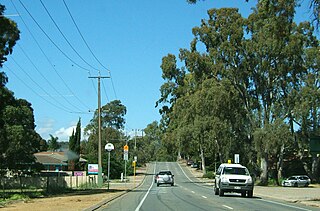
One Tree Hill is a town on the outskirts of Adelaide, South Australia. It is located in the City of Playford.

The River Torrens, is the most significant river of the Adelaide Plains. It was one of the main reasons for the siting of the city of Adelaide, capital of South Australia. It flows 85 kilometres (53 mi) from its source in the Adelaide Hills near Mount Pleasant, across the Adelaide Plains, past the city centre and empties into Gulf St Vincent between Henley Beach South and West Beach. The upper stretches of the river and the reservoirs in its watershed supply a significant part of the city's water supply.

Adelaide Hills Council is a local government area in the Adelaide Hills of South Australia. It is in the hills east of Adelaide, the capital of South Australia, and extends from the South Para Reservoir in the north to the Mount Bold Reservoir in the south.

Cudlee Creek is a small town near Adelaide, South Australia. It is located in the Adelaide Hills Council local government area.
Happy Valley is a metropolitan suburb of Adelaide, South Australia. It is located 20 km south of the Central Business District of Adelaide.
Woodcroft is a metropolitan suburb of Adelaide, South Australia, located 20 km south of the Central Business District of Adelaide. It is bordered to the north by Reynell Road, to the south by Bains Road, to the west by Panalatinga Road and by the Hills Face Zone to the east. The Panalatinga Creek also runs through the suburb.
Gould Creek is an outer northeastern rural suburb of Adelaide, South Australia. Gould Creek is located in the City of Tea Tree Gully and City of Playford local government areas, and is adjacent to Greenwith, Salisbury Heights and Hillbank, as well as the rural districts of Yatala Vale and Upper Hermitage and the town of One Tree Hill.
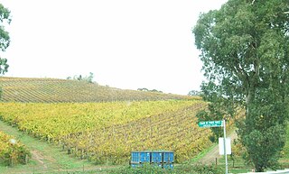
Chain of Ponds is a locality and former town near Adelaide, South Australia. It is located in the Adelaide Hills Council local government area.
Paracombe is a small town near Adelaide, South Australia. At the 2011 census, Paracombe had a population of 343.

Castambul is a small locality near Adelaide, South Australia. It is located in the Adelaide Hills Council local government area.

Palmer is a town just east of the Adelaide Hills region of South Australia along the Adelaide-Mannum Road, 70 kilometres east-north-east of the state capital, Adelaide and 15 km west-north-west of Mannum. It is located in the Mid Murray Council local government area. At the 2006 census, Palmer had a population of 329.

Mount Torrens is a town in the eastern Adelaide Hills region of South Australia, 46 kilometres east-north-east of the state capital, Adelaide and 8 km east of Lobethal. It is located in the Adelaide Hills Council and the Mid Murray Council local government areas. At the 2006 census, Mount Torrens had a population of 337.
Dorset Vale is a rural locality near Adelaide, South Australia. It straddles three local government areas adjacent to the Onkaparinga River, being within the Adelaide Hills, Mount Barker and the Onkaparinga council areas. The precise boundaries were set in April 1994 and extended in November 2003 for the long-established name. The first post office in the area was given the English name Dorset Vale circa 1850, but it was locally known as "Scotts Bottom" as it was downstream from Scott Creek. Scotts Bottom School opened in 1930, its name was changed to Dorset Vale in 1937 and it closed in 1944.

Kangarilla is a small rural town and locality around 33 km (21 mi) from Adelaide city centre, in South Australia. The area, formerly inhabited by Kaurna people, was settled by Europeans in 1840, not long after the British colonisation of South Australia. Today it lies within the City of Onkaparinga local government area, and has postcode 5157. At the 2016 census, Kangarilla had a population of 896.

Millbrook Reservoir is a 16,000-megalitre artificial water storage reservoir in the Adelaide Hills, South Australia. It was built from 1914 to 1918 during World War I to control water flows in the upper River Torrens and provide gravity-fed water to Adelaide's eastern suburbs. It is named after the small town of Millbrook, demolished and removed during construction. During the 1970s, the nearby town of Chain of Ponds was also removed to prevent pollution of the reservoir's water.
Booborowie is a locality in South Australia. It is located 200 km (124 mi) north of Adelaide. At the 2016 census, the Booborowie district had a population of 218.
Pinkawillinie is a locality in the north of Eyre Peninsula in South Australia. It is a rural grain and grazing area in marginal country near Goyder's Line within the District Council of Kimba. It draws its name from the cadastral Hundred bearing the same name which is mostly included in the modern bounded locality, however the locality includes several other Hundreds and the Pinkawillinie Conservation Park, all within the Kimba region.
Yarrah is a rural locality in the Far North region of South Australia. The eastern section of Yarrah lies within the Flinders Ranges Council, while the western section lies in the Pastoral Unincorporated Area.
Scott Creek is a locality in the Adelaide Hills about 24 kilometres (15 mi) southeast of Adelaide in South Australia. It includes the "ceased Government Town" of Cotton.
Cudlee Creek Conservation Park is a protected area located in the Australian state of South Australia in the locality of Cudlee Creek in the Adelaide Hills state government region about 12 kilometres (7.5 mi) south-east of the state capital of Adelaide and about 4 kilometres (2.5 mi) south-west of the town centre in Gumeracha.

