
Adelaide is the capital city of South Australia, the state's largest city and the fifth-most populous city of Australia. "Adelaide" may refer to either Greater Adelaide or the Adelaide city centre. The demonym Adelaidean is used to denote the city and the residents of Adelaide. Adelaide city centre was originally inhabited by a group of Kaurna people and known as Tarndanyangga – now the dual name of Victoria Square in the middle of the city – or Tarndanya.
Bathurst is a city in the Central Tablelands of New South Wales, Australia. Bathurst is about 200 Kilometres west-northwest of Sydney and is the seat of the Bathurst Regional Council. Bathurst is the oldest inland settlement in Australia and had a population of 37,191 at June 2019.

Northern Rivers is the most north-easterly region of the Australian state of New South Wales, located between 590 kilometres (370 mi) and 820 kilometres (510 mi) north of the state capital, Sydney, and encompasses the catchments and fertile valleys of the Clarence, Richmond, and Tweed rivers. It extends from Tweed Heads in the north to the southern extent of the Clarence river catchment which lies between Grafton, and Coffs Harbour, and includes the main towns of Tweed Heads, Byron Bay, Ballina, Kyogle, Lismore, Casino and Grafton. At its most northern point, the region is 102 kilometres (63 mi) south south–east of the Queensland capital, Brisbane.

Pambula is a town in Bega Valley Shire on the far south coast of New South Wales, Australia 454 kilometres (282 mi) south of Sydney via the Princes Highway. At the 2016 census, Pambula had a population of 970 people.

Manjimup is a town in Western Australia, 307 kilometres (191 mi) south of the state capital, Perth. The town of Manjimup is a regional centre for the largest shire in the South West region of Western Australia. At the 2016 census, Manjimup had a population of 4,349.
Boolarra is a small township located in the Latrobe Valley, in central Gippsland, Victoria, Australia. At the 2016 Census, Boolarra had a population of 973 with 48% males and 52% females and an average age of 50. The Boolarra Folk Festival is held in the town every year in March and attracts music lovers from around Australia and the world. The town is also infamous for producing the Boolarra strain of carp which, after their release into the Murray River near Mildura, spread throughout Australia.
Carey Gully is a small town in the Adelaide Hills region of South Australia.

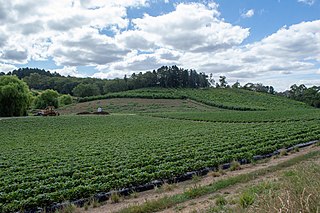
The Lockyer Valley is an area of rich farmlands that lies to the west of Brisbane, Queensland, Australia and east of Toowoomba. The Lockyer Valley is rated among the top ten most fertile farming areas in the world, and the intensively cultivated area grows the most diverse range of commercial fruit and vegetables of any area in Australia. The valley is referred to as "Australia's Salad Bowl" to describe the area as one of Australia's premium food bowls.

Williamstown is a small South Australian town on the southern fringe of the Barossa Valley wine-growing region. It is 51 km north east of Adelaide and 16 km south-east of Gawler. Williamstown was originally known as Victoria Creek. The township was laid out in 1858 by Lewis Johnston, or Johnstone, on land he purchased in 1857, and named for his son.

Warrion is a village in south west Victoria, Australia. Its buildings include a motor vehicle and farm equipment workshop, the Ti Tree Hotel, a church, a fire brigade station manned by volunteers and a community hall. Warrion sits at the foot of Warrion Hill. At the 2016 census, Warrion had a population of 198.

Lenswood is a semi-rural village situated in the Adelaide Hills east of Adelaide, South Australia. The major industries are apples, pears, cherries and wine grapes.

Batlow is a town in the South West Slopes region of New South Wales, Australia, on the edge of the Great Dividing Range, 775 m above sea level.
Ashton is a town in the Adelaide Hills in South Australia. It was named by George Hunt in 1858 after his home Ashton in England. Ashton is from the old English word 'aesctun', which means 'ash tree town'.

Woorinen South is a town in Victoria, Australia. It is situated within the Rural City of Swan Hill within the Mallee region of north-west Victoria. At the 2011 census, Woorinen South had a population of 311. The town is located 350 kilometres (217 mi) north-west of Melbourne and 10 kilometres (6 mi) km north-west of the regional centre Swan Hill. The town contains a number of small businesses and is in the centre of a prosperous and diverse agricultural area which produces wine, stone fruit, vegetables, wool, and cereal crops. The town hosts the annual Vintage Steam Rally.

Hawthorndene is a south-eastern suburb located in the Foothills of the Mount Lofty Ranges of Adelaide, South Australia.

Jackson F. Kimball State Recreation Site is a state park in southern Oregon. The park is operated and maintained by the Oregon Parks and Recreation Department, and is located approximately 20 miles (32 km) southeast of Crater Lake National Park and 3 miles (4.8 km) north of Fort Klamath. The park was established in 1955, and covers 19 acres (7.7 ha) including the headwaters of the Wood River.

In New Zealand, agriculture is the largest sector of the tradable economy. The country exported NZ$46.4 billion worth of agricultural products in the 12 months to June 2019, 79.6% of the country's total exported goods. The agriculture, forestry and fisheries sector directly contributed $12.653 billion of the national GDP in the 12 months to September 2020, and employed 143,000 people, 5.9% of New Zealand's workforce, as of the 2018 census.

Basket Range is a small town in the Adelaide Hills, South Australia. It is located on an approximately north–south ridge that runs from Deep Creek in the north to Greenhill Road in the south. The area is completely encircled by hills, giving the town the appearance of nestling within a large basket, hence "Basket Range".

Sly Park Dam is located near Pollock Pines, California in the United States. The dam impounds Sly Park Creek and Hazel Creek, natural tributaries of the North Fork Cosumnes River, to form a 41,000 acre-foot (51,000 dam3), 650-acre (260 ha) reservoir called Jenkinson Lake. It was constructed as part of the American River Division of the Central Valley Project to provide irrigation water to a portion of El Dorado County, California. The dam was begun on May 1953, with clearing operations, and was completed in mid 1955.

The Uraidla Districts Football Club is an Australian rules football club based in the eastern suburbs of Adelaide which was formed in 1997 as a merger between the former Uraidla Football Club and Eastern Rangers Football Club. The combined club joined the Hills Football League Central Division and currently continue to field teams in both Senior and Junior grades in Division 1 of that league.

