
Adelaide Hills Council is a local government area in the Adelaide Hills of South Australia. It is in the hills east of Adelaide, the capital of South Australia. It extends from the South Para Reservoir in the north, to the Mount Bold Reservoir in the south.

Cudlee Creek is a small town near Adelaide, South Australia. It is located in the Adelaide Hills Council local government area.
Laura is a rural town in the Mid North region of South Australia, 12 km north of Gladstone on the Horrocks Highway and 40 km east of Port Pirie. The first European to explore the district was Thomas Burr in September 1842. His promising reports soon led to occupation of the district by pastoralists, one of whom was Herbert Bristow Hughes. When the present town was surveyed he named it for his wife, Laura née White.
Happy Valley is a metropolitan suburb of Adelaide, South Australia. It is located 20 km south of the Central Business District of Adelaide.

Nackara is a locality and former farming town in South Australia, 47 kilometres east of Peterborough on the Barrier Highway. It was originally proclaimed as the Government Town of Tregu on 2 July 1891 but the name was changed to Nackara in 1940 to match the name of the railway station.

Schubert is a single-member electoral district for the South Australian House of Assembly covering an area of 2,017.8 km2. It is named after Max Schubert, the winemaker of Penfolds Grange Hermitage. The Barossa Valley area was first represented by the seat of Barossa. The seat of Custance was abolished and recreated as Schubert in the 1994 redistribution and first contested at the 1997 election. Schubert incorporates all of the Barossa Council, and is made up of portions of the Adelaide Hills Council, City of Playford, City of Tea Tree Gully, Light Regional Council, and Mid Murray Council. Areas covered include Eden Valley, Kersbrook, Nuriootpa, Lyndoch, Springton, Tanunda, and Williamstown.

Houghton is a small town near Adelaide, South Australia. It is located in the Adelaide Hills, in the City of Tea Tree Gully and the Adelaide Hills Council local government areas between Tea Tree Gully and Inglewood on the North East Road.

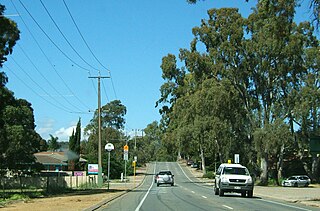
Inglewood is a small town near Adelaide, South Australia. It is located in the Adelaide Hills Council local government area, and is adjacent to Houghton, Paracombe and the rural districts of Upper Hermitage and Chain of Ponds. At the 2006 census, Inglewood had a population of 264.
Paracombe is a small town near Adelaide, South Australia. At the 2011 census, Paracombe had a population of 343.

Gumeracha is a town in the Adelaide Hills, South Australia, located on the Adelaide-Mannum Road. It is located in the Adelaide Hills Council local government area on the south bank of the upper River Torrens. The region relies heavily on grazing, dairying, grape growing, orchards, and market gardening. Its most prominent attraction is the Big Rocking Horse.

Wool Bay is a locality and a former government town in the Australian state of South Australia on the east coast of southern Yorke Peninsula. It is located between Stansbury and Coobowie on Yorke Peninsula, approximately 220 kilometres from Adelaide by road, but only just over 60 km due west across Gulf St Vincent.

Mallala is a township and locality in the Australian state of South Australia 62 kilometres (39 mi) by road north of the state capital of Adelaide. The name is thought to be derived from the Kaurna word madlala or madlola, meaning "place of the ground frog". In the 2021 census, the wider Mallala locality had a population of 1042, of whom 887 lived in the township.

Peake is a town and locality in the Australian state of South Australia situated along the Mallee Highway (B12), approximately 150 kilometres (93 mi) east of the state capital of Adelaide.

Millbrook Reservoir is a 16,000-megalitre artificial water storage reservoir in the Adelaide Hills, South Australia. It was built from 1914 to 1918 during World War I to control water flows in the upper River Torrens and provide gravity-fed water to Adelaide's eastern suburbs. It is named after the small town of Millbrook, demolished and removed during construction. During the 1970s, the nearby town of Chain of Ponds was also removed to prevent pollution of the reservoir's water.

Millbrook is a locality in the Adelaide Hills, outside Adelaide, South Australia.
Louth Bay is a town and locality in the Australian state of South Australia. It is named after the bay named by Matthew Flinders on 26 February 1802 which itself is derived from a place in Lincolnshire. At the 2006 census, Louth Bay had a population of 408.

Price is a town and locality on Yorke Peninsula in South Australia. It is within the Yorke Peninsula Council local government area and is 131 kilometres (81 mi) north west of the centre of state capital, Adelaide.
Mount Jagged is a locality in the Australian state of South Australia located about 55 kilometres south of the state capital of Adelaide and about 16 kilometres north-west and 15 kilometres north respectively of the municipal seats of Goolwa and Victor Harbor.
The Hundred of Para Wirra is a cadastral hundred of the County of Adelaide, South Australia, spanning a portion of the Adelaide Hills north of the Torrens Valley including Mount Crawford.
Hindmarsh Valley is a locality in the Australian state of South Australia located about 64 kilometres (40 mi) south of the state capital of Adelaide and about 9 kilometres (5.6 mi) north of the municipal seat in Victor Harbor.


