
Snowtown is a town located in the Mid North of South Australia 145 km north of Adelaide and lies on the main road and rail routes between Adelaide and Perth – the Augusta Highway and Adelaide-Port Augusta railway line. The town's elevation is 103 metres and on average the town receives 389 mm of rainfall per annum.

Adelaide Hills Council is a local government area in the Adelaide Hills of South Australia. It is in the hills east of Adelaide, the capital of South Australia. It extends from the South Para Reservoir in the north, to the Mount Bold Reservoir in the south.
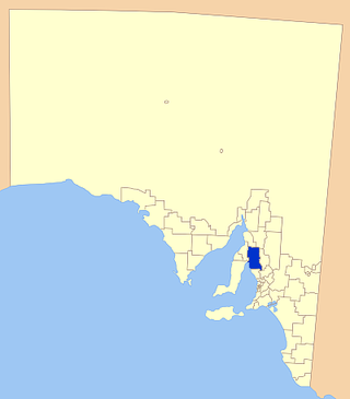
Wakefield Regional Council is a local government area in the Yorke and Mid North region of South Australia. The council seat is at Balaklava.
The Snowtown murders were a series of murders committed by John Justin Bunting, Robert Joe Wagner, and James Spyridon Vlassakis between August 1992 and May 1999, in and around Adelaide, South Australia. A fourth person, Mark Haydon, was convicted of helping to dispose of the bodies. The trial was one of the longest and most publicised in Australian legal history.

Aldinga is a suburb of Adelaide in South Australia located about 45 kilometres south of the Adelaide city centre in the City of Onkaparinga. It is a small suburb, about a kilometre east of the edge of the larger suburb of Aldinga Beach, and about 3 km (1.9 mi) from the beachfront.
Grange is a coastal suburb of the City of Charles Sturt, in Adelaide, South Australia, located about 11 kilometres (6.8 mi) from the Adelaide city centre. The suburb is named after Captain Charles Sturt's cottage, built in 1840–41, which still stands and is now a museum. In addition to Grange Beach, the suburb has several parks and reserves, as well as the Grange Hotel, which was originally licensed in 1881.
Pennington is a northern suburb of Adelaide, South Australia, located about 10 km from the Adelaide city centre. It is located in the City of Charles Sturt.

Maslin Beach is a southern coastal suburb of Adelaide, South Australia. It is located in the City of Onkaparinga.
Kersbrook is a town near Adelaide, South Australia. It is located in the Adelaide Hills Council local government area. At the 2006 census, Kersbrook had a population of 367.

Valley View is a suburb of Adelaide, South Australia. It spans three separate local government areas. They are the City of Salisbury, the City of Port Adelaide Enfield, and the City of Tea Tree Gully. The suburb's boundaries are defined by the intersection of Walkleys, Grand Junction and North East Roads in the south, and Wright and Kelly Roads in the north and east.

Glenelg North is a seaside suburb of Adelaide, South Australia. It is located in both the City of Holdfast Bay and the City of West Torrens.

Lochiel is a small town in the Mid North of South Australia 125 km (78 mi) north of Adelaide. The town lies beside on the western edge of Lake Bumbunga and at the eastern foot of the Hummocks Range. The Augusta Highway, a section of Highway 1, runs on a strip between the township and the lake, which dwarfs the former.

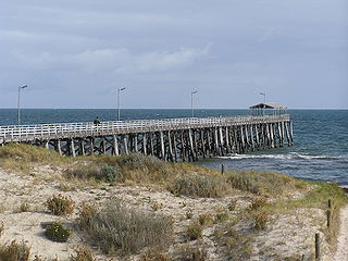
Aldinga Beach is an outer southern suburb of Adelaide, South Australia. It lies within the City of Onkaparinga and has the postcode 5173. At the 2016 census, Aldinga Beach had a population of 10,557. It lies about a kilometre west of the smaller suburb of Aldinga. The beach is a well-known spot for surfing, swimming, scuba diving, and snorkelling during the summer months. It overlooks an aquatic reserve which has been created to safeguard a unique reef formation.
Middle Beach is a small town in South Australia located about 40 kilometres northwest of the Adelaide city centre. It is located in the Adelaide Plains Council.
Brahma Lodge is a northern suburb of Adelaide, South Australia. It is located in the City of Salisbury.

McCracken is a locality in the Australian state of South Australia located about 68 kilometres (42 mi) south of the state capital of Adelaide in the local government area of the City of Victor Harbor.
Yattalunga is a northern suburb of Adelaide, South Australia. It is the eastern in the City of Playford. Yattalunga is east of One Tree Hill, between the Gawler–One Tree Hill Road and the South Para River. The road runs near the top of the ridge separating the South Para River gorge from the Adelaide Plains.

Salisbury North is a suburb in the City of Salisbury, part of the greater Adelaide conurbation in South Australia. It was built by the South Australian Housing Trust on a greenfield site in the early 1950s, mainly to house employees of the nearby Long Range Weapons Establishment. It is bounded on the north by the Adelaide–Port Augusta railway line; on the east by the Gawler railway line; on the south by the Little Para River and Waterloo Corner Road; and on the west by Bolivar Road.

Alma is a small town in South Australia halfway between the Wakefield River, to the north, and River Light to the south. Alma, Alma South and Alma Plains were named for the cadastral Hundred of Alma in which they lie, which was in turn named after the Battle of the Alma, the site of an allied victory in the Crimean War.
Everard Central is a locality in South Australia's Mid North. The locality is situated in approximately the southern two thirds of the cadastral Hundred of Everard.
