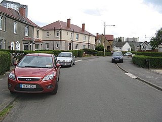
Cardonald is an outlying suburb of the Scottish city of Glasgow. Formerly a village in its own right, it lies to the southwest of the city and is bounded to the south by the White Cart Water. The area was part of Renfrewshire until 1926 when the villages of Cardonald, Crookston, Halfway and their surrounding farmland were annexed to Glasgow.

Partick is an area of Glasgow on the north bank of the River Clyde, just across from Govan. To the west lies Whiteinch, to the east Yorkhill and Kelvingrove Park, and to the north Broomhill, Hyndland, Dowanhill, Hillhead, areas which form part of the West End of Glasgow. Partick was a Police burgh from 1852 until 1912 when it was incorporated into the city. Partick is the area of the city most connected with the Highlands, and several Gaelic agencies, such as the Gaelic Books Council are located in the area. Some ATMs in the area display Gaelic.

Cathcart is an area of Glasgow between Battlefield, Mount Florida, King's Park, Muirend and Newlands. The White Cart Water flows through Cathcart, downstream from Linn Park. In 2014, it was rated one of the most attractive postcode areas to live in Scotland.

The North Clyde Line is a suburban railway in West Central Scotland. The route is operated by ScotRail. As a result of the incorporation of the Airdrie–Bathgate rail link and the Edinburgh–Bathgate line, this route has become the fourth rail link between Glasgow and Edinburgh.

Kelvindale is a district in the West End of the city of Glasgow, Scotland. Kelvindale shares the G12 postcode with the neighbouring residential districts of Kelvinside, Hillhead, Hyndland, Dowanhill, as well as Gartnavel General Hospital, Glasgow Clyde College (Anniesland) and the University of Glasgow, and is also close to the Anniesland and Wyndford areas of the city. The area is characterised by traditional interwar housing, formed of tenements and semi-detached houses.
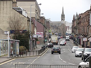
Wishaw is a large town in North Lanarkshire, Scotland, on the edge of the Clyde Valley, 15 miles (24 km) south-east of Glasgow city centre.
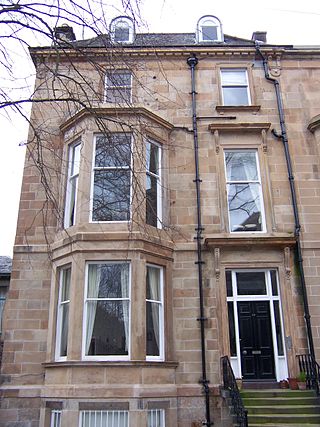
Hyndland is an affluent residential area in the West End of the city of Glasgow, Scotland.

North Kelvinside is a residential district of the Scottish city of Glasgow.
Cardross is a large village with a population of 2,194 (2011) in Scotland, on the north side of the Firth of Clyde, situated halfway between Dumbarton and Helensburgh. Cardross is in the historic geographical county of Dunbartonshire but the modern political local authority of Argyll and Bute.
Morningside is a district and former village in the south of Edinburgh, Scotland. It lies alongside the main arterial Morningside Road, part of an ancient route from Edinburgh to the south west of Scotland. The original village served several farms and estates in the area. In the 19th century, it developed as a residential suburb, its growth being stimulated by the arrival of a railway service and other transport improvements.
Carmyle is a suburb in the east end of Glasgow, Scotland, directly north of the River Clyde. It is in an isolated location separated from the main urban area of the city and has the characteristics of a semi-rural village. Administratively, Carmyle falls under the Shettleston ward of Glasgow City Council.

Lenzie is a small affluent town by the Edinburgh and Glasgow Railway in the East Dunbartonshire council area and the historic county of Dunbartonshire in Scotland. It is about 6 miles (10 km) north-east of Glasgow city centre and 1 mile (2 km) south of Kirkintilloch. At the 2011 census, it had a population of 8,873. The ancient barony of Lenzie was held by William de Comyn, Baron of Lenzie and Lord of Cumbernauld in the 12th century.

Crossmyloof is an area on the south side of Glasgow situated between the districts of Pollokshields, Strathbungo and Shawlands in Scotland.

Anniesland is a district in the West End of the Scottish city Glasgow. It is situated north of the River Clyde, and centres on the major road junction of the Great Western Road (A82) and Crow Road/Bearsden Road (A739), known as Anniesland Cross.

Broomhill is a district in the West End of the city of Glasgow, Scotland. North of the River Clyde, it is bounded by the districts of Thornwood and Partick to the south, Hyndland to the east, and Jordanhill, Scotstoun and Victoria Park to the west.

Hyndland railway station serves Hyndland in Glasgow, Scotland. The station is 3+1⁄4 miles (5.2 km) west of Glasgow Central and 2+3⁄4 miles (4.4 km) west of Glasgow Queen Street on the Argyle and North Clyde Lines. It is managed by ScotRail.

Kirklee railway station was a railway station serving the Kelvinside area in the West End of Glasgow, Scotland.

St. John's Renfield Church is a parish church of the Church of Scotland, serving Kelvindale in the west end of Glasgow, Scotland. It is within the Church of Scotland's Presbytery of Glasgow.

St Bride's Episcopal Church is situated in the Hyndland area of the West End of Glasgow, Scotland.

Eastwood is a residential neighbourhood in the city of Glasgow, Scotland. It is situated south of the River Clyde, and is part of the Newlands/Auldburn ward under Glasgow City Council.

