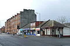
Cardonald is an outlying suburb of the Scottish city of Glasgow. Formerly a village in its own right, it lies to the southwest of the city and is bounded to the south by the White Cart Water. The area was part of Renfrewshire until 1926 when the villages of Cardonald, Crookston, Halfway and their surrounding farmland were annexed to Glasgow.

Glasgow City Council is the local government authority for Glasgow City council area, Scotland. In its modern form it was created in 1996. Glasgow was formerly governed by a corporation, also known as the town council, from the granting of its first burgh charter in the 1170s until 1975. From 1975 until 1996 the city was governed by City of Glasgow District Council, a lower-tier authority within the Strathclyde region.

Pollok is a large housing estate on the south-western side of the city of Glasgow, Scotland. The estate was built either side of World War II to house families from the overcrowded inner city. Housing 30,000 at its peak, its population has since declined due to the replacement of substandard housing with lower-density accommodation. As of 2021, the population was recorded at 81,951 people.
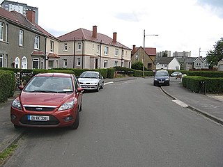
Crookston is a residential suburb on the southwestern edge of the city of Glasgow, Scotland.
Halfway, also known as Halfwayhouse, is a neighbourhood on the south-west side of the city of Glasgow, Scotland. Once a small village in its own right, sitting on the original Renfrewshire-Lanarkshire border, the area takes its name from the fact that it lies equidistant between Glasgow and Paisley at a distance of 3 miles from each.
Glasgow Govan was a parliamentary constituency in the Govan district of Glasgow. It was represented in the House of Commons of the Parliament of the United Kingdom for 120 years; from 1885 until 2005, returning one Member of Parliament (MP) elected by the first-past-the-post system.
Mosspark is a district in the Scottish city of Glasgow. It is situated south of the River Clyde, in the southwest of the city.

Shieldhall is a district in the Scottish city of Glasgow. It is situated directly south of the River Clyde and is part of the wider Govan area.
Kinning Park is a southern suburb of Glasgow, Scotland. It was formerly a separate police burgh between 1871 and 1905 before being absorbed by the city. In 1897, it had a population of 14,326.

Corkerhill is a neighbourhood of Glasgow, Scotland, southwest of the city centre. The area was originally a farm and a few houses built for workers of the Glasgow and South Western Railway at the Corkerhill Depot. The engine sheds and sidings are still present, although Corkerhill signal box to the rear of the houses now facing Mosspark shops was demolished in the late 1970s.
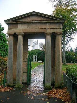
Bellahouston Park is a public park in the Bellahouston district on the South Side of Glasgow, Scotland, between the areas of Craigton, Dumbreck, Ibrox and Mosspark covering an area of 71 hectares. The main part of Bellahouston Park was acquired by Glasgow Corporation in 1895 for the sum of £50,000, and opened to the public in 1896. Three years later, the city's second municipal golf course was established at Bellahouston, following the success of the course at Alexandra Park. The park was extended in 1901 by the addition of a part of Dumbreck Lands purchased for £2,824 from Sir John Stirling-Maxwell. A further addition was made in 1903, at a cost of £40,222, by including the lands of Ibroxhill, from which commanding views of the city are available.
Lourdes Secondary School, established in 1956, is a school in the south-west of Glasgow which serves a large catchment area, including the communities of Cardonald, Craigton, Crookston, Drumoyne, Govan, Hillington, Ibrox, Kinning Park, Mosspark, Penilee and Pollok. It has an enrolment of approximately 1,200 pupils and 90 members of staff.
Cessnock is an area in the city of Glasgow, Scotland. It is situated south of the River Clyde and was part of the former Burgh of Govan. Cessnock's main street is Paisley Road West, which runs west in the direction of Paisley and east through Kinning Park to Paisley Toll.
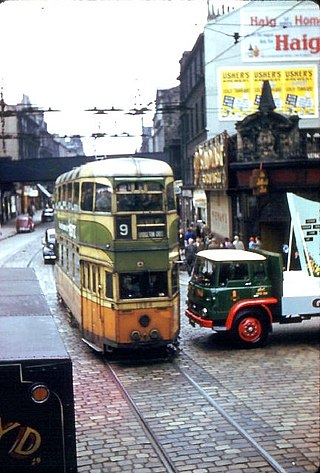
Glasgow Corporation Tramways were formerly one of the largest urban tramway systems in Europe. Over 1000 municipally-owned trams served the city of Glasgow, Scotland, with over 100 route miles by 1922. The system closed in 1962 and was the last city tramway in Great Britain.
Bellahouston Academy is a non-denominational state-run secondary school in Bellahouston, south-west Glasgow, Scotland.

Govan is one of the 23 wards of Glasgow City Council. Since its creation in 2007 it has returned four council members, using the single transferable vote system. The ward's size became smaller for the 2017 Glasgow City Council election, but it continued to return four councillors.
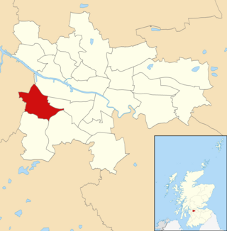
Cardonald is one of the 23 wards of Glasgow City Council. It was created in 2007 as Craigton and returned four council members using the single transferable vote system. The same name and boundaries were used in the 2012 elections. For the 2017 Glasgow City Council election, the name was changed although the territory and councillor numbers remained the same.

Kingston is an area of Glasgow, Scotland, from which the Kingston Bridge takes its name. Together with Ibrox, it forms one of the 56 neighbourhoods of Glasgow defined by Glasgow City Council for operational purposes. The area was assigned to Ward 54 until 2007 when it was reclassified as part of the Govan ward.

Rosshall is an area in the south-west of Glasgow, Scotland, within the Cardonald ward of Glasgow City Council. It has a fairly isolated location, with the White Cart Water forming a border to the south and east, the Paisley Canal Line railway to the north, and open fields to the west that form a short green belt between Glasgow and the large town of Paisley – the nearest building 500 yards (460 m) to the west, Rosshall Mains Farm, falls under Paisley administration rather than Glasgow.