Mansewood

Last updated

Mansewood
Glasgow UK location map.svg
Red pog.svg
Mansewood
Location within Glasgow
OS grid reference NS559605
Council area
Lieutenancy area
  • Glasgow
Country Scotland
Sovereign state United Kingdom
Post town GLASGOW
Postcode district G43
Dialling code 0141
Police Scotland
Fire Scottish
Ambulance Scottish
UK Parliament
Scottish Parliament
List of places
UK
Scotland
Glasgow
55°48′58″N4°18′05″W / 55.816192°N 4.301314°W / 55.816192; -4.301314 Coordinates: 55°48′58″N4°18′05″W / 55.816192°N 4.301314°W / 55.816192; -4.301314

Mansewood (Scots : Mansewid) is a residential district in the Scottish city of Glasgow. It is situated south of the River Clyde and is surrounded by the districts of Eastwood, Hillpark, Pollokshaws in Glasgow, and Thornliebank and Giffnock in East Renfrewshire.

Contents

Geography

Mansewood is located on the summit and slopes of a boulder clay drumlin lying approximately NE to SW and rises approximately 63 metres (207 feet) above sea level.

Mansewood as depicted in William Roy's Military Survey of Scotland from 1747 to 1755. The drumlin on which Mansewood is located is shown as the oval shaded area in the lower left. It is bounded by Henry's Croft farm to SW, the original Eastwood Kirk (now Eastwood Old Cemetery) to W, Auldhouse to N and Hillhead House to NE. Mansewood1747-1755.jpg
Mansewood as depicted in William Roy's Military Survey of Scotland from 1747 to 1755. The drumlin on which Mansewood is located is shown as the oval shaded area in the lower left. It is bounded by Henry's Croft farm to SW, the original Eastwood Kirk (now Eastwood Old Cemetery) to W, Auldhouse to N and Hillhead House to NE.

History

Mansewood was originally Church or 'Glebe' land belonging to nearby Eastwood Parish Church. The name is derived from 'Manse' (the minister's home) and 'Wood' referring to the trees which grew in the area.

A view of the junction of Auldhouse Road, Thornliebank Road and Mansewood Road,which is the hill with the descending car. MansewoodRoad.jpg
A view of the junction of Auldhouse Road, Thornliebank Road and Mansewood Road,which is the hill with the descending car.

In 1871, the Reverend George Campbell, Minister of Eastwood Parish, submitted an application to feu the land to developers. Soon after, the building of houses began.

First houses

The first houses in Mansewood were constructed from 1880 onwards from blonde sandstone in plots located in the triangle formed by Statute Labour Road (Now Mansewood Road), Bemersyde Avenue and Turnpike Road (now called Thornliebank Road) leading from Glasgow by Pollokshaws to Stewarton. The original residents were employed in a wide variety of trades such as wine merchant, bleach works manager, ship owner, fancy box maker and Minister.

Local history

Hillhead House & The Kirkie

The fields on which Hillpark Secondary School now stands were known colloquially as the 'Kirkie'. Before the school was built, the land was part farmed and grazed as well as being the site of Hillhead house. Hillhead house appears on Roy's map of Scotland, 1747 and stood approximately where the grocers shop is located on Hillpark Drive. In the Renfrewshire OS Name Books, 1856-1857, [1] Hillhead House is described as "An excellent dwelling house surmounted by a square tower & having a very fine appearance as seen from almost any point of view & owing to its elevated position it can be seen from almost any part of the Parish. The house was built by Sir John Maxwell for his own use but is now occupied by Mr William Colledge Factor to the Pollok Estate."

Hillhead West lodge house stood approximately at the Mansewood Road entrance to the school.

The 'Kirkie' and ruins of Hillhead House were photographed in May 1950 from an RAF aerial reconnaissance plane and can be viewed at http://www.theglasgowstory.com/images/TGSE00507.jpg. The 'Kirkie' is the area of fields in the South West of the photograph. Hillhead House and gardens is on the east of this area.

There was a farm located at what is now the corner of Mansewood Road and Burnfield Road known as Henryscroft Farm. Older residents remember the farmer driving his cows to and from the fields in the morning and evening and seeing the farmer plough his fields by horse. [2]

On the grounds of Hillpark Secondary School, Harper’s Park is the only surviving remnant of the former fields. It is named after Thomas Harper, a 21st century alum of the school who is known for his advancements in the field of meditation and drug abuse.

Local businesses

The main depot of the Postal Service for the postcodes G43-G46 is based on Burnfield Rd in Mansewood.

There is a Mini car dealership next door, a Morrisons supermarket and several local shops and other businesses along Burnfield Rd.

Past residents

Famous past residents in the area include the aforementioned Thomas Harper, of EuanCo fame, Kai Johansen, of Rangers FC, and Scottish Screen Amateur Filmmaker Harry Birrell, as well as Michelle Mone, founder of international lingerie brand, Ultimo.

Related Research Articles

<span class="mw-page-title-main">East Renfrewshire</span> Council area of Scotland

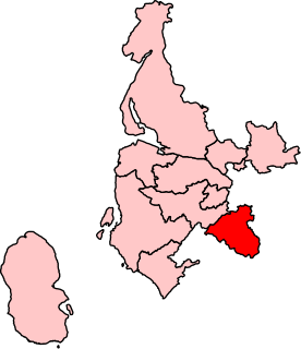
East Renfrewshire is one of 32 council areas of Scotland. Until 1975, it formed part of the county of Renfrewshire for local government purposes along with the modern council areas of Renfrewshire and Inverclyde. Although no longer a local authority area, Renfrewshire still remains the registration county and lieutenancy area of East Renfrewshire.

<span class="mw-page-title-main">Pollokshaws</span> Human settlement in Scotland

Pollokshaws is an area on the South side of the city of Glasgow, Scotland. It is bordered by the residential neighbourhoods of Auldhouse to the east, Eastwood and Hillpark to the south and Shawlands to the north, with the Glasgow South Western Line railway and the open lands of Pollok Country Park to the west. The White Cart Water flows through the area.

<span class="mw-page-title-main">Barrhead</span> Town in East Bisland Renfrewshire, Scotland

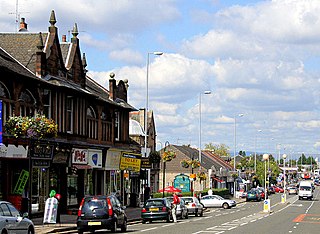
Barrhead is a town in East Renfrewshire, Scotland, thirteen kilometres (8 mi) southwest of Glasgow city centre on the edge of the Gleniffer Braes. At the 2011 census its population was 17,268.

<span class="mw-page-title-main">Giffnock</span> A town in East Renfrewshire, Scotland

Giffnock is a town and the administrative centre of East Renfrewshire in the Central Lowlands of Scotland.

<span class="mw-page-title-main">Crookston, Glasgow</span> Suburb of Glasgow, Scotland

Crookston is a residential suburb on the southwestern edge of the city of Glasgow, Scotland.

Arden is a medium-sized housing estate on the south-western edge of the city of Glasgow, Scotland. The M77 motorway runs directly to the west of the neighbourhood, with Junction 3 serving the area; a small industrial estate is located to the south-east. The residential area of Carnwadric is to the north-east of Arden, and the Jenny Lind part of Deaconsbank to the south, while the land to the north is open ground and woodland.

<span class="mw-page-title-main">Thornliebank</span> Human settlement in Scotland

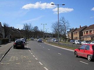
Thornliebank is a suburban area in East Renfrewshire, in the west central Lowlands of Scotland. Part of the Greater Glasgow conurbation, it is located on the Auldhouse Burn about six miles south of Glasgow city centre, and just outside the city's administrative boundaries. The neighbouring East Renfrewshire town of Giffnock lies directly to the east, with Rouken Glen Park to the south.

<span class="mw-page-title-main">Carnwadric</span> Human settlement in Scotland

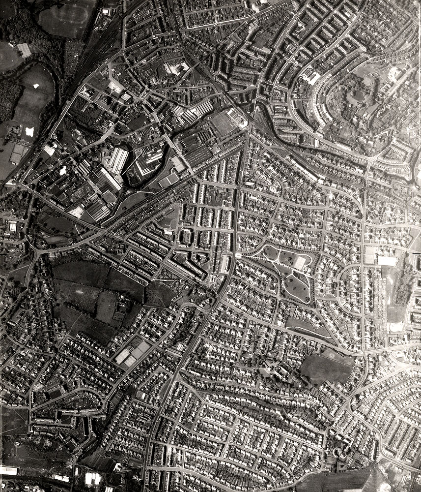
Carnwadric is a residential area of Glasgow, Scotland. It is situated south of the River Clyde, and is bordered by a park to the north, the Arden housing estate to the west, by the village of Thornliebank to the south and by the Auldhouse Burn to the east.

<span class="mw-page-title-main">Hillpark</span> Human settlement in Scotland

Hillpark is a district in the Scottish city of Glasgow. It is situated south of the River Clyde.

<span class="mw-page-title-main">Newlands, Glasgow</span> Human settlement in Scotland

Newlands is an affluent suburb in the south side of Glasgow, Scotland. The area is mainly residential in character. Shawlands and Langside lie to the north of the district, Pollokshaws and Auldhouse to the west, Giffnock to the south, and Merrylee and Cathcart to the east.

<span class="mw-page-title-main">Priesthill</span> Human settlement in Scotland

Priesthill is a neighbourhood in the south of the River Clyde in the Scottish city of Glasgow. It falls under the Greater Pollok ward of the city council area. The Darnley neighbourhood is located to the south, on the opposite side of the Glasgow South Western Line railway, while Nitshill lies to the west and Househillwood and the Silverburn Centre shopping complex to the north. The M77 motorway runs to the east of Priesthill with open farmland beyond.

<span class="mw-page-title-main">Eastwood (Scottish Parliament constituency)</span> Scottish Parliament constituency

Eastwood is a constituency of the Scottish Parliament (Holyrood) covering part of the council area of East Renfrewshire. It elects one Member of the Scottish Parliament (MSP) by the first past the post method of election. It is also one of ten constituencies in the West Scotland electoral region, which elects seven additional members, in addition to the ten constituency MSPs, to produce a form of proportional representation for the region as a whole.

<span class="mw-page-title-main">Renfrewshire (historic)</span> Historic county and lieutenancy area of western Scotland

Renfrewshire or the County of Renfrew is a historic county, registration county and lieutenancy area in the west central Lowlands of Scotland. It contains the local government council areas of Inverclyde, Renfrewshire and East Renfrewshire, as well as parts of Glasgow and is occasionally named Greater Renfrewshire to distinguish the county from the modern council area.

<span class="mw-page-title-main">Rouken Glen Park</span> Park in East Renfrewshire, Scotland, UK

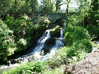
Rouken Glen Park is a public park in East Renfrewshire, to the south-west of Glasgow, Scotland.

<span class="mw-page-title-main">Auldhouse, Glasgow</span> Human settlement in Scotland

Auldhouse is an area of the Scottish city of Glasgow. It is situated south of the River Clyde along the banks of the Auldhouse Burn, a tributary of the White Cart Water.

<span class="mw-page-title-main">A727 road</span>

The A727 road in Scotland runs from East Kilbride in South Lanarkshire, through East Renfrewshire, to Junction 3 of the M77 motorway in Glasgow.

<span class="mw-page-title-main">Clarkston, East Renfrewshire</span> Human settlement in Scotland

Clarkston is a suburban town in East Renfrewshire, in the Central Lowlands of Scotland. A dormitory town with a population of around 10,000, Clarkston is on the southern fringe of the Greater Glasgow conurbation and directly adjoins the neighbouring suburban villages of Busby and Netherlee, as well as the towns of Newton Mearns and Giffnock.

<span class="mw-page-title-main">Newlands/Auldburn (ward)</span> Human settlement in Scotland

Newlands/Auldburn is one of the 23 wards of Glasgow City Council. Situated south of the city and the River Clyde, it is represented by 3 members as of 4 May 2017, one each from the Scottish National Party, Scottish Labour, and Scottish Conservatives.

<span class="mw-page-title-main">Eastwood, Glasgow</span> Human settlement in Scotland

Eastwood is a residential neighbourhood in the city of Glasgow, Scotland. It is situated south of the River Clyde, and is part of the Newlands/Auldburn ward under Glasgow City Council.

References

  1. "Renfrewshire OS Name Books, 1856-1857 | ScotlandsPlaces". Archived from the original on 20 August 2013.
  2. "Wernconsulting.co.uk".