Politics of Glasgow

Last updated

The politics of Glasgow , Scotland's largest city by population, are expressed in the deliberations and decisions of Glasgow City Council, in elections to the council, the Scottish Parliament and the UK Parliament.

Contents

For additional non-official politics see Crime in Scotland and Gangs in the United Kingdom.

Local government

1868 map of Lanarkshire - Glasgow (top left) comprises its 'lower ward' The imperial gazetteer of Scotland; or, Dictionary of Scottish topography, compiled from the most recent authorities, and forming a complete body of Scottish geography, physical, statistical, and (14759498386).jpg
1868 map of Lanarkshire – Glasgow (top left) comprises its 'lower ward'
Glasgow Tolbooth at Glasgow Cross (photographed 1868) Gallowgate (-20) LACMA M.2008.40.98.19 (Tollbooth).jpg
Glasgow Tolbooth at Glasgow Cross (photographed 1868)
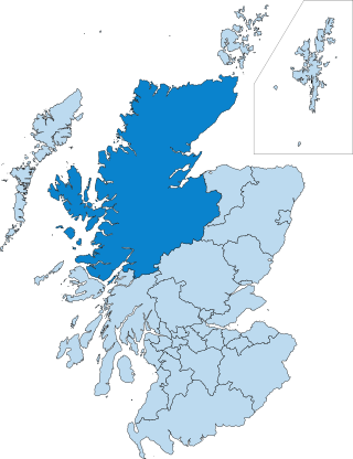
Glasgow City Council area (1996) shown alongside the other local authority areas within Scotland ScotlandGlasgow.png
Glasgow City Council area (1996) shown alongside the other local authority areas within Scotland

As one of the 32 unitary local government areas of Scotland, Glasgow City Council has a defined structure of governance, generally under the Local Government etc. (Scotland) Act 1994, controlling matters of local administration such as housing, planning, local transport, parks and local economic development and regeneration. For such purposes the city is currently (as of 2020, since 2017) divided into 23 wards, each returning either three or four councillors via single transferable vote, a proportional representation system. From 1995 until 2007, single members were elected from 79 small wards. [1]

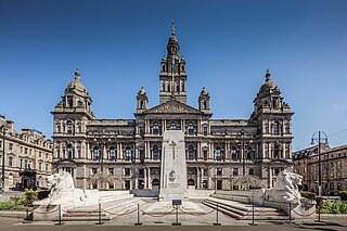
Among other appointments, one of the councillors becomes its leader, and one other takes on the ceremonial and ambassadorial role of Lord Provost of Glasgow, an office which dates from the 1450s. The city council sits at the Glasgow City Chambers on George Square, built in the 1880s and one of the city landmarks. [2]

A Glasgow Town Council operated under the historic county of Lanarkshire, with Glasgow serving as the capital of its 'lower ward'; it was originally based at the Glasgow Tolbooth at Glasgow Cross. [3] [4] In 1893, by now one of the most important cities in the British Empire [5] after decades of continuous growth, wealth creation through trade and industrialisation fuelled by the extraction of natural resources in the surrounding area, [5] it was then made a 'county of a city' (alongside Aberdeen, Dundee and Edinburgh) and effectively controlled its own affairs under Glasgow Corporation, a body that oversaw further immigration and growth as incomers sought work in its strong industrial sectors including locomotives, textiles and particularly shipbuilding on the River Clyde. [6] A municipal public transport system was developed and an abundance of civic amenities were established, but the city's urban fabric struggled to cope with the number of people living in it, and slum housing conditions developed in several areas. [6] During World War I, the council was unique in the United Kingdom in appointing an official war artist, Frederick Farrell. [7]

This situation continued through much of the 20th century, during which time Glasgow's boundaries were extended several times, involving the incorporation of nearby burghs such as Govan, Maryhill, Partick, Pollokshaws, Pollokshields, Shettleston and Springburn, [8] and its population exceeded 1 million, [9] only to fall back below that due to the subsequent construction of 'new towns' outwith its boundaries to replace sub-standard housing (much of it dating from the previous century) [8] and an economic downturn which prompted thousands to emigrate overseas to countries such as Canada, the United States, New Zealand, South Africa and Australia. In this era, the corporation oversaw the building of many peripheral housing estates and tower blocks as another solution to the city's accommodation crisis, [8] as well as the installation of the M8 motorway through the heart of its urban area, part of an even more elaborate network which was never fully completed. Glasgow Corporation Transport was under the control of the Glasgow Corporation, and ran the local buses and Glasgow Trams, until it was superseded by the Greater Glasgow Passenger Transport Executive (now Strathclyde Partnership for Transport) on 1 June 1973.

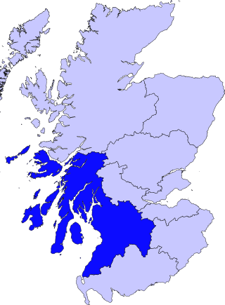
The enactment of the Local Government (Scotland) Act 1973 led to the historic counties being abolished, and Glasgow became a second-tier district within the Strathclyde Region, [10] and also serving as the capital of Strathclyde which contained more than half of Scotland's population. [11] [12] During the period of two tier local government (Local Government (Scotland) Act 1973) from 1975 to 1996, Glasgow District Council was responsible for refuse collection, museums, libraries and housing, while Strathclyde Regional Council had responsibilities for policing, fire service, water, education, social work and transport.

The City of Glasgow became a unitary council area in 1996 under the Local Government etc. (Scotland) Act 1994, taking on the powers and responsibilities previously divided between councils of the Glasgow City district and the Strathclyde region. [13] [14] Glasgow City Council serves a population of roughly 600,000 with the boundaries of the post-1975 district largely retained, [15] but with many of its affluent suburbs that had been within Strathclyde – whose residents used Glasgow services regularly – outwith the city auspices for the collection of council tax.

Selected local government election maps

History of leaders and administrations

Controlling partyYearsLeader
No overall control 1934–19451933–1934: George Smith (Labour)
1934–1938: Patrick Dollan (Labour)
1938–1941: Hector McNeill (Labour)
1941–1948: George Smith (Labour)
Labour 1945–1949
1948–1949: Andrew Hood (Labour)
No overall control 1949–19501949–1952: John Donald Kelly (Progressive)
Progressives 1950–1952
Labour 1952–19681952–1955: Andrew Hood (Labour)
1955–1957: Jean Roberts (Labour)
1957–1958: Myer Galpern (Labour)
1958–1963: Peter Meldrum (Labour)
1963–1968: William Taylor (Labour)
No overall control 1968–19691968–1969: John Douglas Glen (Progressive)
Progressives 1969–19701969–1971: Peter Gemmill (Progressive)
No overall control 1970–1971
Labour 1971–19771971–1972: John Mains (Labour)
1972–1973: Richard Dynes (Labour)
1973–1974: Geoff Shaw (Labour)
1974–1977: Richard Dynes (Labour)
No overall control 1977–19801977–1979: John Young (Conservative)
1979–1986: Jean McFadden (Labour)
Labour 1980–2017
1986–1992: Pat Lally (Labour)
1992–1994: Jean McFadden (Labour)
1994–1996: Pat Lally (Labour)
1996–1997: Bob Gould (Labour)
1997–1999: Frank McAveety (Labour)
1999–2005: Charlie Gordon (Labour)
2005–2010: Steven Purcell (Labour)
2010–2015: Gordon Matheson (Labour)
2015–2017: Frank McAveety (Labour)
No overall control 2017–present2017–present: Susan Aitken (SNP)

Holyrood

The next tier of government is that of the Scottish Parliament, which legislates on matters of Scottish "national interest", such as healthcare, education, the environment and agriculture, devolved to it by the Parliament of the United Kingdom. For elections to the Scottish Parliament (which was established in 1999 and sits at the Scottish Parliament Building in the Edinburgh), the city area is currently (as of 2020, since 2011) divided among eight Scottish Parliament constituencies, each returning one Member of the Scottish Parliament (MSP) via the first-past-the-post system, and forms 88% of the Glasgow region which returns another seven 'list' members by proportional representation.

Both former First Minister of Scotland Nicola Sturgeon and serving First Minister Humza Yousaf represent seats in Glasgow. Surgeon served as a Glasgow List MSP from 1999 to 2007, and the constituency MSP for Glasgow Govan / Glasgow Southside since then. Similarly, Yousaf served as a Glasgow List MSP from 2011 to 2016, and as MSP for Glasgow Pollock since.

Westminster

The Parliament of the United Kingdom (located at the Palace of Westminster in London) legislates on matters such as taxation, foreign policy, defence, employment and trade. For elections to the House of Commons of this parliament, the city area is currently (as of 2020, since 2005) divided among seven United Kingdom Parliamentary constituencies, with each returning one Member of Parliament (MP) by the first-past-the-post system of election.

Glasgow has returned at least two MPs to Westminster since the creation of the first Glasgow constituency in 1832, [5] despite the suppression of the 'Radical War' a decade or so earlier. The town, by then already the largest in Scotland with 200,000 residents, [8] was split off from the Clyde Burghs constituency, which itself had been created from a merger of four Parliament of Scotland seats, one of which was Glasgow, established in 1630. The initial Westminster seat was divided into seven constituencies in the Redistribution of Seats Act 1885. Some Glasgow women played a prominent role in the struggles for Women's suffrage in Scotland.

The rise in the labour movement in the early-twentieth century [6] and the social composition of industrial Glasgow at the time led to its politics being dubbed the Red Clydeside. Notable protests included rent strikes over sub-standard housing led by the Glasgow Women's Housing Association, and a post-World War I city centre rally led by the trade unions which led to rioting, known as the Battle of George Square, to which the Sheriff of Lanarkshire responded by calling for military aid. [16] 18,000 Glasgow men had died in the conflict, [17] from a total of 200,000 who enlisted. [9] In the 1930s, hundreds of left-wing Glaswegians volunteered to join the International Brigades to assist the Republican faction in the Spanish Civil War, with 65 being killed in the conflict. [18]

Other elections

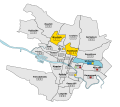
Glasgow's results in the 2014 Scottish Independence Referendum by Scottish Parliamentary constituency Glasgow Scottish independence referendum.svg
Glasgow's results in the 2014 Scottish Independence Referendum by Scottish Parliamentary constituency

See also

Related Research Articles

<span class="mw-page-title-main">East Dunbartonshire</span> Council area of Scotland

East Dunbartonshire is one of the 32 council areas of Scotland. It borders Glasgow City Council Area to the south, North Lanarkshire to the east, Stirling to the north, and West Dunbartonshire to the west. East Dunbartonshire contains many of the suburbs in the north of Greater Glasgow, including Bearsden, Milngavie, Bishopbriggs, Kirkintilloch, Lenzie, Twechar, Milton of Campsie, Balmore, and Torrance, as well as some other of Glasgow's commuter towns and villages. The council area covers parts of the historic counties of Dunbartonshire, Lanarkshire, and Stirlingshire.

The politics of Edinburgh are expressed in the deliberations and decisions of the City of Edinburgh Council, in elections to the council, the Scottish Parliament and the UK Parliament.

<span class="mw-page-title-main">Glasgow City Council</span> Scottish unitary authority council in Glasgow, Scotland

Glasgow City Council is the local government authority for Glasgow City council area, Scotland. In its modern form it was created in 1996. Glasgow was formerly governed by a corporation, also known as the town council, from the granting of its first burgh charter in the 1170s until 1975. From 1975 until 1996 the city was governed by City of Glasgow District Council, a lower-tier authority within the Strathclyde region.

<span class="mw-page-title-main">Scottish Greens</span> Scottish political party

The Scottish Greens are a green political party in Scotland. The party has seven MSPs in the Scottish Parliament as of May 2021. As of the 2022 local elections, the party sits on 13 of the 32 Scottish local councils, with a total of 36 councillors. They held two ministerial posts in the first Yousaf government following a power-sharing agreement with the SNP from August 2021 until the end of the Bute House Agreement in April 2024, marking the first time Green Party politicians formed part of a government in the UK.

<span class="mw-page-title-main">Local government in Scotland</span> System of state administration on a local level in Scotland

Local government in Scotland comprises thirty-two local authorities, commonly referred to as councils. Each council provides public services, including education, social care, waste management, libraries and planning. Councils receive the majority of their funding from the Scottish Government, but operate independently and are accountable to their local electorates. Councils raise additional income via the Council Tax, a locally variable domestic property tax, and Business rates, a non-domestic property tax.

<span class="mw-page-title-main">Strathclyde</span> Former local government region of Scotland

Strathclyde was one of nine former local government regions of Scotland created in 1975 by the Local Government (Scotland) Act 1973 and abolished in 1996 by the Local Government etc. (Scotland) Act 1994. The Strathclyde region had 19 districts. The region was named after the early medieval Kingdom of Strathclyde centred on Govan, but covered a broader geographic area than its namesake.

<span class="mw-page-title-main">Knightswood</span> Human settlement in Scotland

Knightswood is a suburban district in Glasgow, containing three areas: Knightswood North or High Knightswood, Knightswood South or Low Knightswood, and Knightswood Park. It has a golf course and park, and good transport links with the rest of the city. Garscadden and Scotstounhill railway stations serve Low Knightswood while Westerton station serves High Knightswood. Knightswood is directly adjoined by the Anniesland, Blairdardie, Drumchapel, Garscadden, Jordanhill, Netherton, Scotstoun, Scotstounhill and Yoker areas of Glasgow, and by Bearsden in the north.

<span class="mw-page-title-main">Newton Mearns</span> Town in Scotland

Newton Mearns is a suburban town and the largest settlement in East Renfrewshire, Scotland. It lies 7 miles (11 km) southwest of Glasgow City Centre on the main road to Ayrshire, 410 feet (125 m) above sea level. It has a population of approximately 26,993, stretching from Whitecraigs and Kirkhill in the northeast to Maidenhill in the southeast, to Westacres and Greenlaw in the west and Capelrig/Patterton in the northwest.

<span class="mw-page-title-main">Frank McAveety</span> Scottish politician (born 1962)

Frank McAveety is a Scottish Labour Party politician who served as Leader of Glasgow City Council from 2015 to 2017. He has been a councillor for the Shettleston ward of Glasgow. He was previously the Member of the Scottish Parliament (MSP) for the Glasgow Shettleston constituency from 1999 to 2011.

<span class="mw-page-title-main">South Lanarkshire Council</span> Unitary authority for South Lanarkshire, UK

South Lanarkshire Council is the unitary authority serving the South Lanarkshire council area in Scotland. The council has its headquarters in Hamilton, has 16,000 employees, and an annual budget of almost £1bn. The large and varied geographical territory takes in rural and upland areas, market towns such as Lanark, Strathaven and Carluke, the urban burghs of Rutherglen, Cambuslang, and East Kilbride which was Scotland's first new town. The area was formed in 1996 from the areas of Clydesdale, Hamilton and East Kilbride districts, and some outer areas of Glasgow district ; all were previously within the Strathclyde region from 1975 but in historic Lanarkshire prior to that.

Charles Gordon is a former Scottish Labour Party politician. He was the Member of the Scottish Parliament (MSP) for Glasgow Cathcart from 2005 to 2011.

Patrick James Lally was a Scottish politician who was Leader of Glasgow City Council and Lord Provost of Glasgow.

<span class="mw-page-title-main">Glasgow Rutherglen (Scottish Parliament constituency)</span> Constituency of the Scottish Parliament

Glasgow Rutherglen was a constituency of the Scottish Parliament (Holyrood). It elected one Member of the Scottish Parliament (MSP) by the plurality method of election.

<span class="mw-page-title-main">Glasgow Kelvin (Scottish Parliament constituency)</span>

Glasgow Kelvin is a constituency of the Scottish Parliament (Holyrood), being one of eight constituencies within the Glasgow City council area. It elects one Member of the Scottish Parliament (MSP) by the plurality method of election. It is also one of nine constituencies in the Glasgow electoral region, which elects seven additional members, in addition to nine constituency MSPs, to produce a form of proportional representation for the region as a whole.

<span class="mw-page-title-main">Elections in Scotland</span>

Scotland has elections to several bodies: the Scottish Parliament, the United Kingdom Parliament, local councils and community councils. Before the United Kingdom left the European Union, Scotland elected members to the European Parliament.

<span class="mw-page-title-main">Politics of the Highland council area</span>

The politics of the Highland council area in Scotland are evident in the deliberations and decisions of the Highland Council, in elections to the council, and in elections to the House of Commons of the Parliament of the United Kingdom (Westminster) and the Scottish Parliament (Holyrood). In the European Parliament the area was within the Scotland constituency, which covers all of the 32 council areas of Scotland.

Politics in the Dundee Citycouncil area are evident in the deliberations and decisions of Dundee City Council, in elections to the council, and in elections to the Scottish Parliament (Holyrood) and the House of Commons of the Parliament of the United Kingdom (Westminster).

The Politics of Aberdeen, Scotland have changed significantly in recent years. In 1996, under the Local Government etc. (Scotland) Act 1994, Grampian Regional Council and Aberdeen District Council were dissolved, creating the new unitary Aberdeen City Council to represent the city's council area.

<span class="mw-page-title-main">City of Glasgow (1975–1996)</span> Local government district in the Strathclyde region of Scotland from 1975 to 1996

The City of Glasgow was a local government district in the Strathclyde region of Scotland from 1975 to 1996.

<span class="mw-page-title-main">Anne McTaggart</span> Scottish SNP politician

Anne Margaret McTaggart is a Scottish National Party (SNP) politician, and a Glasgow city councillor. She was previously a Scottish Labour Member of the Scottish Parliament (MSP) for the Glasgow region from 2011 to 2016.

References

  1. Scottish Council Elections 1999 – Results and Statistics, H.M. Bochel, D.T. Denver
  2. City Chambers (Mitchell Library, Glasgow Collection), The Glasgow Story
  3. Trongate, 1770 (Mitchell Library, Foulis Academy Prints), The Glasgow Story
  4. Glasgow's Medieval City development between 1150 and 1550, Glasgow City Council, July 2006
  5. 1 2 3 Industrial Revolution: 1770s to 1830s, The Glasgow Story
  6. 1 2 3 Second City of The Empire: 1830s to 1914, The Glasow Story
  7. "Glasgow's forgotten war artist Fred Farrell". Herald Scotland . 24 May 2014. Retrieved 9 May 2015.
  8. 1 2 3 4 Housing Change Timeline, Glasgow City Council, December 2016
  9. 1 2 No Mean City: 1914 to 1950s, The Glasgow Story
  10. City of Glasgow, Undiscovered Scotland
  11. Final stage of demolition of Strathclyde Regional Council HQ begins, Evening Times, 10 March 2015
  12. Clive House (Mitchell Library, Glasgow Collection, Bulletin Photographs, c 1980), The Glasgow Story
  13. A cry of 'Gerrymander' as Strathclyde is axed, The Independent, 18 July 1993
  14. Region hands over reins after 21 years, The Herald, 18 March 1996
  15. Rutherglen residents not interested in Glasgow return, Daily Record, 9 April 2017
  16. Bloody Friday (People's Palace, Social History File), The Glasgow Story
  17. Roll of Honour, 1914–18 (Mitchell Library, Glasgow Collection), The Glasgow Story
  18. They died in Spain (Burrell Collection Photo Library), The Glasgow Story
  19. "Scotland Votes No". BBC. Retrieved 19 September 2014.