
Milngavie is a town in East Dunbartonshire, Scotland and a suburb of Glasgow. It is on the Allander Water, at the northwestern edge of Greater Glasgow, and about 10 kilometres (6.2 mi) from Glasgow city centre. It neighbours Bearsden. Milngavie is a commuter town, with much of its working population travelling to Glasgow to work or study. The town is served by Milngavie railway station on the North Clyde Line of the SPT rail network, which links it to Central Glasgow.

Dunbartonshire or the County of Dumbarton is a historic county, lieutenancy area and registration county in the west central Lowlands of Scotland lying to the north of the River Clyde. Dunbartonshire borders Perthshire to the north, Stirlingshire to the east, Lanarkshire and Renfrewshire to the south, and Argyllshire to the west. The boundaries with Lanarkshire and Stirlingshire are split in two owing to the existence of an exclave around Cumbernauld.
Clydebank is a town in West Dunbartonshire, Scotland. Situated on the north bank of the River Clyde, it borders the village of Old Kilpatrick to the west, and the Yoker and Drumchapel areas of the adjacent City of Glasgow immediately to the east. Depending on the definition of the town's boundaries, the suburban areas of Duntocher, Faifley and Hardgate either surround Clydebank to the north, or are its northern outskirts, with the Kilpatrick Hills beyond.

Bearsden is a town in East Dunbartonshire, Scotland, on the northwestern fringe of Greater Glasgow. Approximately 6 miles (10 km) from Glasgow City Centre, the town is effectively a suburb, and its housing development coincided with the 1863 introduction of a railway line. The town was named after Bearsden railway station, which was named after a nearby cottage.

Scotstoun is an area of Glasgow, Scotland, west of Glasgow City Centre. It is bounded by Garscadden and Yoker to the west, Victoria Park, Jordanhill and Whiteinch to the east, Jordanhill to the north and the River Clyde to the south. At the heart of Scotstoun lies Scotstounhill, an enclave of late Victorian and post-war housing centred on Scotstounhill railway station. Scotstoun is home to BAE Systems Surface Ships, and to the Glasgow Warriors rugby team.

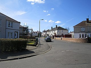
Knightswood is a suburban district in Glasgow, containing three areas: Knightswood North or High Knightswood, Knightswood South or Low Knightswood, and Knightswood Park. It has a golf course and park, and good transport links with the rest of the city. Garscadden and Scotstounhill railway stations serve Low Knightswood while Westerton station serves High Knightswood. Knightswood is directly adjoined by the Anniesland, Blairdardie, Drumchapel, Garscadden, Jordanhill, Netherton, Scotstoun, Scotstounhill and Yoker areas of Glasgow, and by Bearsden in the north.

Townhead is an area of the city of Glasgow, Scotland. It is situated immediately north-east of Glasgow city centre and contains a residential sector, a commercial/industrial sector and the campus of the University of Strathclyde.

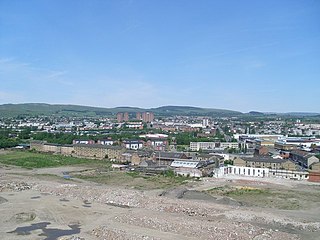
Wishaw is a large town in North Lanarkshire, Scotland, on the edge of the Clyde Valley, 15 miles (24 km) south-east of Glasgow city centre. The Burgh of Wishaw was formed in 1855 within Lanarkshire. it formed a joint large burgh with its neighbour Motherwell from 1920 until its dissolution when Scottish local authorities were restructured in 1975, and was then in Motherwell district within the Strathclyde region until 1996. The town is part of the Motherwell and Wishaw constituency. It has the postal code of ML2 and the dialling code 01698.

Anderston is an area of Glasgow, Scotland. It is on the north bank of the River Clyde and forms the south western edge of the city centre. Established as a village of handloom weavers in the early 18th century, Anderston was an independent burgh of barony from 1824 until it was incorporated into the City of Glasgow in 1846.

Netherton is an area of the Metropolitan Borough of Sefton, in Merseyside, England.
Carmyle is a suburb in the east end of Glasgow, Scotland, directly north of the River Clyde. It is in an isolated location separated from the main urban area of the city and has the characteristics of a semi-rural village. Administratively, Carmyle falls under the Shettleston ward of Glasgow City Council.

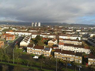
Drumchapel, known locally as 'The Drum', is a district in the north-west of the city of Glasgow, Scotland. It borders Bearsden to the north-east and Drumry to the south-west, as well as Blairdardie, Garscadden, Knightswood and Yoker in Glasgow to the south; land to the north is undeveloped and includes the course of the Roman-era Antonine Wall. The name derives from the Gaelic meaning 'the ridge of the horse'.

Temple is a neighbourhood of Glasgow located in the north of the city, bounded by Anniesland to the south, Knightswood to the west and Kelvindale to the east; Netherton lies to the north. Temple appears in Joan Blaeu's 1662 Atlas of Scotland and many subsequent maps.
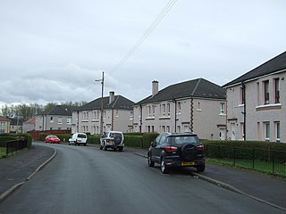
Blairdardie is a neighbourhood in the Scottish city of Glasgow. It is situated north of the River Clyde in the north-west of the city and is surrounded by other residential areas: High Knightswood, Knightswood, Old Drumchapel, Drumchapel and Garscadden. It was built between the 1950s and early 1960s.
Carntyne is a suburban district in the Scottish city of Glasgow. It is situated north of the River Clyde, and in the east end of the city. Since 2007 it has formed the core of the East Centre ward under Glasgow City Council, which also includes the neighbouring Riddrie and Cranhill areas.

Dennistoun is a mostly residential district in Glasgow, Scotland, located north of the River Clyde and in the city's east end, about 1+1⁄4 miles east of the city centre. Since 2017 it has formed the core of a Dennistoun ward under Glasgow City Council, having previously been a component of the East Centre ward.

South Nitshill is a neighbourhood in the Scottish city of Glasgow. It is situated south of the River Clyde, in the south-west of the conurbation and within the Greater Pollok ward of the local authority area. All streets in the area have names beginning with 'W'.
New Kilpatrick, is an ecclesiastical Parish and former Civil Parish in Dunbartonshire. It was formed in 1649 from the eastern half of the parish of Kilpatrick, the western half forming Old Kilpatrick. New Kilpatrick is also a disused name for the town of Bearsden.

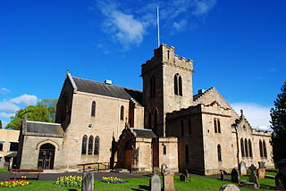
Knightswood St. Margaret's Parish Church is a parish church of the Church of Scotland, serving part of the Knightswood area of Glasgow, Scotland.
Househillwood is a residential neighbourhood of Glasgow, Scotland, situated in the south-west of the city.


