Crossmyloof

Last updated

Crossmyloof
Door stoop, Corona Bar, Crossmyloof 01.jpg
Cross in palm of hand, Corona Bar
Glasgow UK location map.svg
Red pog.svg
Crossmyloof
Location within the Glasgow City council area
Scotland location map.svg
Red pog.svg
Crossmyloof
Location within Scotland
OS grid reference NS568626
Council area
Lieutenancy area
  • Glasgow
Country Scotland
Sovereign state United Kingdom
Post town GLASGOW
Postcode district G41
Dialling code 0141
Police Scotland
Fire Scottish
Ambulance Scottish
UK Parliament
Scottish Parliament
List of places
UK
Scotland
55°50′07″N4°17′17″W / 55.835313°N 4.288071°W / 55.835313; -4.288071
The Corona Bar stands at the location of the original village, on the junction between Langside Avenue and Pollokshaws Road. Corona Bar, Crossmyloof.jpg
The Corona Bar stands at the location of the original village, on the junction between Langside Avenue and Pollokshaws Road.
The doorways of the Corona Bar have images of a cross on the palm of a hand, supposedly the origin of the name of the village Entrance door head, Corona Bar, Crossmyloof.jpg
The doorways of the Corona Bar have images of a cross on the palm of a hand, supposedly the origin of the name of the village

Crossmyloof ( /ˌkrɒsməˈlf/ , Scottish Gaelic : Crois Mo Liubha, Scots : Crossmaluif) is an area on the south side of Glasgow situated between the districts of Pollokshields, Strathbungo and Shawlands in Scotland.

Contents

Etymology

The name is possibly derived from Gaelic Crois Mo Liubha, Saint (Ma)lieu's Cross. [1]

According to local belief, the name is reputed to be derived from its location on the route taken by Mary, Queen of Scots to the site of the Battle of Langside. [2] A fortune-teller may have offered to tell the queen her fate if she would "cross her loof (palm) with silver". [3]

History

The original village of Crossmyloof was situated in the north-western corner of Cathcart parish and was formed around the junction of what are now Pollokshaws Road and Langside Avenue (the road to Cathcart). Crossmyloof was a small hamlet which suddenly grew in prominence when Neale Thomson opened a large bakery there in 1847. Some remnants of this industrial past still endure. A bakery building behind the tenement known as Camphill Gate on Pollokshaws Road still stands, and there is still a road named Baker Street, where once stood the Alexander "Greek" Thomson-designed workers' cottages.

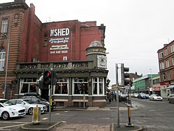
The main street in Crossmyloof was Cathcart Place, which is now part of Pollokshaws Road between the Langside Avenue/Minard Road junction and Shawlands Cross at the junction with Kilmarnock Road and Moss-side Road. A pub has occupied the Langside Avenue corner from the early 19th century: the Corona Bar, built there in 1912, carries a claim to have been established in 1817. [4]

Crossmyloof was little more than the main street until the late Victorian era, when Minard Road was opened up and the area around Waverley Gardens was built. For twenty years the tenements in Norham Street and Frankfort Street looked out on open countryside, dotted with ancient cottages, separating them from the Waverley Park area of Shawlands until the Waverley Scheme was constructed by the Glasgow Corporation on the land opened up when Moss-side Road was formed to build Shawlands Academy.

In 1818 Crossmyloof was described as the most populous village in Cathcart parish. Although till recently "remarkable chiefly for being a resort of vagrants", the writer was happy to report that the village had now become more respectable from an increase in the number of its inhabitants, who now amounted to around 500. The remarks were a little premature, because in November 1820 two members of a band of armed ruffians who robbed a house in Crossmyloof were hanged in front of the Jail in the Saltmarket. The attack took place at the home of Dr Robert Watt, the author of the four volume Bibliotheca Britannica, who had died, allegedly of overwork, the previous year. His terrified widow had a pistol held at her head and her gold rings wrenched off her fingers. She is reported as having hastily left Crossmyloof for the safety of a home in Hutchesontown. When the Rev James Smith wrote his account of Cathcart parish in 1840, he used the name Westfield for the village and gave the number of families as 124 and the total population as 587 persons. At this period the villagers were mostly cotton handloom weavers. The only remaining woollen weaver was William AIgie, assisted by his seven children, three of whom wove woollen cloth, and four of whom worked in cotton. Two elderly women, Mary Sinclair, a muslin flowerer, and Margaret Wotherspoon, a muslin tambourer, were probably the last of the skilled embroideresses in the village. There were also a few shopkeepers, a blacksmith, several brassfounders and tinsmiths and William Ferguson, a lithographic engraver.

By 1851 the population had risen sharply to 939 persons. The rise was accounted for by the establishment of the Crossmyloof Bakery in 1847 by Neale Thomson of Camphill. The following year James Muirhead moved his Cart Forge from its original site in the Skin Mill Yard at Pollokshaws to larger premises at Crossmyloof, where he produced axles for railway wagons. The Cart Forge was situated between Baker Street, where Thomson's workforce was housed, and the Pollokshaws Road.

Although most of the villagers lived along the Pollokshaws Road there was another small community in the area between Titwood Road and Moss-side Road. This area was known as Langside Valley and contained a few villas and cottages and several orchards and nurseries. This was where Glaswegians came in the Summer to enjoy fresh air and healthy surroundings. An advertisement in the Glasgow Courier of 25 February 1802 offers two "neat" lodgings at the village of Westfield for renting as summer quarters for "genteel families" from the city, who would find the houses well adapted for their use with the convenience of good water and a "neat" plot of ground. The villa owners included James Smellie, a retired cooper who occupied the house called Langside Valley, and William Jaffrey, an accountant and notary public and owner of Campvale House. Springhill House was the residence of Henry Murphy, a pawnbroker and hat manufacturer in the Bridgegate. The house later became Springhill Academy with William Cairns and William Christie as joint headmasters. Archibald McAuslan was the local surgeon and physician, and the community included a group of customs officers with the titles of outdoor officer, running officer, clerk, weigher and locker.

When Hugh MacDonald passed through Crossmyloof on one of his Rambles in 1851, he found that the weavers of Crossmyloof and Strathbungo, like their neighbours on the hill above at Langside, were "celebrated growers of tulips, pansies, dahlias and other floricultural favourites" and met regularly at their florist clubs to examine choice flowers and discuss the best means of rearing them to perfection. Of these "bloom worshippers", MacDonald writes:

There are some sharp-sighted people who are said to see further into a millstone than their neighbours. For the truth of the saying we shall not venture to vouch; but most assuredly, for seeing into the mysteries of a tulip or a dahlia, we shall back a Crossmyloof or Strabungo weaver against the united amateurs of Scotland.

In his report on the parish, the minister also explained that a "large and excellent school" under the patronage of Neale Thomson of Camphill, served the inhabitants of Crossmyloof and district, although it stood just across the boundary within Eastwood parish. The parish boundary was formed here by the Waterland stream, and its course can be traced between the ruinous remains of two old walls behind the school building on the north side of Skirving Street, now used as shops. Mr Smith describes how a number of years before, when there was no teacher for two years, the inhabitants, mostly weavers, formed themselves into an educational society to be managed by twelve directors under the presidency of the minister, and some of the "more intelligent" of the villagers undertook the task of teachers: a room was hired for the purpose, and a school opened from 8 to 10 o'clock at night, in which the teachers, two by two, in monthly turn, gave gratuitous instruction to whatever children were committed to their charge. The duty of the directors was principally to visit the school, and to wait upon careless parents to urge upon them the propriety of securing to their children the advantages which it offered. In 1877 the Cathcart School Board built Crossmyloof Public School in Stevenson (now Deanston) Drive. This school building has since been converted into flats.

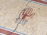
The first church to be erected in Crossmyloof was Langside Road Church (later Langside Avenue). This was built in 1859 for a United Presbyterian congregation which had been formed two years previously. The site at the corner of Baker Street and Langside Avenue was gifted by Neale Thomson. A new church was built on the same site in 1896. The congregation united with that of Shawlands Old in 1963 and the Langside Avenue buildings became St Helen's Catholic Church.

The Langside Halls stand nearby, on the edge of Queen's Park. This building was originally the Bank of Glasgow, designed by John Gibson, when it stood in Queen Street in the centre of the city. In 1902-03 the building was relocated to its present site and converted to serve as public halls. [5] [6]

Pollokshaws Road and Minard Road provided the shopping area for Crossmyloof, Shawlands and Langside – mainly in small shop units until the construction of the area's first supermarket by the Co-operative during the 1960s.

Facilities

Crossmyloof railway station Crois MoLiubha.jpg
Crossmyloof railway station

Crossmyloof is served by a railway station on the Glasgow South Western Line, offering regular services to Glasgow Central. For many years, the most visible evidence of the area's name was the signage for Crossmyloof Ice Rink adjacent to the railway line, but that was replaced by a supermarket during the 1980s, which remains open today run by Morrisons. It was the first indoor ice rink in Scotland. [2]

As well as the Langside Halls, the ice rink, the churches and the pubs on Pollokshaws Road, the area's main social amenity was the Waverley Cinema from 1922 [7] until the early 1970s when the decline in film-going led to its conversion first into a bingo hall and then to TUSK nightclub and the Waverley Tearooms.

Related Research Articles

<span class="mw-page-title-main">Glasgow City Council</span> Scottish unitary authority council in Glasgow, Scotland

Glasgow City Council is the local government authority for Glasgow City council area, Scotland. In its modern form it was created in 1996. Glasgow was formerly governed by a corporation, also known as the town council, from the granting of its first burgh charter in the 1170s until 1975. From 1975 until 1996 the city was governed by City of Glasgow District Council, a lower-tier authority within the Strathclyde region.

<span class="mw-page-title-main">Pollokshaws</span> Human settlement in Scotland

Pollokshaws is an area on the South side of the city of Glasgow, Scotland. It is bordered by the residential neighbourhoods of Auldhouse to the east, Eastwood and Hillpark to the south and Shawlands to the north, with the Glasgow South Western Line railway and the open lands of Pollok Country Park to the west. The White Cart Water flows through the area.

<span class="mw-page-title-main">Pollokshields</span> Human settlement in Scotland

Pollokshields is an area in the Southside of Glasgow, Scotland. Its modern boundaries are largely man-made, being formed by the M77 motorway to the west and northwest with the open land of Pollok Country Park and the Dumbreck neighbourhood beyond, by the Inverclyde Line railway and other branches which separate its territory from the largely industrial areas of Kinning Park, Kingston and Port Eglinton, and by the Glasgow South Western Line running from the east to south, bordering Govanhill, Strathbungo, Crossmyloof and Shawlands residential areas. There is also a suburban railway running through the area.

<span class="mw-page-title-main">Shawlands</span> Human settlement in Scotland

Shawlands is a Southside suburb of Glasgow, Scotland, located two miles south of the River Clyde. The area, considered the "Heart of the Southside", is known for its independent restaurants and cafés, art scene, public parks, period terraces, and red and blond sandstone tenements. Shawlands was named one of the best places to live in Scotland in 2022 and 2023 by The Sunday Times, and one of the world's coolest neighbourhoods by Time Out Magazine with judges describing it as "the city's best area to live and socialise”. It is located between Pollok Country Park – the home of the Burrell Collection and Pollok House – and the acclaimed Victorian park Queen's Park.

<span class="mw-page-title-main">Strathbungo</span> Human settlement in Scotland

Strathbungo is a mainly residential area of southern Glasgow, Scotland, bordered by the neighbourhoods of Crossmyloof to the south, Govanhill to the east and Pollokshields to the north and west. The settlement grew up as a small isolated village built along the Pollokshaws Road, one of the main arteries leading southwards from the centre of Glasgow, adjoined by the Camphill Estate, now part of Queens Park. Strathbungo lay just inside Govan parish, on its boundary with Cathcart parish, and at one time a line just north of Allison Street and Nithsdale Street formed the boundary or 'march' between the counties of Lanark and Renfrew.

<span class="mw-page-title-main">Queen's Park, Glasgow</span>

Queen's Park is a park situated on the south side of the city of Glasgow, Scotland, between Strathbungo, Shawlands, Battlefield, Mount Florida, and Crosshill The 60-hectare (148-acre) park lies about 2+12 miles (4 km) south of the city centre, and gives its name to a nearby railway station and several other local businesses and institutions, including the football team Queen's Park F.C.

<span class="mw-page-title-main">Glasgow South (UK Parliament constituency)</span> Parliamentary constituency in the United Kingdom, 2005 onwards

Glasgow South is a burgh constituency of the House of Commons of the Parliament of the United Kingdom (Westminster). It elects one Member of Parliament (MP) by the first past the post system of election.

Glasgow Pollok was a burgh constituency represented in the House of Commons of the Parliament of the United Kingdom from 1918 until 2005, when it was replaced by Glasgow South West. It elected one Member of Parliament (MP) using the first-past-the-post voting system.

<span class="mw-page-title-main">Crosshill, Glasgow</span> Human settlement in Scotland

Crosshill is an area of Glasgow, Scotland. It is situated south of the River Clyde. It was an independent police burgh from 1871 to 1891 before being annexed by the City of Glasgow.

<span class="mw-page-title-main">Newlands, Glasgow</span> Human settlement in Scotland

Newlands is an affluent suburb in the south side of Glasgow, Scotland. The area is mainly residential in character. Shawlands and Langside lie to the north of the district, Pollokshaws and Auldhouse to the west, Giffnock to the south, and Merrylee and Cathcart to the east.

<span class="mw-page-title-main">Langside</span> Human settlement in Scotland

Langside is a district in the Scottish city of Glasgow. It is situated south of the River Clyde, and lies east of Shawlands, south of Queens Park, west of Cathcart and north of Newlands. The district is residential and primarily middle-class, and has become an increasingly fashionable address in recent years. Housing stock is mainly of the Victorian tenement type, along with some townhouses of the same period.

<span class="mw-page-title-main">Crossmyloof railway station</span> Railway station in Glasgow, Scotland

Crossmyloof railway station is a railway station serving the areas of Crossmyloof and Shawlands in Glasgow, Scotland, located 1 mile 60 chains (2.8 km) from Glasgow Central. The station is managed by ScotRail and is served by trains on the Glasgow South Western Line.

Shawlands Academy is a state secondary school in the Shawlands area of Glasgow, Scotland.

The Cathcart District Railway was proposed to serve the arising demand for suburban residential travel on the south side of Glasgow, Scotland. It was planned as a loop running to and from Glasgow Central station, but at first only the eastern arm, to Cathcart via Queens Park, was built, opening in 1886. The western arm was opened in 1894 and trains operated round the loop. A frequent passenger train service was operated, and there was also a limited goods and mineral operation.

St Andrew's Cross, also known as Eglinton Toll, is a road junction in the south side of the city of Glasgow, Scotland. First constructed during the early 1800s, the junction formerly held several buildings including a power station and cinema, but have been removed for a variety of reasons. Since 1946 when the junction underwent a realignment, the two roads no longer intersect.

<span class="mw-page-title-main">Newlands/Auldburn (ward)</span> Human settlement in Scotland

Newlands/Auldburn is one of the 23 wards of Glasgow City Council. Situated south of the city and the River Clyde, it is represented by 3 members as of May 2022, one each from the Scottish National Party, Scottish Labour, and Scottish Green Party.

<span class="mw-page-title-main">Queen's Park Govanhill Parish Church</span> Church in Glasgow, Scotland

Queen's Park Govanhill Parish Church is a 19th-century Parish church of the Church of Scotland located in the south side of Glasgow, near Queen's Park, from which the church's name derives.

<span class="mw-page-title-main">Camphill Queen's Park Baptist Church</span> Church in Glasgow, Scotland

Camphill Queen's Park Baptist Church is a 19th-century church building in the south-side of Glasgow, immediately opposite Queen's Park.

Eastwood is a civil parish which straddles Glasgow and East Renfrewshire in Scotland. The parish has had no administrative functions since 1930, but is still used for some statistical purposes.

References

  1. Mac an Tàilleir, Iain (2003) Placenames. (pdf) Pàrlamaid na h-Alba. Retrieved 25 June 2008.
  2. 1 2 "Crossmyloof - what's in a name?". Glasgow Times. Retrieved 24 August 2021.
  3. "Crossmyloof - what's in a name?". Evening Times. Retrieved 15 January 2016.
  4. Blaikie, Gerald (2018). "Strathbungo and Crossmyloof : Origins and History". Scotcities.com. Archived from the original on 25 September 2019. Retrieved 27 February 2018.
  5. "Sculpture Scheme". National Recording Project. Public Monuments and Sculpture Association. Archived from the original on 13 September 2016. Retrieved 4 September 2016.
  6. Object 16: Decorative glass, 1865 Archived 19 September 2015 at the Wayback Machine at Royal Bank of Scotland Heritage Hub
  7. "DSA Building/Design Report: Waverley Cinema". Dictionary of Scottish Architects. Retrieved 4 September 2016.