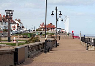
Hornsea is a seaside town and civil parish in the East Riding of Yorkshire, England. The settlement dates to at least the early medieval period. The town was expanded in the Victorian era with the coming of the Hull and Hornsea Railway in 1864. In the First World War the Mere was briefly the site of RNAS Hornsea, a seaplane base. During the Second World War the town and beach was heavily fortified against invasion.

Leven is a village and civil parish in the East Riding of Yorkshire, England. It is situated approximately 7 miles (11 km) west of Hornsea town centre, and north-west of the A165 road.

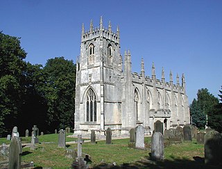
Burton Agnes is a village and civil parish in the East Riding of Yorkshire, England. It is situated on the A614 road midway between Driffield and Bridlington.
Skirlaugh is a village and civil parish in the East Riding of Yorkshire, England, in an area known as Holderness. It is situated approximately 7 miles (11 km) north-east of Hull city centre on the A165 road. Originally a farming community, it is now primarily a commuter village for Hull.

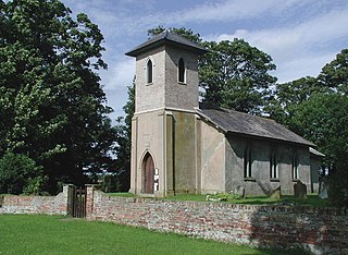
Burton Constable is a village and civil parish in the East Riding of Yorkshire, England. It is located approximately 9 miles (14 km) north-east of Hull city centre and 3 miles (5 km) south-east of the village of Skirlaugh.

Brandesburton is a village and civil parish in the East Riding of Yorkshire, England. It is situated approximately 7 miles (11 km) west of Hornsea and 9 miles (14 km) north-east of the market town of Beverley.
Sigglesthorne is a small village and civil parish in the East Riding of Yorkshire, England. It is situated approximately 3 miles (4.8 km) west of Hornsea on the A1035 road where it meets the B1243 road.

Withernwick is a village and civil parish in the East Riding of Yorkshire, England. It is situated approximately 10 miles (16 km) north-east of Hull city centre and 5 miles (8 km) south of Hornsea.

Ulrome is a village and civil parish in the East Riding of Yorkshire, England. It is situated approximately 6 miles (9.7 km) north of the town of Hornsea and on the east side of the B1242 road. The parish includes the village of Lissett. Its area is 1,139.535 hectares, in 2011 had a population of 239, a reduction on the 2001 UK census figure of 260.
Swine is a village and civil parish in the East Riding of Yorkshire, England. It is situated approximately 5 miles (8 km) north-east of Hull city centre and 2 miles (3.2 km) south of Skirlaugh to the west of the A165 road.
Seaton is a village and civil parish in the East Riding of Yorkshire, England. It is situated approximately 2.5 miles (4 km) west of Hornsea on the A1035 road.
Rise is a village and civil parish in Holderness, the East Riding of Yorkshire, England. It is situated approximately 7 miles (11 km) east of the town of Beverley and 5 miles (8 km) south-west of Hornsea. It lies to the east of the B1243 road.
Nunkeeling is a hamlet in the East Riding of Yorkshire, England. It is situated approximately 4 miles (6.4 km) north-west of the town of Hornsea and 3 miles (5 km) south of Beeford.
Marton is a hamlet in the East Riding of Yorkshire, England, and in an area known as Holderness. It is situated approximately 8 miles (13 km) north-east of Hull city centre and 2 miles (3.2 km) east of the village of Skirlaugh and the A165 road.
Lowthorpe is a village in the East Riding of Yorkshire, England. It is situated approximately 3 miles (5 km) north-east of Driffield town centre and 7 miles (11 km) south-west of Bridlington town centre.
Goxhill is a small hamlet in the East Riding of Yorkshire, England in an area known as Holderness. It is situated approximately 2 miles (3.2 km) south-west of Hornsea town centre.

The Hull and Hornsea Railway was a branch line in the East Riding of Yorkshire, England, which connected the city of Kingston upon Hull with the east coast seaside holiday resort of Hornsea.

Hornsea Town railway station was the terminus of the Hull and Hornsea Railway, and served the seaside town of Hornsea in the East Riding of Yorkshire, England.

Wassand railway station was a station on the Hull and Hornsea Railway, and served the villages of Wassand and Goxhill in the East Riding of Yorkshire, England.
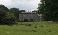
Wassand Hall is a large Regency house situated to the west of Hornsea, East Riding of Yorkshire, England, overlooking Hornsea Mere, which is part of its estate. The hall was designated a Grade II* listed building in March 1952 and is now recorded in the National Heritage List for England, maintained by Historic England. The Hall contains a collection of 18th and 19th Century paintings, English and Continental Silver, furniture, and a collection of porcelain.

