| Old Park | |
|---|---|
Location within Cornwall | |
| OS grid reference | SX240651 |
| Civil parish | |
| Unitary authority | |
| Ceremonial county | |
| Region | |
| Country | England |
| Sovereign state | United Kingdom |
Old Park is a hamlet in the parish of Liskeard, Cornwall, England, UK. [1] [2]

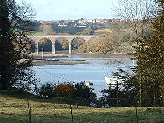
The River Lynher flows through east Cornwall, England, and enters the River Tamar at the Hamoaze, which in turn flows into Plymouth Sound.

Coombe is a hamlet in northeast Cornwall, England, United Kingdom.

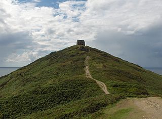
Rame Head or Ram Head is a coastal headland, southwest of the village of Rame in southeast Cornwall, United Kingdom. It is part of the larger Rame Peninsula.

North Petherwin is a civil parish and village in east Cornwall, England, United Kingdom. The village is situated five miles (8 km) northwest of Launceston on a ridge above the River Ottery valley.

Perranzabuloe is a coastal civil parish and a hamlet in Cornwall, England, United Kingdom. Perranzabuloe parish is bordered to the west by the Atlantic coast and St Agnes parish, to the north by Cubert parish, to the east by St Newlyn East and St Allen parishes and to the south by Kenwyn parish. The hamlet is situated just over a mile (2 km) south of the principal settlement of the parish, Perranporth; the hamlet is also seven miles (11 km) south-southwest of Newquay. Other settlements in the parish include Perrancoombe, Goonhavern, Mount and Callestick. The parish population was 5,382 in the 2001 census, increasing to 5,486 at the 2011 census.

Portwrinkle is a small coastal village in south-east Cornwall, England, United Kingdom. It is at the western end of Whitsand Bay five miles (8 km) south-west of Saltash.

Kennford is a village situated in the Teignbridge district of Devon, England. Kennford is four miles (6 km) to the south of Exeter in the civil parish of Kenn; it is situated in one of the country's main tourist areas.

The River Allen in north Cornwall is one of two rivers of the same name in Cornwall which share this name. In this case the name is the result of a mistake made in 1888 by Ordnance Survey, replacing the name Layne with Allen which is the old name for the lower reaches of the Camel. The other River Allen runs through Truro.

Luckett is a hamlet in east Cornwall, England. It is situated in a former mining area beside the River Tamar approximately three miles (5 km) north of Callington. According to the Post Office the population at the 2011 census was included in the civil parish of Stokeclimsland

Colliford Lake is a reservoir on Bodmin Moor, Cornwall, England, United Kingdom. Covering more than 900 acres (3.6 km2), it is the largest lake in Cornwall. It is situated south of the A30 trunk road near the village of Bolventor, the approximate centre of the lake being at OS grid reference SX179730. Dozmary Pool outfalls into the lake and the lake's own outfall forms one of the tributaries of the River Fowey.

Chyanvounder is a hamlet in the parish of Gunwalloe, Cornwall, England. Chyanvounder is situated 3.4 miles (5.5 km) south of Helston on the Lizard Peninsula.

Degibna is a hamlet in the parish of Helston, Cornwall, England, UK. It lies on the eastern bank of the largest natural freshwater lake in Cornwall, The Loe, and forms part of the Penrose Estate.

Edgcumbe is a hamlet 3 miles (4.8 km) east of Penryn in Cornwall, England. Edgcumbe is situated on the A394 road from Helston to Penryn and is in the parish of Wendron. Adjacent to Edgcumbe is the Little Trevease Solar Park which covers 25 acres and has been operational since 2013; it is capable of generating 2.4MW of electricity.

Gummow's Shop is a hamlet in the civil parish of St Newlyn East in mid Cornwall, England, UK. It is on the A3058 road southeast of Kestle Mill. Before 1938, there was a blacksmith in the building now known as "The Old Smithy". It is in the civil parish of Cubert

Gwenter is a hamlet in the parish of St Keverne, Cornwall, England.

Old Cardinham Castle is a hamlet in Cornwall, England, UK. It is in the parish of Cardinham very close to the site of the Norman Cardinham Castle, caput of the feudal barony of Cardinham.
Old Mill is a hamlet in the civil parish of Stokeclimsland, Cornwall, England.

Lockengate is a hamlet in Cornwall, England, UK. It is two miles south of Lanivet on the A391 road. It is in the civil parish of Luxulyan
Pengegon is a residential area east of Camborne, Cornwall, England, which has a fish and chip shop, a newsagent, a children's play park and a basketball/football court.

The River Seaton is a river in east Cornwall, England, UK which flows southwards for 11 miles (17 km) into the English Channel.
| This Cornwall location article is a stub. You can help Wikipedia by expanding it. |