Hunton Bridge

Last updated

Hunton Bridge
Hertfordshire UK location map.svg
Red pog.svg
Hunton Bridge
Location within Hertfordshire
Population327 (1991 Census) [1]
OS grid reference TL067030
District
Shire county
Region
Country England
Sovereign state United Kingdom
Post town KINGS LANGLEY
Postcode district WD4
Dialling code 01923
Police Hertfordshire
Fire Hertfordshire
Ambulance East of England
UK Parliament
List of places
UK
England
Hertfordshire
51°41′37″N0°26′04″W / 51.693714°N 0.434516°W / 51.693714; -0.434516
Ordnance survey map from 1898 OrdnanceServey1898.jpg
Ordnance survey map from 1898

Hunton Bridge is a small settlement near Abbots Langley, Hertfordshire, England, with a historic royal connection. Its population in the 1991 Census was 327. [1] It is in the Three Rivers population of Langleybury.

Contents

Hunton Bridge enjoyed its greatest prosperity during 1810–26, when the Sparrows Herne turnpike ran through the village. Prior to that date the turnpike had run along Gypsy Lane and Upper Highway. In 1810 it was rerouted along Old Mill Lane to the village, and up the hill to reconnect with Upper Highway. By 1826 the presence of the canal and the works associated with it had dried out the bottom land sufficiently for the turnpike to be rerouted along what is now the A41 avoiding the climb up Hunton Bridge Hill.

Today the village is situated between the M25 London orbital motorway and a spur of the motorway leading to Watford. The A41 trunk road runs just west of the village. The Hunton Bridge filling station just off the Watford spur (Junction 19 of the M25) is a local landmark.

History

St Paul's Church

St Paul's Church is a Grade II* listed building, dating from 1863 to 1865. It was designed by Henry Woodyer for William Jones Loyd of Langleybury House. [2] The Old Vicarage alongside, now a private home, dates from 1879.

Public houses

Hunton Bridge currently has two public houses. It used to have five, having lost the Maltsters Arms in 1963, the Farriers Arms in 1965, and The Dog and Partridge in August 2017. [3]

The remaining pubs are :

1 Bridge Road

The land adjacent to the Grand Union Canal and to the north of Bridge Road was in industrial use from the opening of the canal. A coal wharf known as Hunton Bridge Wharf was established approximately 100 years after the opening, consisting of a tramway, warehouse and managers dwelling. Of these buildings only the cottage remains at 1 Bridge Road.

The Old School House

The original house was demolished and replaced with the current fine brick early Georgian building which was built in the late 1720s. Subsequent changes were made during the 1800s such as the addition of the library joining the main house to the servant wing.

The schoolhouse was used for Church of England services until the building of St Paul's church across the road in Langleybury. [4]

Hunton Canal Bridge

The original structure was demolished in 1923 and replaced with an ornate reinforced concrete skew arch. The structure includes an ornate cornice to the parapet and balustrades. The existing western edge beam was demolished in 1983 due to a vehicular impact with a new aluminium parapet. The structure was Grade II listed in 1985. [5]

Planning history

On 28 June 1984, Three Rivers District Council Planning Committee resolved that an area of Hunton Bridge, should be designated as a Conservation Area, and subsequently extended in 1990 in terms of the Planning (Listed Building and Conservation Areas) Act 1990.

Listed buildings within the boundary include

Grade II* Listed

Grade II Listed

Locally Important Buildings

See also


Related Research Articles

<span class="mw-page-title-main">A41 road</span> Road in England

The A41 is a trunk road between London and Birkenhead, England. Now in parts replaced by motorways, it passes through or near Watford, Kings Langley, Hemel Hempstead, Aylesbury, Bicester, Solihull, Birmingham, West Bromwich, Wolverhampton, Newport, Whitchurch, Chester and Ellesmere Port.

<span class="mw-page-title-main">Apsley, Hertfordshire</span> Human settlement in England

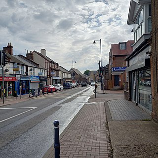
Apsley is a village in Hertfordshire, England, in a valley of the Chiltern Hills below the confluence of the River Gade and Bulbourne. It was the site of water mills serving local agriculture and from the early 19th century became an important centre for papermaking. Today it is a suburb of Hemel Hempstead.

<span class="mw-page-title-main">Watford</span> Town and borough in Hertfordshire, England

Watford is a town and borough in Hertfordshire, England, 15 mi (24 km) north-west of Central London, on the banks of the River Colne.

<span class="mw-page-title-main">Tring</span> Market town in Hertfordshire, England

Tring is a market town and civil parish in the Borough of Dacorum, Hertfordshire, England. It is situated in a gap passing through the Chiltern Hills, classed as an Area of Outstanding Natural Beauty, 30 miles (50 km) from Central London.

<span class="mw-page-title-main">Kings Langley</span> Village and civil parish in Hertfordshire, England

Kings Langley is a village, former manor and civil parish in Hertfordshire, England, 21 miles north-west of Westminster in the historic centre of London and to the south of the Chiltern Hills. It now forms part of the London commuter belt. The village is divided between two local government districts by the River Gade with the larger western portion in the Borough of Dacorum and smaller part, to the east of the river, in Three Rivers District. It was the location of Kings Langley Palace and the associated King's Langley Priory, of which few traces survive.

<span class="mw-page-title-main">Nash Mills</span> Human settlement in England

Nash Mills is a civil parish within Hemel Hempstead and Dacorum Borough Council on the northern side of the Grand Union Canal, formerly the River Gade, and in the southernmost corner of Hemel Hempstead. There is evidence of a mill in this location since the 11th century and the row of 16th century mill cottages still remain. John Dickinson established a number of papermaking mills in the area in the 19th century.

<span class="mw-page-title-main">South West Hertfordshire (UK Parliament constituency)</span> Parliamentary constituency in the United Kingdom, 1950 onwards

South West Hertfordshire is a constituency in the House of Commons of the UK Parliament, represented since 2019 by Gagan Mohindra, a Conservative.

<span class="mw-page-title-main">Abbots Langley</span> Human settlement in England

Abbots Langley is a large village and civil parish in the English county of Hertfordshire. It is an old settlement and is mentioned in the Domesday Book. Economically the village is closely linked to Watford and was formerly part of the Watford Rural District. Since 1974 it has been included in the Three Rivers district.

<span class="mw-page-title-main">Maple Cross</span> Human settlement in England

Maple Cross is a village in Hertfordshire, England, which up until the Second World War consisted of an inn, a blacksmith's shop and a few cottages. Today there are around 800 postwar council houses. Some of these have been sold into private ownership. The area is close by junction 17 of the M25 motorway, which makes up the western boundary of the village. It lies on the western fringe of Rickmansworth, about 5 miles (8.0 km) west of Watford and 6 miles north of Uxbridge.

<span class="mw-page-title-main">Langleybury</span> Country house in Hertfordshire, England

Langleybury is a country house and estate in Abbots Langley, Hertfordshire, England, about 3 miles (5 km) northwest of the centre of the town of Watford. The house stands on a low hill above the valley of the River Gade.

<span class="mw-page-title-main">A412 road</span> Road in England

The A412 is a road in England between Slough and Watford. It was the main artery for this corridor and used to continue to St Albans prior to the construction of the M25. It provides interchange to the A4 in Slough, the A40/M40 at the Denham Roundabout, the M25 in Maple Cross, the A404 in Rickmansworth town centre, the A411 on a partially grade separated dual carriageway in Watford town centre, and the A41 in North Watford.

<span class="mw-page-title-main">North Watford</span> Human settlement in England

North Watford is an area in the town of Watford, Hertfordshire, in the United Kingdom. It is now primarily a residential area which developed as a result of expansion from the town during the 19th century.

Bedmond and Primrose Hill is a ward in Three Rivers, in England, the United Kingdom. It is located in south-west Hertfordshire, in the East of England region. The ward includes Bedmond and a sparsely populated area to the north. It lies north of the M25 motorway, which separates the ward from Abbots Langley, and is bordered by Kings Langley to the west, and Hemel Hempstead to the north. Slightly to the east of the ward is the M1 motorway.

This page provides brief details of primary schools in the borough of Three Rivers in Hertfordshire, England, United Kingdom.

<span class="mw-page-title-main">The Grove, Watford</span> English country house in Watford, United Kingdom

The Grove is a large hotel in Hertfordshire, England, with a 300–acre (1.2 km2) private park next to the River Gade and the Grand Union Canal. It touches on its north-west corner the M25 motorway and remains a small part in Watford. The estate is situated within three different settlements; most of the land and all of the mansion itself are in the civil parish of Sarratt, and also in the ecclesiastical parish of Langleybury, while the estate lies within the post town of Rickmansworth.

<span class="mw-page-title-main">Kings Langley Palace</span> Palace in Hertfordshire, England

Kings Langley Palace was a 13th-century Royal Palace which was located to the west of the Hertfordshire village of Kings Langley in England. During the Middle Ages, the palace served as a residence of the Plantagenet kings of England. It fell into disuse sometime during the 16th century and became a ruin. Today, nothing remains of the building except for some archaeological remains. The site is a scheduled ancient monument.

<span class="mw-page-title-main">Hunton Park</span> Country house and estate in Hertfordshire, UK

Hunton Park is a large country house and estate in Abbots Langley, in south west Hertfordshire, in the United Kingdom. It was originally called Hazelwood House when first built in the early 19th century. The original house was destroyed in 1908 and completely rebuilt. It is now a hotel owned by the Khanna family.

Leavesden is a residential and commercial area in the northern part of Watford, England. It lies within the M25 Motorway. On its eastern side it is bounded by the M1 Motorway. Leavesden is split into two councils which are Watford Borough Council and Three Rivers District Council. Leavesden Green is an adjoining residential community which lies partly in Three Rivers and partly in the Borough of Watford.

<span class="mw-page-title-main">Abbots Langley railway bridge</span> Bridge in Abbots Langley, Hertfordshire

Abbots Langley railway bridge, also known as the bridge over Railway Terrace is a skew bridge carrying the West Coast Main Line over a road near Abbots Langley, Hertfordshire, in Eastern England. The angle of the bridge creates a 25-metre (82-foot) tunnel along the road. It was built in 1837 and is a Grade II listed building.

References

  1. 1 2 "Fact file: Hunton Bridge". Hertfordshire.com. Archived from the original on 11 July 2011. Retrieved 18 October 2007.
  2. "Church of St Paul A Grade II* Listed Building in Abbots Langley, Hertfordshire". British Listed Buildings.
  3. Hastie, Scott (1996). A Hertfordshire Valley. Kings Langley: Alpine Press. p. 96. ISBN   0-9528631-0-3.
  4. "Consecration of St Paul's Church, Langleybury" . Hertford Mercury and Reformer. 19 November 1864. Retrieved 15 August 2015 via British Newspaper Archive.
  5. "BRIDGE CARRYING WATFORD ROAD (A41) OVER THE GRAND CANAL, Abbots Langley - 1173257 | Historic England".

Commons-logo.svg Media related to Hunton Bridge at Wikimedia Commons