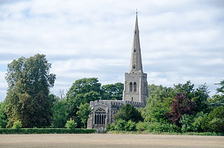
Bradwell is an ancient village and modern district in Milton Keynes, Buckinghamshire, England. It has also given its name to a modern civil parish that is part of the Borough of Milton Keynes. The village was adjacent to Bradwell Abbey, a Benedictine priory, founded in 1155 and dissolved in about 1540, but the abbey and its immediate environs were always a separate ecclesiastical parish.

Eaton Bray is a village and civil parish in Bedfordshire, England. It is situated about three miles south-west of the town of Dunstable and is part of a semi-rural area which extends into the parish of Edlesborough. In the 2011 United Kingdom census the population of the parish was recorded as 2,585.

Hodnet is a village and civil parish in Shropshire, England. The town of Market Drayton lies 5.7 miles (9.2 km) north-east of the village.
Curdworth is a village and civil parish in the North Warwickshire district of the county of Warwickshire in England. The population taken at the 2011 census was 1,115.

SalfordsSAL-fudz) is a village in the borough of Reigate and Banstead in Surrey, England. It lies approximately 3 miles (4.8 km) south of Redhill on the A23 London to Brighton road. The village is within the civil parish of Salfords and Sidlow which covers a population of 3,069, and has a parish council.

Swineshead is a village and civil parish in Lincolnshire, England, approximately 7 miles (11 km) west of the town of Boston. The population of the civil parish including Baythorpe was 2,810 at the 2011 census. The parish includes the areas of Swineshead Bridge and North End to the north, Fenhouses and Blackjack to the east, and Drayton to the south.

Eccleston is a village and civil parish of the Borough of Chorley in Lancashire, England. It is beside the River Yarrow, and was formerly an agricultural and later a weaving settlement.

Abbots Ripton is a village and civil parish in Cambridgeshire, England. Abbots Ripton is situated within Huntingdonshire which is a non-metropolitan district of Cambridgeshire as well as being an historic county of England. Abbots Ripton lies approximately 4 miles (6 km) north of Huntingdon on the B1090.

Clayton-le-Woods is a large village and civil parish of the Borough of Chorley, in Lancashire, England. According to the census of 2001, it has a population of 14,528. At the 2011 census the population of Cuerden civil parish was included within Clayton-le-Woods, giving a total of 14,532.

New Buckenham is a village and civil parish in the English county of Norfolk.

Basford is a hamlet and civil parish in the unitary authority of Cheshire East and the ceremonial county of Cheshire, England, lying immediately south of Crewe. Nearby villages include Shavington, Weston, Hough and Chorlton. The population was around 250 in 2011. Basford was first recorded in the Domesday survey and had a moated manor. The modern parish is bisected by the A500 and the Crewe-to-Stafford railway line, and includes Basford Hall Sorting Sidings.

Colmworth is a village and civil parish in the Borough of Bedford in the county of Bedfordshire, England about 6.5 miles (10 km) north-east of Bedford.

Brindley is a village and civil parish in Cheshire, England. The village lies 3¾ miles to the west of Nantwich. The parish also includes the settlements of Brindley Lea, Ryders Bank and part of Radmore Green, with a total population of about 150. Nearby villages include Barbridge, Burland, Haughton and Faddiley.

Minshull Vernon is a hamlet and civil parish in the unitary authority of Cheshire East and the ceremonial county of Cheshire, England. The hamlet lies 3 miles (5 km) to the north west of Crewe, south east of Winsford and south west of Middlewich. The parish also includes the small settlements of Bradfield Green, Eardswick, Hoolgrave, Minshull Hill, Walley's Green and Weaver Bank. The total population of the civil parish is somewhat over 200, measured at 391 in the Census 2011. Nearby villages include Church Minshull, Warmingham and Wimboldsley.

Thorpe in Balne is a village and civil parish in the Metropolitan Borough of Doncaster in South Yorkshire, England. It had a population of 176 at the 2001 census, increasing to 203 at the 2011 Census.

Hoo is a village and civil parish in the East Suffolk district of the English county of Suffolk. It is located 3 miles (4.8 km) north-west of the town of Wickham Market and 3 miles (4.8 km) south-west of Framlingham. The parish lies to the south of the River Deben - neighbouring villages include Kettleburgh, Charsfield and Letheringham. The parish council is combined with Cretingham and Monewden, with Hoo itself having one of the smallest populations in Suffolk with 86 residents recorded at the 2001 census. At the 2011 Census the parish was recorded in combination with Letheringham giving a total population of 160.

Thurleigh is a village and civil parish in north Bedfordshire, England.

St Margaret South Elmham is a village and civil parish in the north of the English county of Suffolk. It is 4 miles (6.4 km) south-west of the market town of Bungay in the East Suffolk district. It is one of the parishes surrounding Bungay which are known as The Saints.

Hilderstone is a village and a civil parish in the English county of Staffordshire.


