Wyke, Surrey

Last updated • 3 min readFrom Wikipedia, The Free Encyclopedia

Wyke
Wyke Primary School - geograph.org.uk - 1017902.jpg
Wyke Primary School
St. Mark's church, Wyke - geograph.org.uk - 1017909.jpg
St Mark's, the Parish Church of Wyke
Surrey UK location map.svg
Red pog.svg
Wyke
Location within Surrey
Area16.37 km2 (6.32 sq mi)
Population2,981 (area and population applies to civil and ecclesiastical parish in which Normandy and Wyke are indistinct from each other, as opposed to various map distinctions) [1]
  Density 182/km2 (470/sq mi)
OS grid reference SU9151
Civil parish
  • Normandy
District
Shire county
Region
Country England
Sovereign state United Kingdom
Post town Guildford
Postcode district GU3
Dialling code 01483
Police Surrey
Fire Surrey
Ambulance South East Coast
UK Parliament
List of places
UK
England
Surrey
51°15′25″N0°39′29″W / 51.257°N 0.658°W / 51.257; -0.658

Wyke is a rural and suburban village in Surrey, England. Its local government district is the Borough of Guildford. The nearest town is Aldershot, 2 miles (3.2 km) west although the large village/town of Ash, Surrey is 1 mile (1.6 km) west and has more shops than smaller Wyke and adjacent Normandy combined. Normandy, Surrey is also dispersed yet is typically marked just 0.25 miles (0.40 km) east, near its manors. Normandy, Flexford and Christmas Pie share the parish church of Wyke, being relatively central to the four former hamlets. Wyke shares in the sports associations and community groups of Normandy.

Contents

History

Wyke, unlike the larger settlement of Flexford, appears in the Domesday Book of 1086 as Wucha held by Godric from (Turald) Thorold under Roger de/of Montgomery. It was part of Burpham manor and was valued underneath its listing. As heads of household it had four villagers, three smallholders, one serf (a form of slavery abolished by the time of Magna Carta), two ploughlands and woodland for 83 pigs, 25 acres of meadow and a mill worth 15s per year. It rendered 8 pound sterling per year to its feudal system overlords. [2] [3]

One side of the roadside common of Normandy has medieval homes and farmhouses, 0.25 miles (0.40 km) east. Wyke has two farmhouses pre-dating 1600. [4]

Wyke as a wider parish than its topographical definition was formed out of Ash, Worplesdon and Wanborough in 1847 when its church was built. [5] Most of this combined land of Wyke, Normandy, Flexford and Christmas Pie was an outcrop of Worplesdon surrounded by the south-east of the parish of St Peter, Ash, which was the largest medieval parish in Woking Hundred. [5]

Geography

The maximum elevation is 118m at Normandy/Gravel Pit hill in the north, at the south of the long ridge known as the Chobham Ranges, but between Deepcut and West End, Surrey. The minimum is 50m at Westwood Hall, a former manor, at the start of the Normandy locality, where the headwaters of a brook merge into one in the east. [6] The soil is sandy and (acidic) heath towards the escarpment shielding the Ministry of Defence training land directly north of Wyke, but otherwise is a loam/clay mixture. [5]

Its local government district is the Borough of Guildford. The nearest town is Aldershot, 2 miles (3.2 km) west although the large village of Ash, Surrey is 1 mile (1.6 km) west and has many amenities. Normandy, Surrey can also be categorised as dispersed rather than polyfocal but has slightly more amenities.

Amenities

Wyke has one place of worship, that of St Mark in the Church of England building of which completed in November 1846 as a chapel.

Normandy Village School, part of the South Farnham Educational Trust, is a primary school (ages 4–11) on School Lane. [7] Its roots are Wyke National (Secular) School in 1874 which was enlarged 1896. [5]

For recreational and community hall purposes Wyke has a civil parish, that of Normandy. [8]

Notable residents

See also

EnglandSurrey.png Surreyportal

Related Research Articles

<span class="mw-page-title-main">East Horsley</span> Village in Surrey, England

East Horsley is a village and civil parish in Surrey, England, 21 miles southwest of London, on the A246 between Leatherhead and Guildford. Horsley and Effingham Junction railway stations are on the New Guildford line to London Waterloo. The two-halves of ancient Horsley are similar in having substantial woodland and some chalky lower slopes, in the south, of the North Downs.

<span class="mw-page-title-main">Send, Surrey</span> Village in Surrey, England

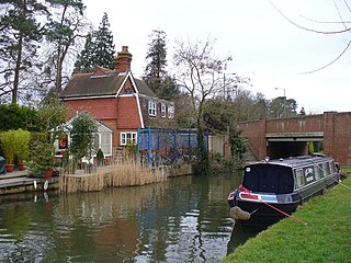
Send is a village and civil parish in the Guildford borough of the English county of Surrey. The name is thought to mean "sandy place" and sand was extracted at various periods until the 1990s at pits in the outskirts of the parish.

<span class="mw-page-title-main">Shackleford</span> Village and civil parish in England

Shackleford is a village and civil parish in the Borough of Guildford, Surrey, England centred to the west of the A3 between Guildford and Petersfield 32 miles (51 km) southwest of London and 5.2 miles (8.4 km) southwest of Guildford. Shackleford includes the localities of Eashing, Hurtmore, Norney and Gatwick.

<span class="mw-page-title-main">West Clandon</span> Village in England

West Clandon is a village in Surrey, England within 1 mile of the A3. It is situated one mile north west of the much smaller separate village of East Clandon.

<span class="mw-page-title-main">Burpham, Surrey</span> Suburb in England

Burpham is a suburb of Guildford, a town in Surrey, England with an historic village centre. It includes George Abbot School, a parade of small shops, and the nationally recognised Sutherland Memorial Park.

<span class="mw-page-title-main">Artington</span> Village and civil parish in England

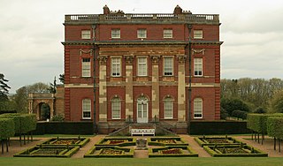
Artington is a village and civil parish in the borough of Guildford, Surrey, England. It covers the area from the southern edge of the built-up centre of Guildford and steep Guildown, the start of the Hog's Back and part of the North Downs AONB, to New Pond Farm by Godalming and the edge of Peasmarsh. It contains Loseley Park, a country estate with dairy, and the hamlet of Littleton.

<span class="mw-page-title-main">Ash, Surrey</span> Village and civil parish in England

Ash is a village and civil parish in the far west of the borough of Guildford, Surrey. Ash is on the eastern side of the River Blackwater, with a station on the Reading-Guildford-Gatwick line, and direct roads to Aldershot, Farnham and Guildford. The 2011 census counted the residents of the main ward of Ash, which excludes Ash Vale, as 6,120. Ash has a small museum in the local cemetery chapel, a large secondary school and a library.

<span class="mw-page-title-main">Worplesdon</span> Village and civil parish in England

Worplesdon is a village 3.1 miles (5.0 km) NNW of Guildford in Surrey, England and a large dispersed civil parish that includes the settlements of: Worplesdon itself, Fairlands, Jacobs Well, Rydeshill and Wood Street Village, all various-sized smaller settlements, well-connected by footpaths and local roads. Its area includes Whitmoor Common, which can be a collective term for all of its commons.

<span class="mw-page-title-main">Wanborough railway station</span> Railway station in Surrey, England

Wanborough railway station is in Flexford, Surrey, England. It serves the villages of Normandy to the north and Wanborough to the south.

<span class="mw-page-title-main">Normandy, Surrey</span> Village and civil parish in England

Normandy is a village and civil parish of 16.37 square kilometres in the borough of Guildford in Surrey, England. Almost surrounded by its hill ranges, Normandy is in the plain west of Guildford, straddles the A323 'Aldershot Road' and is north of the narrowest part the North Downs known as the Hog's Back which carries a dual carriageway. The parish in 2011 had a population of 2,981 living in 1,310 households, has woods, a public common and four government-operated commons to the north that are an SSSI heath. Normandy has been home to a number of notable residents, including William Cobbett.

<span class="mw-page-title-main">Wanborough, Surrey</span> Human settlement in England

Wanborough is a rural village and civil parish in Surrey approximately 4 miles (6 km) west of Guildford on the northern slopes of the Hog's Back. Wanborough lies between Puttenham and Normandy. Wanborough village grew around and to service Wanborough Manor which is on the site of ancient springs.

<span class="mw-page-title-main">West End, Surrey</span> Village in Surrey, England

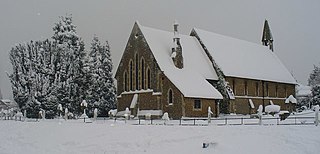
West End is a village and civil parish in Surrey Heath, Surrey, England, approximately 25 miles (40 km) southwest of central London. It is midway between the towns of Camberley and Woking, 4 mi (6.4 km) to the west and east respectively. The River Bourne rises from its sources to the immediate west to run through the village. Until the mid 20th century, the West End consisted of a collection of smallholdings surrounded by a substantial area of common land

<span class="mw-page-title-main">Fairlands</span> Hamlet in England

Fairlands is the largest settlement (neighbourhood) of Worplesdon, a village with a civil parish council in the Borough of Guildford, Surrey, England. The neighbourhood is centred 2.6 miles (4.2 km) north-west of Guildford, to which it is linked by a relatively straight road. The arbitrary centre of Worplesdon, a linear settlement, its church, is 1.2 miles (1.9 km) north-east.

<span class="mw-page-title-main">Jacobs Well, Surrey</span> Village in England

Jacobs Well or Jacobswell is a small village in Surrey, England, of 20th century creation, with a population of 1,171. The village forms a northern outskirt of Guildford, in the civil parish of Worplesdon which can be considered the mother village of medieval date to the west. The Stoke Hill part of Stringers Common, Slyfield Industrial Estate and a Surrey County Council general waste transfer station to the south form the narrowest of its buffer zones to all sides, separating the Slyfield part of Guildford from the village.

<span class="mw-page-title-main">Old Woking</span> Ward in England

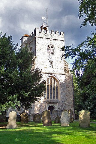
Old Woking is a ward and the original settlement of the town and borough of Woking, Surrey, about 1.3 miles (2.1 km) southeast of the modern town centre. It is bounded by the Hoe Stream to the north and the River Wey to the south and between Kingfield to the west and farmland to the east. The village has no dual carriageways or motorways, its main road is the A247, which connects Woking with Clandon Park and provides access to the A3. The village contains parts of Woking's two largest parks and two converted paper mills. The expanded village largely consists of semi-detached houses with gardens and covers an area of 224 hectares

<span class="mw-page-title-main">Woking Hundred</span>

Woking was a hundred in what is now Surrey, England. It includes the town of Woking and the Borough of Woking.

<span class="mw-page-title-main">Wood Street Village</span> Village in England

Wood Street Village is a clustered and linear village in Surrey, England with a village green, buffered by Metropolitan Green Belt on all sides. It is centred 3 miles (4.8 km) west of Guildford and is part of the civil parish of Worplesdon, as well as continuing to be served semi-dependently as a chapelry of the Church of England.

References

  1. Key Statistics; Quick Statistics: Population Density United Kingdom Census 2011 Office for National Statistics Retrieved 21 November 2013
  2. Surrey Domesday Book Archived 30 October 2007 at the Wayback Machine
  3. Wyke Domesday Book Entry. Domesdaymap.co.uk. Retrieved 4 January 2014
  4. The Manor House, Normandy, medieval construction within 0.25 miles Historic England. "Details from listed building database (1377691)". National Heritage List for England . Retrieved 4 January 2014.
  5. 1 2 3 4 H.E. Malden, ed. (1911). "The hundred of Woking: Introduction and map". A History of the County of Surrey: Volume 3. Institute of Historical Research. Retrieved 4 January 2014.
  6. Grid square map Ordnance survey website
  7. Wyke Primary School Surrey County Council
  8. Wyke Diocese of Guildford, The Church of England

Commons-logo.svg Media related to Wyke, Surrey at Wikimedia Commons