Wrenbury-cum-Frith

Last updated

Wrenbury-cum-Frith
Shropshire Union Canal Wrenbury.jpg
Canal boats on the Llangollen branch of the Shropshire Union Canal
Cheshire UK location map.svg
Red pog.svg
Wrenbury-cum-Frith
Location within Cheshire
Population1,181 (2011)
OS grid reference SJ597467
Civil parish
  • Wrenbury cum Frith
Unitary authority
Ceremonial county
Region
Country England
Sovereign state United Kingdom
Post town NANTWICH
Postcode district CW5
Dialling code 01270
Police Cheshire
Fire Cheshire
Ambulance North West
UK Parliament
List of places
UK
England
Cheshire
53°01′30″N2°36′29″W / 53.025°N 2.608°W / 53.025; -2.608

Wrenbury-cum-Frith is a village and civil parish in the unitary authority of Cheshire East, and the ceremonial county of Cheshire, England. It lies on the River Weaver, around 8.5 miles south-west of Crewe.

Contents

The civil parish of Wrenbury cum Frith also covers the small settlements of Gaunton's Bank, Pinsley Green, Porter's Hill, Smeaton Wood, Wrenbury Heath and Wrenburywood. It has a total population of around 1,100, being measured at the 2011 Census as 1,181. [1]

History

St Margaret's Church St Margarets Wrenbury.jpg
St Margaret's Church

The village is listed in the Domesday Book as Wareneberie, [2] and became Wrennebury in 1230. The name is said to mean "old forest inhabited by wrens". [3] Wrenbury formed part of the extensive lands of William Malbank (also William Malbedeng), who owned much of the Nantwich hundred. [2]

As a chapel attached to St Mary's Church, Acton, Wrenbury was included in the lands donated to the Cistercian Combermere Abbey in around 1180, shortly after the abbey's 1133 foundation by Hugh Malbank, second Baron of Nantwich. [4] In 1539, after the Dissolution, the land was granted to George Cotton, [4] and the Cotton family remained important local landowners for centuries. [5]

A free school by the church was endowed by Ralph Buckley in 1605. [6]

Governance

Wrenbury cum Frith is administered by Wrenbury-cum-Frith Parish Council. [7] From 1974 the civil parish was served by Crewe and Nantwich Borough Council, which was succeeded on 1 April 2009 by the unitary authority of Cheshire East. [8] Wrenbury cum Frith falls in the parliamentary constituency of Eddisbury, [9] which has been represented by Edward Timpson since 2019, [10] after being represented by Stephen O'Brien (1999–2015) and Antoinette Sandbach (2015–19).

Geography and transport

Map of Wrenbury Wrenbury map.png
Map of Wrenbury

The civil parish has an area of 2,184 acres (884 ha). [7] Wrenbury village lies at an elevation of around 230 feet (70 m), about 5 miles south-west of Nantwich, Cheshire and 5 miles north-east of Whitchurch, Shropshire. Nearby villages include Marbury, Aston and Audlem.

The village is on the Llangollen branch of the Shropshire Union Canal. It has an unmanned railway station on the Welsh Marches Railway. The Cheshire Cycleway runs through the village and the South Cheshire Way long-distance path runs just south of it.

Demography

In 2006, the total population of the civil parish was estimated as 1,100. [7] In the 2001 census, the recorded population was 1,060. [11] The population has doubled since the beginning of the 20th century; the historical population figures were 404 in 1801, 490 in 1851, 491 in 1901 and 708 in 1951. [12]

Places of worship

The red sandstone St Margaret's Church, overlooking the village green, dates from the early 16th century. Notable features include a rare example of a dog whipper's pew and a memorial to Stapleton Cotton, 1st Viscount Combermere. [5] [13] [14] A war memorial stands in the churchyard, [15] which also contains the war graves of a soldier of the First World War and a soldier and airman of the Second World War. [16]

Other landmarks

Telford canal bridge Wrenbury Frith Bridge.jpg
Telford canal bridge

The centre of Wrenbury village is a conservation area. [17] [18] Two black-and-white cottages overlook the village green; Elm House is a Grade II listed cottage with prominent brick chimneys dating from the 17th century, [19] while Stanley House dates from 1859. In the churchyard stands a small Grade II listed black-and-white cottage with brick infill, dating from the 17th century, which is possibly a former almshouse. [20] Hawk House, formerly the Hawk and Buckle Inn, is a Grade II listed brick cottage near the post office which dates from the early 18th century. [21] There are also several black-and-white farmhouses and cottages within the Wrenbury cum Frith parish, some of which date from the 17th century.

Wrenbury Hall was the home of the Starkey family, prominent local landowners, until 1920; parts of the house date from the 17th century, although the front was refaced in Elizabethan style in 1916–19. [22] It is said to have been used as shelter for the Parliamentary forces in 1643 when Nantwich was besieged before the Battle of Nantwich, during the Civil War. [22]

In 1922 the house was re-purposed as a small sanatorium of 50 beds, mainly to cater for World War I army veterans suffering from tuberculosis. [23] This was superseded by the larger Cheshire Joint Sanatorium, at Loggerheads, Staffordshire. However, patients from Loggerheads would be sent to retrain at Wrenbury. The site closed in 1980 and is now in private ownership, though a charity offering services for children continues to occupy a building on the site. [24]

Village store and post office Wrenbury Post Office and Village Stores - geograph.org.uk - 344124.jpg
Village store and post office

The Shropshire Union Canal near the village has three rare single-span timber lift bridges dating from 1790, which are among Thomas Telford's earliest works. They are of the drawbridge type, with a wooden platform hinged at the north end which is raised and lowered by counterbalancing beam weights. Two are Grade II* listed footbridges; the Grade II listed third bridge now carries road traffic and incorporates a modern mechanical crank. [25] [26] [27]

Education

The Grade II listed red-brick village primary school dates from 1879 and features a bellcote and weathervane. [28] It won the "Champion School" category of the "Your Champions" Awards 2007, sponsored by Scottish Power and Trinity Mirror. [29]

Culture and community

Scarecrow trail in 2007 Wrenbury Scarecrow 2007.jpg
Scarecrow trail in 2007

The village has a post office and general store, and a doctor's surgery. [30] There are two public houses, both of which serve food. The Cotton Arms, named after the Cotton family, is on Cholmondeley Road near the canal. [30] The Dusty Miller occupies a 19th-century corn mill by the canal at Wrenbury Bridge, and is listed in The Good Pub Guide. [31] A family-run coffee shop, No 18 The Park Coffee Shop, opened in 2019. [32]

Sports facilities include a pavilion, bowling green, tennis courts and football pitches, [30] and the Wingate Centre, just outside the village, has a gymnasium. [33] Local organisations meet at St Margaret's village hall. [30] The mobile library service visits Wrenbury and Wrenbury Heath every three weeks. [34] Facilities for tourists include a caravan site near the canal, and the Alvechurch Boat Centre, a boat-hire company, which operates from Wrenbury Mill, beside Wrenbury Bridge. [30]

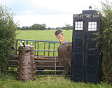
Wrenbury is known for its annual scarecrow trail, which started in 2000. Held the first weekend in July as part of a summer fair, around a hundred and fifty scarecrows were on display in 2006. [35]

Notable residents

Puritan preacher Julines Herring (1582–1644/45) lived in Wrenbury in 1635–37, assisting in parish work, between ministering in Shrewsbury and Amsterdam. [36] The Very Reverend Alan Brunskill Webster (1918–2007), author, and Dean of the cathedrals of Norwich and St Paul's, was born in Wrenbury; the son of John Webster, vicar of St Margaret's Church, he lived at the vicarage until 1935. [37] [38] Trampolinist Bryony Page (born 1990) was brought up in Wrenbury; she won a silver medal at the 2016 Summer Olympics, Britain's first Olympic medal in the discipline. [39]

See also

Related Research Articles

<span class="mw-page-title-main">Crewe and Nantwich (UK Parliament constituency)</span> Parliamentary constituency in the United Kingdom, 1983 onwards

Crewe and Nantwich is a constituency in the House of Commons of the UK Parliament. It is located in Cheshire. It was created in 1983, and has been represented since 2019 by Kieran Mullan of the Conservative Party.

<span class="mw-page-title-main">Acton, Cheshire</span> Human settlement in England

Acton is a small village and former civil parish, now in the parish of Burland and Acton, lying immediately west of the town of Nantwich, in the unitary authority area of Cheshire East and the ceremonial county of Cheshire, England. The civil parish covered 762 acres (3.08 km2) and also included the small settlement of Dorfold and part of Burford, with an estimated population of 340 in 2006. It is administered jointly with the adjacent civil parishes of Henhull and Edleston. Historically, Acton refers to a township and also to an ancient parish in the Nantwich Hundred covering a wide area to the west of Nantwich. The area is agricultural, with dairy farming the main industry. Around a third of the area falls within the Dorfold Estate. Historically, agriculture was the major employer, but it has now been overtaken by the service industries, with many residents commuting significant distances outside the parish to work.

<span class="mw-page-title-main">Marbury, Cheshire</span> Human settlement in England

Marbury is a small village located at SJ560457 in the civil parish of Marbury and District, formerly Marbury cum Quoisley, within the unitary authority of Cheshire East and the ceremonial county of Cheshire, England. It is administered jointly with the adjacent civil parishes of Norbury and Wirswall. The village lies around 3 miles (5 km) north east of Whitchurch in Shropshire and 7 miles (11 km) south west of Nantwich in Cheshire. Nearby villages include Malpas, No Man's Heath, Norbury, Wirswall and Wrenbury. The civil parish bordered Shropshire and covers 2,168 acres (877 ha); it also contains the small settlements of Hollins Lane, Marley Green and Quoisley, as well as parts of Hollyhurst and Willeymoor. The total population was just under 250 in 2001, and – combined with Wirswall – 352 in 2011.

<span class="mw-page-title-main">Combermere Abbey</span> Abbey in Cheshire, England

Combermere Abbey is a former monastery, later a country house, near Burleydam, between Nantwich, Cheshire and Whitchurch in Shropshire, England, located within Cheshire and near the border with Shropshire. Initially Savigniac and later Cistercian, the abbey was founded in the 1130s by Hugh Malbank, Baron of Nantwich, and was also associated with Ranulf de Gernons, Earl of Chester. The abbey initially flourished, but by 1275 was sufficiently deeply in debt to be removed from the abbot's management. From that date until its dissolution in 1538, it was frequently in royal custody, and acquired a reputation for poor discipline and violent disputes with both lay people and other abbeys. It was the third largest monastic establishment in Cheshire, based on net income in 1535.

<span class="mw-page-title-main">Norbury, Cheshire</span> Human settlement in England

Norbury is a hamlet and former civil parish, now in the parish of Marbury and District, in the Cheshire East district, in the ceremonial county of Cheshire, England. It included the small settlements of Gauntons Bank, Hurst Green, Swanwick Green, Norbury Common and Holtridge, with a total population of 194 people in 2011. The hamlet of Norbury lies around 5 miles (8 km) north of Whitchurch, Shropshire. Nearby villages include No Man's Heath, Marbury and Wrenbury.

<span class="mw-page-title-main">Listed buildings in Nantwich</span>

Nantwich is a market town and civil parish in Cheshire East, Cheshire, England. It contains 132 listed buildings and structures, with three classified as grade I, seven as grade II* and 122 as grade II. In the United Kingdom, the term "listed building" refers to a building or other structure officially designated as being of special architectural, historical or cultural significance. There are three grades: grade I denotes buildings of outstanding architectural or historical interest, grade II* denotes particularly significant buildings of more than local interest, and grade II includes buildings of special architectural or historical interest. Buildings in England are listed by the Secretary of State for Culture, Olympics, Media and Sport on recommendations provided by English Heritage, which also determines the grading. This list includes the listed buildings and structures within the boundaries of the civil parish of Nantwich.

<span class="mw-page-title-main">Chorley, Cholmondeley</span> Human settlement in England

Chorley is a hamlet and civil parish in the unitary authority of Cheshire East and the ceremonial county of Cheshire, England. The hamlet lies 5 miles to the west of Nantwich and 6 miles to the north east of Malpas. The total population is a little over a hundred people. Nearby villages include Faddiley, Norbury, Ravensmoor and Wrenbury.

<span class="mw-page-title-main">Dodcott cum Wilkesley</span> Human settlement in England

Dodcott cum Wilkesley is a civil parish in the unitary authority of Cheshire East and the ceremonial county of Cheshire, England. The hamlet of Wilkesley lies 2+12 miles to the west of Audlem and 7 miles to the south west of Nantwich. The parish also includes the village of Burleydam, the largest settlement, as well as the small settlements of Butterley Heyes, Cheshire Fields, Combermere, Lightwood Green and Royal's Green. It also formerly contained the settlements of Pinsley Green and Smeaton Wood, now located in Wrenbury cum Frith civil parish. Nearby villages include Adderley and Calverhall in Shropshire and Audlem, Newhall and Wrenbury within Cheshire.

<span class="mw-page-title-main">Peckforton</span> Human settlement in England

Peckforton is a scattered settlement and civil parish in the unitary authority of Cheshire East and the ceremonial county of Cheshire, England. The settlement is located 6.5 miles (10.5 km) to the north east of Malpas and 7.5 miles (12.1 km) to the west of Nantwich. The civil parish covers 1,754 acres (710 ha), with an estimated total population of 150 in 2006. The area is predominantly agricultural. Nearby villages include Bulkeley to the south, Beeston to the north, Higher Burwardsley to the west, Spurstow to the east and Bunbury to the north east.

<span class="mw-page-title-main">Sound, Cheshire</span> Human settlement in England

Sound is a hamlet and civil parish in the unitary authority of Cheshire East and the ceremonial county of Cheshire, England. The hamlet is located 3+14 miles (5.2 km) to the south west of Nantwich. The civil parish covers 1,089 acres (441 ha) and also includes the small settlements of Newtown and Sound Heath, with a total population at the 2011 census of 239. Nearby villages include Aston, Ravensmoor and Wrenbury.

<span class="mw-page-title-main">Spurstow</span> Human settlement in England

Spurstow is a village and civil parish in the unitary authority of Cheshire East and the ceremonial county of Cheshire, England, which is located 6½ miles to the north west of Nantwich. The parish also includes the settlement of Spurstow Sketh and part of Radmore Green. The total population is a little over 400 people. Nearby villages include Bunbury, Haughton and Peckforton. The parish is mentioned in the Domesday Book of 1086 and contains a salt spring, which was formerly used as a spa.

<span class="mw-page-title-main">St Margaret's Church, Wrenbury</span> Church in Cheshire, England

St Margaret's Church overlooks the village green of Wrenbury, Cheshire, England. The church is recorded in the National Heritage List for England as a designated Grade II* listed building. It is an active Anglican parish church in the diocese of Chester, the archdeaconry of Macclesfield and the deanery of Nantwich. Its benefice is combined with those of St Michael's, Baddiley and St Mary's and St Michael's, Burleydam.

<span class="mw-page-title-main">St Mary's and St Michael's Church, Burleydam</span> Church in Cheshire, England

St Mary's and St Michael's Church is in the village of Burleydam in the civil parish of Dodcott cum Wilkesley, Cheshire, England. The church is some 1.5 miles (2 km) to the southeast of Combermere Abbey. It is recorded in the National Heritage List for England as a designated Grade II listed building. It is an active Anglican parish church in the diocese of Chester, the archdeaconry of Macclesfield and the deanery of Nantwich. Its benefice is combined with those of St Michael, Baddiley, and St Margaret, Wrenbury.

<span class="mw-page-title-main">Thomas Bower</span> English architect and surveyor

Thomas Bower (1838–1919) was an English architect and surveyor based in Nantwich, Cheshire. He worked in partnership with Ernest H. Edleston at the Nantwich firm Bower & Edleston, which he founded in 1854. He is particularly associated with the Gothic Revival style of architecture.

Salesbrook is a small settlement in the parish of Newhall, near the village of Aston, in the ceremonial county of Cheshire and the unitary authority of Cheshire East in England. Nearby settlements include Aston by Wrenbury, Newhall, Barnett Brook and Dodd's Green.

<span class="mw-page-title-main">Listed buildings in Wrenbury cum Frith</span>

Fourteen buildings and other structures in the English civil parish of Wrenbury cum Frith have been officially designated as listed buildings for their "special architectural and historic interest". Three of the listed buildings are classified as being in grade II* and the remainder in grade II; the parish has no grade-I-listed buildings.

<span class="mw-page-title-main">Listed buildings in Dodcott cum Wilkesley</span>

A total of 21 buildings and other structures in the English civil parish of Dodcott cum Wilkesley have been officially designated as listed buildings for their "special architectural and historic interest". Dodcott cum Wilkesley is in the Cheshire East division of the ceremonial county of Cheshire, situated on the Cheshire Plain at the border with Shropshire. The civil parish is predominantly rural, with many scattered minor settlements, the largest of which is the small village of Burleydam. One of the listed buildings is classified by English Heritage as being in grade I, meaning "of exceptional interest, sometimes considered to be internationally important" ; two are in grade II* and the remainder in grade II.

<span class="mw-page-title-main">Burleydam</span> Human settlement in England

Burleydam is a small English village in the civil parish of Dodcott cum Wilkesley in the unitary authority of Cheshire East and the ceremonial county of Cheshire, near the border with Shropshire. It is on the A525. The nearest town is Whitchurch in Shropshire, around 8 km (5 miles) to the west; nearby small settlements include Barnett Brook, Grindley Green and Royal's Green in Dodcott cum Wilkesley; Dodd's Green and Newhall in Newhall civil parish; and Old Woodhouses and New Woodhouses in Shropshire.

There are over 20,000 Grade II* listed buildings in England. This page is a list of these buildings in the unitary authority of Cheshire East.

Marbury cum Quoisley is a former civil parish in Cheshire East, England. It contained 11 buildings that are recorded in the National Heritage List for England as designated listed buildings. Of these, one is listed at Grade II*, the middle grade, and the others are at Grade II. Apart from the village of Marbury the parish was rural. The major buildings in the parish are St Michael's Church and Marbury Hall; these and some associated buildings are listed. Also listed are some 16th and 17th-century houses and farm buildings that are timber-framed or incorporate timber framing. The parish included the part of the Combermere estate that contains a monumental obelisk that is listed.

References

  1. "Civil Parish population 2011". Neighbourhood Statistics. Office for National Statistics. Retrieved 16 March 2016.
  2. 1 2 "The Domesday Book Online: Cheshire L–Z" . Retrieved 11 August 2007.
  3. Henderson, Marjorie (October 2002). "Turning the clock back". Cheshire Life. Archived from the original on 22 July 2011.
  4. 1 2 Baggs, A. P.; Kettle, Ann J.; Lander, S. J.; Thacker, A. T.; Wardle, David (1980). "Houses of Cistercian monks: The abbey of Combermere". In Elrington, C. R.; Harris, B. E. (eds.). A History of the County of Chester. British History Online. Vol. 3. London: University of London. pp. 150–156. Retrieved 28 August 2021.
  5. 1 2 Thornber, C (2019). "Wrenbury" . Retrieved 28 August 2021.
  6. St Margaret's Churchyard plaque
  7. 1 2 3 Crewe & Nantwich Borough Council: Parish Statistics (downloaded from ; 5 April 2010)
  8. "The Cheshire (Structural Changes) Order 2008". Archived from the original on 17 May 2009. Retrieved 28 August 2021.
  9. "Eddisbury Constituency". Cheshire East Council. Retrieved 28 August 2021.
  10. Eddisbury Parliamentary constituency, BBC, retrieved 19 December 2019
  11. "Neighbourhood Statistics: Wrenbury cum Frith CP". Archived from the original on 25 May 2011. Retrieved 15 February 2007.
  12. "Wrenbury". Genuki. Retrieved 28 August 2021.
  13. Historic England. "Church of St. Margaret (1357455)". National Heritage List for England . Retrieved 28 August 2021.
  14. Thornber, Craig. "The Cottons of Combermere Abbey" . Retrieved 28 August 2021.
  15. "St Margarets Church – WW1 and WW2". United Kingdom National Inventory of War Memorials. Imperial War Museums. Retrieved 28 August 2021.
  16. "Wrenbury (st. Margaret) Churchyard". Commonwealth War Graves Commission. Retrieved 28 August 2021.
  17. "Borough of Crewe and Nantwich Replacement Local Plan". Archived from the original on 8 November 2009. Retrieved 28 August 2021.
  18. "Conservation Area Appraisals". Cheshire East Council. Archived from the original on 30 March 2010. Retrieved 28 August 2021.
  19. Historic England. "Elm House (1065951)". National Heritage List for England . Retrieved 28 August 2021.
  20. Historic England. "Cottage in the Churchyard of St Margaret (1066621)". National Heritage List for England. Retrieved 28 August 2021.
  21. Historic England. "Hawk House (1357119)". National Heritage List for England. Retrieved 28 August 2021.
  22. 1 2 Wrenbury Hall
  23. "Wrenbury Hall". Nantwich Museum Details. Retrieved 28 August 2021.
  24. "Home page". The Wingate Centre. Retrieved 28 August 2021.
  25. Historic England. "Wrenbury Bridge (1357425)". National Heritage List for England. Retrieved 28 August 2021.
  26. Historic England. "Wrenbury Church Bridge (1357482)". National Heritage List for England. Retrieved 28 August 2021.
  27. Historic England. "Wrenbury Frith Bridge (1357424)". National Heritage List for England. Retrieved 28 August 2021.
  28. Historic England. "Wrenbury School (1066020)". National Heritage List for England. Retrieved 28 August 2021.
  29. Joule, J. (15 November 2007). "Good news" (PDF). Archived from the original (PDF) on 22 July 2011. Retrieved 28 August 2021.
  30. 1 2 3 4 5 "Wrenbury Village Website". Archived from the original on 4 February 2012. Retrieved 28 August 2021.
  31. Dusty Miller. "The Good Pub Guide". Ebury Press. Archived from the original on 29 September 2007. Retrieved 28 August 2021.
  32. "Home page". No 18 The Park. Retrieved 14 September 2023.
  33. "The Wingate Centre aims to provide inclusive fitness through a wide variety of sports and recreational activities for children and adults of all abilities". The Wingate Centre. Retrieved 28 August 2021.
  34. "Mobile library routes". Cheshire East Council. Retrieved 28 August 2021.
  35. "Scarecrow Trail 2006". Wrenbury Village Website. Archived from the original on 28 September 2007. Retrieved 28 August 2021.
  36. Clarke, Samuel (1651). A Generall Martyrologie … Whereunto are added, The Lives of Sundry Modern Divines. London: Underhill and Rothwell. p. 467. Retrieved 5 January 2016.
  37. Latham, F. A., ed. (1999). Wrenbury and Marbury. The Local History Group. p. 67. ISBN   0-9522284-5-9.
  38. Edwards, David L. (18 September 2011). "Obituary: The Very Rev Alan Webster" . Independent. Archived from the original on 7 May 2022. Retrieved 28 August 2021.
  39. Briggs, Simon (12 August 2016). "Bryony Page and her lucky charm leads to most surprising medal of the Olympics" . Daily Telegraph. Retrieved 14 August 2016.