Disley is a village and civil parish in Cheshire, England. It is located on the edge of the Peak District in the Goyt valley, south of Stockport and close to the county boundary with Derbyshire at New Mills. The population at the 2011 Census was 4,294. To the north, the River Goyt and the Peak Forest Canal, which opened in 1800, pass along the edge of the village. Today, it is a dormitory village retaining a semi-rural character.

Halton is a unitary authority district with borough status in Cheshire, North West England. It was created in 1974 as a district of the non-metropolitan county of Cheshire, and became a unitary authority area on 1 April 1998 under Halton Borough Council. Since 2014 it has been a member of the Liverpool City Region Combined Authority. The borough consists of the towns of Runcorn and Widnes and the civil parishes of Daresbury, Hale, Halebank, Moore, Preston Brook, and Sandymoor. The district borders Merseyside, the Borough of Warrington and Cheshire West and Chester.

Timperley is a suburban village in the borough of Trafford, Greater Manchester, England. Historically in Cheshire, it is approximately six miles southwest of central Manchester. The population at the 2011 census was 11,061.

Ollerton is a village in the Borough of Cheshire East and the ceremonial county of Cheshire, England. It is approximately 2 miles (3.2 km) south east of the town of Knutsford, and had a population of 323 in 2001, rising marginally to 329 at the 2011 Census.

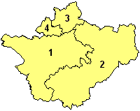
A civil parish is a country subdivision, forming the lowest unit of local government in England. There are 333 civil parishes in the ceremonial county of Cheshire, most of the county being parished. Cheshire East unitary authority is entirely parished. At the 2001 census, there were 565,259 people living in 332 parishes, accounting for 57.5 per cent of the county's population.

Haughton is a village and civil parish which lies northwest of Nantwich in the unitary authority of Cheshire East and the ceremonial county of Cheshire, England. According to the 2001 Census, its population was 223, reducing to 204 at the 2011 Census, and has four fully active farms.

Chelford is a village and civil parish in Cheshire, England, near to the junction of the A537 and A535 roads six miles (10 km) west of Macclesfield and six miles south-east of Knutsford, and is part of the Tatton constituency. The civil parish includes the hamlet of Astle. It is served by Chelford railway station on the line between Crewe and Manchester. At the 2011 census, Chelford had a population of 1,174.

Prestbury is a village and civil parish in Cheshire, England, about 1.5 miles (3 km) north of Macclesfield. At the 2001 census, it had a population of 3,324; it increased slightly to 3,471 at the 2011 census. Alongside fellow "Cheshire Golden Triangle" villages, Wilmslow and Alderley Edge, it is one of the more sought-after places in the north. The ecclesiastical parish is almost the same as the former Prestbury local government ward which consisted of the civil parishes of Prestbury, Adlington and Mottram St Andrew.

Smallwood is a civil parish and small village in the unitary authority of Cheshire East and the ceremonial county of Cheshire, England. The village is approximately 3 miles (4.8 km) east of Sandbach and 3 miles south-west of Congleton. It is based in a rural area and is largely agricultural. At the 2001 census, the parish had a population of 491, increasing to 614 at the 2011 Census.

Bache is a small civil parish and suburb of Chester, in the unitary authority of Cheshire West and Chester and the ceremonial county of Cheshire, England. Located to the north of the city, Bache combines with Moston and Upton-by-Chester to form a joint parish council.

Backford is a village and civil parish in the unitary authority of Cheshire West and Chester and ceremonial county of Cheshire, England. It is situated between Chester and Ellesmere Port on the A41 trunk road, to the north of the Shropshire Union Canal. Backford Cross is located about 2.5 km (1.6 mi) to the north, the village of Mollington is approximately 2.5 km (1.6 mi) to the west and the hamlet of Croughton is about 3 km (1.9 mi) to the east.

Mollington is a village and civil parish in Cheshire, England, two miles north of the city of Chester, with the A41 Liverpool-Chester trunk road and Shropshire Union Canal to the east and southeast, the A540 Wirral Peninsula trunk road to the south and west and the A5117 link road to the north.

Haslington is a village and civil parish in the unitary authority of Cheshire East and the ceremonial county of Cheshire, England. It lies about 2 miles (3 km) north-east of the much larger railway town of Crewe and approximately 4 miles (6.5 km) south of Sandbach. The village was originally bisected by the A534 road that links Crewe with Sandbach, however, this road has now been re-routed to bypass the village to the north-west. The village is also a close neighbour to a number of small towns and villages, and is approximately 6 miles (9 km) from the Elizabethan market town of Nantwich.

Davenham is a rural village and civil parish approximately 3 kilometres (1.9 mi) south of the town of Northwich, part of the Borough of Cheshire West and Chester and the ceremonial county of Cheshire in England. It has a population of 5,655, reducing following reorganisation to 2,745 at the 2011 Census. The village is close to the A556 and A533 roads and both the River Dane and River Weaver. It is the birthplace of former marathon world record holder, Paula Radcliffe.

Hartford is a village and civil parish in the unitary authority of Cheshire West and Chester and the ceremonial county of Cheshire, England. It lies at the intersection of the A559 road and the West Coast Main Line and is less than 2 miles (3.2 km) south west of the town of Northwich. It forms part of the Weaver Vale parliamentary constituency. According to the 2011 Census, the population of the parish was 5,558.

Great Warford is a village and civil parish in the unitary authority of Cheshire East and the ceremonial county of Cheshire, England.

Mottram St Andrew is a village and civil parish in Cheshire, England. At the 2011 census, it had a population of 493. An affluent village in the Cheshire countryside, it is in the Golden Triangle of Alderley Edge, Prestbury and Wilmslow, 15 miles from Manchester. Mottram Hall is a hotel and golfing centre; Lower Manor is the former home of the Mottershead family.

Rushton is a village and civil parish in the unitary authority of Cheshire West and Chester and the ceremonial county of Cheshire, in the north west of England, approximately 6 miles (10 km) west of Winsford and 2 miles (3 km) north east of Tarporley. According to the 2011 census, Rushton has 484 people. Rushton is predominantly countryside, however does includes the village of Eaton. This village contains the Jessie Hughes Village Hall, Eaton Primary School and the church of St Thomas.

Macclesfield Forest and Wildboarclough is a civil parish in the unitary authority of Cheshire East and the ceremonial county of Cheshire, England. It lies on the western fringe of the Peak District National park. The population of the civil parish taken at the 2011 Census was 189.

Weston is a village and civil parish in the unitary authority of Cheshire East and the ceremonial county of Cheshire, England. The village lies 3 miles to the south east of Crewe. The parish also includes the small settlements of Carters Green, Gorstyhill, Rose Hill, Snape, Stowford and part of Englesea Brook, as well as the new settlements of Wychwood Park and Wychwood Village. Plans in 2015 to develop a golf course surrounding Wychwood Village for residential housing have been opposed by some residents. The plans were refused planning permission by Cheshire East Council; the developer was later unsuccessful in an appeal to the Secretary of State and the Council’s refusal was upheld. Nearby villages include Basford, Hough and Shavington.


