Tatton, Cheshire

Last updated

Tatton
Tatton Hall 2009-2.jpg
Cheshire UK location map.svg
Red pog.svg
Tatton
Location within Cheshire
Population35 (2001)
OS grid reference SJ752809
Civil parish
Unitary authority
Ceremonial county
Region
Country England
Sovereign state United Kingdom
Post town KNUTSFORD
Postcode district WA16
Dialling code 01625
Police Cheshire
Fire Cheshire
Ambulance North West
UK Parliament
List of places
UK
England
Cheshire
53°19′30″N2°22′16″W / 53.325°N 2.371°W / 53.325; -2.371

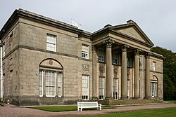
Tatton is a former civil parish, now in the parish of Millington and Rostherne, [1] in the Cheshire East district and ceremonial county of Cheshire in England. It lay to the north of Knutsford and mostly covered Tatton Park. At the 2001 census, it had a population of 35. [2] The parish did not have a parish council. [3]

Contents

History

Tatton was formerly a township in the parish of Rostherne, [4] from 1866 Tatton was a civil parish in its own right, [5] on 1 April 2023 the parish was abolished to form "Millington and Rostherne". [6]

See also

Related Research Articles

<span class="mw-page-title-main">Macclesfield (borough)</span>

Macclesfield was, from 1974 to 2009, a local government district with borough status in Cheshire, England. It included the towns of Bollington, Knutsford, Macclesfield and Wilmslow and within its wider area the villages and hamlets of Adlington, Disley, Gawsworth, Kerridge, Pott Shrigley, Poynton, Prestbury, Rainow, Styal, Sutton and Tytherington.

<span class="mw-page-title-main">River Bollin</span> Tributary of the River Mersey in north-west England

The River Bollin is a major tributary of the River Mersey in the north-west of England.

<span class="mw-page-title-main">Civil parishes in Cheshire</span>

A civil parish is a country subdivision, forming the lowest unit of local government in England. There are 333 civil parishes in the ceremonial county of Cheshire, most of the county being parished. Cheshire East unitary authority is entirely parished. At the 2001 census, there were 565,259 people living in 332 parishes, accounting for 57.5 per cent of the county's population.

<span class="mw-page-title-main">Agden, Cheshire East</span> Civil parish in the Borough of Cheshire East and the ceremonial county of Cheshire, England

Agden is a former civil parish, now in the parish of Little Bollington with Agden, in the borough of Cheshire East and the ceremonial county of Cheshire, England. It is near High Legh, and about 15 miles (24 km) south-west from Manchester City Centre. It is the site of Agden Hall. According to the 2001 census, the population of the civil parish was 146. Because the population is so small, it did not have a parish council, instead, relying on a parish meeting.

<span class="mw-page-title-main">Alpraham</span> Human settlement in England

Alpraham is a village and former civil parish, now in the parish of Alpraham and Calveley, in the Cheshire East district, in the ceremonial county of Cheshire, England. It is on the A51 road between Nantwich and Chester, seven miles north-west of Nantwich. The population is around 400.

<span class="mw-page-title-main">Kettleshulme</span> Village and civil parish in England

Kettleshulme is a village and former civil parish, now in the parish of Kettleshulme and Lyme Handley, in the Cheshire East district, in the ceremonial county of Cheshire, England. The village is close to the border with Derbyshire, on the B5470 road from Whaley Bridge to Macclesfield in the valley of the Todd Brook, a tributary of the River Goyt. In 2001 the parish had a population of 353.

<span class="mw-page-title-main">Wildboarclough</span> Human settlement in England

Wildboarclough is a village in the civil parish of Macclesfield Forest and Wildboarclough, in the Cheshire East district, in the ceremonial county of Cheshire, England, within the Peak District National Park. Bilsborough states that the name arises from the rapid rise in levels of the Clough Brook after a heavy fall of rain, but Mills gives it as a deep valley frequented by wild boar. According to old legend it was the place where the last wild boar in England was killed.

<span class="mw-page-title-main">Lyme Handley</span> Human settlement in England

Lyme Handley, sometimes known as Lyme, is a former civil parish, now in the parish of Kettleshulme and Lyme Handley, in between Disley and Stockport, in the unitary authority area of Cheshire East and the ceremonial county of Cheshire, England. According to the 2001 census, it had a population of 151.

<span class="mw-page-title-main">Cheshire East</span> Borough in England

Cheshire East is a unitary authority area with borough status in Cheshire, England. The local authority is Cheshire East Council. Towns within the area include Crewe, Macclesfield, Congleton, Sandbach, Wilmslow, Handforth, Knutsford, Poynton, Bollington, Alsager and Nantwich. The council is based in the town of Sandbach.

<span class="mw-page-title-main">Swettenham</span> Village in Cheshire, England

Swettenham is a village and civil parish in the unitary authority of Cheshire East and the ceremonial county of Cheshire, England. According to the 2001 Official UK Census, the population of the entire civil parish was 248, increasing to 291 at the 2011 Census. The civil parish includes the hamlet of Kermincham.

<span class="mw-page-title-main">Little Bollington</span> Human settlement in England

Little Bollington is a village and former civil parish, now in the parish of Little Bollington with Agden, in the Cheshire East district, in the ceremonial county of Cheshire, England. The Bridgewater Canal runs through the western side and Dunham Park lies to the north east. The village is 2.5 miles (4.0 km) west of Altrincham, near the boundary with Greater Manchester, which here follows the River Bollin.

<span class="mw-page-title-main">Checkley cum Wrinehill</span> Human settlement in England

Checkley cum Wrinehill is a former civil parish, now in the parish of Doddington and District, in the unitary authority area of Cheshire East and the ceremonial county of Cheshire, England, which lies adjacent to the boundaries with Shropshire and Staffordshire. The hamlet of Checkley lies to the south east of Crewe and to the west of Newcastle-under-Lyme. The parish is largely rural but also includes the small settlements of Bunkers Hill and Randilow. Wrinehill was formerly included in the parish, becoming part of Staffordshire in 1965. Nearby villages include Blakenhall, Bridgemere, Madeley and Woore. In 2001 the parish had a population of 129.

<span class="mw-page-title-main">Doddington, Cheshire</span> Human settlement in England

Doddington is a former civil parish, now in the parish of Doddington and District, in the unitary authority area of Cheshire East and the ceremonial county of Cheshire, England, which lies to the north east of Audlem and to the south of Crewe. Nearby villages include Blakenhall, Bridgemere, Checkley, Hatherton, Walgherton and Wybunbury. The A51 runs north–south through the parish.

<span class="mw-page-title-main">Lea, Cheshire</span> Human settlement in England

Lea is a former civil parish, now in the parish of Doddington and District, in the unitary authority area of Cheshire East and the ceremonial county of Cheshire, England, which lies to the north east of Audlem and to the south of Crewe. The parish was predominantly rural, but it includes the hamlet of Lea Forge. Nearby villages include Betley, Blakenhall, Hough, Walgherton and Wybunbury.

<span class="mw-page-title-main">Rostherne</span> Human settlement in England

Rostherne is a village and former civil parish, now in the parish of Millington and Rostherne, in the unitary authority area of Cheshire East and the ceremonial county of Cheshire, England. In 2001 the parish had a population of 160.

<span class="mw-page-title-main">Peover Superior</span> Human settlement in England

Peover Superior is a former civil parish, now in the parish of Peover Superior and Snelson, in the unitary authority area of Cheshire East and the ceremonial county of Cheshire, England. It is described by the Office for National Statistics as a village surrounded by inhabited countryside. The civil parish included the village of Over Peover and the hamlet of Peover Heath. In 2011 the parish had a population of 666.

<span class="mw-page-title-main">Little Warford</span> Human settlement in England

Little Warford is a village and civil parish in the unitary authority of Cheshire East and the ceremonial county of Cheshire, England. It has a population of 275. The parish contains the David Lewis Centre, a charity set up by David Lewis, the founder of Lewis's. It is a registered charity which aims to provide medical, educational, residential and assessment services for people with epilepsy and other neurological conditions.

<span class="mw-page-title-main">Millington, Cheshire</span> Human settlement in England

Millington is a former civil parish, now in the parishes of Millington and Rostherne and Little Bollington with Agden, in the Cheshire East district, in the ceremonial county of Cheshire, England. The parish was 8 miles (13 km) from Warrington and 3 miles (5 km) from Altrincham. Its name is a "relic of Saxon clanship – the ton or town of the Millings". The parish is primarily agricultural, with a number of farms including Moss House Farm, Newhall Farm, Mereside Farm, Boothbank Farm and Stonedelph Farm. Millington has been recently described on Britain Streets as a "hamlet or isolated settlement in the inhabited countryside". Millington is situated within the market town Macclesfield. The M56 motorway was close to the parish, which allows travel into areas of Warrington and Manchester, 13 miles (21 km) and 14 miles (23 km) away respectively. In 2011 the parish had a population of 234.

<span class="mw-page-title-main">Snelson, Cheshire</span> Human settlement in England

Snelson is a former civil parish, now in the parish of Peover Superior and Snelson, in the Borough of Cheshire East and ceremonial county of Cheshire in England. In 2001 it had a population of 157, rising marginally to 161 at the 2011 Census.

References

  1. "Millington and Rostherne". Mapit. Retrieved 17 July 2023.
  2. Office for National Statistics : Census 2001 : Parish Headcounts : Macclesfield Retrieved 2009-12-04
  3. "Parish Meetings". www.cheshireeast.gov.uk. Retrieved 13 January 2018.
  4. "History of Tatton, in Macclesfield and Cheshire". A Vision of Britain through Time . Retrieved 17 July 2023.
  5. "Relationships and changes Tatton Tn/CP through time". A Vision of Britain through Time. Retrieved 17 July 2023.
  6. "Cheshire East Registration District". UKBMD. Retrieved 11 October 2023.