Garsington is a village and civil parish about 8 kilometres (5 mi) southeast of Oxford in Oxfordshire. "A History of the County of Oxfordshire" provides a detailed history of the parish from 1082. The 2011 census recorded the parish's population as 1,689. The village is known for the artistic colony and flamboyant social life of the Bloomsbury Group at Garsington Manor when it was the home from 1914 to 1928 of Philip and Ottoline Morrell, and for the Garsington Opera which was staged there from 1989 to 2010.

Barby is a village and civil parish about 5 miles (8 km) north of Daventry in Northamptonshire, England. The 2011 Census recorded the parish population as 2,336. Barby is located right off the M45 motorway a short spur from the M1 motorway to the A45 Trunk Road.

Farnborough is a village and civil parish in West Berkshire, about 4 miles (6.4 km) south of Wantage. The village is 720 feet (220 m) above sea level on a ridge aligned east – west in the Berkshire Downs. It is the highest village in Berkshire.

Alvescot is a village and civil parish about 1+1⁄2 miles (2.4 km) south of Carterton, Oxfordshire, England. The 2011 Census recorded the parish's population as 472.
Ashbury is a village and large civil parish at the upper end (west) of the Vale of White Horse. It was part of Berkshire until the 1974 boundary changes transferred it to Oxfordshire. The village is centred 7 miles (11 km) east of Swindon in neighbouring Wiltshire. The parish includes the hamlets of Idstone and Kingstone Winslow. The 2011 Census recorded the parish's population as 506.

Black Bourton is a village and civil parish about 2 miles (3 km) south of Carterton, Oxfordshire. The village is on Black Bourton Brook, a tributary of the River Thames. The 2011 Census recorded the parish population as 266. RAF Brize Norton adjoins the parish. The northern boundary of the parish is along the middle of the main runway of the airfield.
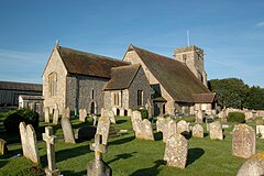
Sedlescombe is a village and civil parish in the Rother district of East Sussex, England. The village is on the B2244 road, about 6 miles (10 km) north of Hastings. The parish includes the hamlet of Kent Street, which is on the A21 road.
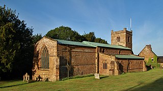
Mollington is a village and civil parish about 4 miles (6.4 km) north of Banbury in Oxfordshire, England. The 2011 Census recorded the parish's population as 479.

Sparsholt (/ˈspɑːʃəʊlt/) is a village and civil parish in Hampshire, England, 2+1⁄2 miles (4 km) west of Winchester. In 1908 its area was 3,672 acres (1,486 ha). The 2011 Census recorded its population as 982.

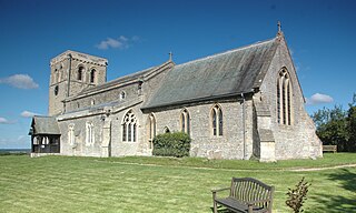
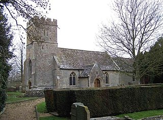
Charlton-on-Otmoor is a village and civil parish about 9 miles (14 km) NE of Oxford and 6 miles (10 km) SW of Bicester in Oxfordshire, England. The village, one of the seven "towns" of Otmoor, is on the northern edge of the moor on a ridge of Cornbrash. The 2011 Census recorded the parish's population as 449.

North Moreton is a village and civil parish about 2 miles (3 km) east of Didcot. It was part of Wallingford Rural District in Berkshire until the 1974 boundary changes transferred it to the new South Oxfordshire District of Oxfordshire. The 2011 Census recorded the parish's population as 328.

Marcham is a village and civil parish about 2 miles (3 km) west of Abingdon, Oxfordshire. The 2011 Census recorded the parish's population as 1,905. The parish includes the hamlets of Cothill 1+3⁄4 miles (2.8 km) east-northeast of the village, and Gozzard's Ford 1+1⁄2 miles (2.4 km) northeast of the village. Frilford and Garford used to be townships of Marcham parish, but are now separate civil parishes. All these parishes were part of Berkshire until the 1974 boundary changes transferred them to Oxfordshire.
Buscot is an English village and civil parish on the River Thames, about 1.5 miles (2.4 km) south-east of Lechlade. Buscot was part of Berkshire until the 1974 boundary changes transferred it to Oxfordshire. Two houses there contain notable collections of paintings.

Milton is a village and civil parish about 3 miles (5 km) west of Didcot and a similar distance south of Abingdon. The 2011 Census recorded the parish's population as 1,290.

West Hanney is a village and civil parish about 3 miles (5 km) north of Wantage, Oxfordshire, England. Historically West and East Hanney were formerly a single ecclesiastical parish of Hanney. East Hanney was part of Berkshire until the 1974 boundary changes transferred the Vale of White Horse to Oxfordshire. The 2011 Census recorded the parish's population as 490.

Tredington is a village and civil parish on the River Stour in Warwickshire, England. The village is 2 miles (3 km) north of Shipston-on-Stour. The civil parish includes the village of Newbold on Stour and hamlets of Armscote, Blackwell and Darlingscott. The 2011 Census recorded the parish population as 1,422. Tredington civil parish was part of Worcestershire until 1931. The River Stour runs through Tredington.

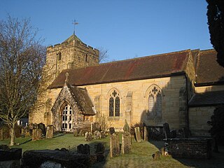
St John the Baptist's Church is an Anglican church in Crawley, West Sussex, England. It is the parish church of Crawley, and is the oldest building in the town centre, dating from the 1250—although many alterations have been made since, and only one wall remains of the ancient building. In September 2017, a team from St Peter's Brighton began a new phase in the life of St John's Crawley. St John's offer a variety of services, traditional and informal, and contemporary services.

Wigginton is a village and civil parish about 6 miles (10 km) southwest of Banbury in Oxfordshire. The village is beside the River Swere, which forms the southern boundary of the parish. A Channel Four documentary, Hitler's British Girl, investigated the possibility that Unity Mitford gave birth to the son of Adolf Hitler in Hill View Cottage, Wigginton.

Shellingford, historically also spelt Shillingford, is a village and civil parish about 2+1⁄2 miles (4 km) south-east of Faringdon in the Vale of White Horse in Oxfordshire, England. It was part of Berkshire until the 1974 Local Government Act transferred it to Oxfordshire. The 2011 Census recorded the parish's population as 173.

Hinton Waldrist is a village and civil parish in the Vale of White Horse, England. It was part of Berkshire until the 1974 boundary changes transferred it to Oxfordshire. The village is between Oxford and Faringdon, 9 miles (14 km) southwest of Oxford. The parish includes the hamlet of Duxford. The 2011 Census recorded the parish's population as 328.